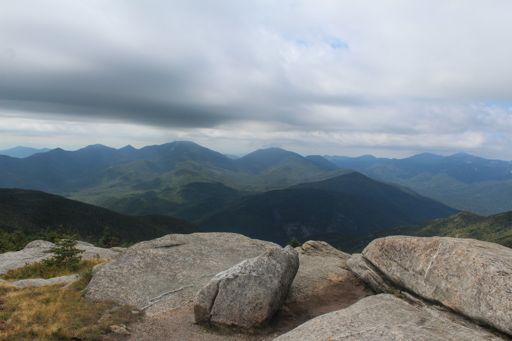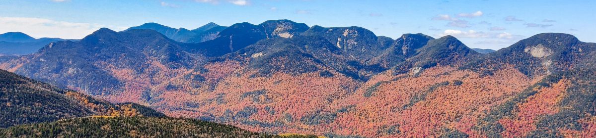
Colvin (39) and Blake (42) with Indian Head and Fish Hawk Cliffs

6/3/2017

Weather reports for this day had been spotty all week, with everything ranging from sun to clouds to rain to snow, but I had been set on hiking no matter what, and at least if weather wasn’t great, then the trails shouldn’t be very crowded. I got up at 4am, checked the weather again, and it looked promising! So I hopped in my car and headed to the St. Huberts parking lot off of Rt. 73 (technically on Ausable Club Rd.). I arrived at around 7am, the lot was already around half-full, and headed up the road alongside a very difficult looking golf course.

 photo DSC00012_zpshwz3y7wt 2_zpslni2ojpr.jpg
Ausable Club

I met and chatted with a friendly couple from Ottawa along the way, and 10 minutes later I signed in at the register by the gate with a pep in my step.

Surprisingly, there were no bugs out yet, but I fully expected o be swarmed later in the day. At any rate, the walk along Lake Rd was a nice warm up before starting any climbing, and it follows a scenic brook along the way.

My initial plan for the day was to hit Indian Head first, because people are always talking about how amazing it is and I wanted to see what all the fuss was about, then to hit Fish Hawk Cliffs, Colvin, Nippletop, then Dial, and I wanted to follow Gil Brook on the way up. So when I saw the first sign for Gil Brook, I followed that trail.

I absolutely have to recommend this trail to anyone and everyone looking to hike in this region, and I recommend going up it instead of down, because you can see all of the waterfalls as you come up to them. I spent soooo much time putzing around by the brook, but it was only 8am and I wanted to get to know my new camera (a mirrorless Sony a6000, much smaller and lighter than my big Canon, which was also in my pack of course)!

If at any point along a trail you encounter a sign with two arrows, one for an “easy” route and one for a “Scenic” route, take the scenic route!

There were two such signs along the path, and boy were they worth it. It wasn’t even a difficult traverse, and the waterfalls were stunning. What is it about waterfalls that makes me want to be standing under them?

Shortly after the last waterfall, I came upon a junction for Colvin/Indian Head/Elk Pass, and as I paused to snap a photo, another hiker approached from the trail I had just been on. We stopped to talk for a minute, and he suggested that I absolutely do not want to orphan out Blake Mountain, since the way to get to it is generally by climbing Colvin first.  So if I didn’t do it today, I’d have to come back and climb Colvin again to get it. So I said, Ok, this hike is getting really ambitious, but sure, I’ll add Blake to the list! He continued on, and I admired the Gil Brook for a moment more before continuing on.

About two minutes later, at 9am, I encountered the same hiker (shoutout to Josh) at another Junction sign. He was debating whether to climb Indian Head, but was hesitant because he hadn’t told anyone he would be going there. I said I was planning to climb it too, so together we set off up the path to Indian Head.

30 minutes later we arrived at the summit and our minds were blown. Honestly, I could have stayed there all day, it was so incredible. But, alas, I’m an aspiring 46er and didn’t want to miss the chance to bag some high peaks.

We stayed up there for almost 30 minutes enjoying the views and trying to figure out which mountains were around us. It was really nice having someone to hike with; not only did I have someone to talk to besides myself (I’d already caught myself mumbling to myself a few times that day, which was mildly concerning), but I had someone to take my picture! I had taken my tripod out of my pack that morning, so I wasn’t really planning on being in any photos.

 photo DSC00055_zpserxbadjp 2_zpskifjlb2v.jpg
The peaks behind me are Colvin and Blake

Having enjoyed our fill of the beautiful landscape, we next set off for Fish Hawk Cliffs, and arrived there 15 minutes later at 10:15am. NOW I KNOW WHY IT’S CALLED INDIAN HEAD! I was really wondering about that on the climb up, and it was so freaking cool to see Indian Head from another angle.

 photo DSC00059_zpsthods0up 2_zpslmoetjse.jpg
Indian Head, in the center

We didn’t linger long there, and began our descent down to the col between Colvin and Indian Head. Now, as I’ve mentioned before, I am SLOW when hiking steep terrain. I have very weak joints, and landing wrong could collapse my knees, so I go very slowly, using my arms a lot to lower myself down to avoid any injuries. My new hiking buddy, however, was much faster, so I encouraged him to go on at his own pace so I wouldn’t slow him down and, at some point along the way to Colvin, he did. This was fine with me, because now I could go exactly as slowly a I needed without feeling rushed. After reaching the col, the climb back up Colvin was a bit tricky and just never seemed to end. It was getting pretty muddy and slick, and more than once as I walked through a muddy patch I felt my boot sink in and schlurrrp as I pulled it back out. At least there were still, somehow, no bugs! At some point I started hearing people talking, and finally, 2 hours after leaving Fish Hawk Cliffs and about 5 hours from the trailhead, I made it to the summit!

The summit was a glorified rock with about 6 people already hanging out at the top. My hiking buddy and I reunited, and I immediately sat my butt down and ate food. And then ate some more food. And then a little more. I was really hungry, guys.

The summit was very windy, and it was about 52°F, which is probably why bugs weren’t an issue all day. While the views from the summit certainly weren’t 360°, it was incredible to be right in the middle of the Adirondacks and so close to the other high peaks.

 photo DSC00064_zpslofyrljv 2_zpszznlhd2a.jpg
Looking back toward Indian Head
 photo DSC00068_zpsb0canqtv 2_zpswjciaewi.jpg
Mt Marcy behind me, with snow still towards the summit

This was my 10th high peak, so I’m officially in double digits! Talking with the other people at the summit, it seemed the overall consensus was that Blake Mountain SUCKS. It’s a steep climb down from Colvin, and a steep climb  up to Blake, which has no views and isn’t even 4000ft, then back down Blake and up Colvin again. Now, on the climb up to Colvin, I had had my cap on and was looking down and completely missed BOTH junction signs just before the summit. Yikes. We left the summit at about 12:40pm and headed down towards Blake.

The descent didn’t start out too bad, albeit expectedly muddy, and 20 minutes later I had the first glimpse of Blake. Boy was that a demoralizing sight.

 photo DSC00077_zpsfxe52mqc 2_zpsubko1kzm.jpg
Blake Mtn

As we headed down, things got STEEP. The mud made things very tricky and slick, and it was a bit intimidating. Luckily there were a few ladders to help with the worst spots.

Both of us decided to descend next to the ladder rather than actually using the rungs due to how steep and widely spaced the rungs were. Now, being the graceful moose that I am, I lost traction part of the way down, and slid down on my butt. On the way, my hiking pole got caught under my pack, which jammed the pole about a foot into the mud at the bottom of the slope. I had to laugh at myself, as Josh asked me “Is your pole stuck in the mud?” and I replied, “Sure is!”. I unearthed it, and we continued on down to the col.

 photo DSC00089_zpsbiuhjb6d_LI_zpscf51vifw.jpg
The hole from my pole, circled in red

As I’m writing this, I’m surprised because it felt like that descent took forever, but was apparently only 35 minutes. At 1:15pm, we reached the col between the mountains.

My hiking buddy went on ahead during the ascent up Blake, and another hiker or two passed me as well, looking tired and covered in mud, but still in good spirits. Everyone I met this day had been absolutely awesome, and I stopped to talk with many of them. I even met a group of students from my university coming down Blake, one of whom I’d actually taught before! Even though Blake is kind of a really awful mountain, the people I met along the way more than made up for it, probably because the only people who would be out there are people who just love hiking, like me. No matter how tough the hike, everyone is willing to meet one another and lend a hand.

As this climb was dragging on, I saw a man who had passed me earlier was now coming back down. When I asked him if the summit was anywhere close, I heard Josh yell up ahead “It’s right here! Keep going!” so with a last burst of energy, I scrambled up to the summit at 2:15pm, which was noted with a small pile of rocks and no view. Time from Colvin: 1.5hrs. Time from trailhead: 7hr 15min.

We both had some snacks and victory chocolate, and I gratefully let my heavy pack fall off of my shoulders.

While we were up there, another gentleman reached the summit with us, and the first word out of his mouth was an exasperated “F**k!”. We burst out laughing; that one expression completely summed up the hike to Blake. The three of us sat together for some time chatting and dreading the trip back to Colvin.

Nevertheless, at 2:45 we headed back the way we came. I was moving so incredibly slowly sown the steep, muddy rocky slopes, and was soon left behind by my hiking buddy, which was again fine with me. At least if I fell on my rear no one would be there to see it! Surprisingly, despite my lack of grace, I never did fall. I was so incredibly relieved when I made it back to the col to Colvin, because the worst of the descents for the whole trip were over. I made my way back up Colvin, and again the climb never seemed to end. Every time I though I must be close, it just kept going.

I sat once again upon the summit of Colvin at 3:50pm, alone this time, and enjoyed the most delicious fruit cup I’ve ever eaten in my life. At 4pm, I left my perch, now drained of any ambition to climb Nippletop and Dial. It was getting windier and the clouds were more forboding, and I didn’t want to be on a summit in the rain. As I headed down, I met another group of really fun people heading up for Colvin and Blake, and encouraged them to keep going because the summit was literally 2 minutes away. We talked for a few minutes, then parted ways. Climbing down from Colvin was tougher than I had anticipated, with lots of slick muddy rocks, steep descents, and rock hopping, and my knees soon started to ache and feel weak. I finally reached the junction after an hour of very careful descent.

The going was much easier after the junction, and I sped right along the Gil Brook trail, bypassing the scenic overlooks that I’d already seen. I made it back to Lake Rd at about 6pm. I hadn’t used a restroom since 7am, and the rushing water of Gil Brook alongside the road was not helping my bladder situation, so I really picked up my pace to make it back to the parking lot! Along the way, I rescued a small bright orange salamander from the middle of the road and chatted with a nice fellow from Montreal (shoutout to Maxim) while we walked back to the gate. I signed out, then practically ran back to the parking lot. I made it there at about 7pm, after 12 hours of hiking, and was SO HAPPY that I had a change of clothes, socks, and shoes waiting for me in the car.

I drove the two hours back home all with a stunning sunset in front of me. 11 down, 35 more to go! You’re next, Dial and Nippletop.

Colvin Mountain: 4057′

Blake Mountain: 3960′

Indian Head: 2700′

Fish Hawk Cliffs: 2600′

Total Duration: ~12 Hours

Round Trip Distance: ~15 miles

All images are property of adktrailtalesandtails and may only be used with express permission.

Jay Mountain

05/20/2017

Today was a perfect day for hiking, so Juno and I loaded up our packs and headed out at 7am to get to the trailhead at 9am. I just have to say, ::SPOILER ALERT:: this was in the top 2 of the COOLEST MOUNTAINS I’VE EVER CLIMBED! Seriously, even though this mountain isn’t a high peak, it should not be overlooked. Clearly, other people already know that secret, because the little parking lot at the trailhead at the intersection of Jay Mountain Rd and Upland Meadows Rd was already full when we arrived. We parked on the street, took our starting photos, and headed off.

 photo IMG_3194 2_zpsvwzksedw.jpg
New hiking backpack!

The trail started climbing right from the start, gradually and continually via switchbacks. We signed in at the register a few minutes after leaving the trailhead, and soon after followed a cool low rock wall along the trail.

 photo IMG_3196 2_zpsyms4qwrv.jpg
Rock Wall

Juno was so excited to be sporting her new pack so that she could carry her own water! Or maybe just I was excited to not have to carry her water! Either way, she trotted back and forth excitedly, while I trudged up behind her.

I’ve come to realize that the first 30 minutes of any hike are the hardest! I’m constantly checking my watch, thinking “It must have been an hour already!” and it’s only been 15 minutes. After those first 30 minutes I tend to find my stride.

Juno was on her best behavior today. About 20 minutes in, this little cream colored poodle came running up to us from behind, owner nowhere in sight, and started BITING JUNO! She jumped back, looked at me like “What the heck, Mom?!” and then chased him off. She made sure the dog stayed away from me, then came back, and we waited together for the irresponsible owner and his dog to pass us. I thought this would be a one time thing, but unfortunately those two would continue to haunt our beautiful hike. This happened two or three more times throughout the day. The owner claimed the dog was just afraid of big dogs, but  scared dogs tend not to run up to big dogs trying to fight. No, sir, your dog is just aggressive, not scared. I don’t want to go on about this anymore, just, if you have a dog that’s not friendly with other dogs and doesn’t respond to your commands, KEEP IT ON A LEASH! My poor pupper was snapped at/possibly bitten 4 times during this hike, while she has never bitten anything/anyone in her entire life, and there were so many other dogs on this trail that the angry little dog could’ve hurt. Anyway, that’s enough of that. We were determined to enjoy our day to the max anyway, and continued on our way, enjoying the bright greenness of everything around us. What a welcome sight after dreary winter!

After about an hour of steady but gradual climbing, we paused for a short snack and water break, and to let a couple of young guys and their sweet hound pup pass us. A little bit afterward, I looked to my left and saw a tall mountain through the trees. I thought, “Hey! That might be Whiteface! I remember reading that there’s a great view of it from Jay!”, then I realized, nope, that tall mountain that looks sooooo far away is, in fact, Jay Mountain. So, we picked up our pace.

So I learned for sure during this hike that my dog requests my permission to do things (you wouldn’t know at home, when she’s constantly scheming and stealing socks). She saw these big boulders, ran over to them, then looked at me and started heading back, expecting to be told “No”. So when I encouraged her to go up there, she ran back excitedly, hopped up on the biggest boulder, and literally posed for the camera. Later, she did the same thing at a much more dangerous rock cliff that she wanted to climb up, I told her no, and she sighed and fell into line behind me.

Since Juno and I apparently dawdle–a lot–we had to stop quite a few times to let speedier people pass us up. We don’t mind though! Everyone was so happy today, and happy to see my sweet little girl, and she was happy to see them. After about a mile, mile and a half of climbing, we reached a little col over to Jay mountain, and Juno got a nice refreshing drink from the stream.

I was well prepared for bugginess today, with deet and permethrin, but there really weren’t many out! I also thought it was be a sea of mud, but again, nothing! It was really a perfect day, clear blue skies, moderate temp, and I couldn’t have asked for more.

Nearing 2.5 miles into the trail, the woods cleared out quite a bit, and we got a sneak peek of the amazing views behind us.

Shortly after, we reached a small junction where the trail split to the left and right. We chose to go left, which led us up to a gorgeous bare-rock lookout where a few of the people who passed us were lounging and having a snack.

I looked to the right, saw an impressive-looking rocky peak, and asked the nearest couple if that was indeed the peak of Jay. They confirmed this, and said that even though the ridge looks like it’s wooded from this angle, we’ll be walking along the other side where it’s open.

We were excited about the ridge, and didn’t want to waste any time, so Juno and I took a last look at the views, then headed off. We went back to the junction, met a really fun group of young men heading up to the lookout, then turned left at the junction to head up to the ridge.

 photo IMG_3241 2_zpsnydstlto.jpg
Whiteface Mountain, with it’s many ski trails.

This is where things got interesting. Very soon after this point, the foliage really thinned out and I could see we were indeed following a trail across a ridge where we could see out all around us. It was INCREDIBLE!! I couldn’t stop pausing to stare in awe. There were some thin trees that I could see through and around, and a lot of green ground foliage.

 photo IMG_3246 2_zpswtchvdcu.jpg
This is the ledge where Juno would later find her own dog pack

The trail continued climbing steadily, but I really didn’t notice it since I was so absorbed in the scenery. When we surpassed the little thin trees, we were basically in open air, often climbing on bare rock ridge in between following dirt trails.


The mountain in the distance, in the center, is Big Slide Mountain with the smaller Three Brothers leading up to it just to the left

The summit(s) looked so far away, but honestly it was nice to know that we’d have so much time to travel along the ridge. It was like a great book that you don’t want to finish because then it’d be over; we wanted to prolong the adventure for as long as possible.

There weren’t any blazes or trail markers along the ridge, but luckily, there were many many cairns leading the way. There were so many times when I’d stop and look around, unsure of which way to go, and I’d spot a cairn placed just perfectly to guide the way.

While the trail up Jay is pretty mellow for the most part (until the final stretch up to the real summit), there were a couple of places where I had to pause and plan how to climb up a huge vertical boulder. Juno of course just popped right up to the top with no effort at all, and would sit at the top to watch over me while I dragged my butt up there too.

 photo IMG_3294 2_zps91llfgmi.jpg
False summit on the left, true on the right.

We followed this for about a mile and a half before we reached what we had been thinking was the peak at about 11:45am. Well, it turned out that it was a false peak, and to get to the “real” summit we would have to first descend, then ascend very steep, large rock faces to get to a slightly higher elevation than we were already at. It was probably only less than 0.5 miles away, but I guessed it would take at least half an hour to climb. As much as I hate not making it to the summits of mountains, I didn’t want to make Juno come back down that steep trail to the summit and risk hurting her joints. I decided to just stay where we were and enjoy more of our time at the false summit instead of using that time to hike to a slightly higher peak. Plus, there were a bunch of people at the true summit but I had the false one to myself for the time being!

Juno and I sat down and enjoyed our lunches, she ate almost all of her kibble and half of my Babybel cheese on top of that. Refreshed, we put our feet up to soak in the sun and feel fresh mountain breeze and I enjoyed my victory chocolate.

After a few minutes, I unpacked my tripod, switched to my wide-angle lens, and trekked over to the other side of the ridge to take some photos.

Looking East to Lake Champlain below the horizon with Vermont’s Green Mountains beyond.

After about 25 minutes, a large group arrived and set up near where I had left my pack. Juno and I headed up there and made quick friends with the boisterous group. They were so funny, cracking the same weird kinds of jokes that I do, and we enjoyed each others company while Juno cozied up to them trying to get food. I offered to take a photo of them, and they excitedly obliged. Meanwhile, while they were lining up, one of them shout-laughed at Juno to “Get out of my bag!”. Yup, my little schemer was using the opportunity to snoop and look for morsels. That’s my girl! Then she and I lined up to have our photo taken.

I really enjoyed the group of people I was hangin’ out with, and we sat and chatted for quite a while. Just as Juno and I were getting ready to go, a group of 4 older people came to the false summit from the real summit, fawning over Juno. Seriously, it must be nice to be such a cute dog. The other group left, and June and I sat and chatted with this awesome, energetic, HILARIOUS new group for a few minutes and took a photo for them, too. We were so lucky to meet such awesome people today!! So many times, people we pass just look miserable on hikes, and just mumble as we pass them, but the thrill of hiking was contagious today.

We talked for a few minutes, the we all headed down the mountain at about 1pm. This part of the hike was hilarious. While climbing up the rocky ridge, there are a lot of very well-placed cairns to show the way exactly where and when they were needed. However, on the way back down, there wasn’t such luck. The 6 of us got turned around about 5 times, slipped gracefully down some very loose scrabbling, and tripped over Juno since she’d adopted them all as her packmates for the day.

After a while, I ended up leaving the little group behind. They were enjoying the views, and I was concerned about getting Juno back into the shaded woods, out of the sun. I had hoped to see them again before we left, but no such luck 😦

At one point, I had paused to admire the scenery, and when I turned back to the right, Juno was up on a rock ledge…with 3 other dogs!! They were all SO CUTE with each other! She fit right in, like they were all just a pack of sweet dogs that had known each other forever. Then, yet another dog showed up, a mastiff who looked like she was really over all of this “exercise” business, and all four dogs went to greet her, tails wagging. This was just the sweetest thing, they were all so happy together.

We left them to continue on their way, and made our way back into the forest. The rest of the descent was completely uneventful. We didn’t encounter any of the fun groups we’d met on the way up, just a hiker or two here and there making their way up the mountain. We kept up a good pace, with Juno mostly following right on my heels. I was almost surprised when we made it to the trail register and signed out by 3pm, and couldn’t believe the amount of cars now lining the road!

We took our leaving photo together, which didn’t go very well, and headed to the car to pack up. This was such a great day, with great people and perfect weather. I can’t wait to climb this one again, and make it all the way to the summit! Happy Trails!

 photo IMG_3335 2_zpsilbodhdh.jpg
My fabulous hat hair
 photo IMG_3336 2_zpsoocxyzmd.jpg
One sleepy pupper

Jay Mountain: 3600′ Elevation Gain: ~2000′
Round trip distance: ~8 miles
Total Duration: 5 hiking hours + 1 summit hour

All images are property of adktrailtalesandtails and may not be used unless with express permission

Whiteface Mtn. (5), Esther Mtn. (28), and Marble Mtn.

11/01/2016

It had been nearly 2 MONTHS since I’d last climbed a 46er, and I’d been thinking for a while that I was long overdue, however every weekend that I’d planned to climb these mountains, the skies decided to open up! So I said, I’ll show them (…the skies, I guess), I’ll go on a Tuesday! So after a sleepless Halloween night, I got up at 4:30am to head down to Wilmington. There were a couple of trails to choose from, but I decided to choose the less-traveled one that’s a mile shorter just to try to avoid still being on the trail when darkness falls considering that I had planned to climb Marble, Esther, and Whiteface Mountains all in one day. The trail I was aiming for started at the Atmospheric Science Research Center (ASRC). I had never been there before, so when I arrived a little before 7am (still in the dark) I was a bit concerned, because the trail was not obvious. So I parked in the big parking lot in front of the ASRC and proceeded to wander aimlessly for about 30 minutes, sometimes stumbling up a trail-that’s-not-a-trail before getting lost and deciding that could not possibly be the right way. Just as the sun started to illuminate the parking lot, I stomped frustratedly back to my car to regroup. Should I drive to the more well-known trail? Surely I wouldn’t get there until at least 8am, and it’d be an extra 2 miles of hiking. I’d definitely be coming home in the dark if I go that way. What are my other options? Just go home? Just then–I looked up and saw that early morning light had illuminated a previously invisible, MINISCULE sign that said “Hikers <–“. OMG. I started the engine, drove literally a minute more around the loop, and there was a little parking area on the side of the road, and a trail leading off of it. So without further ado, I started hiking at around 7:30am.

The trail quickly descended down where it joined up with another much wider trail; I turned left here, and kept going.

Shortly afterward, another trail branched off to the left. I continued on the wide path, hoping it was the right way, but not super confident considering the way my morning had gone so far.

A few minutes later I was almost sure I was again on the wrong path, because I came across this big metal cube of machinery, but when I went to investigate, the trail did indeed continue onward; sure enough, a trail sign appeared!

This is where that actual trail began! Huzzah! There was no register or anything, but I continued straight up the path where the climbing began. It then occurred to me that the machinery at the bottom was from an old ski lift up the mountain; this trail just followed the ski lift straight up. It was actually really cool to be able to look back and see exactly where I had started, because it was a straight shot.

At this point, my earlier frustration was just a distant memory; I was so happy and zen-like out there, enjoying the crisp air, the morning’s first light reddening the mountains, and the exhilaration of the climb. I was in such a good mood, that I nearly considered climbing inside this squat little structure I discovered on the way up, before I decided that I absolutely did not want to do that.

45 minutes after leaving the roadside, I alighted upon the top of marble mountain, where I encountered the twin to the cube machine at the bottom of the slope.

I rested here for a couple of minutes enjoying the early light, but when I started to shiver I decided it would be best to move on and warm up.

Almost as soon as I left the summit, I met the junction with the other trail that led up Marble Mtn., and took the right path to carry on up the ridge.

The trail was a lot snowier up here out of the light of the sun, but I was reassured knowing that my microspikes (crampons…whatever) were tucked in my pack, ready when I needed them. Boy was that false hope. (More on that later).

As I climbed, I was lucky enough to catch some glimpses of the mountains through the trees, and what a sight they were.

The trail was a total and complete mess. Some areas were running water, some were solid ice, some were a miserable mix of both. If nothing else, it made for some interesting structures along the way.

Oh, joy! I’ve found another creepy little sled hut, and look! This one comes complete with a moth-eaten burlap blanket too! How cozy :/. Let’s just hope I won’t have to use it, and will be back well before dark.

After climbing up this ridge for almost an hour and a half, it finally flattened out, and I knew I must be close to the junction for Esther.

 photo IMG_2914_zpsu1ty3mil.jpg
Whiteface mtn in the distance

Not 10 minutes later I had arrived at the giant, obvious cairn and the sign for the
herd path up Esther Mountain. I had put my microspikes on at some point climbing up the ridge when it became particularly icy, and they were giving me a bit of a hard time by not staying square on my feet; the left one kept slipping off the side, and I had to adjust it constantly. It wasn’t too bothersome though, I was definitely better off with than without, anyway. So off I went, down the trail to Esther. Along the way, I captured a glimpse of a verrrry far away mountain, and hoped with all I had that it was not Esther. After viewing the same mountain occasionally becoming ever-so-slightly closer, however, I determined I was indeed climbing Esther. To make it better, this herd path was horrible. Ice was covering almost all of it, only it wasn’t even thick enough to hold my weight; I kept punching through, splashing into muddy mucky disgusting water every other step. To make things even better, my brand-new microspikes were not doing so great; the left one continued to slip, and one of the bands on the right foot had snapped completely, leaving it unbalanced and threatening to slip off of my foot. I decided to just keep an eye on it, because I really had no other option. So the going was quite slow, but eventually I made it to the summit of Esther, an hour after leaving the junction.

Apparently this mountain was named for the 15 year old girl who first summitted it. Woah! I’ll settle just for climbing a mountain, not discovering one. I cleared a little patch of rock to have a seat and take a sip of some piping-hot hot chocolate, which I was SO glad for prioritizing at 4:30am.

I didn’t stay long, however, because when I looked up and saw the tower of Whiteface like 4.2 lightyears away, I knew I needed to get moving or I wouldn’t get back to the car until 3pm tomorrow.

This is when the poop really hit the fan for me. The heckin lousy microspikes. During the hour it took me to return to the junction on the ridge, the other strap on the right one broke, so the set of spikes under the front of my right foot kept slipping and popping up over the top of my boot, often stabbing my other leg when it happened. To make matters worse, both straps on the left one also broke during that hour. I was so frustrated and angry at this point, I very nearly chucked both of them off of the mountain, good riddance, but decided to strap them onto my pack in case of emergency, or to burn maliciously later, or whatever. I resolutely took both poles out of my pack, and very carefully made my way up Whiteface. Wow, it looked soooo far away, and TALL. At one point, I reached a really cool clearing that must have been an old ski slope or something, and it was nicely shielded from the wind, so I decided to have a seat on a convenient boulder and have some lunch.

Who can argue with that view? I didn’t stay long (didn’t want to wait for the cold to seep in) and 20 minutes later at about 1pm I reached the giant wall signifying the base of the wall bordering the Whiteface Memorial Highway! I must be close!

I took about 40 pictures of the dang wall, all of which look almost exactly the same, then climbed some slippery rocks up to the road itself.

 photo IMG_2940_zpse4terx8r 3_zpsl196xfne.jpg
Ski lift!

I knew the trail would come to the road, but I wasn’t exactly sure where it would pick back up. I decided to explore the road a little bit, which overlooked some incredible scenery. That said, I wouldn’t want to drive up or down this road, EVER. I’m saying, even in the summer. Nope.

Looking up the road toward the observatory, I decided that the trail must’ve continued up this impossible-to-climb cliff, covered in ice, that I saw when I first climbed up to the road. So for future reference: you never actually walk along the road. I didn’t think any of the buildings were open up ahead, so the only way up would be the precarious trail. Just dandy.

I climbed up very carefully, and at about that point realized that there was NO WAY that I would make it back down the whole mountain without my microspikes. Even the slightest decline can be extremely difficult when icy. I was a bit nervous, but decided to worry about it more after I had reached the summit, because there was no way I was turning back now.

The trail continued along this really cool ridge all the way up to the summit. It would have been even cooler if I was afraid of being blown right off the edge by the omnipresent gusts of wind.

But oh myyyy the views were spectacular! I’ve never seen anything quite like this.

FINALLY, at about 1:30pm, I reached the deserted summit. Not a soul in sight, which was a little creepy, I must admit, but it didn’t bother me much.

I stayed up here for all of 5 minutes. Seriously. It was cold, and it was soooo much later than I had anticipated arriving (stupid microspikes!). So I took a few last pictures, and turned back. Unfortunately for me, the road was closed past that point, so I had to go back the treacherous way I had come up, until the trail met the road again.

And this is where the photos end. I had some very tricky decisions to make at this point. Do I go back down the mountain the way I came up, risking falling on the ice (or worse) with no one around to help for miles and miles, risking returning in the dark (even though I have a headlamp, I’d prefer to not have to use it)? Or do I take the Whiteface Memorial Highway back down, risking the road being immensely long, or not ending up near where my car was parked? In the end, I went with my gut, which was telling me something bad would happen if I took the trail back. I also figured that, if nothing else, the road could lead me to people who would hopefully help me, if need be. So down the road I went, and I didn’t turn back. Though the views were sublime, I was so focused on getting home that I didn’t even think to take out my camera. After an hour of walking, I was getting really nervous, because I didn’t seem to be getting anywhere. I still seemed to be really high up in the mountains, nowhere near the elevation at which I’d parked my car, and there was not a soul in sight. I realized now that the road was definitely closed at the bottom, and reasonably so, but I was afraid the road was 15 or 20 miles long. So at this point I just started running, my heavy pack slamming down onto my shoulders with each step. Soon after, I saw a sign indication the downward slope would continue for another 5 miles. I was simultaneously overjoyed and devastated: the road wasn’t 20 more miles, but I still had 5 miles to go and my whole body was hurting. I decided I had no choice but to continue on; my phone was dead (of course) and the road would EVENTUALLY lead somewhere, hopefully somewhere close to my car, and not on the wrong side of the mountain. I steeled my resolve, and kept running. And running. And running. Then, up ahead, a toll booth!! Are there people in there? Either way, I must be getting close to somewhere. There were no people inside, but when I passed the booth, I looked to my left and had to do a double-take: a LAKE. Somehow, I had reached a low enough elevation for there to be a gorgeous little lake; on top of that, I heard cars nearby! I slowed to a walk, and came to an intersection. Another tough decision: do I turn down the new road, or do I keep going? I had studied maps of the Adirondack region quite a bit, and reasoned that I should stay on the Memorial Hwy. Less than a mile later, I came across a sign, which I read about 6 times just to be sure and not get my hopes up: Marble Mtn. Road, ASRC. I jumped and danced and cheered and ran (read: limped) down the road to where my beautiful gorgeous little blueberry-mobile sat waiting for me (it’s a bright blue subaru…we call it the blueberry, naturally.). I was so grateful to be so lucky, and I peeled out of there to head home. Finishing time: ~4pm. Hey, I beat the sunset!

Whiteface Mountain: 4867′

Esther Mountain: 4240′

Marble Mountain:2753′

Total Duration: ~8.5 Hours

Round Trip Distance: I have no idea…fitbit says 17.5 miles, but that can’t be right….maybe 10-11 miles?

All images are property of adktrailtalesandtails and may only be used with express permission.

The VIC Trails

10/11/16

The day after my dad and I climbed Catamount Mtn, we decided to pick a hike that all four of us could do (both parents, myself, and Juno) instead of climbing another mountain, which my mom wouldn’t join us on. Since we were so close to Paul Smith’s College and the VIC, we decided to explore some of the 25 miles of trails in the VIC. Because the trails were numerous and intersected all over the place, here’s a map for reference. We arrived at the parking lot (VIC Entrance on the map) at about 11:30am, and promptly got lost in the lot simply trying to find the proper trailhead.

By 11:40, we had started off on the light blue trail called the Barnum Brook Trail, taking the lower loop to take advantage of all of the lookouts (marked with binoculars on the map). We reached the first lookout mere moments after leaving the trailhead, and were rewarded with a stunning view of St. Regis Mountain.

A few minutes later, we reached our second lookout.

And then our third. It was really nice to have so many viewing opportunities so frequently along this trail!

We continued along the trail after that, not encountering a single soul, and after a few minutes the trail descended downward to our first of many junctions. I admired a beautiful gazebo planted beneath the trees while my dad consulted the map, then we set off to the left along the Jenkins Mountain Trail. This was a bit of a tease, because Jenkins mountain was what my dad and I had originally been planning to climb.

We continued to follow the Jenkins Mountain Trail all the way to Long Pond (the dark blue trail on the map). For some reason I took a picture of every junction we reached, so here they are! We just continued along Jenkins Trail until we reached the junction to Long Pond.

Up until the trail to Long Pond, the trail had been pretty wide and easy to travel. Now, however, it was much more narrow and more like what I’m used to. The trail meandered through the forest, dropping off sharply on the left side, and angled downward until we reached the lake and the convenient Lean-to adjacent to it.

There was a long, rickety dock leading out into the water, where apparently some lucky visitors to the lean-to had caught some tasty trout. I don’t think trout would have been in our future though, because Juno didn’t miss a beat in leaping off the dock to take a swim in the water.

She jumped back onto the dock, shook the water off of herself and onto me, and contemplated going right back in while hanging out with my dad.

As we were walking along the trail, my dad and I kept noticing all of the luscious mushrooms growing alongside the trail. When I was a kid, he’d take me mushroom-picking every fall, and we’d clean and cook them up while camping (this is something he did as a kid too…must be a Polish thing.). So, naturally, we couldn’t resist. Every few yards, you’d here one of us shout, ‘OOH!’ and we’d scoop them up to smell them and see if they were any good. Of course it didn’t matter either way, because we didn’t have a bag to carry them all in and we didn’t want the hassle of having to clean them all later on, but it was nostalgic. My mom mocked us for how frequently we stopped to pick them, just to toss them back on the ground for the deer to eat. Anyway, we followed the trail to the end of Long Pond, where we crossed the inlet over a fish barrier dam.

We had originally planned to go all the way around Black Pond, but decided for sake of time that we would take the red trail left after Long Pond, which would take us to a narrow strip of land between Black Pond and Little Black Pond. When we reached the edge of Black Pond a few minutes later, I was snapping away photos like no tomorrow.

My parents left me behind to take pictures, and when I found them I realized I’d been wasting my time taking pictures between the trees; there was a perfect little bridge spanning the ponds with amazing vantage points!

 photo IMG_2816_zpsyxrewgch 2_zps4uaz9ykk.jpg
The “Sideways Carrot”, as my Mom called it

When we crossed the bridge, finally, we found a little lean-to complete with pots and pans and a canoe. I was thinking ‘Yeah, we don’t need to leave, I’m living here now.’ It even had a little fire pit and picnic table. Seriously, what else do you need?

Alas, we left the campsite, and continued on the red trail. On the way, we spotted these little yellow mushrooms that mom speculated might be the kind that glow in the dark. Definitely don’t eat them though.

After this, the trail was pretty basic, just a walk through the woods. I had brought my full hiking pack, complete with snacks for all 4 of us, but my parents had only brought a bottle of water each. My mom was starting to have some pain in her lower limb joints, so I suggested we stop on a boulder and have a quick bite to eat before carrying on. Little did we know, things would soon go downhill from here. We finished eating, and headed up the trail. We knew that at some point, we would want to go left on a yellow-marked trail, so when we saw such a trail, we had no hesitation in taking it.

We’d read on the map that there were supposedly marshes on the left side of the trail, but all we saw were trees. So we were immediately skeptical that something wasn’t quite right. The trail was wide, and could have used a bit of bushwhacking, and we noticed several possible-trails branching off but they weren’t really marked and they certainly weren’t marked on the map, so we continued straight. My mom was getting a bit upset at this point, because the ground was difficult to walk on and her knees were really bothering her. This continued on for at least an hour, maybe more. FINALLY we came to a junction with another trail, and I remember saying, ‘I feel like we’re back to where we started’ just before we saw a junction sign to Black Pond….We walked a little further, and came upon an awfully familiar-looking bourler that we had had lunch on. I reassured my parents that I have enough emergency equipment and provisions in my pack for us to go back and live in the lean-to, but they weren’t buying it. Oh well, I tried!

We continued past our boulder, back up to where we had turned down the yellow path previously, and noticed a little path with blue markers branching off to the left. After looking at the map, and concluding we must be in the Twilight Zone because nothing made any damn sense, I said, forget it, I’m going down this blue trail whether it’s the right way or not. Luckily for us, it was indeed the right way, and we enjoyed yet again another beautiful walk through the woods. An hour later, we made it back to the parking lot at the VIC, and returned back to the cabin where we enjoyed a fire by the lake and the hound made herself comfy on the couch, her fur full of brambles and sticks and pine needles, and little creatures…a job fur another day.

All images are property of adktrailtalesandtails and may only be used with express permission.

Catamount Mtn

10/10/16

My parents were visiting again this week, and we went to stay in a little cabin right on Rainbow Lake for a few days. And when I say it was on rainbow lake, I mean ON. It was a converted boat house, and we could have literally cast a fishing line out of the sliding doors in the living room and fished from a la-z-boy.

The view from our living room

My dad and I were set on climbing a mountain or two while we were there, and he had found one that he was excited about because there’s a lot of rock climbing towards the summit. So Monday morning, we got up bright and early (8:00am…) and got to the trailhead at around 9am with the hound in tow.

My dad had read all sorts of exciting things about this trail, how it is one of the most gorgeous woods walks in the area, and it goes through an old field and a forest that had been ravaged by fires in the ’20s, and there are certain colored markers showing the way, and blah blah blah…Yeah. We saw literally none of that.The first mile or so was very easy going, and was a nice walk in the woods, but certainly wasn’t the MOST AMAZING BEAUTIFUL WALK EVER, like the book claimed. At this point, we were just hoping that there was definitely some decent rock climbing action towards the top, and the three of us treaded on.

We took a couple of breaks here and there, and looked behind us every 10 ft we ascended to see if there were any views yet. Juno took every opportunity to climb on some boulders, not knowing the climb that would await her…

About 45 minutes into our hike, we got our first view! Our breaths were taken away at the brilliance of the fall colors (we climbed this mountain during peak fall foliage) and we set off with a new pep in our step in eagerness for the views from the summit.

 photo IMG_2696_zps4h7ousk6 2_zpsvx2cp0ay.jpg
There’s the summit of South peak, through the trees

After about an hour of hiking we came to a little plateau with less surrounding trees. We got a little lost here, as it seems the trail continues straight but actually veers left. We realized our mistake and turned back. The climbing started to get more serious after that.

My dad had read in his guide book that there was a near-vertical chimney that we would have to climb through, and when we thought we had arrived at it he took out his book to see that there was a photo of the very chimney right at the beginning! We had reached the rock-climb! This was a very narrow little passageway, but Juno had no problem scampering up through it.

After a bit more steep rock-climbing, we reached the top of the south summit, where we were rewarded with these incredible views of the surrounding mountains and valleys below. It looked as if someone had draped a giant red blanket over the landscape.

We stopped here for a bit and ate some lunch. Until this point, we hadn’t encountered a single other person, and there was only one other car in the lot when we left, so we were pretty optimistic that we would have the trail to ourselves. Boy were we wrong.

After maybe 15 minutes, we stood up to continue on to the REAL summit. Let’s be honest, it looked REAL intimidating. We would be climbing right up the side, and it was steeeep. At this point, I think we both considered just hanging out at the false summit since the views were so great, but we never would have forgiven our selves for buggering out before we reached the summit, and we were so close. So we loaded up our packs, and carried on.

There’s the REAL summit, straight up those rocks

A mere 25 minutes later of intense rock climbing, we were standing on the summit! It was at about this time that I was seriously thinking that my dog is not a dog at all, but a mountain goat in disguise, because she would just leap up 6ft vertical slabs of rock like it was nothing. I, on the other hand, got myself into a bit of a pickle trying to climb onto a rock ledge with one foot wedged between two tree trunks and the other planted on the rock in front, nearly level with my head. Luckily my dad was there to give me a shove and I scrambled up onto the rock. I took the obligatory picture of the summit marker, then realized there was another summit marker about 10 feet away, so of course I took a picture with that one too. It didn’t occur to me at the time that they look no different, but here are both pictures anyway, one with each foot!


We gratefully tossed our packs on the ground, and began exploring the summit. We met a nice man whom we had encountered on the south summit, and he knew the names of every little pond and lake surrounding us. It was definitely informative, but I have no idea how he can remember all that; everything looks the same from up there. Luckily for us, the sky was finally clearing up from some early-morning clouds, and we could see the summit of Whiteface in the distance!

 photo IMG_2736_zpsknvvyexy 2_zpsnqo1oo7b.jpg
Whiteface Mountain in the distance, with Esther on the left

The three of us sat down to have the last of our snacks, and Juno made quick friends with our impromptu tour guide (he had crackers, and she looooves crackers). I took about 100 photos up here, the scenery was just incredible, and I can’t decide which are the best, so be prepared for a photo montage:

Before long, the summit was packed with people. Tons of groups, and a surprising number of Quebecquoise. Dad and I decided then to take our leave, and head back down to the south summit, but not before taking a summit picture together.

The trip down was treacherous, so the camera went back into my pack. I was really nervous for Juno a lot, since she was jumping off of tall ledges face first with a lot of impact on her joints (she’s just a youngster…only 1.5 years old!). Going back through the chimney was very tough with her, and we had to sandwich her between us and push/pull her along. There were only a few times after that that I had to pick her up from a steep rock and lower her back to the ground. We got turned around once more on the way down, and tourguide man showed up just in the nick of time to tell us we were way off trail. After that, the going was easy. We got back to the register at about 1pm, took our exit photos, and returned back to the cabin for a delicious homecooked meal by my mom.


Catamount Mountain: 3166′ Elevation Gain: 1551′
Round Trip Distance: 3.6 miles
Total Duration: ~4 hours

All images are property of adktrailtalesandtails and may only be used with express permission.

Owl’s Head Mountain

09/17/2016
This week, my parents were visiting from Ohio and we’d decided to take a weekend trip and stay in a cabin right on Long Lake. I definitely couldn’t pass up the opportunity to hike a new mountain, but I didn’t want to be away from my family all day long, so I decided to do a short one called Owl’s Head. I’d read online that it was a 3.2 mile hike, which I’d assumed was round trip…I was wrong, but happily so. When I arrived at the trailhead, there were plenty of cars already lined up, so I took my place in the back of the line and set out with my faithful hound, Juno, at about 12:15pm.

The trail started out with a bit of climbing, but leveled out soon after. I tried let Juno run around off leash for a little bit to burn off some excess energy, but there was an almost constant stream of people heading back down the mountain, and almost as many dogs as there were people, so I clipped her leash back on. Luckily for both of us, she was actually really good on her leash! (For once). After about a mile of completely flat walking through nice shaded woods, we reached a trail junction.

We had about another mile of pretty easygoing walking, and had to maneuver around a huge downed tree. Instead of doing the intelligent thing and going around the tree, June and I decided we could just duck under a part that was lifted off the ground. She of course slipped under really easily, but there was no way I’d be able to do the same while holding onto her leash. Luckily, there were a man and woman just on the other side who offered to take her while I climbed through, which Juno did not take well AT ALL. You’d think she’d been separated from me for a week by the way she was acting when I crawled to the other side less than a minute later.

After that, I set off ahead of the other pair at a pretty fast clip, and let Juno play in a few streams we passed along the way. Because I was holding onto Junes leash, I didn’t have my camera out and just didn’t take many pictures during the climb up, but honestly there wasn’t anything great to look at anyway. Just some regular run-of-the-mill woods. Anyway, I was starting to get real hungry, so we stopped on a nice big rock and had a snack. We shared some cheese crackers, and let the other pair pass us up so we wouldn’t feel pressured to go so fast. I didn’t mind, they were talking pretty loudly the whole time, and it was nice to be able to enjoy the sounds of the woods again. The trail got quite steep after this point, and the going was slow. It was a very scrambly trail and we had to watch our steps. I have to say, I was so proud of my little trailblazer pup; she hadn’t pulled me once, and kept right on pace with me. After what seemed like forever, we finally reached a high point, and were excited to see the remains of the old observer’s cabin foundation. (When I returned back to our cabin after the hike, I noticed a black and whit photo hanging on the wall showing a crew with their tents in the process of building the same observer’s cabin I saw earlier in the day!)

After this point, the trail dipped down to a col before leading us back up a very steep but relatively short ascent to the summit! We were so excited when we got here, we plopped right down and took a photo. We enjoyed some more cheese crackers and fruit leather, and took in the view while mustering up the courage to climb up the fire tower. We made it here at about 1:45pm.

Once we were rested up a little, I made the executive decision to climb up the tower. The problem is, dogs generally don’t like to climb giant swaying metal structures with steps that don’t have backs to them. She had to poke her head in between every single step and look at the ground below her, her little legs shaking as she tentatively climbed up behind me. With a few words of encouragement, I got her to the top, but she refused to climb up through the hatch to get onto the actual platform of the firetower, so she stayed on the top step. BOY was it windy! And cold! I did not stay up there long, since my dog is not the only one with a totally rational fear of heights, but I go some cool pictures of the 360 degree view, and we skedaddled back down onto solid ground where some trees protected us from the wind. Lesson learned, don’t bring dogs up firetowers.

 photo IMG_2669_zpsokviqqcb 2_zpskutjube3.jpg
That peak is where the Observer’s Cabin was located

Back on the ground, we wandered around a bit enjoying the scenery and Juno enjoyed giving me a heckin’ big concern every time she got close to the edge.

We rested for about half an hour, Juno lying on my lap, and decided to take our leave as the wind was picking up and clouds were rolling in. We were nervous about being on top of a mountain next to a veritable lightning rod during a storm, so we hustled back down the mountain. Going back down was SO much faster than going up! We went pretty slow going back down the steep sections, but we were really moving once the trail leveled out. After about an hour since leaving the summit, we reached the trail junction telling us we only had a mile left to go.

About 20 minutes later, we were back at the trailhead taking our leaving pictures by 3:30pm.


After this gratifying day, we returned to our cabin to go kayaking and sit by the fire with our family, watching the sun set across the lake. Not a bad way to end the day!

* Side note: I looked and looked, but found no evidence of owl heads on Owl’s Head mountain. In case you were wondering. *

Owl’s Head Mountain: 2,782 feet, Elevation gain: 1,532 feet

Round Trip Distance: ~6.5 miles

Total Duration: ~3.5 Hours (Including time resting at summit)

All images are property of adktrailtalesandtails and may only be used with express permission.

Giant Mountain (12) and Rocky Peak Ridge (20)

09/10/2016

I woke up bright (er…dark) and early and got out of the house by 4:30am to do this hike. My parents were due to visit from Ohio sometime in the evening, and there was a possibility of rain (and even thunderstorms) in the early afternoon, so I thought I’d get this done quick and easy, the earlier the better. So I arrived at the trailhead on 73 for the Roaring Brook Trail, signed in at the register, and set off by 6:45am.

 photo IMG_2573_zpsjhynxplm.jpg
I call this my ‘Up at 4am’ look

Immediately after leaving the register, I got a view of the so-called “Roaring Brook”….Not a single drop of water. This was really depressing, because the reason I wanted to use this trail was to visit the top and bottom of roaring brook falls, and it wasn’t looking like much would be going on.

Two minutes after leaving the register I came to a junction, and went right to see the bottom of the falls. I wasn’t expecting much, but I could definitely see how this would be an incredible sight with a lot of water. Guess I have to come back in May!

The walk through the forest was uneventful but pretty. It was still dark in the woods with the sun so low, and I passed a few campers still asleep in their tents. After the short walk back to the junction sign, I started the climb up the trail, which was relentless but not technically difficult. After 10 or 15 minutes, I came to another junction sign for a spur trail to the top of the falls. I though, what the heck, it’s right there so I might as well go see it even if there’s almost no water.

HOLY COW was it worth it! This was the COOLEST place! There were places for camping right nearby, and I could climb out into the brook on rocks and see the mountains in the distance. I stayed here for longer than I should have, enjoying the crystal clear waters and indescribable view.

Standing at the tippy-top
Is that the mountain I’m climbing?

The trail leveled out a little bit after the top of the falls, and after about a mile I came to the junction leading to Giant’s Washbowl on the right, and Giant Mtn on the left. I went left, with the intent of descending via the other trail and meeting up with this trail again at that junction.

The going was easy for a little bit after this point, with the trail crossing the brook once or twice more.

Then the real climbing started. And it did not let up. It was some serious climbing, but the path was relatively easy, increasing in scrambli-ness the further up I went. I encountered a few wearied backpackers descending the mountain at this point, but that was it. About 2.5 hours after I left the trailhead, I was excited to find some built-in stairs, which in my mind meant that the summit was near…false hope! It was not!

At this point, the trail increased in difficulty. I was much steeper and not as easily navigable, so the going was slow.

Not 10 minutes after climbing the ladder, I arrived at the junction sign for Ridge Trail, which leads back to Giant’s Washbowl, and the sign saying ‘Giant Mtn: 0.7 Miles’. Woohoo! 0.7 Miles! That should take me less than 30 minutes!…There was a lot of false hope on this trip.

The climbing picked up immediately after that sign, with lots of scrambling and slides, until I came to this amazing ridge. I could see the mountains around me looking both left and right through the trees, and I could see the looming shadow of Giant up ahead, and boy, it did not look close.

The ridge led to the base of Giant, and the climbing was very very steep and difficult, often straight up slides. Towards the top, I passed a junction sign for Rocky Ridge Peak, saying the peak of Giant was 0.3 miles away. Finally, after 3.2 hours of hiking, I reached the wiiiindy summit.

The views were stunning, but I could only stand to be on the very top for a few minutes at a time. My thermometer read 62 F, and it was incredibly windy. I was wearing long trail pants and a running jacket, and still needed to put on my windbreaker. I was so glad that I had it on hand! I climbed down a little bit to take shelter from the wind, and enjoyed my midmorning snack. After resting my feet and warming up some, I ventured back up to the summit to take a picture with the summit plaque.

I didn’t stay long up here; it was cold and windy and I wanted to head over to my second peak. So I headed back down to the junction, and turned left at the sign.

Shortly after descending a few feet along this trail, I encountered an older gentleman enjoying the view from a rocky outcropping. We chatted about how far down we have to go before climbing back up rocky peak, then he let me pass him and I carried on.

He was not kidding when he said this trail would make us work. The trail was only 1.2 miles long, but it was just straight down. It was so very demoralizing, and all I was thinking was how I’d have to come right back up on the way back up Giant, and how there was no way I’d make it back to the trailhead by 2pm. Nevertheless, I carried on, and while I stopped to take a picture of Rocky Peak Ridge looming in the distance, the gentleman (named Tim) passed me right up. Did I mention I’m incredibly slow climbing down?

After what felt like losing 1000ft, I reached the col, and snapped a photo of RPR standing in front of me. The climb up was so much easier, it was relatively gradual and I made it in about 20 minutes from the Col, passing Tim along the way.

An hour after leaving the junction, I made it to the summit at 11:30am. I told myself I could enjoy the views until noon, the I had to be back at the junction by 1pm. I quickly walked over what was clearly the highest point of the bare summit to get to a slightly lower portion of the ridge that was less windy so I could enjoy my lunch and victory chocolate.

14333150_10210713453817544_1838093652070031439_n_zpsqj0gxnt2 (2)

I was here for several minutes before Tim rejoined me, and an entire troupe of tired-looking young backpackers filed up the mountain shortly after. The didn’t stick around though, and neither did Tim, so I had the mountain to myself. I was getting a little bit nervous, however, because it was getting even windier, to the point that it nearly knocked me over, and dark grey clouds were rolling in. So I went back up to the true summit to take a few last pictures and headed back down to the col.

 photo IMG_2637_zpsmqnxcetn 2_zpsqqgiksek.jpg
A cairn, and Giant Mtn

Along the way, I passed the large group resting along the trail, and learned they were an outing club at a nearby college. I got back to the col, and started the exhausting climb back up Giant. Actually, it was a lot worse coming down this part than it was going up. I flew right up it in about 20 minutes, passed Tim again, and took a few minutes break back at the junction since I made it before 1pm.

I enjoyed my last view, then headed as fast as I could back down the mountain. It was getting increasingly dark and windy, and I was sure the skies would open up before I made it to the bottom, so I decided to forgo my side trip to Washbowl and go back the way I came up. The trip down was absolutely uneventful though. I kept pace with a few groups as we leapfrogged each other, and my knees were killing me. I didn’t take many pictures on the way down, just a few of some pretty little berries and flowers growing alongside the trail.

As I neared the bottom, light rain started trickling through the leaves above me, but nothing serious. In the last mile or so, I knew I was getting close, so I started jogging and TOTALLY missed the junction between washbowl and the trailhead, and ended up going half a mile in the wrong direction. I even kept thinking to myself “This doesn’t look familiar…” but I didn’t know for sure until I reached a little junction sign to Nubble. I turned right around, and ran the rest of the way back. I made it back to my car at 3:10pm, almost 8.5 hours after leaving. I jumped in without even taking an exit photo, ripped my boots off, and sped home to make it there before my parents did. 39 more to go!

Giant Mountain: 4,627 feet  Elevation gain: +3050 feet

Rocky Peak Ridge: 4,420 feet  Elevation gain: +990 feet

Round Trip Distance: ~10 miles

Total Duration: ~8.5 Hours

All images are property of adktrailtalesandtails and may only be used with express permission.

Big Slide Mtn (27) with Bushnell Falls and the Three Brothers

Date: 08/26/16

Well, classes start back up on the 29th, and since I’m both taking and teaching a class, and working on my dissertation, and applying for jobs, I really wanted to get out an have a nice long day of hiking while I still can. I decided to go on a weekday in hopes that the trails wouldn’t be too packed, and it was a great decision. So I packed up my stuff Thursday night, and didn’t get a single minute of sleep before I was out the door at 5. I was really excited to climb this mountain and take the little detour over to the falls, and I’d been seriously looking forward to going swimming. I arrived at the trailhead dubbed “The Garden” in Keene at exactly 7am,paid my $7 parking fee, and took almost 30 minutes to get my socks and boots on…in my defense, I had to apply blister bandages, and 3 layers of socks to each foot, and it took a while! It was raining lightly anyway, so I didn’t see the harm in waiting it out a little. At any rate, I signed in at the register at about 7:30am, and took a sharp right to head up the 3 Brothers trail to Big Slide.

The trail starts climbing right out of the gate, and I was SO TIRED from not being able to sleep at all, so I really took my time going up. After about 10 minutes, I came to a junction with the trail to Porter Mountain and stayed to the left to keep on track.

It was so peaceful being in the woods with the sound of light rain hitting the leaves of the canopy above me, I considered curling up to nap under a tree on more than one occasion. But, considering it had only been like 10 minutes since I’d left the register, I figured I shouldn’t go to sleep yet, and kept slowly shambling up. After about 40 minutes, I reached my first incredible view of the surrounding mountains and the storm that was beginning to dissipate. I took about a thousand photos on the way up first brother, since after reaching the first lookout, the rest of the way up is ALL lookouts! I thought I was at the summit so many times. It was like climbing a spiral staircase, but you can’t see through to the other side, and sometimes you cross right through the middle…I know that doesn’t really make any sense, but it would if you’ve climbed this mountain. The views were spectacular, and while the view from each lookout is pretty much the same, the weather was changing constantly and drastically and I was whipping my camera out at every possible opportunity.

Just as I was putting my camera away, the lowest foggiest clouds started floating up on updrafts and dissipating! It was SO COOL! You don’t get to see that many times in your life (well, at least I don’t…) so I brought my camera back out and continued snapping. I must’ve wasted at least 30 minutes just taking pictures.

Look at those rays!

I eventually decided I needed to get my butt moving if I was ever going to reach all of my destinations, so I packed my camera away continued along the trail. I soon found myself inside of a cloud, and the fast wind was blowing it right through the trees, and it got COLD! My little thermometer indicated 60 degrees (on an 84 degree day), and it was so damp, so I bundled up and moved my legs a little faster to keep warm.

I finally made it to the summit of 1st brother after about 1.5 hours of hiking. I didn’t want to spend too much time taking in the sights, since I still had 3 peaks left to summit, but it was hard to tear myself away.

Cute little cairn absolutely not marking the right way to go.

Looking toward the summit of 2nd Brother

Not even 10 minutes later, after descending a bit then climbing back up and then some, I reached the summit of 2nd brother. In retrospect, I’m really glad that I chose to go up this path and down the gentler grade, because there were some definite difficult areas climbing up enormous boulders.

 photo IMG_2483_zps4chgajvy.jpg
Looking back on 1st Brother

The trek over to 3rd brother was a little bit longer, taking me almost 50 minutes, but it wasn’t particularly difficult. Somewhere between 2nd and 3rd brother my stomach started yelling at me to eat some food, so I was eager to get to the summit for a snack break. There wasn’t much in the way of views from this summit, but I sat on a nice rock under a tree where I had a vantage point through some trees and enjoyed some cheese ritz crackers.

After a brief break, I began the descent down to the col and when I turned around to look behind me, I saw that I was again in a cloud and light from the sun was filtering through it in the most amazing way! I threw my pack on the ground and tore through it to find my camera, muttering hurried profanities under my breath because I didn’t want the phenomenon to end before I was ready. Of course, by the time I got my camera pointed in the right direction, the cloud had pretty much passed. UGH! I ran a little ways down the path to where there was still some cloud hanging around, and snapped a picture. I tried, guys, I really did.

About half an hour after leaving the summit of 3rd brother (and 3 hours after leaving the trailhead), I came upon the most gorgeous little creek running through the forest. The whole area was so lush and green, I just had to sit down and enjoy it (and have another snack, of course). I remember thinking I could have lived at that little spot forever.

After another half hour, I had finally reached the col. The signs showing the path I had just come from and the path up Big Slide were very clear, but I was confused because there were two more trails leading from the junction, and they weren’t labelled, so I didn’t know which one was Slide Brook Trail (my intended route back down). I decided I’d figure it out later, and began the 0.3 miles ascent up Big Slide.

This trail was a right bit of work. It was just intimidating! There were several areas where I had to scratch my head for a moment to figure out how to get up and, more importantly, back down without dying. There were two terrifying ladders built up one of the slides, but the second ladder literally only had like 3 rotted wood rungs, so it didn’t do much good.

In all, it took me about 20 minutes to climb to the summit. The views were nice, but I’d already been spoiled by the first two brothers, and was more inclined to lie back and have a nap after chowing on a delicious PB&J Bagel.

 photo IMG_2500_zps6p48yust.jpg
Behold, BAGEL!

Up until this point, I had had the mountains and trail completely to myself, and it was really nice. I was feeling rather antisocial from being so exhausted without sleep, and I welcomed hearing only the sounds of the forest around me. Unfortunately, after about 15 minutes of resting at the summit, I was joined by another group who, for some reason, just struck me as strange. I didn’t really want to share the crowded little summit with them, so I snapped a few more photos of the glistening slides on the distant mountains and what is (presumably) the summit marker, and went on my way.

 photo IMG_2504_zpszqktgbit.jpg
Summit marker? Maybe?

On my way down, I luckily ran into a really fun group who were just having a blast climbing up the mountain. They were resting after having just climbed the ladders, and told me they’d came up via the Slide Brook Trail, and to go straight when I got back down to the col. We wished each other well and I continued my descent, mostly on my rear. The path was so steep and slick from the recent rain! At the col, I ran into a woman and her daughter, who had also come up via the brook trail, and they reaffirmed that it was indeed the trail straight ahead. So, with a pep in my step and looking forward to following the brook down the mountain, I headed off. The trail was pretty boring for a mile or so, but soon after all of the little streams heading down the slope joined up to form a gorgeous brook. I really wish I’d spent more time here. The brook seemed to be flowing down some old slides, and it would split off and re-converge all the time, forming little islands that the trail followed. It was just constant waterfalls and deep pools all the way down, with crystal clear water and sandy floors. I was apparently really thirsty, because I kept thinking how much I wanted to go swim in those pools. I took a little break here and there, letting my hands soak in the freeeeezing water to try to bring some of the swelling down in my fingers. They were like sausages at this point, I could barely make a fist.

After following the river for quite a while, the trail diverged and led me down a looong slippery slide before coming back to the water.

When I got to the bottom of the trail, I encountered a junction sign that said “Trail <-” as in, go left to stay on the trail. I knew that I had to go right at the bottom of the trail to get to John’s Brook Lodge and Bushnell Falls, but I figured that maybe I just wasn’t totally at the bottom yet, so I followed the stupid sign. I made it to a cool outcropping on the Brook, and had my solitude broken once again by the family from the summit. I took a few pictures, and continued on a little ways, only to discover at a trail register that I had gone the totally wrong direction and turned to head back up the half mile or so that I had gone.

I was a little peeved about that sign at the base of the slide Brook Trail, but I made really good time coming down so even though I went ~1 mile out of my way, I was still right on target, and reached JBL at 2pm. It was my goal from here to make it to the top of the falls 1.8 miles away by 2:45, so I set out at a pretty quick pace. The trail was getting pretty crowded at this point with all sorts of people staying at the lodge, which was super cute, by the way! I’d like to stay there sometime.

The trail got a little confusing about 0.5 mile in, because it leads down onto the base of the river, where you’re just walking on the rocky bank without any direction. So for those of you that plan to go this way, just know that the trail never actually crosses the river! I just kept going until the trail picked up again through the woods. After about a mile of easy walking, the trail really started to climb, until it evened out and I found myself walking along a cool ridge with water flowing far below on either side. After walking for about 40 minutes, I was getting a little nervous that I was somehow on the wrong path again, and resolved to get my map out in another few minutes, when I came to a clearing and saw the sign to Bushnell!

It was a mere 0.1 mile near-vertical drop down to the base of the falls below. I had a lot of close calls and very nearly wiped out more than once, but 10 minutes later I reached the falls!

I quickly changed into my swimsuit, had a little snack and my victory chocolate, and jumped into the FRIGID water. I think they need to rename these falls “Giant’s Icepop” or something. So I pretty much got in, stumbled around on the rocks, and got right the hell back out. Even though it was cold, it felt sooo good, and I felt a little less slimy after 7.5 hours of hiking. I wrapped myself in my nice warm towel, and sat on a rock to rest my body and mind, listening to the falls and enjoying the breeze.

I took my leave about 45 minutes later, managing the ascent back to the top much more easily, taking only about 5 minutes. I had really wanted to make this whole trip in 10 hours, so I really hustled to get back to the garden. After I passed the Lodge though, I came upon a high-water bridge over the river. I steeled myself to go up it, and my legs wobbled because only ONE SIDE of the bridge has a railing! WHAT?! Anyway, I went out about halfway, decided that was enough for me, and scrambled right back down.

A few minutes later I came back to the misleading sign. If you see this, go the opposite way than the sign is point to get to JBL!

Several minutes later, I made it back to the place where I originally had to turn around, and saw that I still had nearly 3 miles to go to get back to the Garden. Luckily the going was easy and could really move quickly.

I finally made it back to the parking lot at 6pm, stripped my socks and boots off of my aching blistered feet, guzzled some water, and talked with the people who had come out just after me. They must have left super early, because I parked next to their truck when I arrived, and they had climbed 3 of the 46! We said our goodbyes, and I headed out of the lot satisfied with a successful and gratifying day.

Big Slide Mountain: 4240′ Elevation Gain: 2800′
Round Trip Distance: 16 miles (according to fitbit), 13 miles according to map (including my getting-lost)
Total Duration: 10.5 hours

All images are property of ADK Trail Tales and Tails and may not be used unless with express permission.

Street (31) and Nye (45) Mountains

08/15/2016

Weather: Unpredictable, apparently. (mostly sunny, some clouds, 75 degrees)

I’d been planning to climb these two on my birthday (tomorrow!), but weathermen said it’s supposed to pour all day, so I decided last minute that we’d go today. It was supposed to be sunny in the morning and overcast in the afternoon, which didn’t really matter to me since there aren’t views from either summit. So, with our (my) bags packs and boots on, we left the house at 7am to arrive at the Adirondack Loj sometime before 9. It’s a Monday, and it was already packed at the Loj! Luckily most people were doing the more popular peaks. We took the trail back behind the welcome center, and got a nice view of Heart Lake along the way, and thought maybe we’d take a dip when we were all finished!

We passed a cute little museum that I’d seen when I climbed Mt. Jo back in June, but it still wasn’t open 😦 The flowers and their little description signs were cute though!

I didn’t reaaaally know exactly how to get to the mountain trail, I just assumed I’d figure it out along the way. The last time I stayed at the campground, I walked the trail all around the lake, and I thought I remembered a sign with “Nye” on it somewhere, so that’s all I was going on. At the first junction, I continued straight and passed the trail up to Mt. Jo. Soon after at 9am on the dot, I came to the register for Street and Nye, and signed in. While I was signing in and taking an only somewhat creepy photo of myself (took me 4 tries to get a decent one, so it was obviously going to be a really photogenic day), I heard loud splashing in the lake to my left…Juno had taken it upon herself to catapult through the brush, down the bank, and take a dip in the lake…twice. So she was pretty much soaking wet right from the get-go.

At first, I really did try to keep her on leash, as you’re supposed to do with dogs. The problem became that she is just really bad on a leash. She’s really not great off-leash either, but she usually comes when I call her, and she at least can’t pull me down when she goes charging off after chipmunks.

After a few more minutes of walking along the rocky trail, I came to the sign I had remembered! Except it said “Old Nye Ski Trail,” which really threw me off. In retrospect, I have no idea why it’s called that, I couldn’t possibly imagine anyone skiing down that trail. No way. Upon closer inspection, however, I saw someone had thoughtfully scribbled “& Street” onto the sign, so I was feeling a little more confident. And if I was wrong, well, at least I’d be on a trail somewhere, on some mountain, maybe. Who knows. Better than being at home all day.

So apparently I missed the sign saying the “Trail is not maintained after this point,” which I thankfully knew already and had an idea of what to expect. For being unmaintained and trailless though, it was a decent trail and definitely looked cared for (puncheon, sawed logs, etc.). I’m not sure how I missed the sign, it is literally in the picture I took of the sign for the other route up Mt. Jo (on the left, cut off). I made it here only 10 minutes after signing in. Time to start the real trail!

About 20 minutes later, we came to our first little stream. Actually, it was not-so-little, thanks to all of our recent rain! The trail up to this point was a little damp, but no real mud issues, and I was optimistic the rest of the trail would be the same (lol) and bug free (LOLOL). Juno enthusiastically jumped in and splashed around a bit, and we continued on our way. Up until this point, the trail had been just a nice (albeit uneventful) walk through the woods.

Not more than 5 minutes later we came to a much more boisterous…creek? River? Brook? I don’t know, but it was pretty. It was this point that I was sure we were on the right trail, as I’d read that you have to cross the water just by your own will…there is no bridge, fallen log, or stepping stones, just a cairn to tell you that you do indeed have to cross. We hung out for a few minutes and shared our first snack (cheese crackers!) while a group ahead of us took their time getting their boots back on after crossing. After being thoroughly SOAKED by Juno leaping out of the water, carrying a veritable wave of water with her which of course landed all over me and my pack, I took off my boots and double-layered socks, and VERY carefully stumbled my way ungracefully through the cold water. I was not looking forward to doing this on the way back! We safely arrived at the other side, and while I was drying my feet and stuffing them back into my boots, Juno pulled her leaping-water-wave thing again. So if I wasn’t already soaked, I was now, and I might as well have just swam across the freaking river.

At any rate, we continued on, and soon came to another stream crossing, though this one was a lot more lowkey. There was an impressive tree to cross over on for those more confident in their balance, but I wanted to live, so I just crossed in the shallow water 2 feet away.

After this point, the trail followed several more streams, and we had to rock-hop across one or two of them, but it was easy going. We hadn’t even started to climb yet, and it had already been over an hour!

Finally, after about an hour and 20 minutes, the trail started to climb along a brook or stream or creek or something, as it wound up the mountain. It was getting muddier the farther up we went, and I stopped to bathe myself in deet, which of course didn’t bother the flies at all but it made me feel better about ticks. There were tons of little waterfalls and crystal clear pools of water, so we stopped frequently so June could play in them.

It was about this time that Juno started to drive me NUTS. The trail became a literal mudhole, stinking wet glopping mud, and she LOVED it. This meant that she would gallop from in front of to behind me, splash around in the muck, then go sprinting past me, spraying flecks and globs of muck all over my legs along the way, and then do it all over again. Sometimes she’d pass too close and slam right into my legs. I have no idea how I made it out of this hike relatively unscathed! I put my camera away so it’s life at least would be spared, and we continued to climb…and climb…and climb. I was getting hungry, and Juno was starting to snack on bits of grass sticking up out of the mud, so when we reached a flatter area a little before noon I decided we should take a break and enjoy our gourmet feasts: kibble and dehydrated chicken for Junybean, PB&J sammich and apple for mom! I was so glad I had actually prepared food this time, and wasn’t just stuck eating crackers and trail mix!

About 5 minutes later, we made it to the junction between Street and Nye. I took my camera out of its pack, snapped a picture of the handy (but illegal?) carving in the tree to denote which path is to which mountain. We took a brief break, drank some water, and headed down the path to Street. Of course, I was able to catch a glimpse of the mountain in the distance, and it looked leagues away. Like literal years away. I knew it was closer than it looked, because they always are, but it was still demoralizing to say the least.

That’s it. The green mound peaking between the trees.

The trail got even muckier after that, with just puddles of water hanging out on the trail. We passed some cool forests though and enjoyed the overwhelming greenness of the leaves and moss and ferns. It was absolutely lush! *burning into my memory to remember come winter*

After going down, and then back up up and up, we came to the summit of Street Mountain and chatted with some people we met along the way (they go to a university right by me, go figure!) They were super nice, and the girl (Rhea?) even shared some handpicked crabapples with me, and they were surprisingly tasty! We took pictures for each other, and took our turns at the “lookout,” though there wasn’t much to look out on. June and I took a little break to have a summit snack, then we said our goodbyes (or see-ya-laters, since we were all headed to Nye) and took our leave.

Observing the mud, courtesy of Juno.

We made it back to the junction after what felt like forever of sludging through the mud, and met a lady there who was just coming off the trail to Nye and heading up Street. We talked for a moment, but were too exhausted to speak words well, and just shared how long it took us to get to the junction from each peak. Luckily for me, Nye was only a 10 minute jaunt away! We made it there in no time at all, and hurriedly took a picture. The place was swarming with flies for some reason, the sun was beating down (overcast, my butt, weatherman!) and there were no views to speak of. Side note: it took me like 5 tries to get a decent picture; every time I took one, my face looked like there was something foul-smelling under my nose (well…flies). I finally got a semi-decent one, and we got the heck out.

On the way back, I spied a little trail leading off from the main one that I hadn’t seen coming up; Juno led the way, and found a nice little overlook! I climbed to the top of a large rock and got the best views I had all day. Better than nothing! I snapped a few photos, left, and ran into my new friends from Street mountain, the friendly crabapple people, and informed them of the little offshooting trail. We said our goodbyes, and carried on.

There’s Street Mountain!

I didn’t take my camera out again until we were at the bottom. After we passed the junction, we came across a nice Bulgarian man (the father of the crabapple girl) who had just finished having a snack; Juno ran up to him, and STOLE the plastic cup that his snack had come in! I couldn’t believe that! What a brat. She ran around a bit, he laughed like it was the funniest thing, I told her to drop it, and she did. I felt bad, so I offered to take the slobbered-on garbage back down with me (my pack was already 40+lbs, it wouldn’t make a difference) and he obliged. We continued on our way, very carefully slipping and butt-scooting down the mountain. We had been going for more than an hour when I realized: I NEVER HAD MY VICTORY CHOCOLATE! Juno and I had just shared some fig newtons next to the steep brook, and I saw my little chocolate in my pack, scared and alone. Of course I took that victory chocolate out and crammed it straight into my cakehole, no-regrets style. As I was chomping on a mouthful of dribbling, melting chocolate (with raisins and peanuts and omg) I looked up to see a troupe of like 8 teenage boys slogging their way up the mountain. So as each one miserably greeted me, I had to reply with a mouthful of chocolate. No wonder they looked so miserable though, they were thoroughly unprepared! No hiking boots, no packs, minimal water, and no victory chocolate. I shrugged my shoulders at their naivete, and carried on. When we got back to the big river, it was actually really nice to put my shriveled, blistered feet in that cold, cold water and slip and slide my way across. We rested up for a minute and had another snack, and carried on. My goal from here was to make it back to the trail register by 4pm, so we hurried along. We eventually made it, after getting turned around once or twice, at…4:05. UGH so close! Oh well, close enough for me. We continued down the path all the way to the Heart Lake docks, where I tried to get Juno to swim. She plopped all 4 feet about 2 inches into the water, and looked back at me scornfully, as if to say “You have got to be joking. After what you just put me through, you want me to SWIM?” I nearly jumped in myself, but thought better of it by imagining the freezing soaking 2 hour drive home.

We got back to the car at 4:25, after 30,000 steps, 270 flights of stairs, and 7.5 hours of hiking (according to fitbit). I opened the door, and Juno passed out triumphantly, with paws and legs sticking every which way. Side note: after I snapped this final picture, I didn’t see her head pop back up for the rest of the drive home, except twice: Once to lean forward suddenly, lick my cheek, then disappear just as suddenly to the back seat, and again after I had opened a trail mix bar to eat while driving, and I turned my head and saw her snout-deep into my pack looking for morsels. She sniffed my face, then resumed her nap. After this successful, if muddy day, I decided I’ve learned 3 things: chocolate is to me as spinach is to popeye, never trust weathermen, and I am officially an Adirondack 4-er! Woohoo! 42 more to go!

Taken moments before the hound passed out

Street: 4166′ Elevation Gain: 2300′
Nye: 3895′ Elevation Gain: +400′
Round Trip Distance: 9.1 miles
Total Duration: 7 hours

All images are property of adktrailtalesandtails and may only be used with express permission.

Rooster Comb Mountain

11/21/2015

The weather was chilly as we set out to climb Rooster Comb, so on our way there we stopped at this awesome adventure gear store (The Mountaineer) and bought some convertible scarf things to keep our necks and ears warm. We got to the trailhead on route 73 in Keene Valley and signed in at the register, then started off following a wooden bridge around a little pond behind Keene Central School. The trail followed a little stream, so we of course stopped for pictures.

We really took our time with this hike. The temperature outside was so comfortable to be in (as long as we were bundled up) and the trail offered a lot of interesting sights on the way up.

At about 0.7 miles, we encountered a junction with Snow Mountain, which we considered going up as well, but decided to at least do Rooster Comb first since we probably weren’t as ambitious as we thought we were. The trail was very well maintained, and there weren’t any sections that were particularly difficult. We continued a steady climb until we reached another trail junction at about 2 miles; Straight led to Hedgehog and Lower Wolf Jaw mtns, and left was another junction with the Snow Mtn trail…It’s like the universe was trying to tell us something…

At 2.2 miles, we reached another junction with a little side trail leading to an overlook 0.1 miles away. I don’t recall taking the side trail, and think we just kept moving up to get to the true summit at 2.5 miles. The views were incredible from the top, which was a mostly-bare rock face that had cliff drop-offs on 3 of the 4 sides. It made for some impressive photos!

We relaxed up at the top for quite a while. We had the peak to ourselves, so naturally we goofed around taking all the pictures we wanted (and jumped off of some rocks, too).Lucky thing that we had stopped at that shop beforehand; we had our neck warmers pulled up over our faces to block out the biting wind.

The lighting behind the mountains in the distance was magnificent, but I just couldn’t seem to capture it. We enjoyed the scenery anyway, and the views of Keene Valley from high above with the high peaks surrounding.

After 30-40 minutes at the top, we started to get chilled from the wind, and took our leave. We took our time (as usual) and took a lot of pictures of the path on the way down as the sun was getting lower in the sky.

My hiking buddy for the day

We had decided against climbing Snow mountain due to the setting sun, but we regretted it later since it was only a little over a mile detour. Oh well, next time! We eventually made it back to the pond near the trailhead, and looked back on the mountain we had just climbed.

Rooster Comb Mountain: 2762′ Elevation Gain: 1500′

Round Trip Distance: 5 miles

Total Duration: 4 hours

All images are property of adktrailtalesandtails and may only be used with express permission.