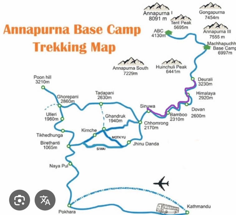
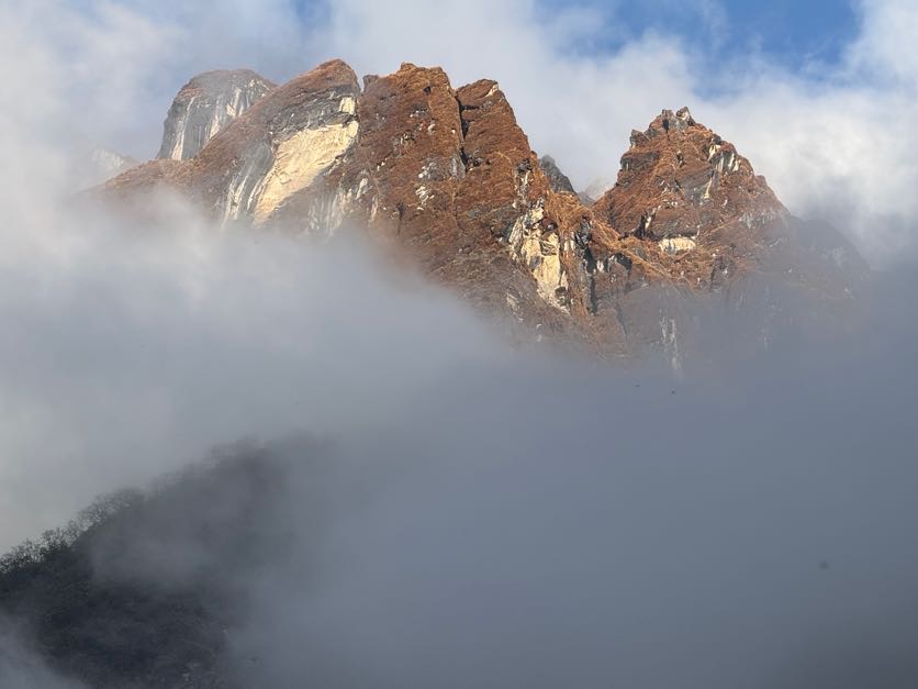
“The mountains are calling and I must go.” – John Muir
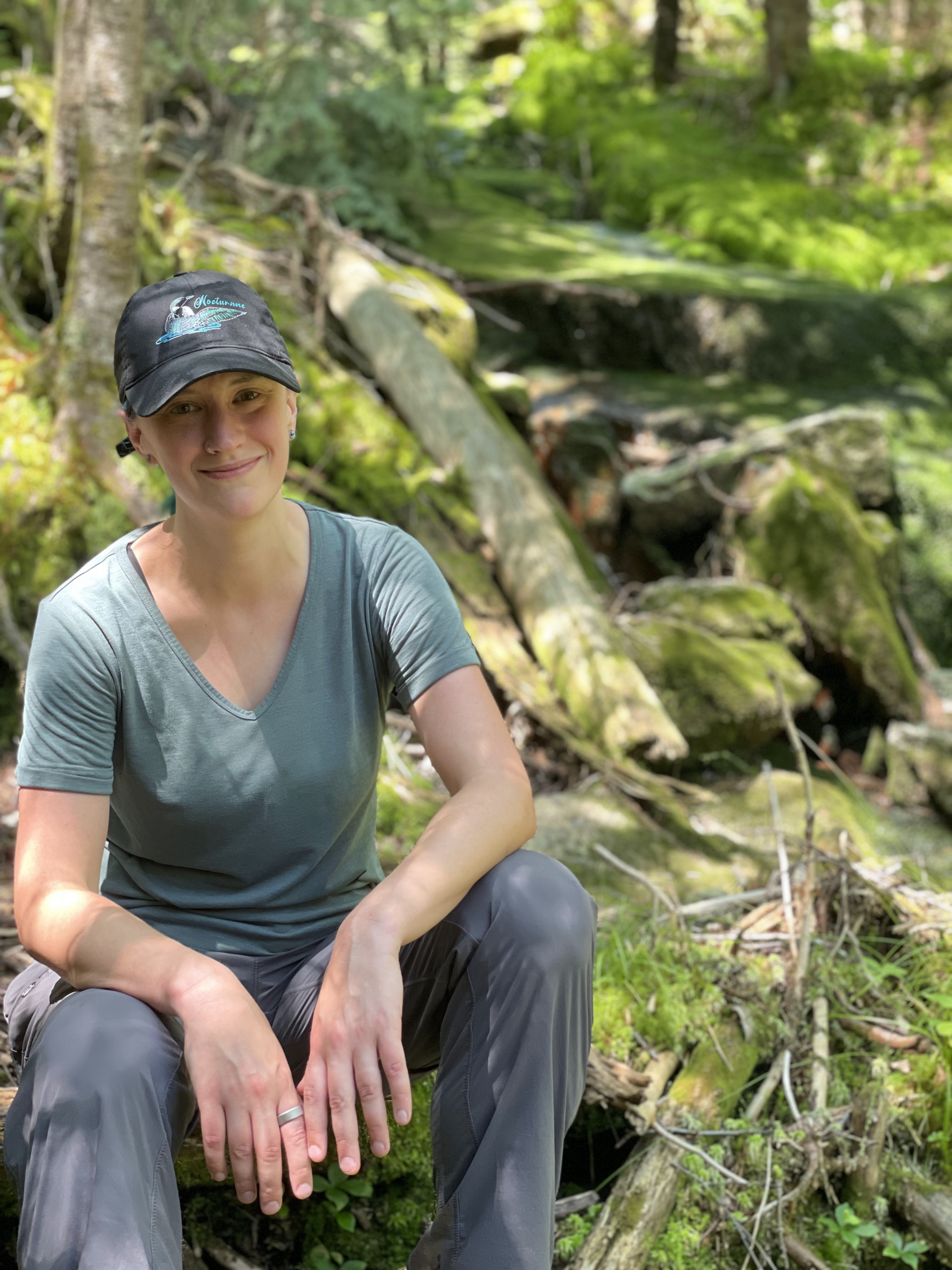
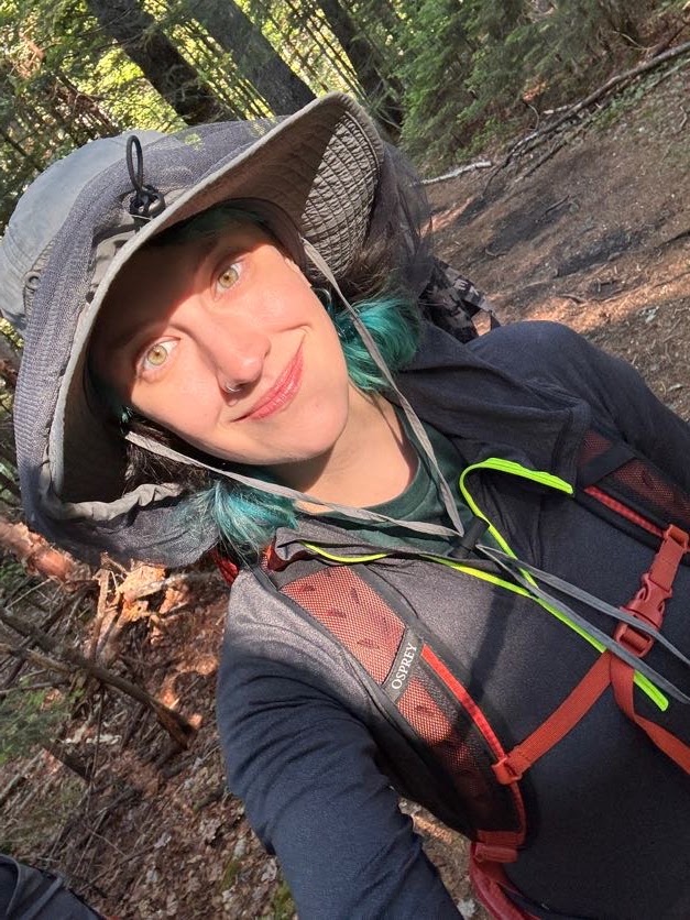
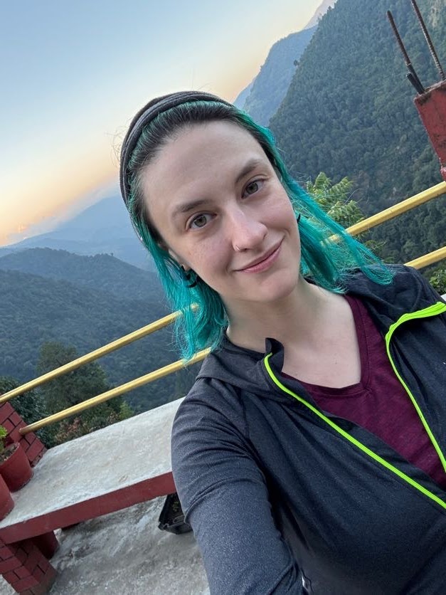
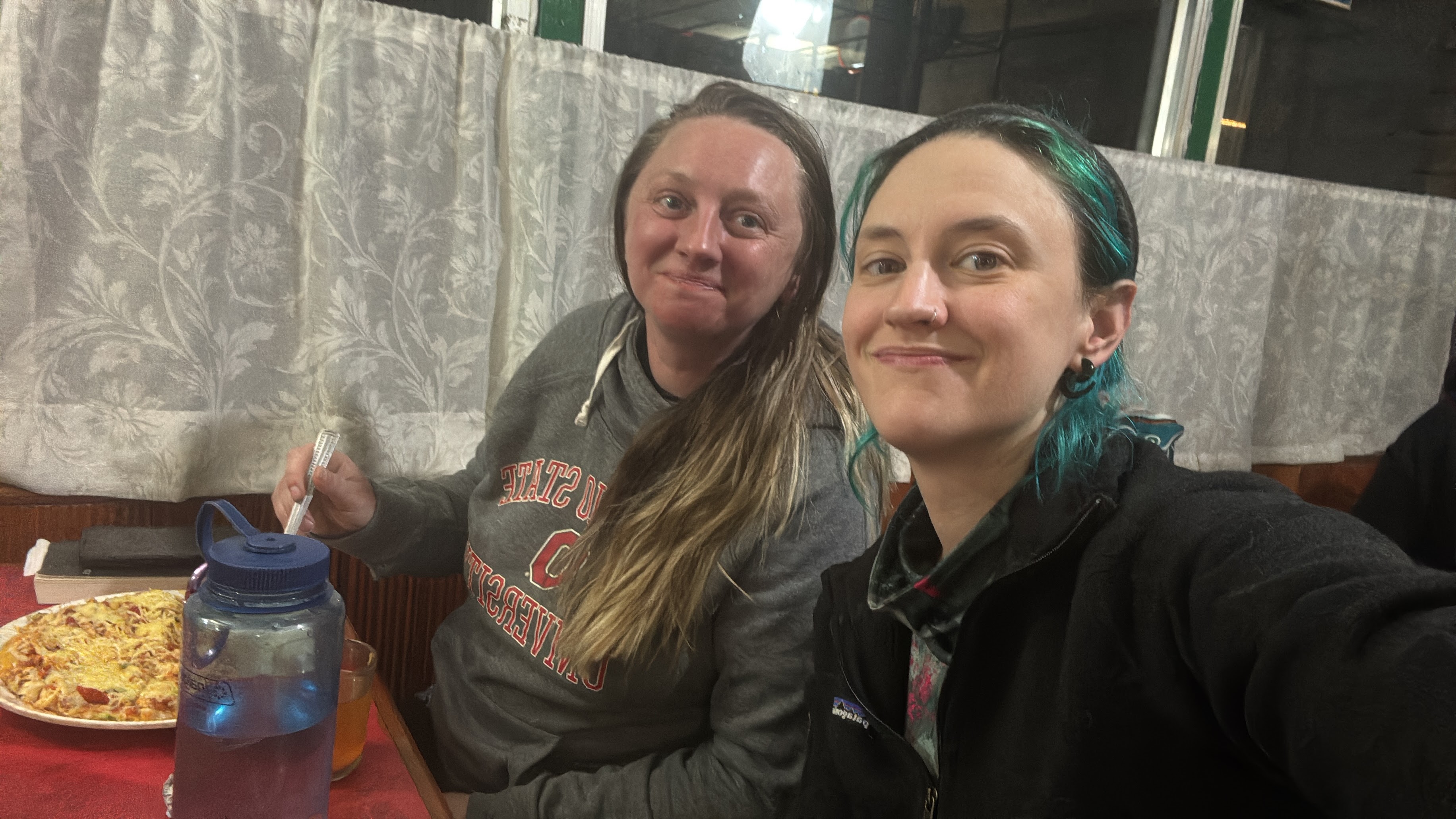
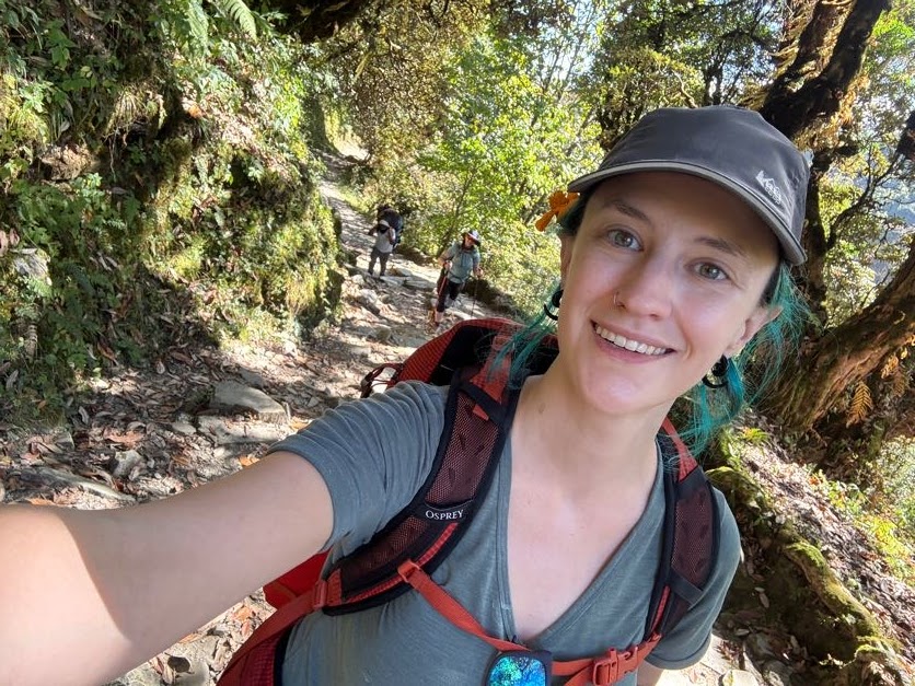
Greetings! I’m Natalie, welcome to my blog! I am a musician (check out my original folksy Adirondack-inspired music at https://www.nocturnnemusic.com/), an engineer, and an avid hiker and photographer. I also have Ehlers Danlos Syndrome – a degenerative genetic disorder that affects all of my joints, that’s resulting in my muscles being the glue that holds my joints together rather than my tendons and ligaments…As you can imagine, that makes hiking quite difficult! EDS is a little-known and underdiagnosed condition largely affecting women, with very little research behind it. Learn more about EDS here: https://www.ehlers-danlos.com/what-is-eds/
On this site you’ll find trip reports from my personal journeys through the mountains. Read through my diaries to stroll with me though the woods, accompany me on my solo 46er adventures, and learn from my triumphs and failures. “Only by going alone in silence, without baggage, can one truly get into the heart of the wilderness. All other travel is mere dust and hotels and baggage and chatter.” – John Muir
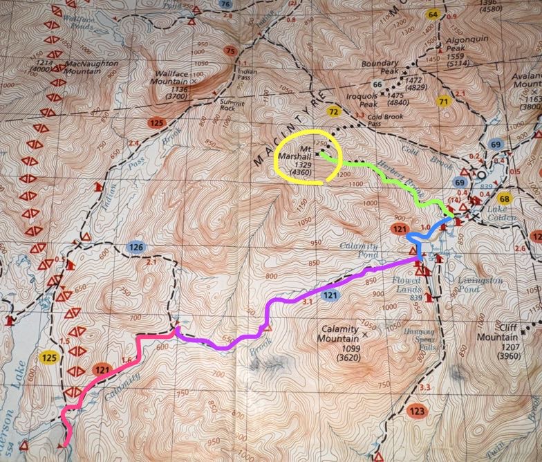
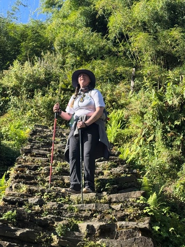
Another day, another waking-up-at-5am-to-climb-a-mountain. Marshall is the second-to-last hike I have left to complete the 46 high peaks. I originally had planned to do this hike in a loop – up Cold Brook to the summit, down Herbert Brook.
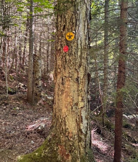
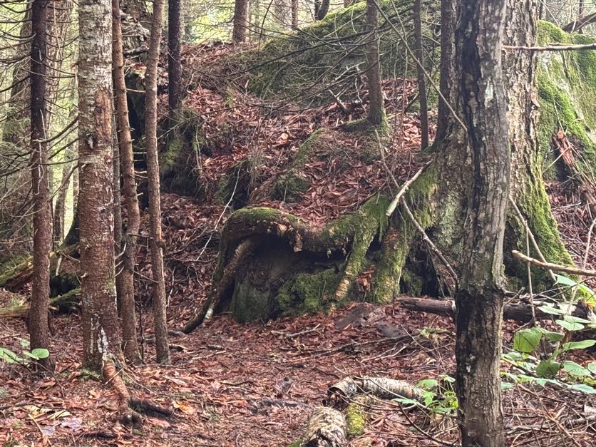
If you’re planning to hike Marshall, you probably know about the plane wreck that you can spot on the way up. In 1969, a pilot hit rough weather and crashed his plane near where the Cold Brook trail now is. Fortunately he survived, but his plane remains in it’s resting place for hikers to check out quite a ways up the trail towards Marshall.
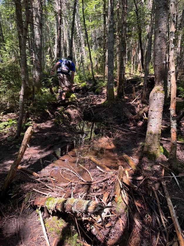
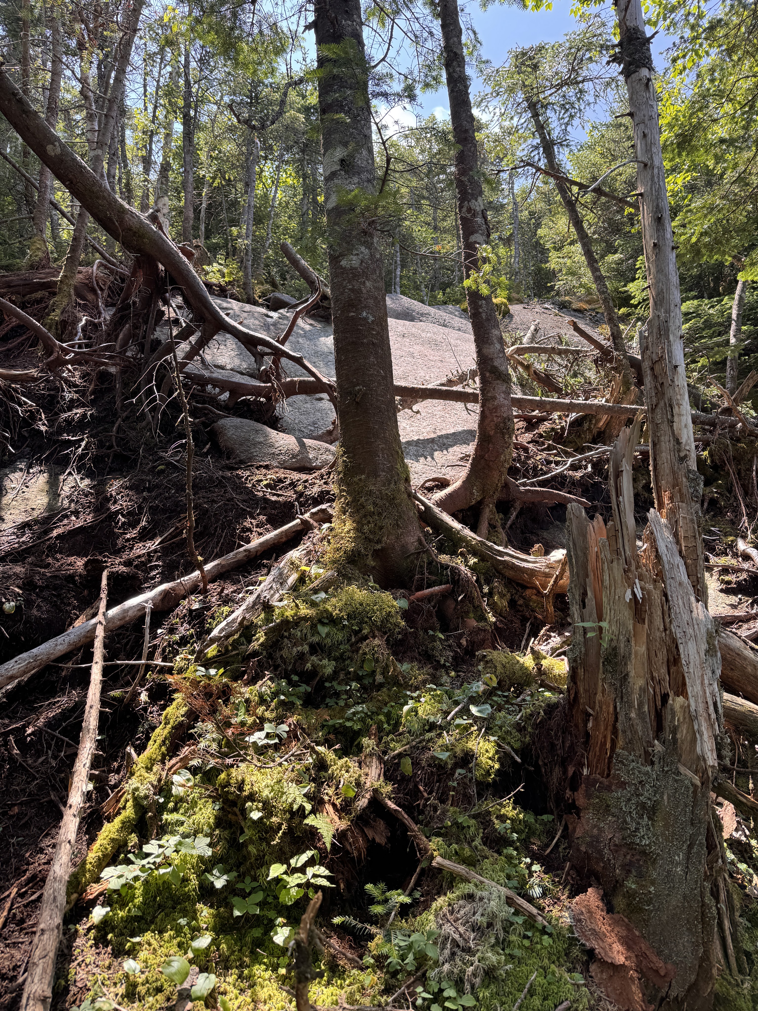
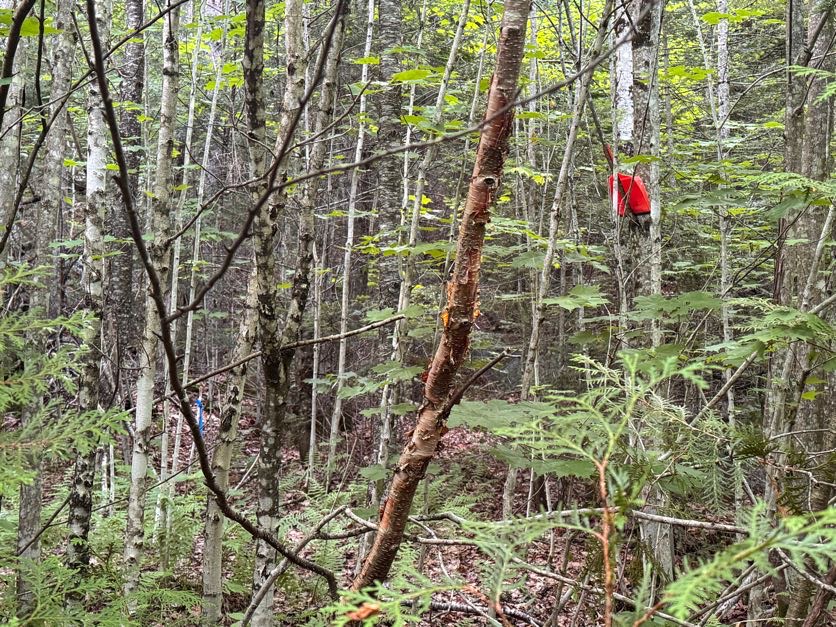
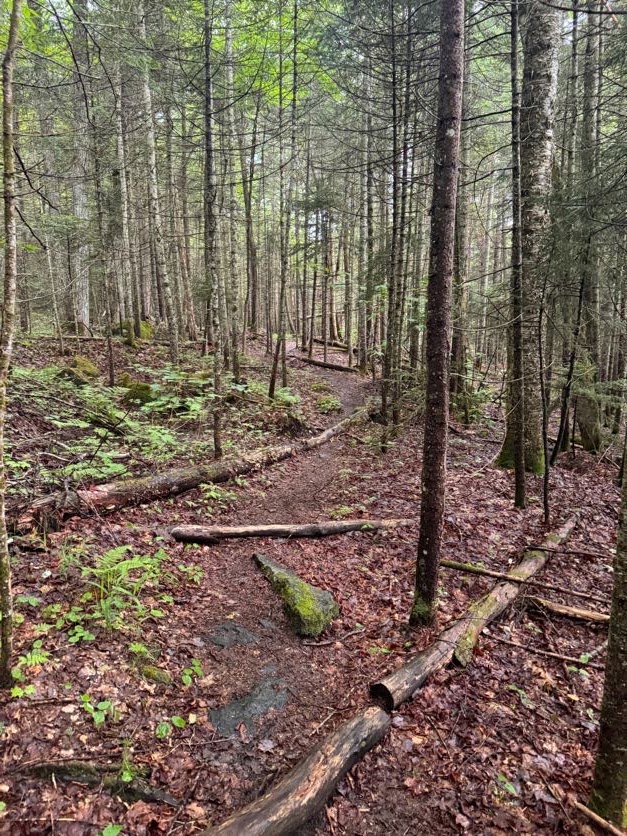
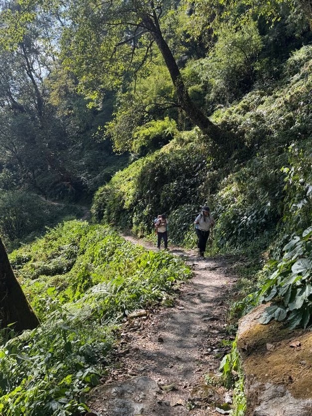
The Cold Brook trail is lightly travelled, steep, and crowded with shrubs and overhanging boughs. Someone recently told me that the Herbert brook trail is like a highway in comparison, so we decided to forego the experience and hike Marshall as an out-and-back via Herbert Brook.
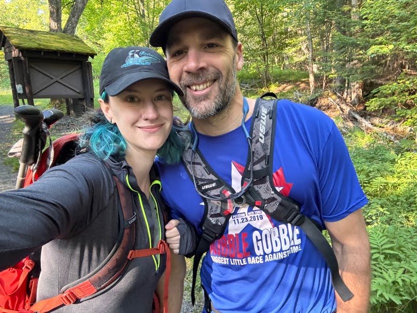
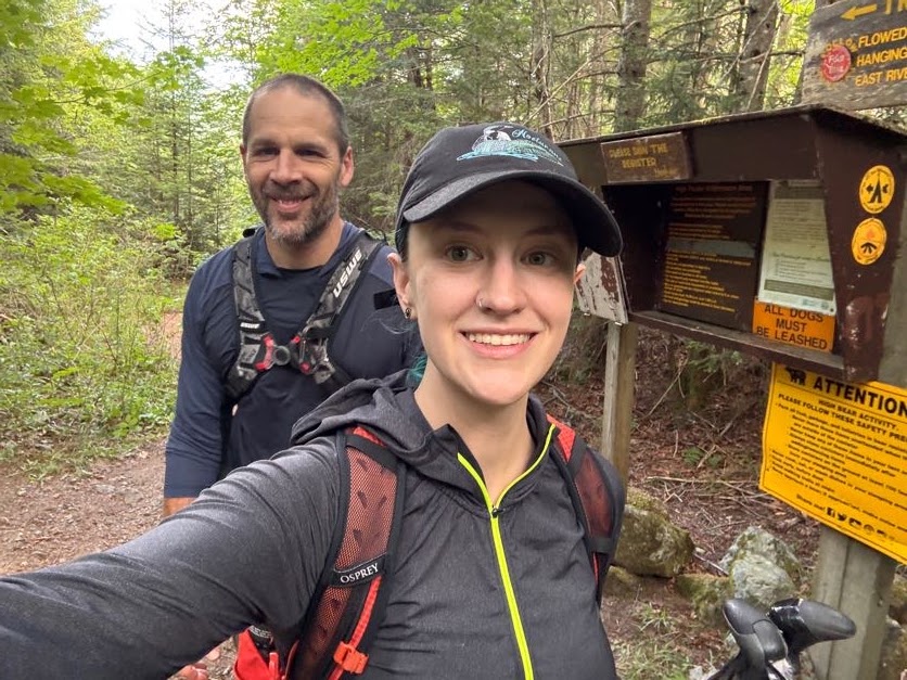
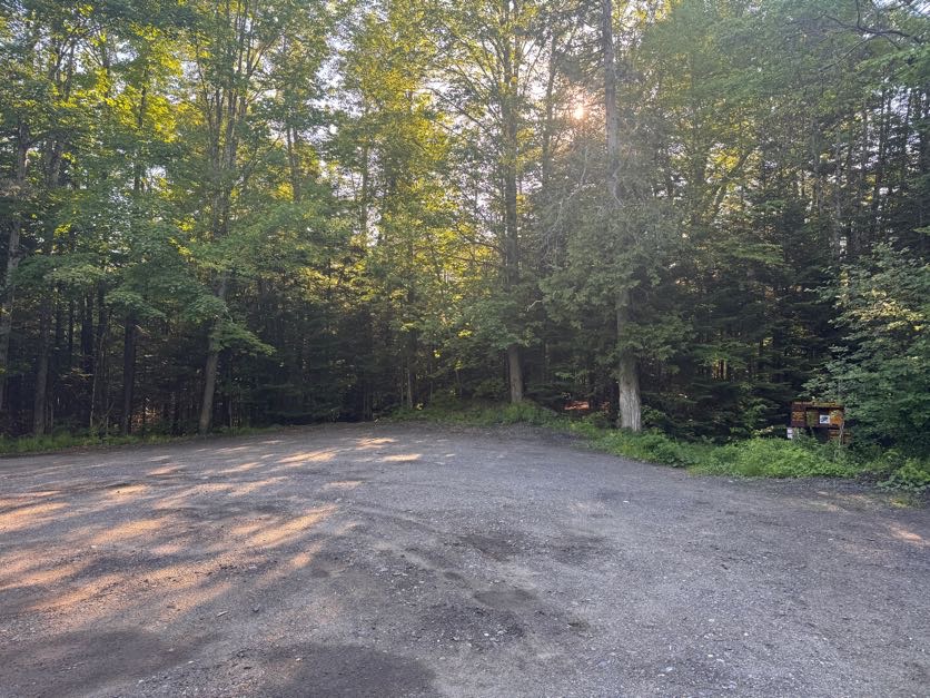
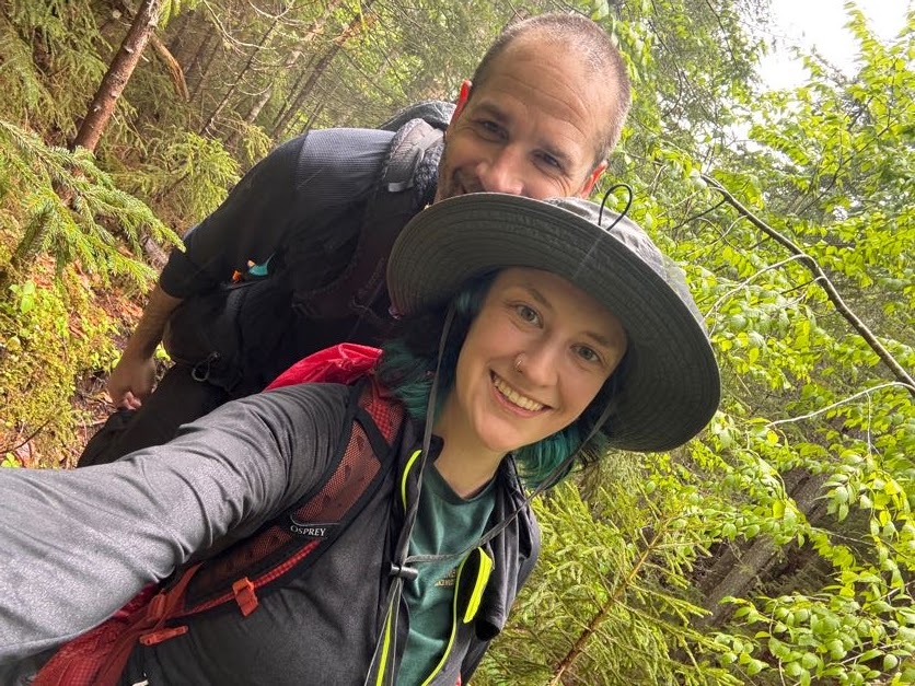
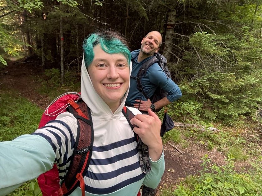
We arrived at 7:38am to a completely full parking lot. We parked behind a short line of cars along the side of the road, tied our boots, and hit the trail.
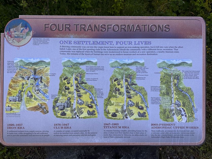
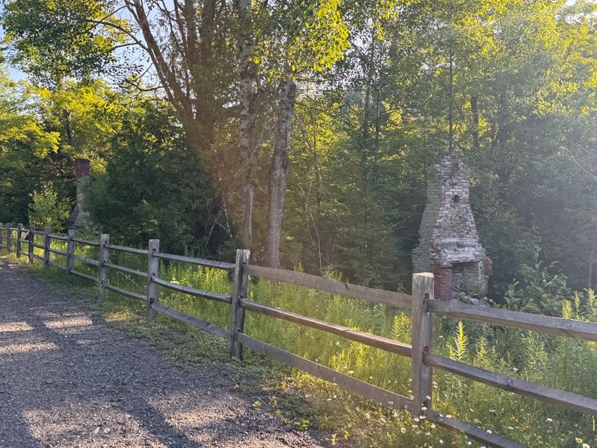
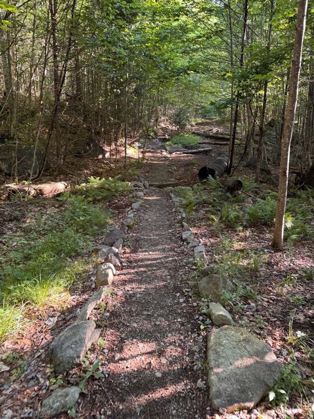
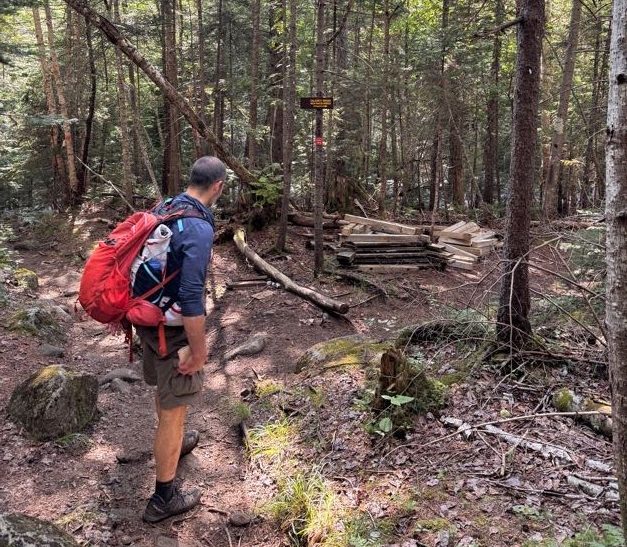
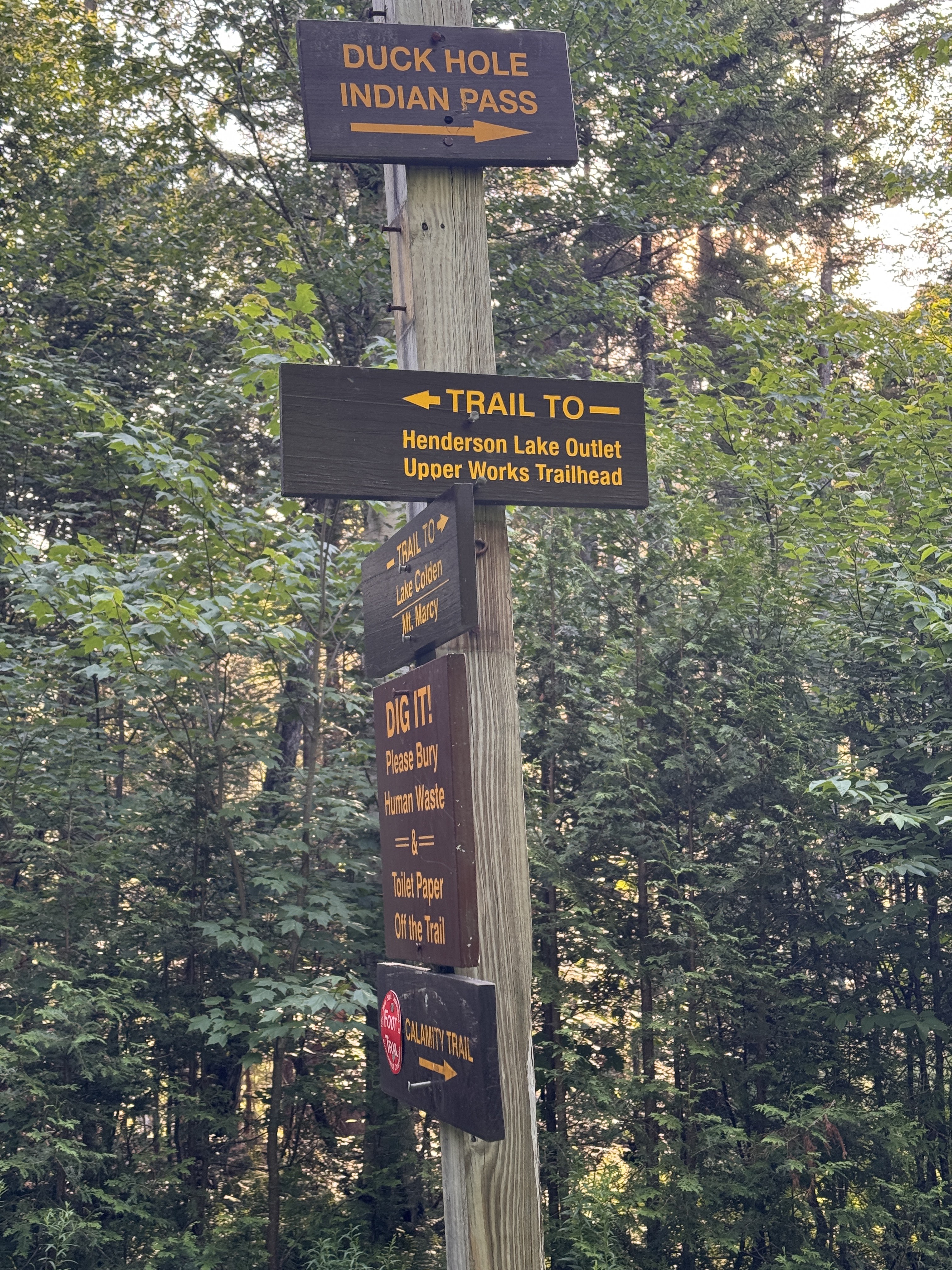
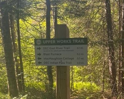
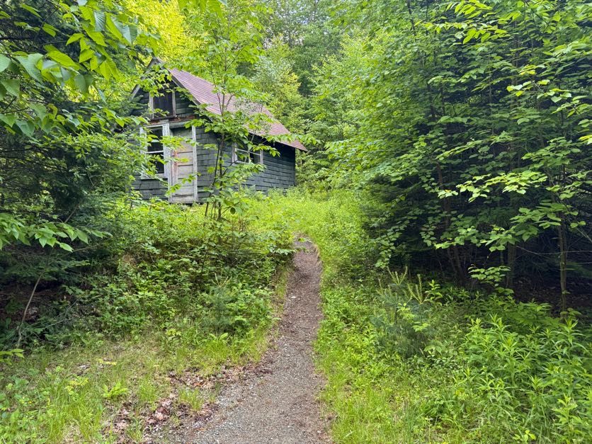
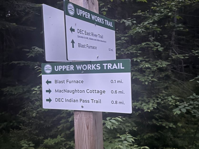
The parking area and trail was different from what I remembered. There’s a gate now that removes access to the smaller parking area right at the trailhead. We stopped at a new-looking sign beside the historical MacNaughton cottage and read some of the new signs that line the gravel road to the trailhead to read about the community that had lived and worked here in the 19th century.
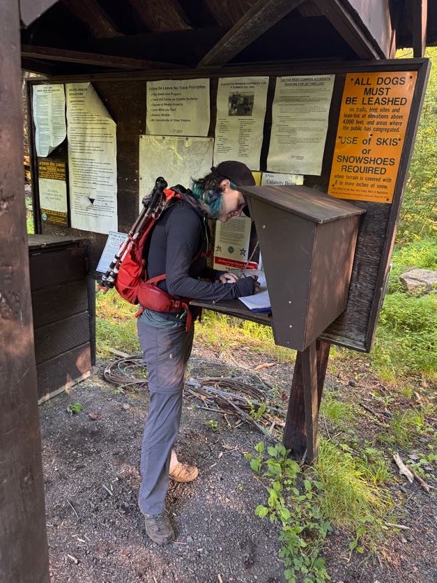
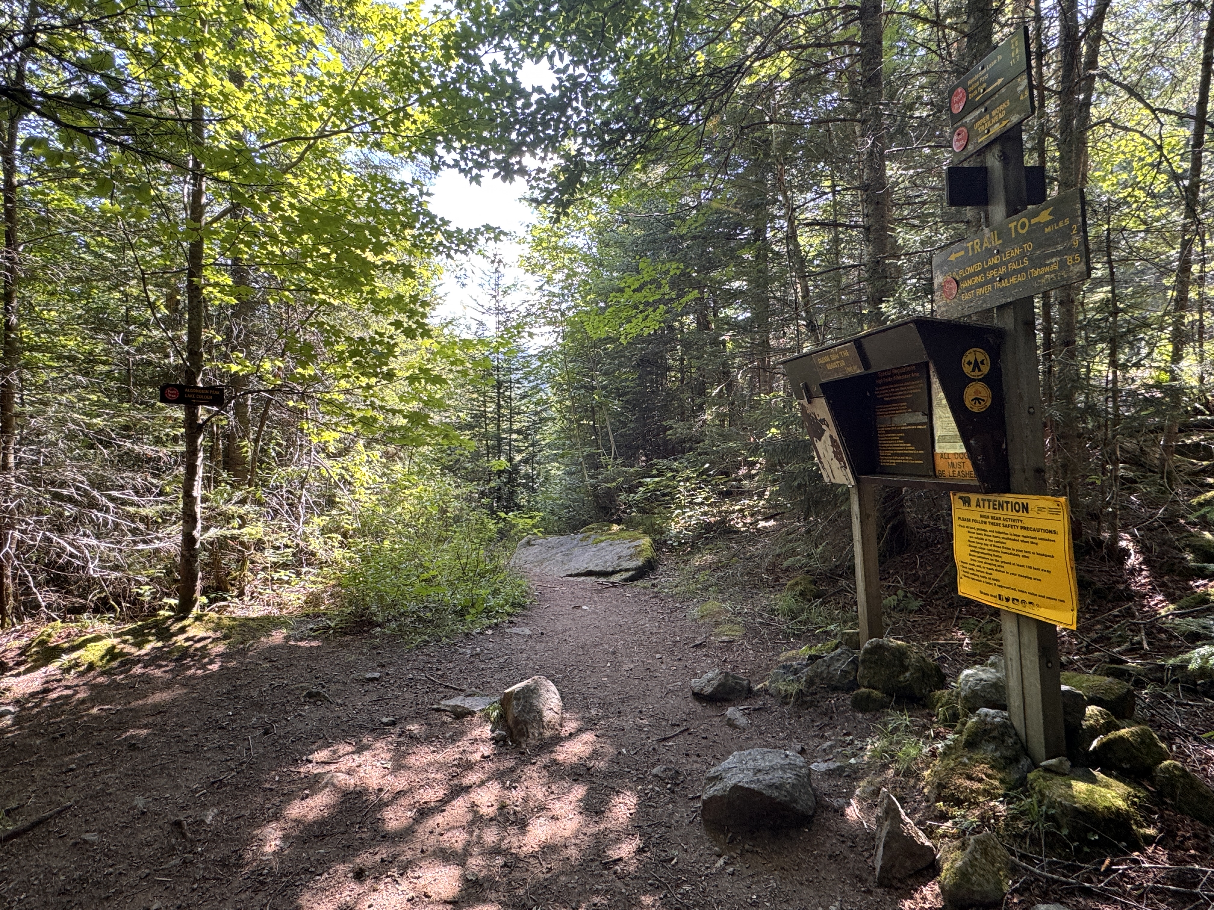
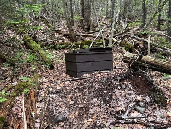
We reached the actual trailhead at 7:45 and signed in, noting the many people already signed in ahead of us, and made sure to also take a photo of the emergency numbers.
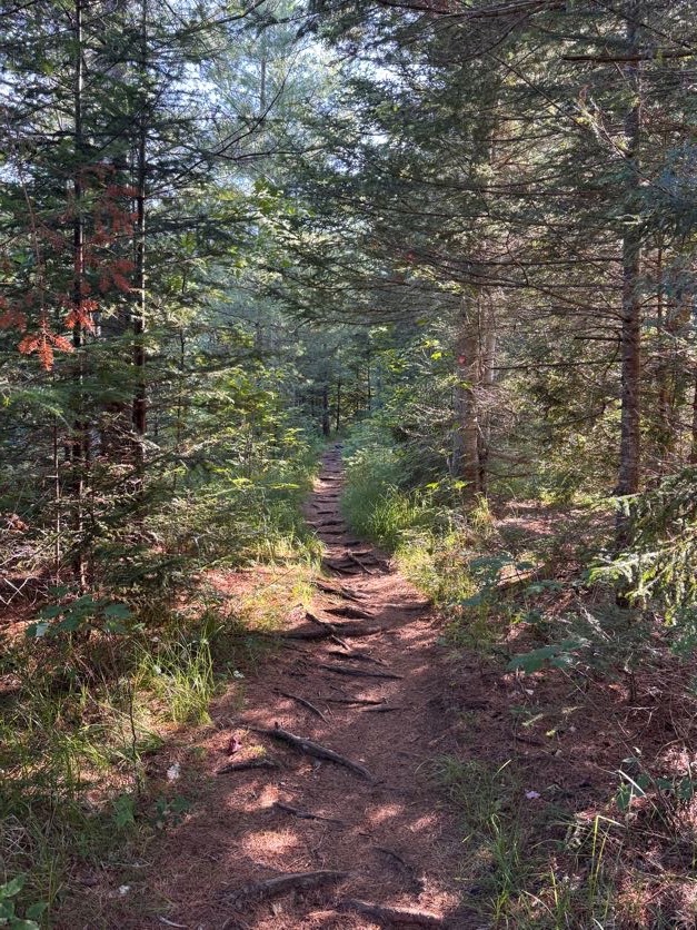
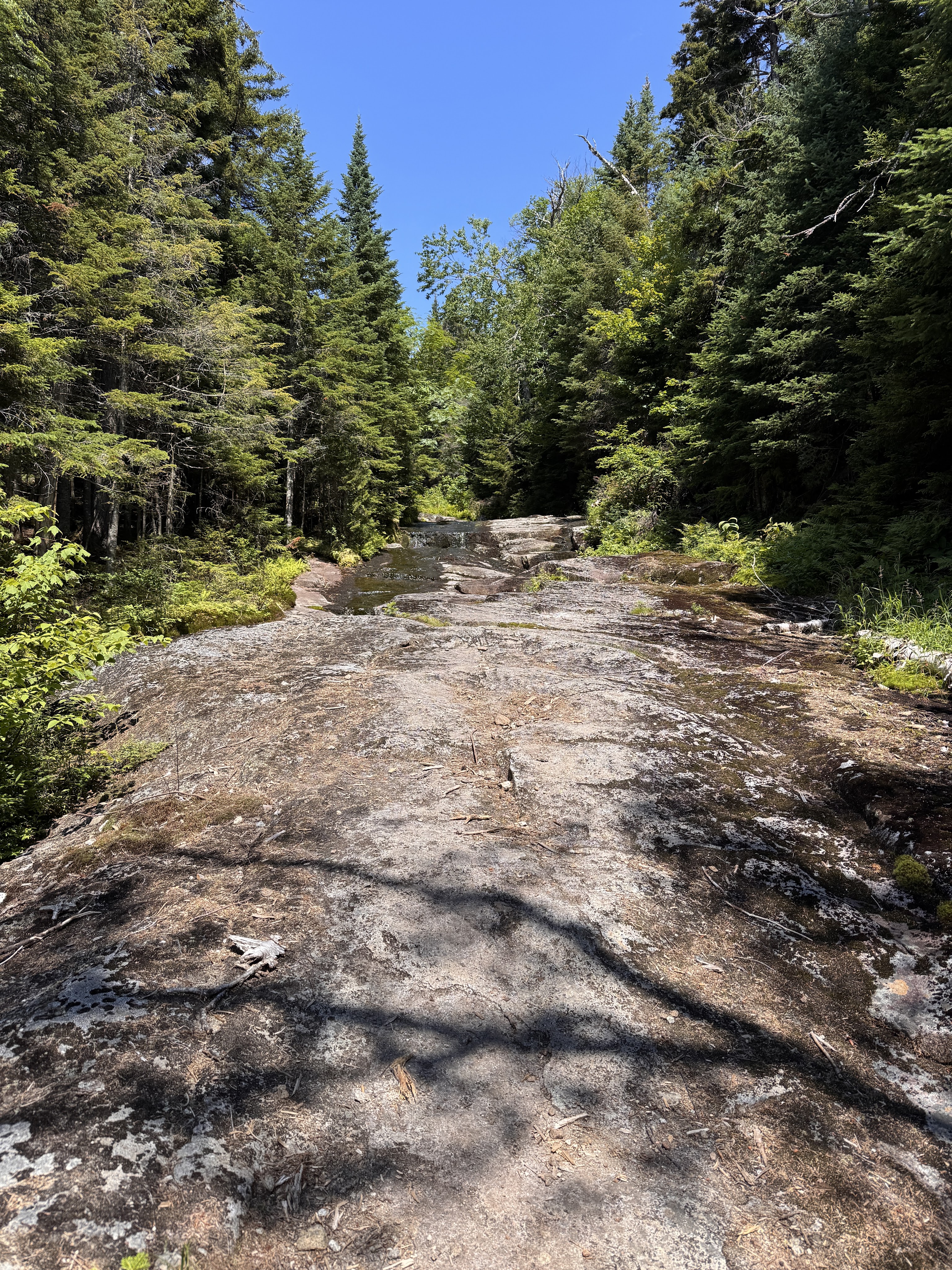
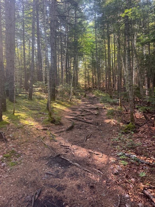
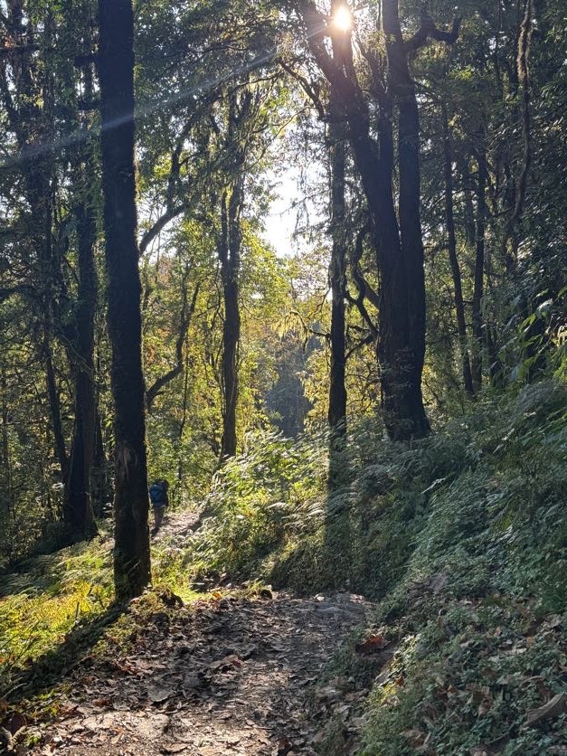
I always enjoy the early morning light through the trees on hikes like this.
It didn’t take more than a few minutes to reach the first junction. We stayed to the right to continue on Calamity Brook Trail.
I’d been feeling very low energy all week – granted, it’s been a really busy week, so that kinda makes sense – but I’m so close to finishing the 46 that nothing can stand in my way now. So I was sleepy and drowsy, but quietly enjoying this pleasant walk through the forest.
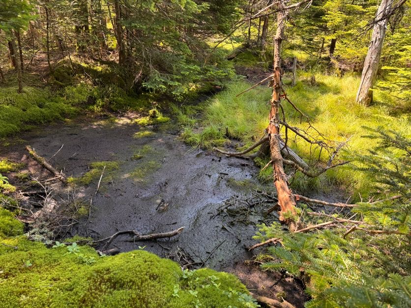
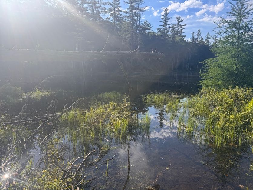
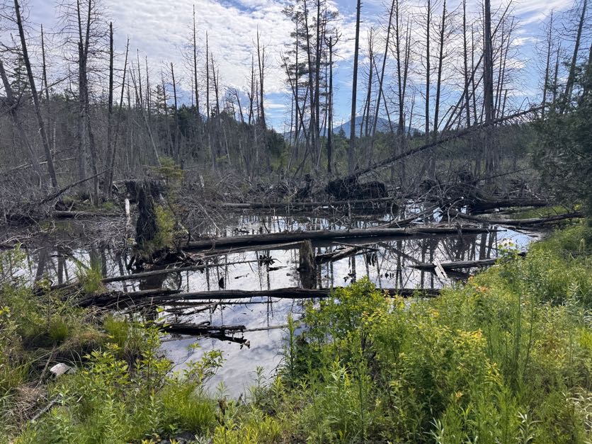
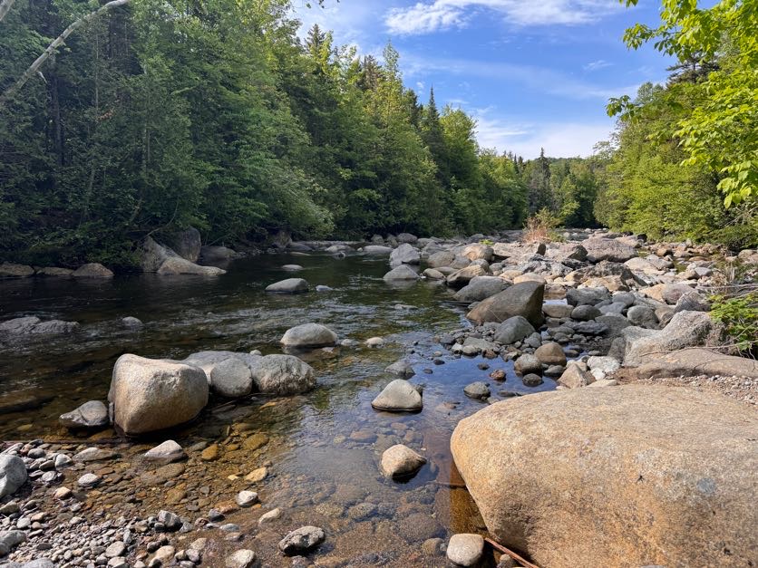
At 8:20 we reached a pool along the brook created from a beaver dam. We looked around but didn’t see any beavers out – they usually prefer evening activity so that makes sense.
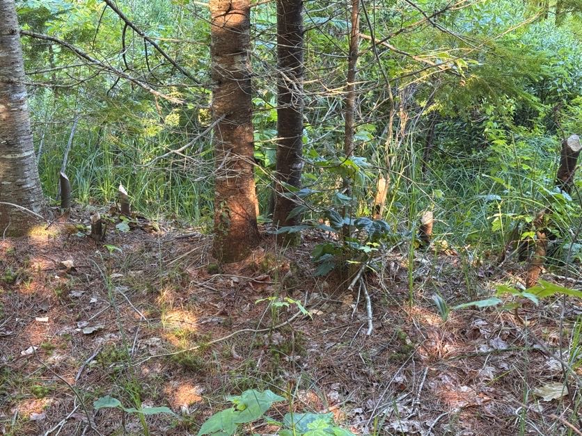
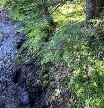
We DID however notice some pretty clear signs of busy beavers alongside the trail!
A few minutes later we reached a spot alongside the brook that we vividly recall from when we came this way with our pup Juno to climb Cliff and Redfield. We had hopped down and crossed the brook to throw sticks in the water for her, she was so happy!
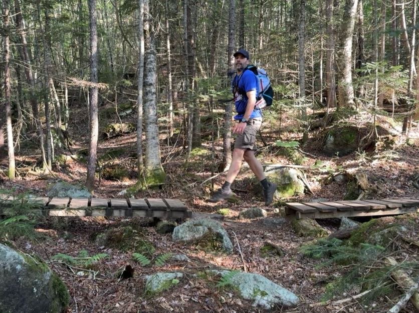
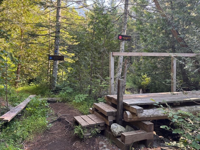
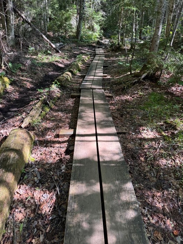
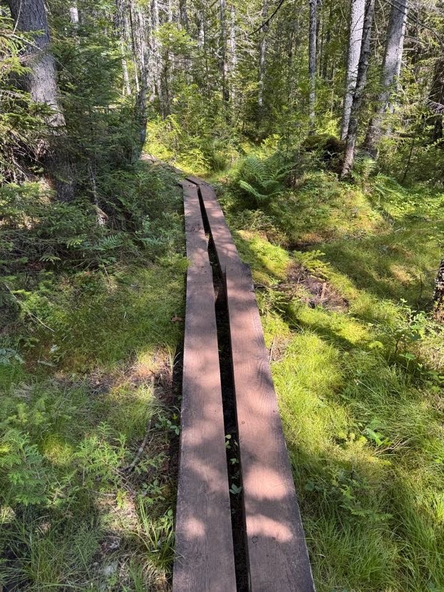
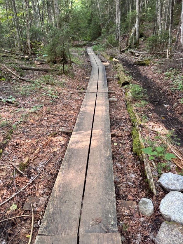
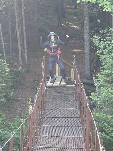
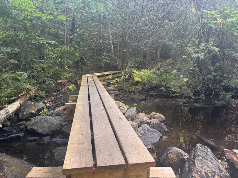
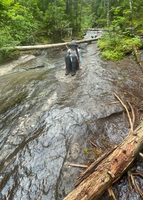
When we crossed these two nice sections of wooden walkway, Gildo said to me “I have an idea…” so anyway here he is magically walking on air to bridge the gap between the walkways.
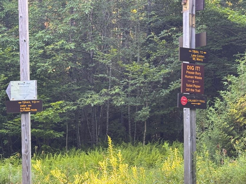
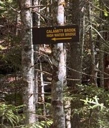
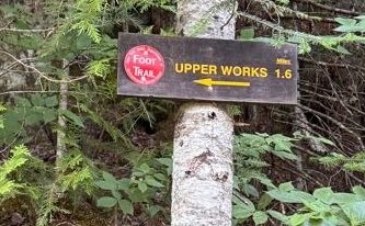
At 8:30 we reached the next junction, indicating we’d gone 1.6 miles. Turning left would take us along Indian Pass; we turned right to cross the bridge and stay on the Calamity Brook trail for another 3.1 miles to the next junction.
Just crossing the bridge normally, as a normal human person would.
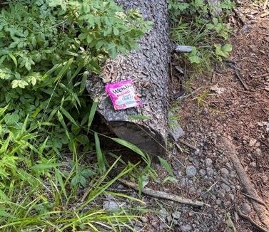
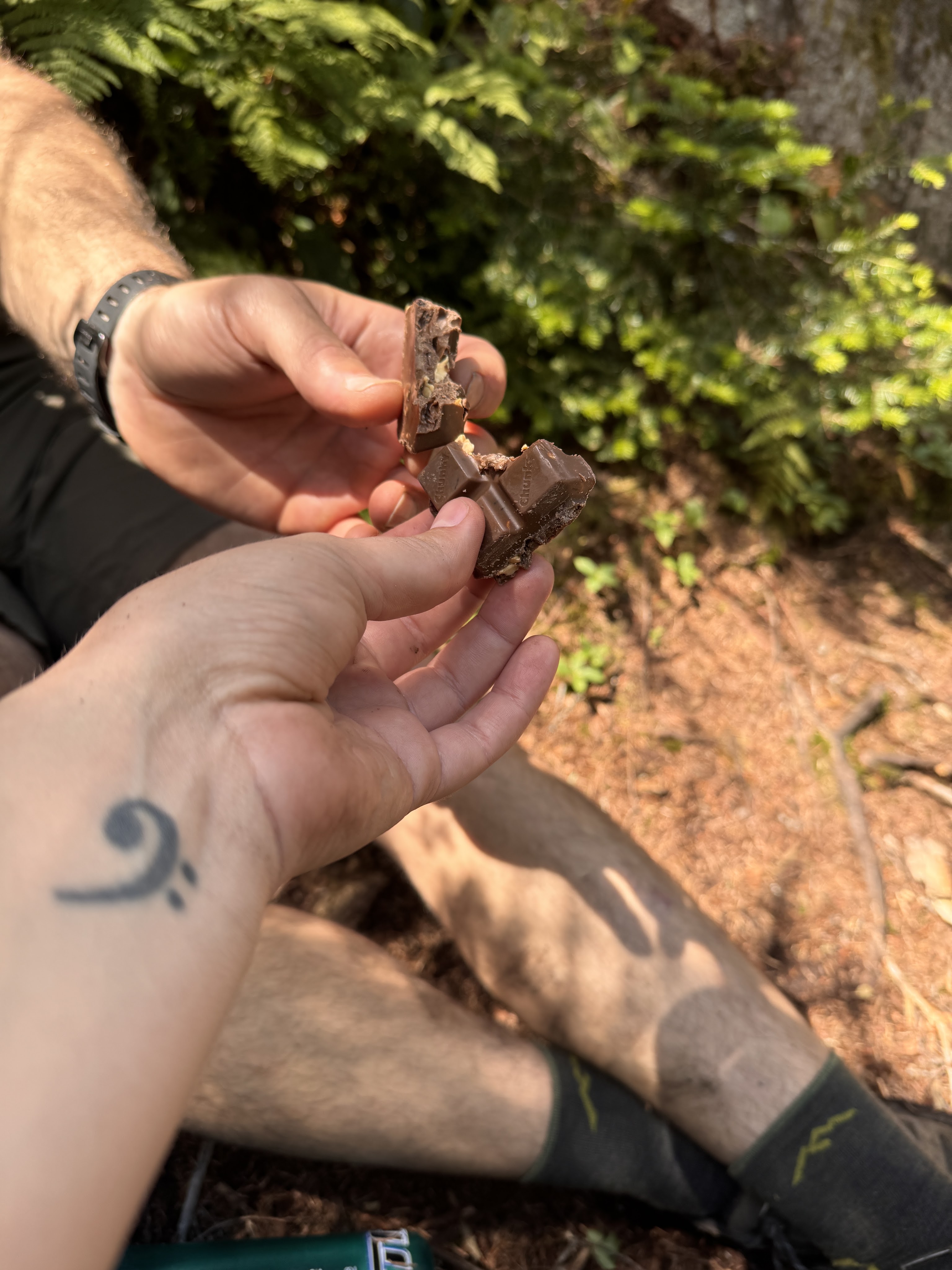
Have I ever told you about the legend of the Golden Squirrel? He likes to follow alongside hikers on the trail, and drop sweet treats to reward the worthiest of hikers. He was pretty active on this particular trail, first striking about an hour in!
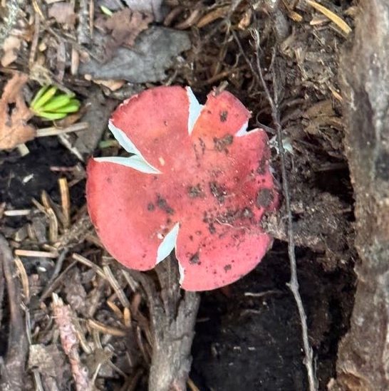
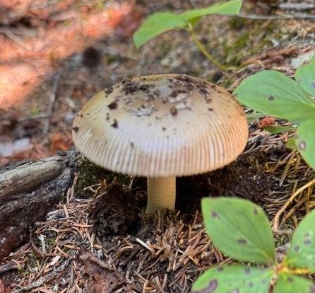
Mushrooms were rife on the trail, we saw so many brightly colored ones along the way like this russula.
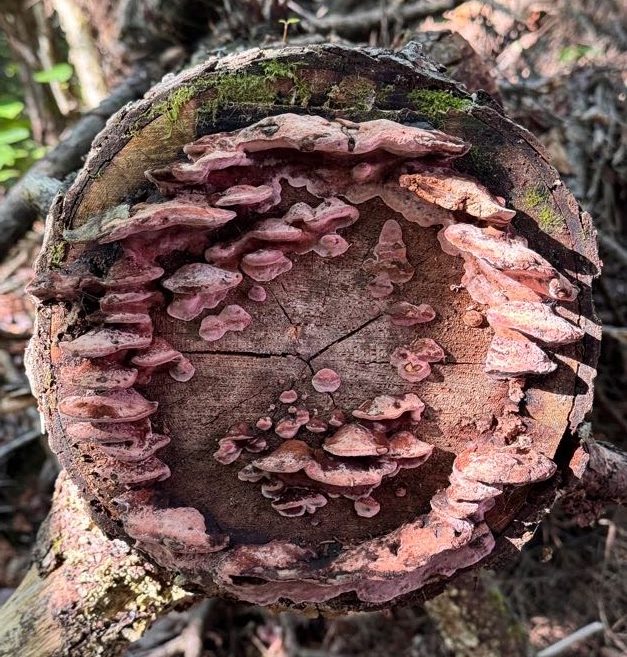
And these mushrooms growing out of a severed tree across the trail.
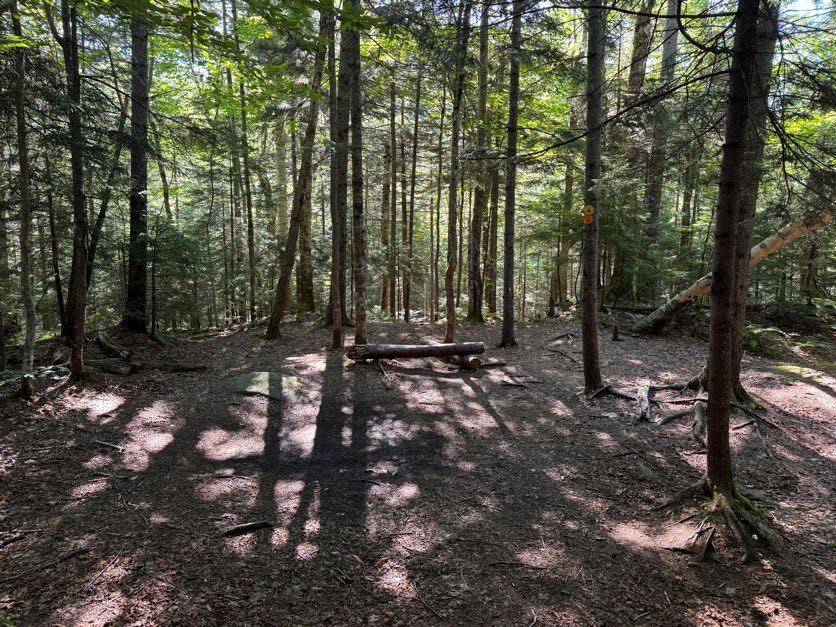
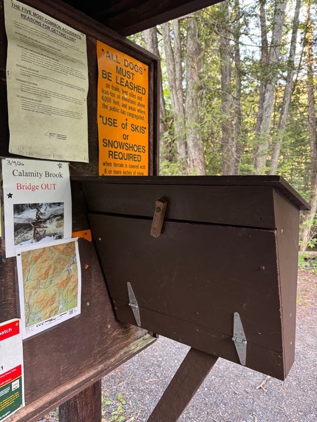
At 9:00 we reached the first real campsite on the map – there was another sign for a campsite further down the trail, but it looked to be across the river and the bridge was out, so I’m not sure how you’d get to it.
We have fond memories of this campsite, so we headed in to rest on the log and have a snack for a quick break.
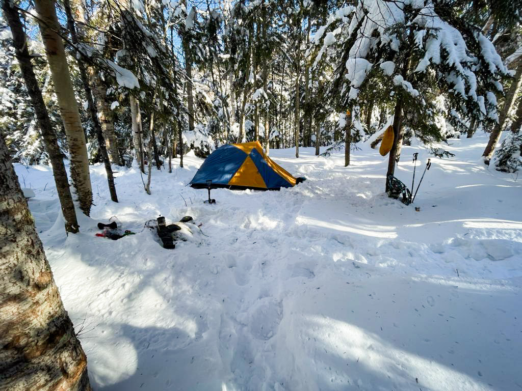
We actually tried to summit Marshall once before – in February of 2021. It was frigid cold and we had planned to camp near the base of Marshall. However barely 3 miles into the hike, the pain in my knees flared up and left me unable to go any further. So we set up camp right here and hiked out in the morning. It was -15 degrees F overnight, and a balmy +15 degrees F INSIDE the tent! But we surivived!
After 10 minutes or so we continued on our way.
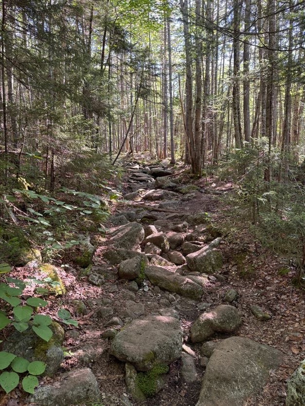
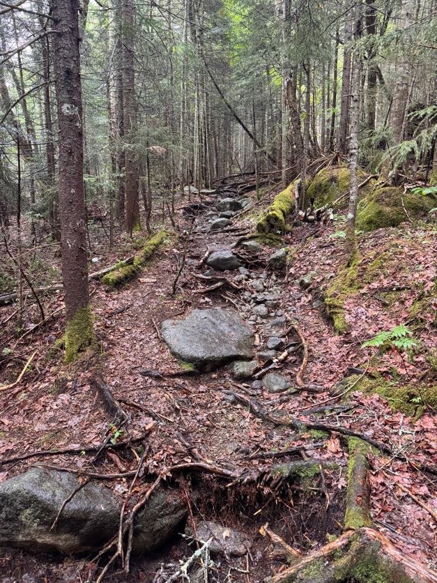
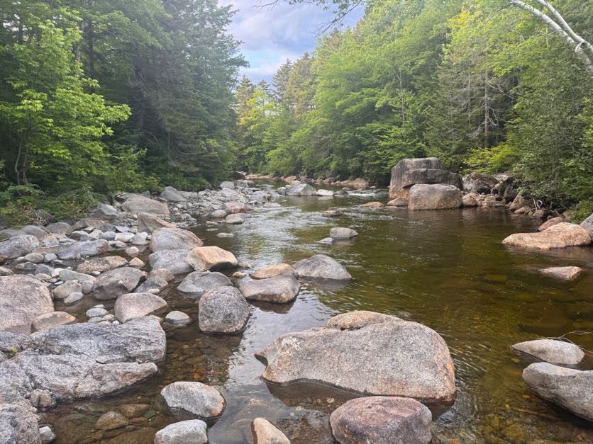
One thing I DO remember from our Cliff and Redfield trek is how rocky this dang trail is. It’s probably not a big deal to most but all these rocks and boulders on the path cause a lot of pain to my knees and hips, so I was careful to step around them when possible; though it did slow us down.
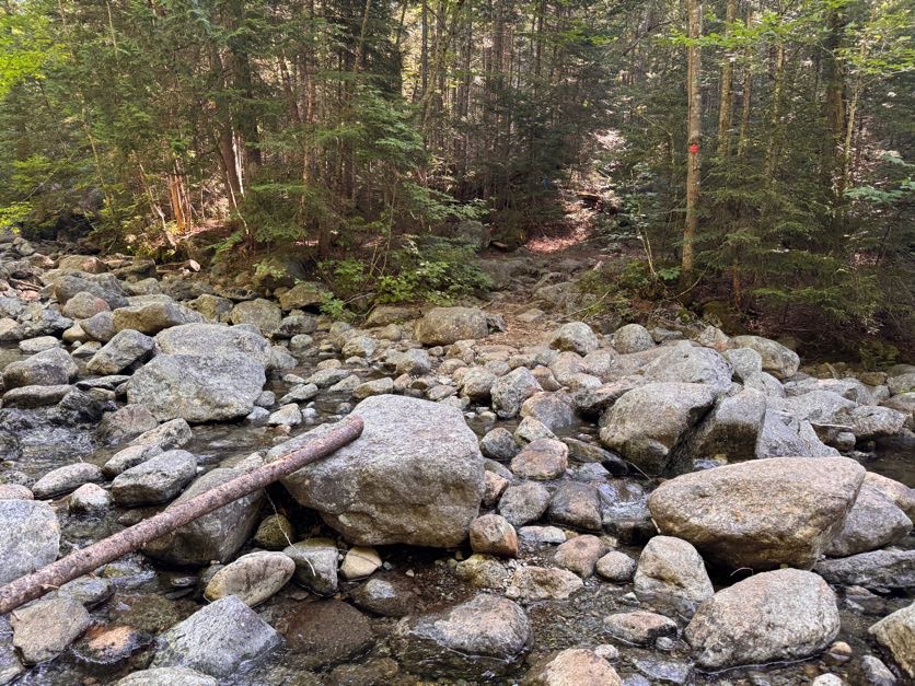
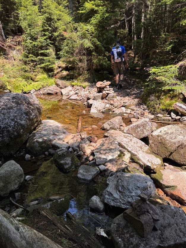
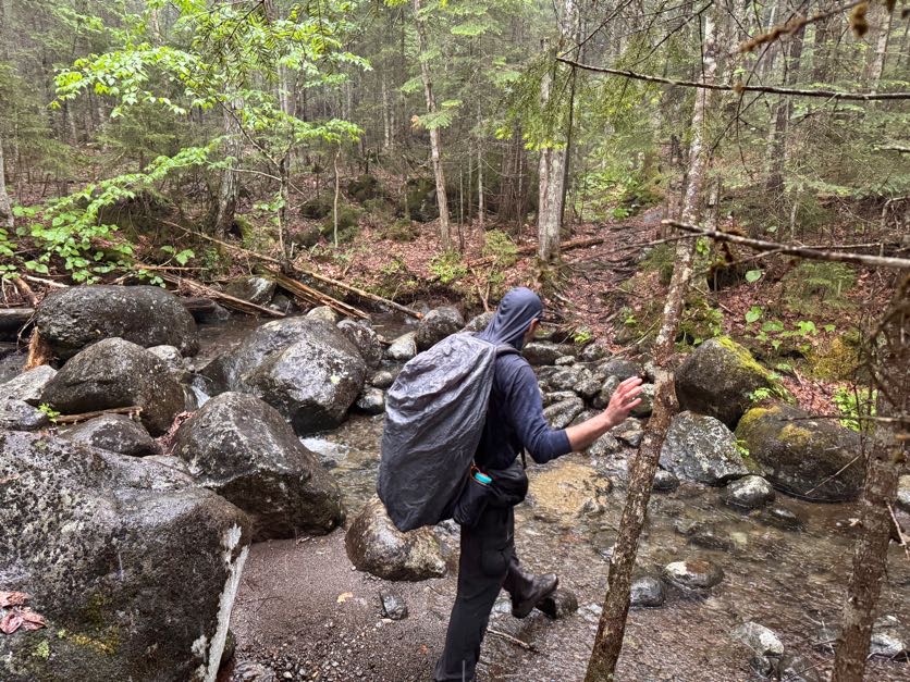
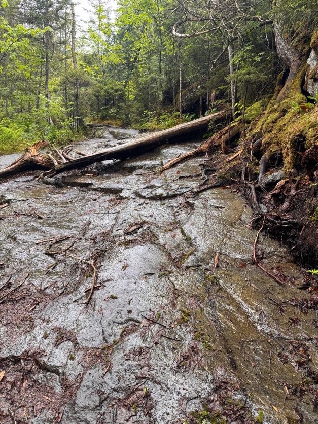
At 9:24 we reached the Calamity Brook crossing. A sign at the trailhead noted that the bridge had been washed away so we didn’t bother following this sign.
No worries though, the brook is perfectly easy to cross – just beware and DON’T TRUST ROCKS! (This is the catchphrase of the day by the way).
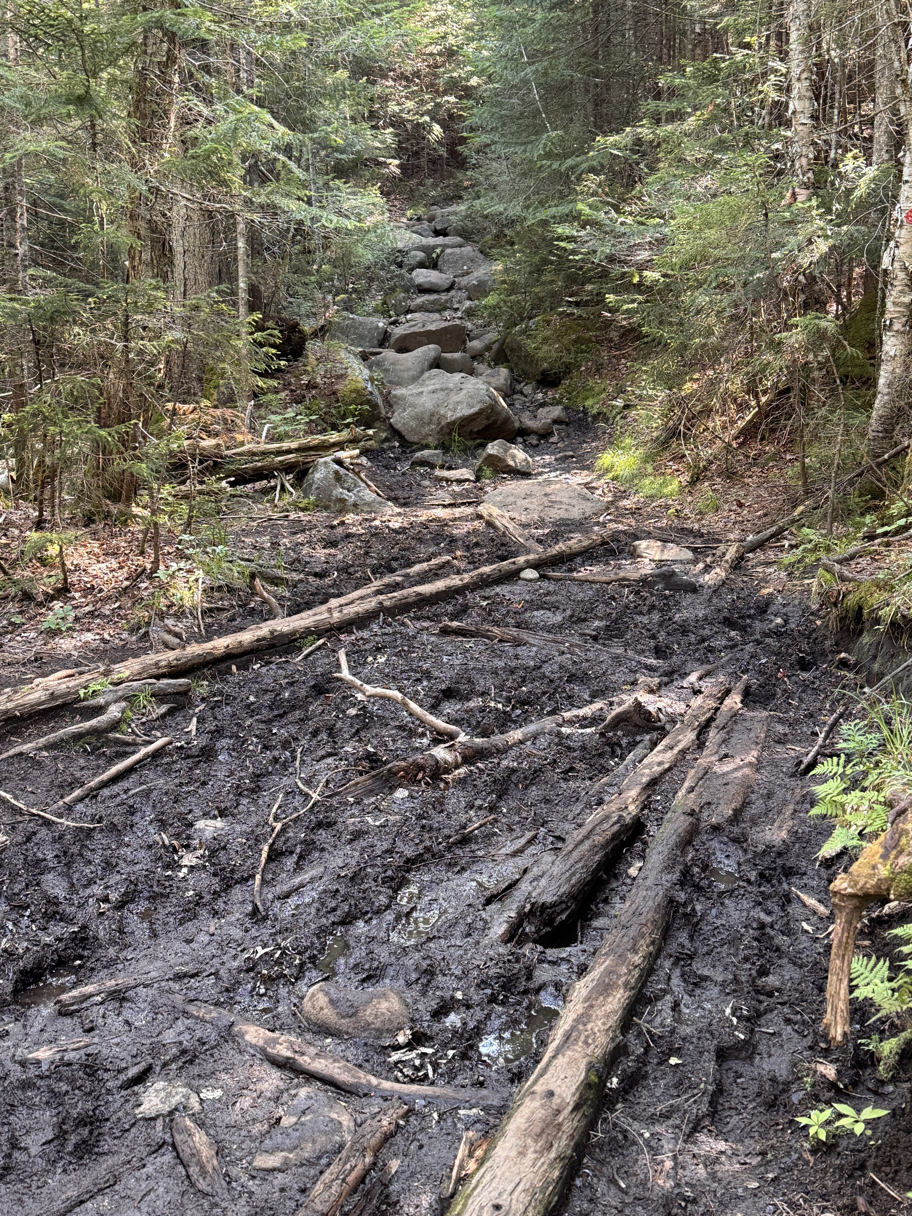
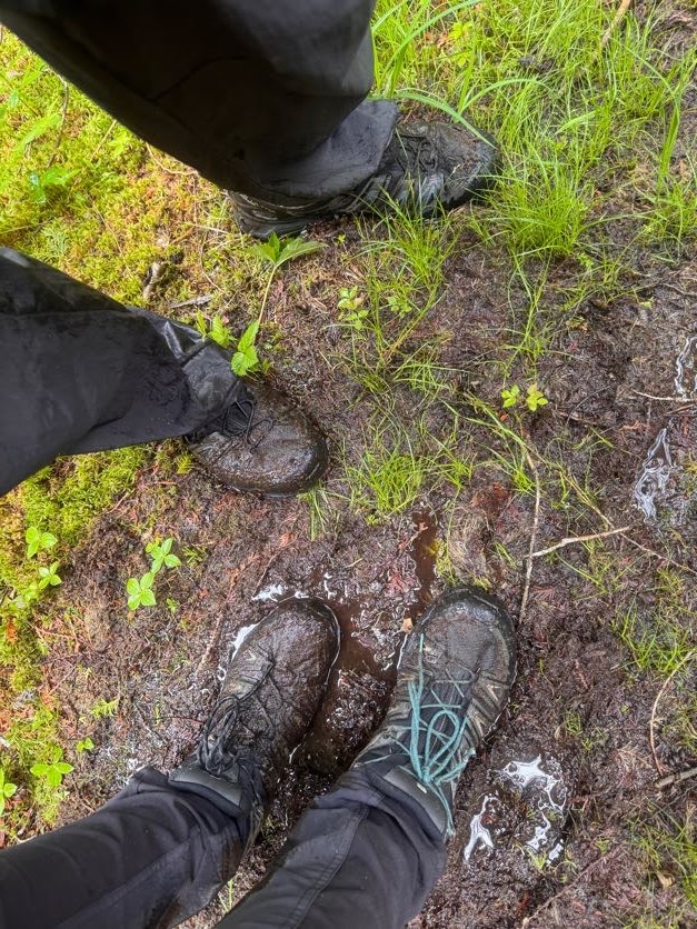
The further we went on this trail, the more Adirondack-y it became. If there isn’t any mud, are we even in the ADK?
Mud AND rocks? Oh yes, we are here.
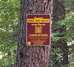
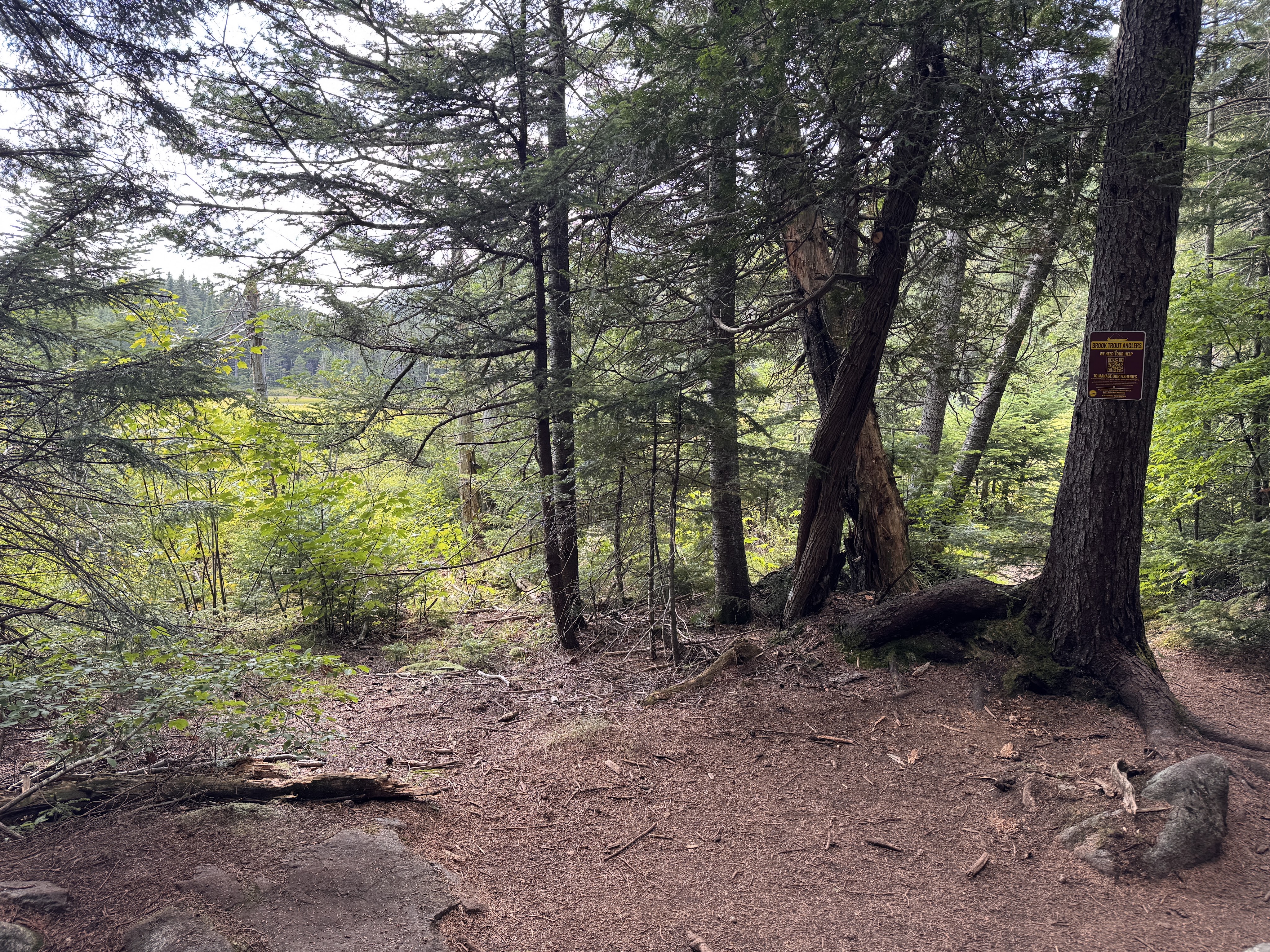
At 10:00am we reached a small unmarked junction marked with a sign for brook trout anglers.
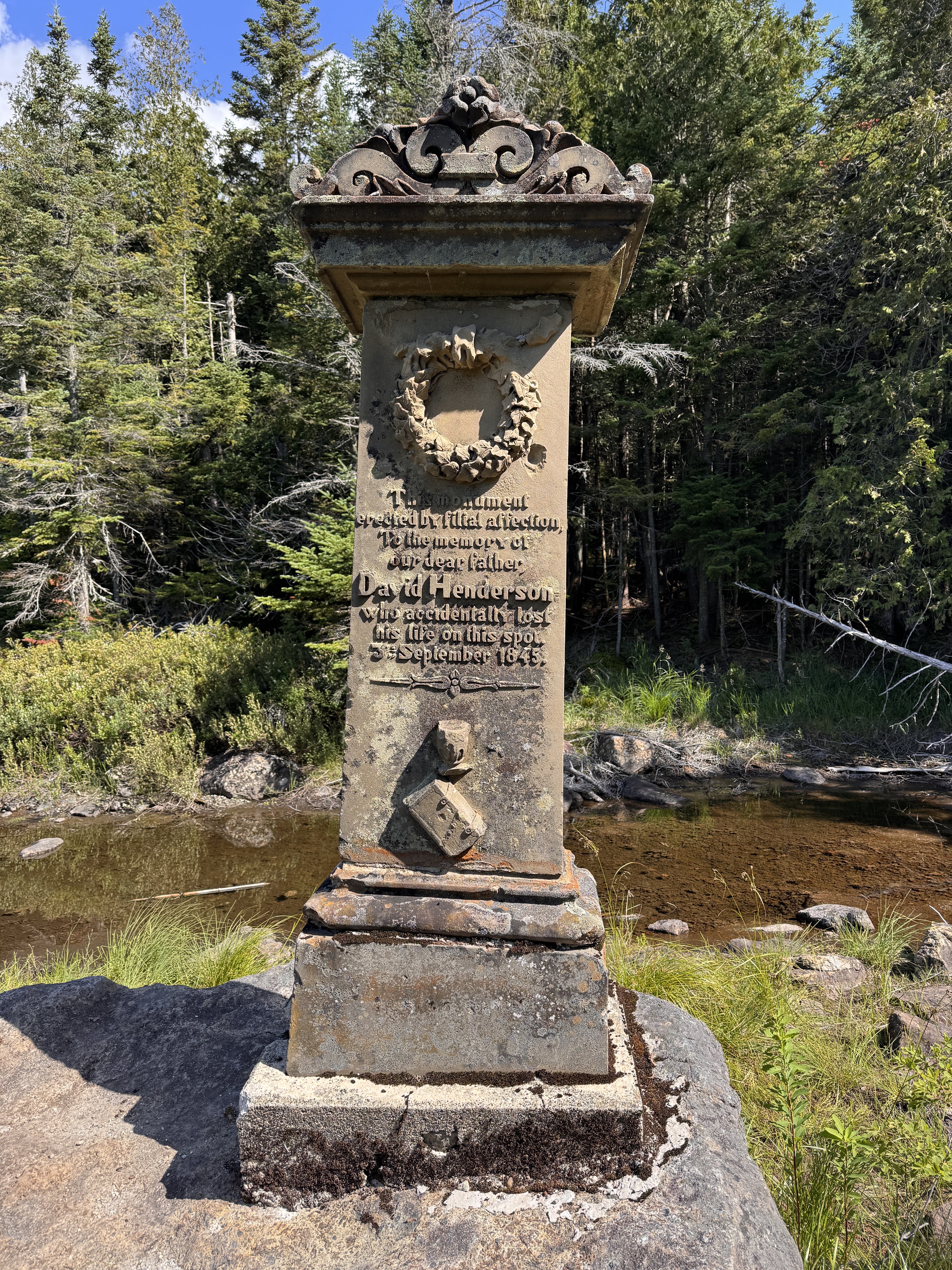
We followed the small spur trail to a monument on the edge of Calamity pond.
The monument marks the spot where David Henderson – a founding member of the iron ore works – had lost his life accidentally at this spot when he set his pistol down and it discharged into his abdomen. This pond and the brook we’ve been trekking along are so named Calamity because of this event.
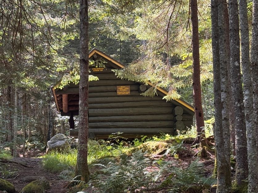
We carried on and 15 minutes later we were passing the Calamity lean-to, with the next register and junction just beyond.
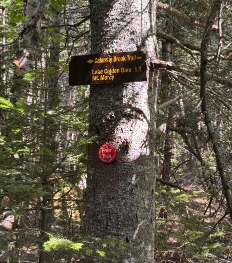
We took a moment to sign in and double check our map before following the sign to stay on the Calamity Brook trail towards the lake Colden dam.
It was less than a mile to the junction to the Herbert Brook trail from here.
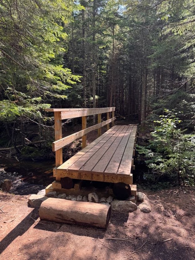
After 30 minutes, we reached the bridge over Herbert Brook and stopped for a few minutes to have first lunch and top off our water supply before starting the ~2 mile push to the summit.
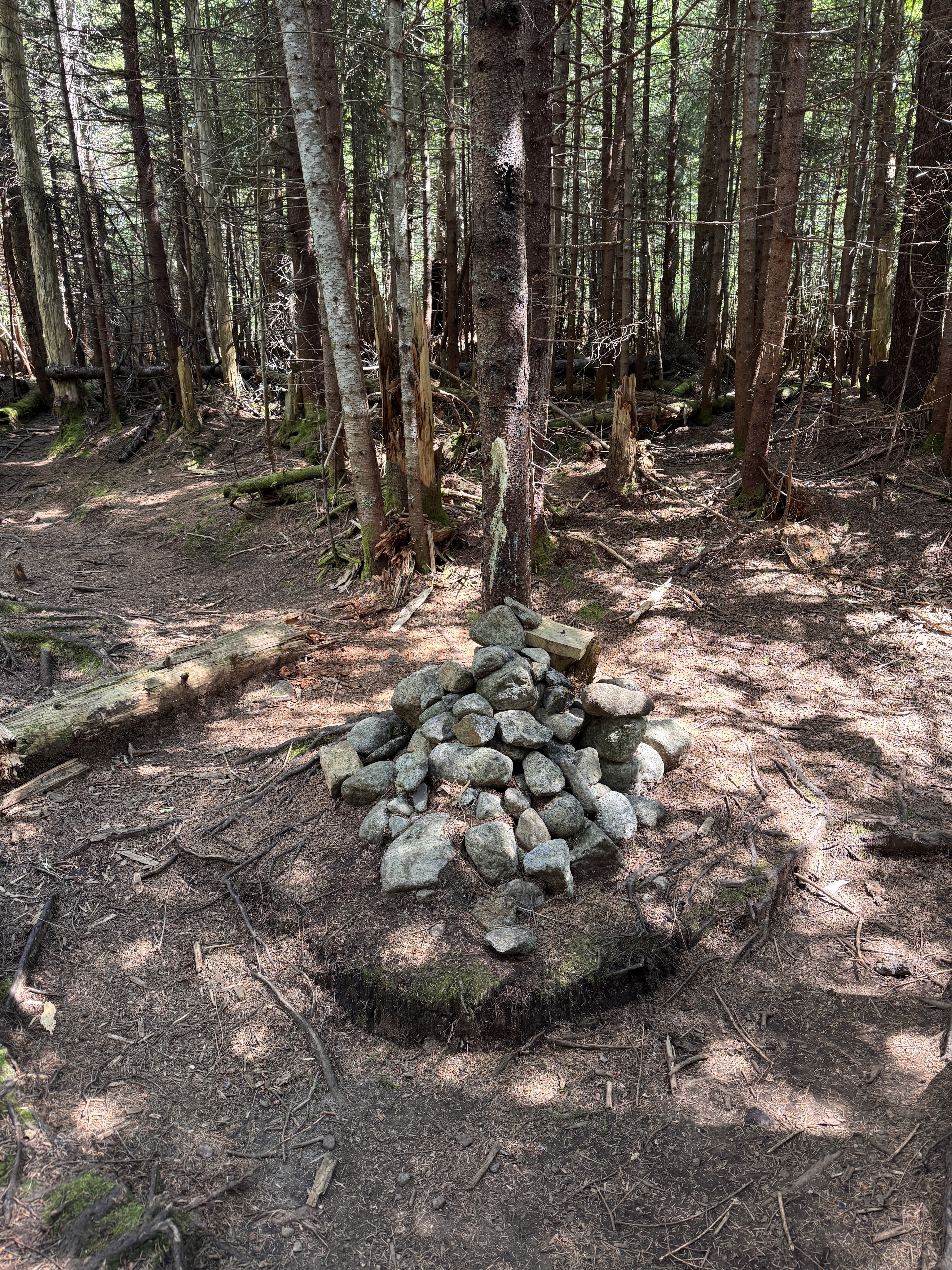
At 11:10 we again loaded up our bags and turned left at the large cairn just past the bridge.
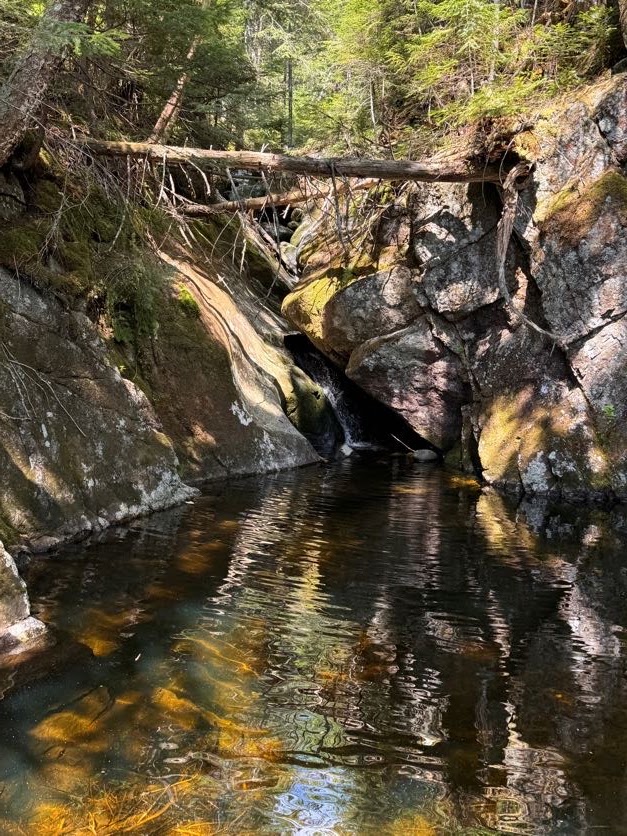
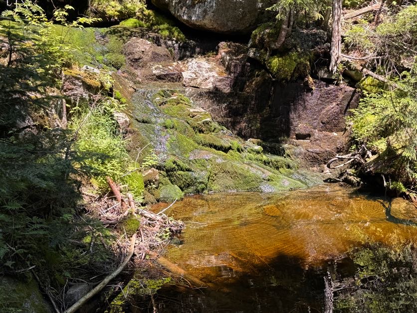
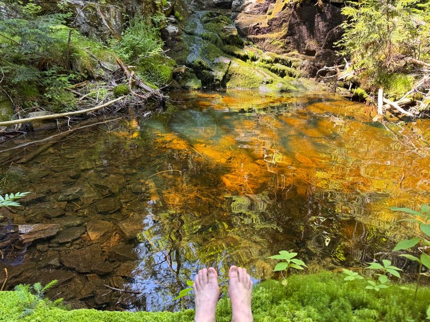
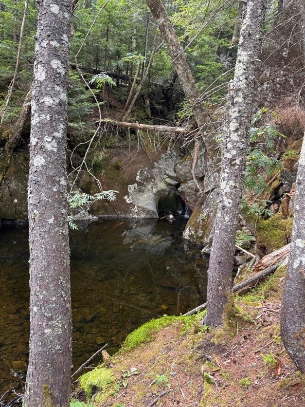
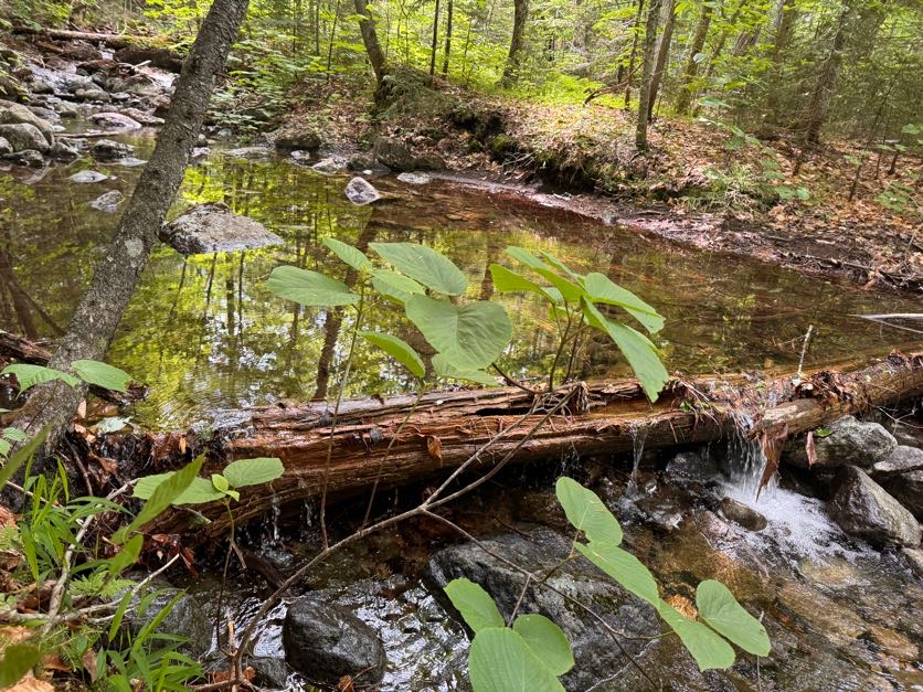
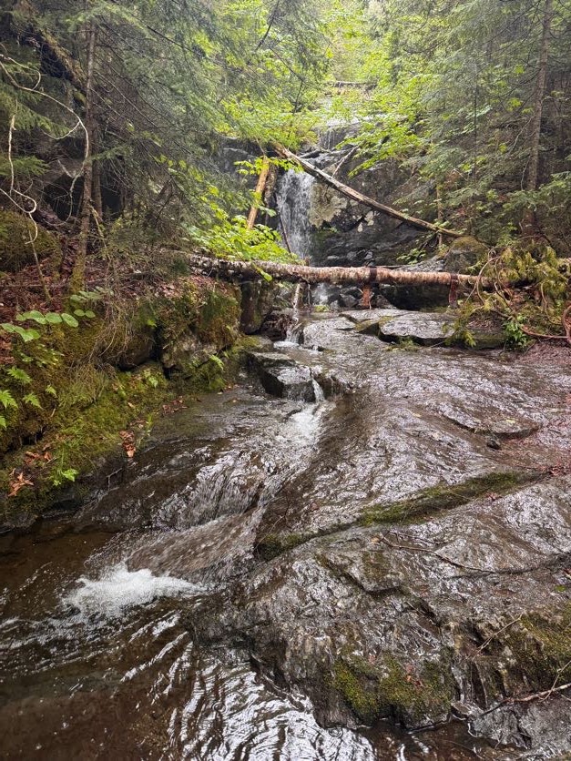
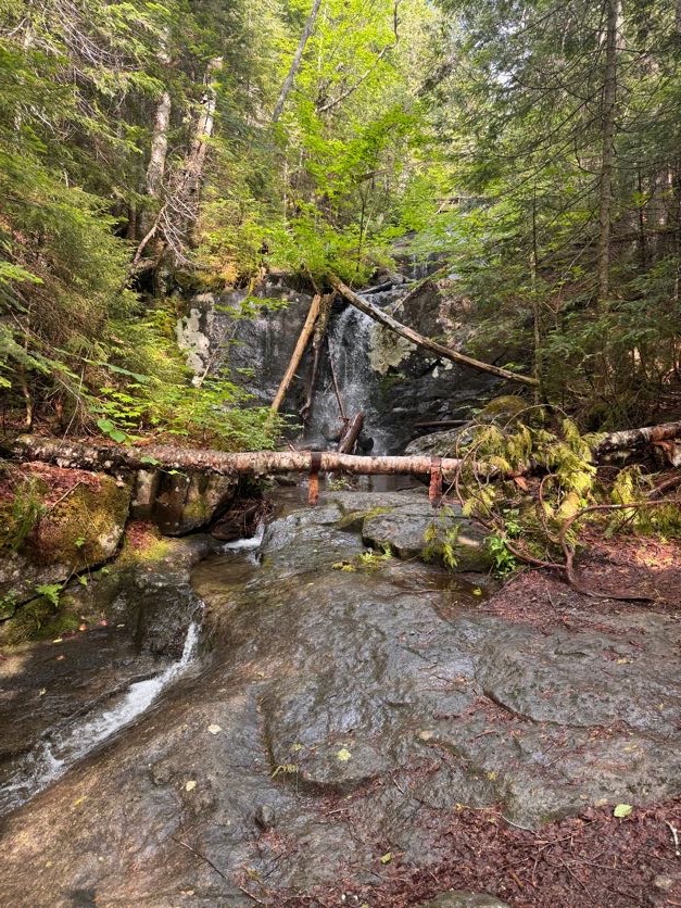
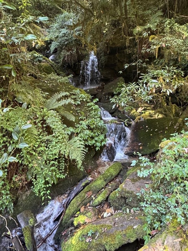
Within a few minutes, we arrived at the most lovely waterfall-fed pool and daydreamed about jumping right in.
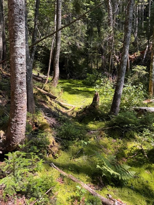
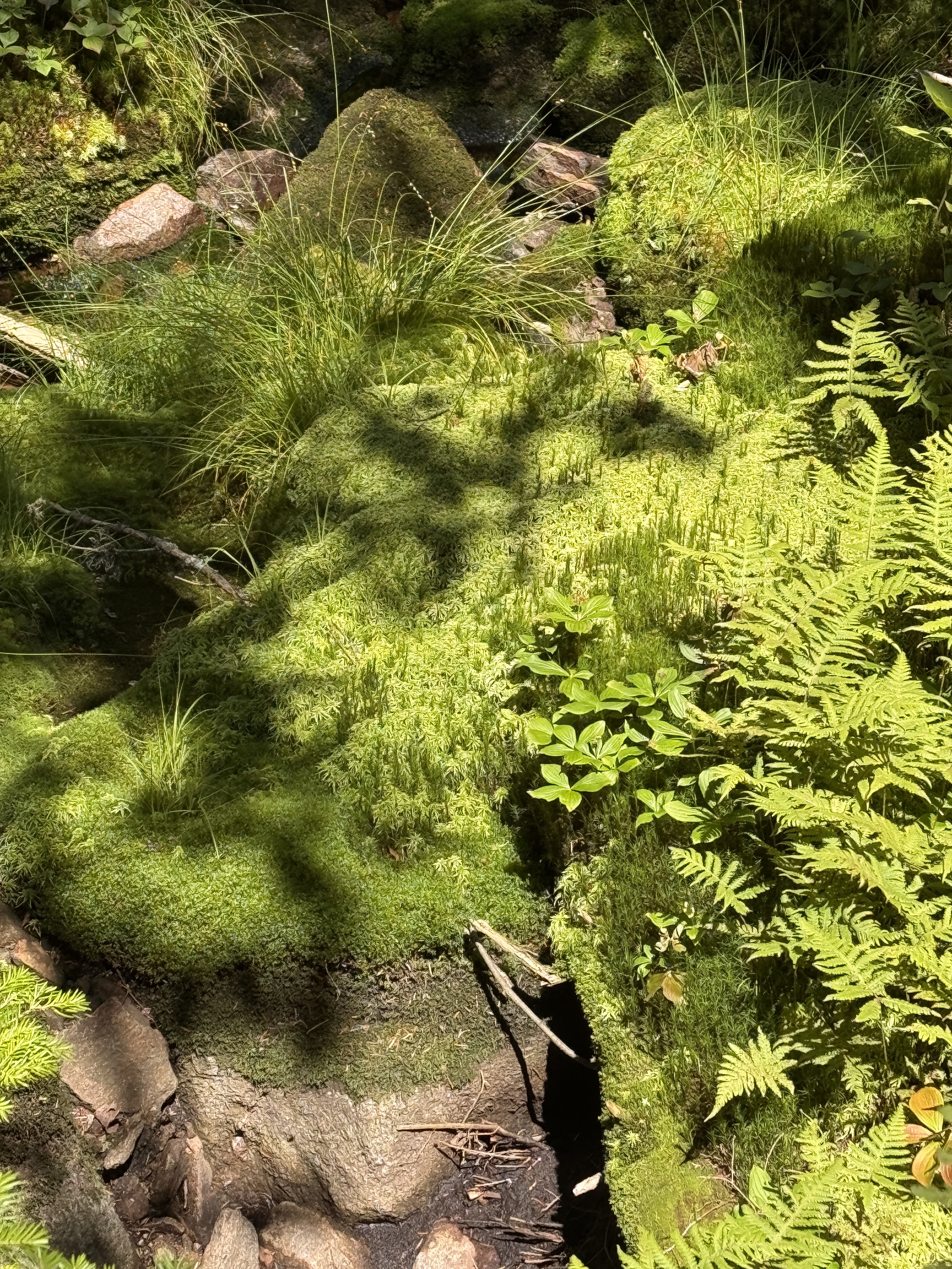
Instead we wound our way up to the top of the waterfall. This trail was gorgeous, winding it’s way through the most verdant lush moss all the way. Naturally I had to test it out for myself!
As I walk through forests, I like to reach out to touch the plants and rocks and moss and whatnot as I go. Sometimes I reach down to pick up pieces of lichen. So when I found some Old Man’s Beard lichen, we just had to, you know…
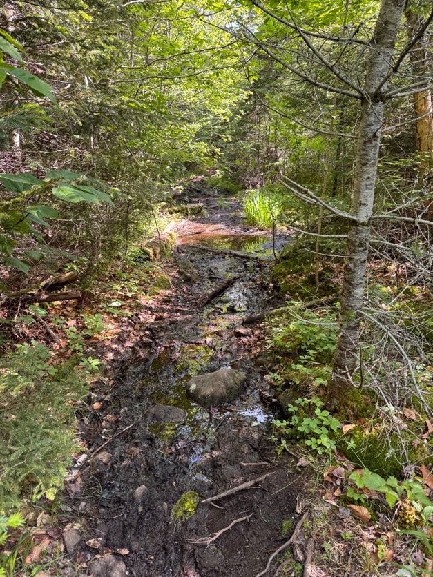
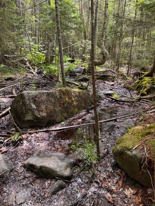
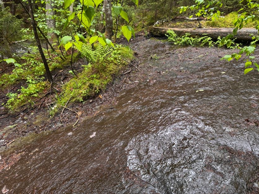
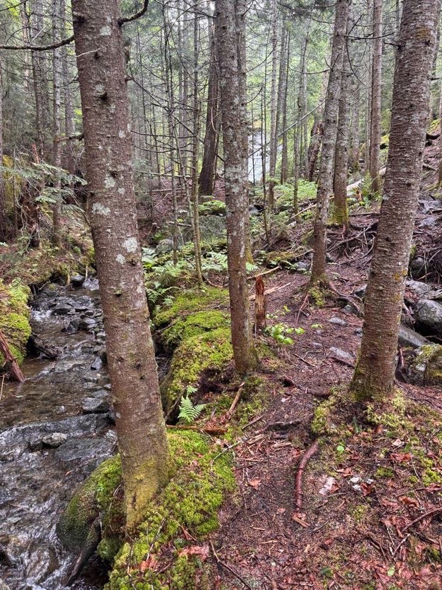
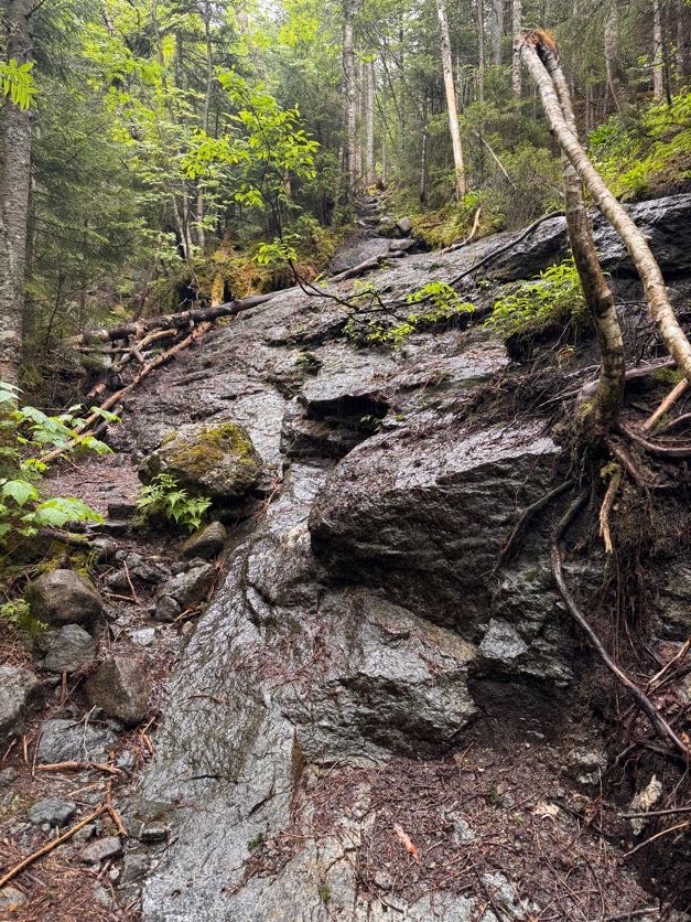
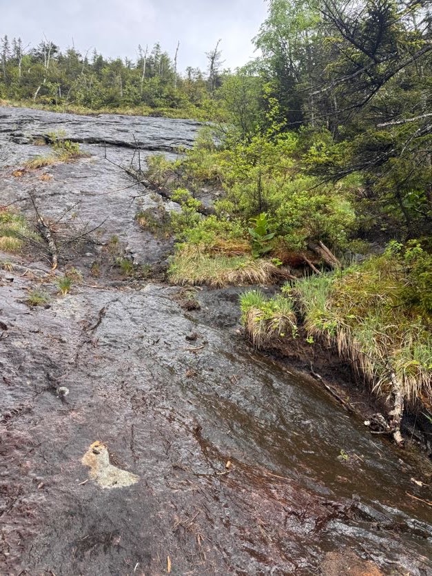
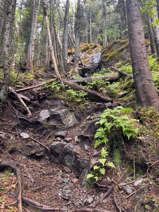
The trail up Herbert Brook is unmarked and unmaintained. So a lot of it is a sort of choose-your-own-adventure experience. As long as you stay near the water, you’re on the right path. And if the brook is pretty dry like it was for us, it’s best to just walk straight up it.
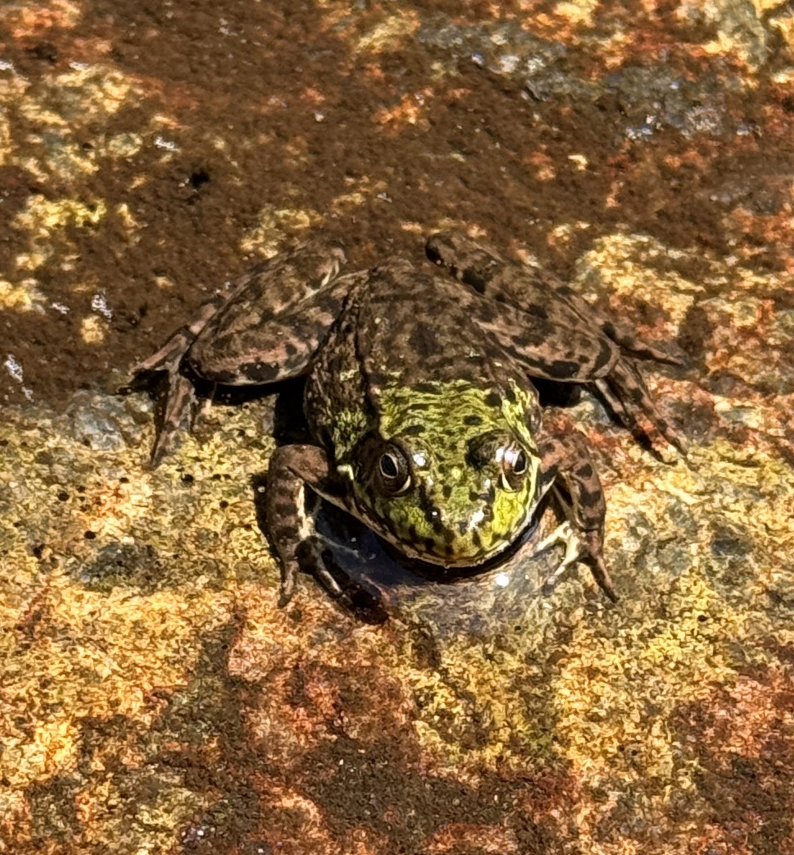
The nice part of that is the walking is easy and you can look for little critters in the pools as you go, like this frog!
Some cairns are scattered about to help you find your way when weaving in, out, and around the brook.
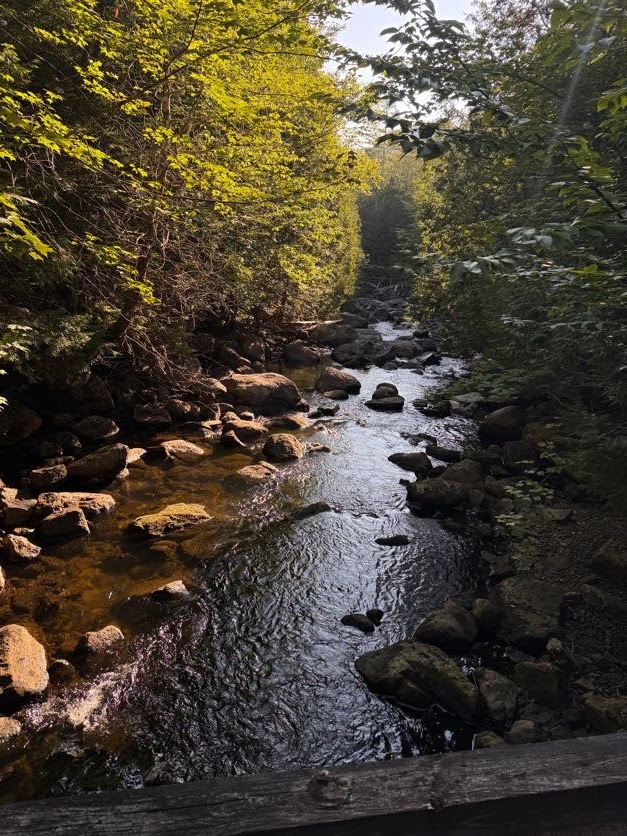
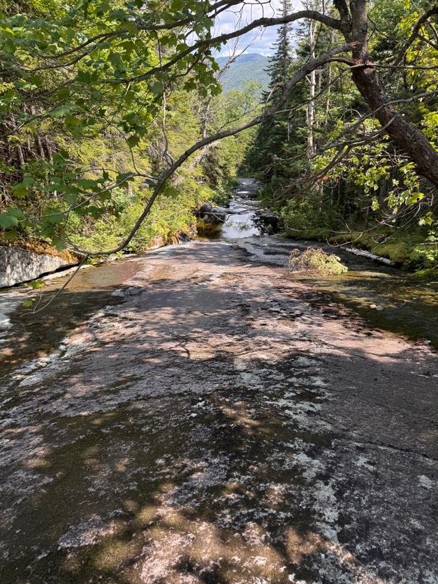
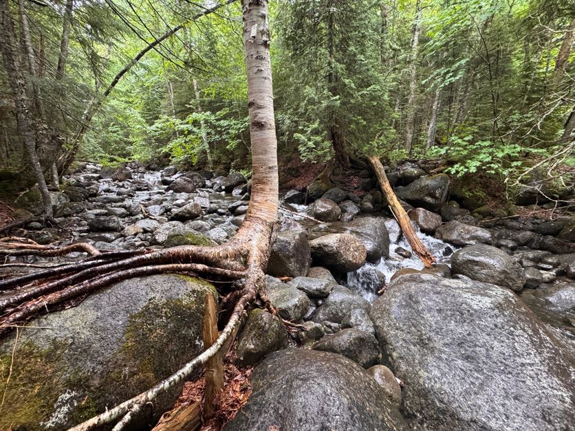
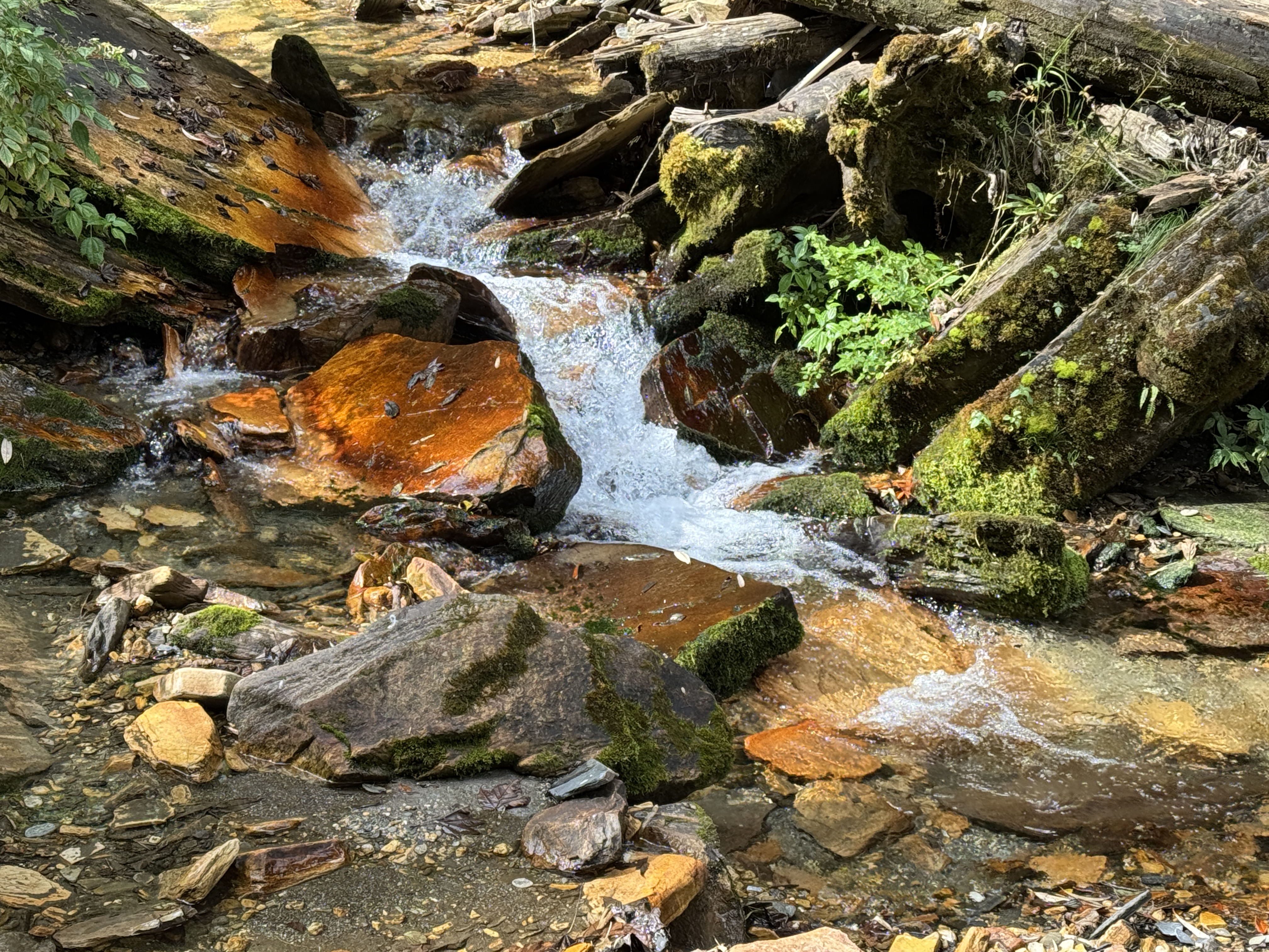
Pictures don’t do justice to the beauty of this stream. So many shades of green, soft thick moss, the trickle of water glistening in the sun…It all just makes me long to be a small little creature so I might live in that moss.
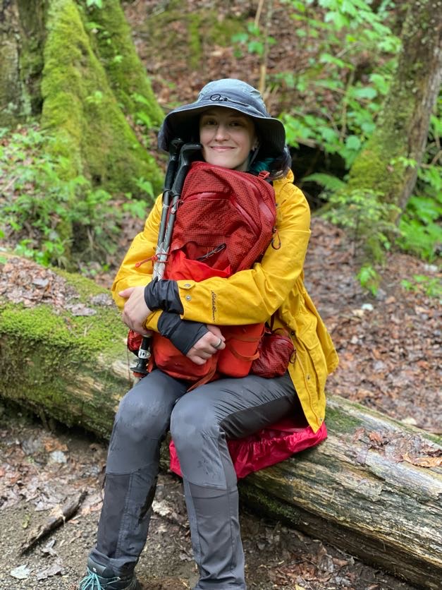
Gildo requested I sit on this log to get a picture with the beautiful background. What do you think, should it be the cover of my next single “46 Ways To Get Home”? (It comes out in a few weeks!!)
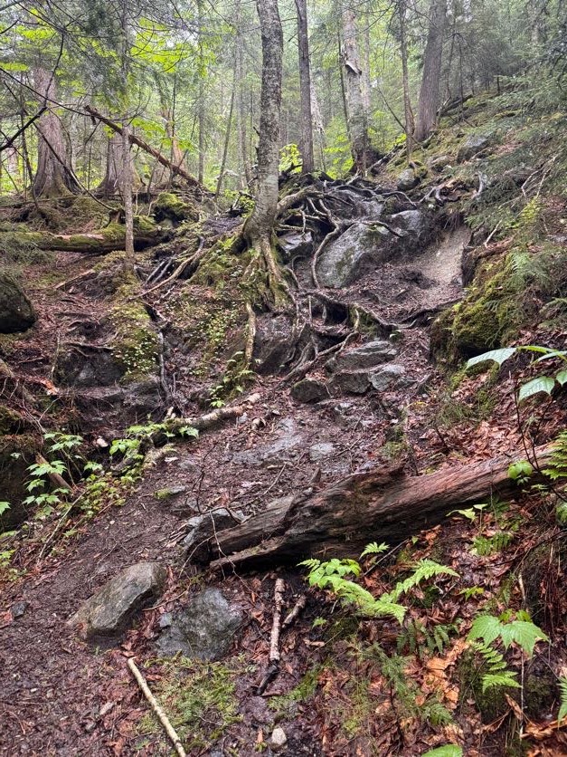
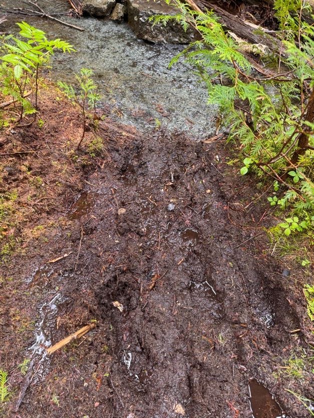
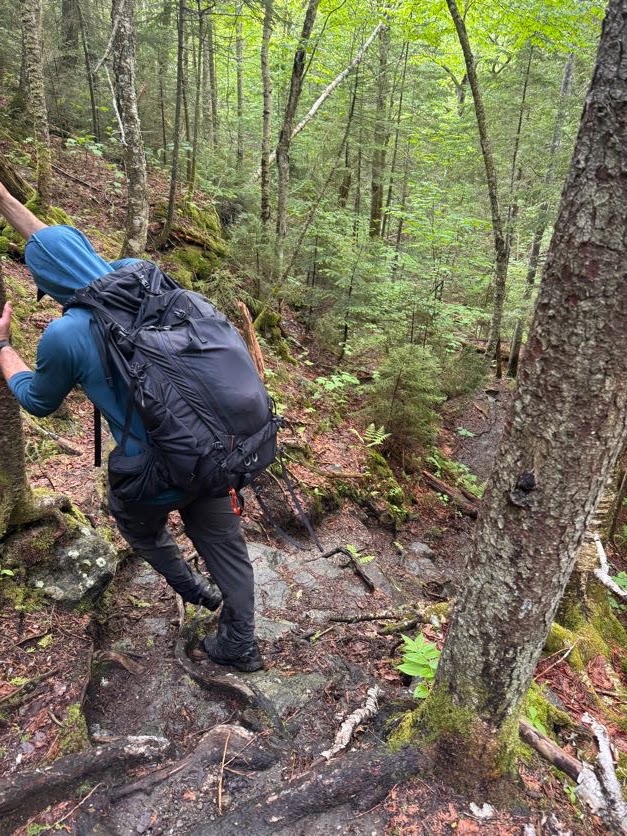
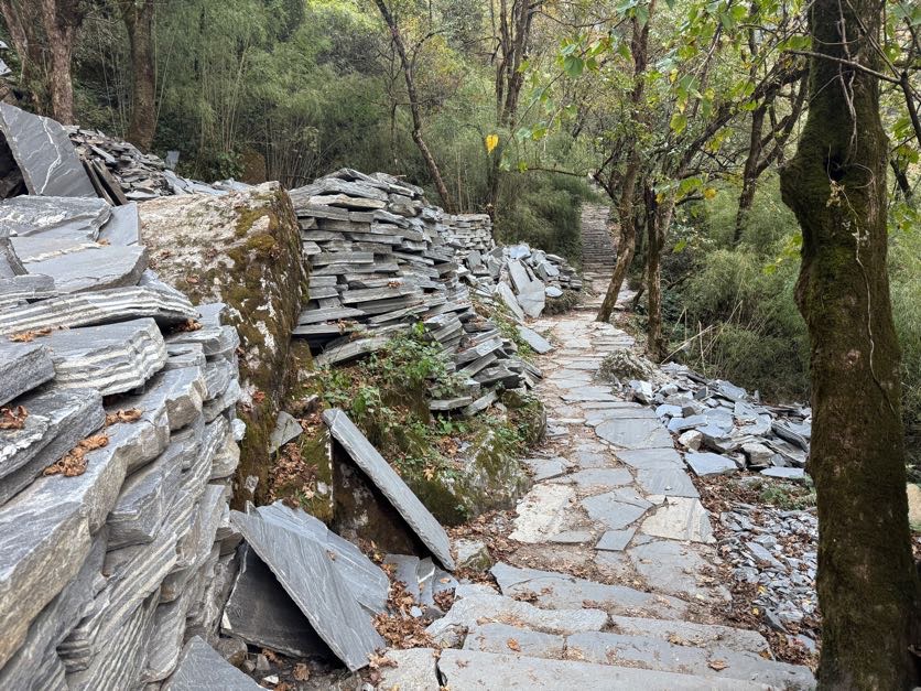
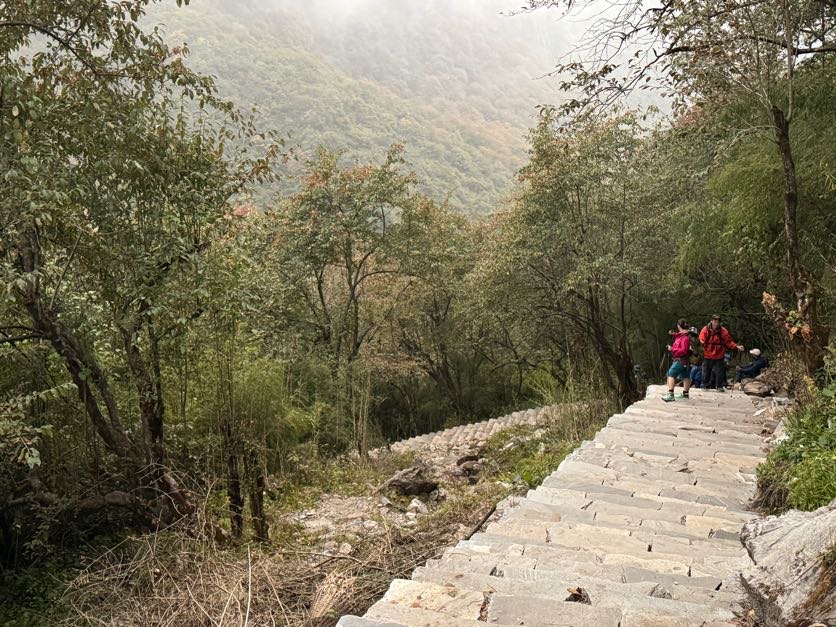
This trail wasn’t the most difficult I’ve ever done, but it was clearly not a maintained one. Lots of roots and rocks and mud – fortunately it hasn’t rained recently so the mud wasn’t quite so treacherous. But it did make me wonder – if this was a highway in comparison to the Cold Brook trail, then what was THAT trail like!?
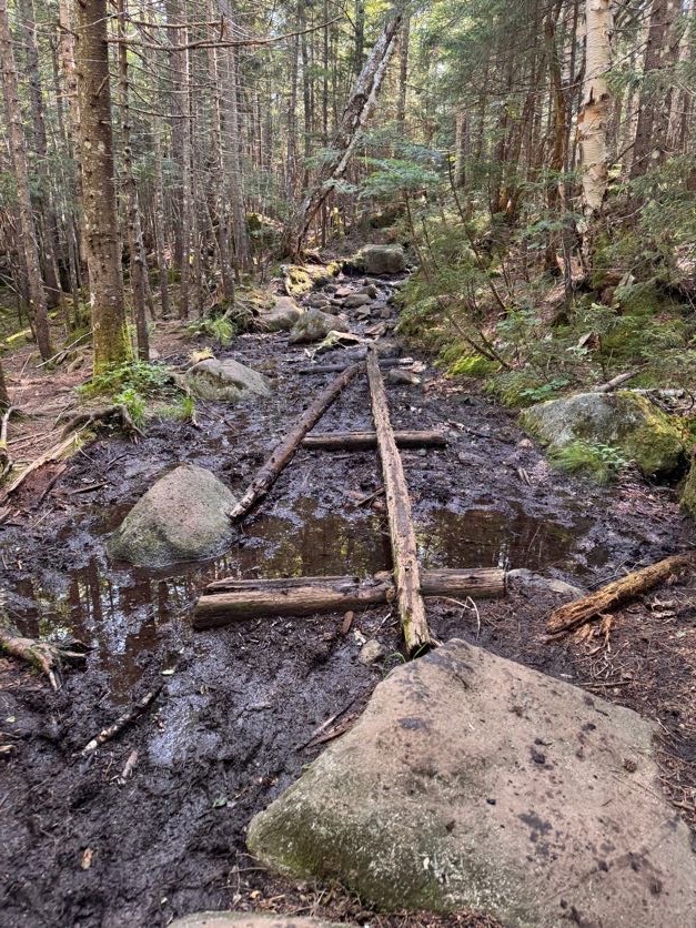
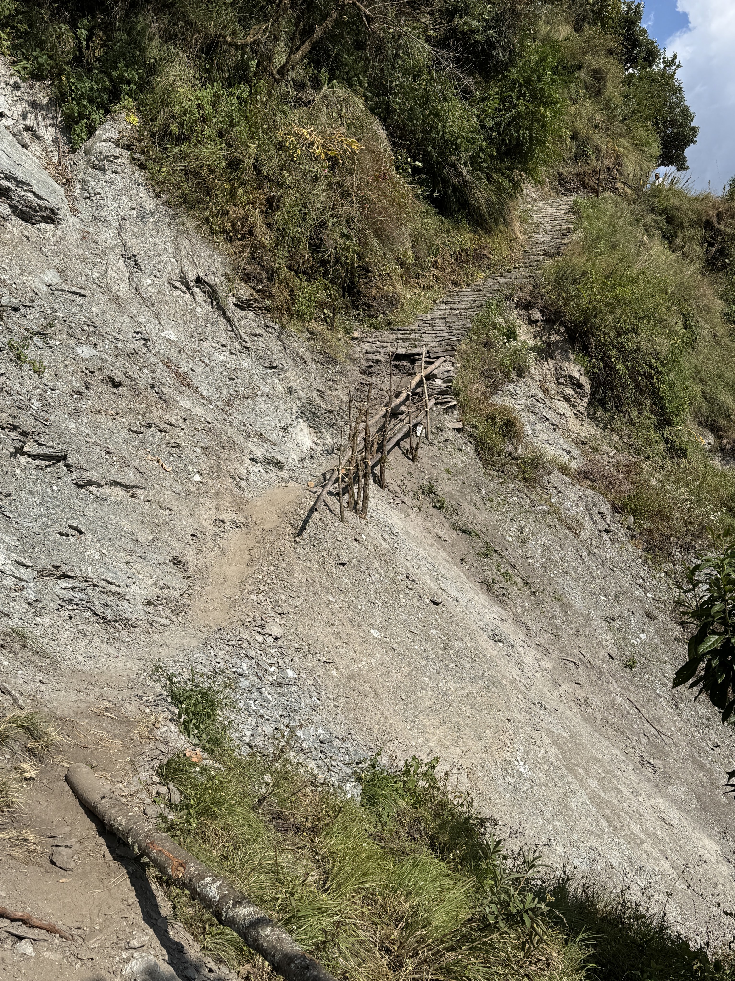
There was one point at which the trail split – the choose-your-own-adventure game again – and I chose right while Gildo chose left. We shouted to each other through the trees, trying to convince each other to switch sides, when I came upon this:
I was able to skirt along it to pick my way back towards the other trail, but I noticed some daring voyagers had just sent it straight through the mud. I made it back to where Gildo was but in the end, if I’d just continued on the path I was already on, they would have converged. So don’t sweat it if you think you’ve taken the wrong way, and don’t bother going through the mud – just stay on the path until they meet again!
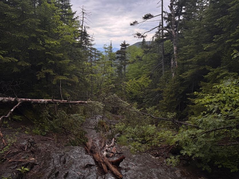
After about an hour and a half, the brook disappeared and we knew we were getting close. But I was sooooo tired. It took a lot of convincing to get my legs to keep moving. Especially in spots like this…
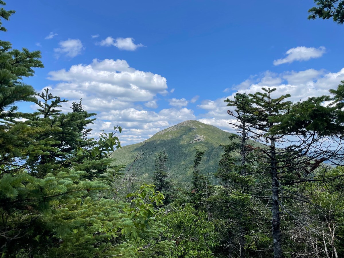
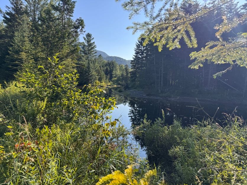
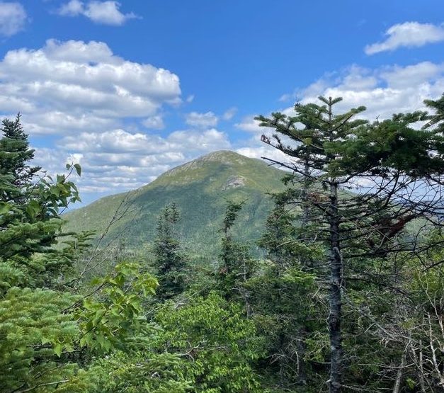
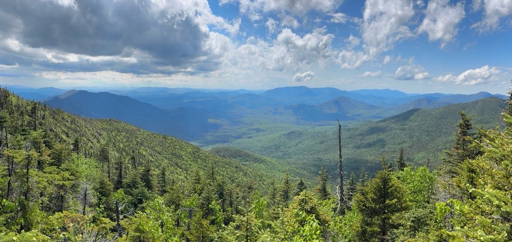
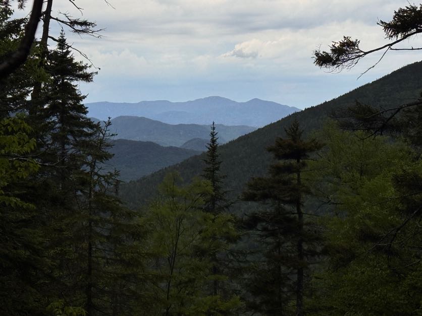
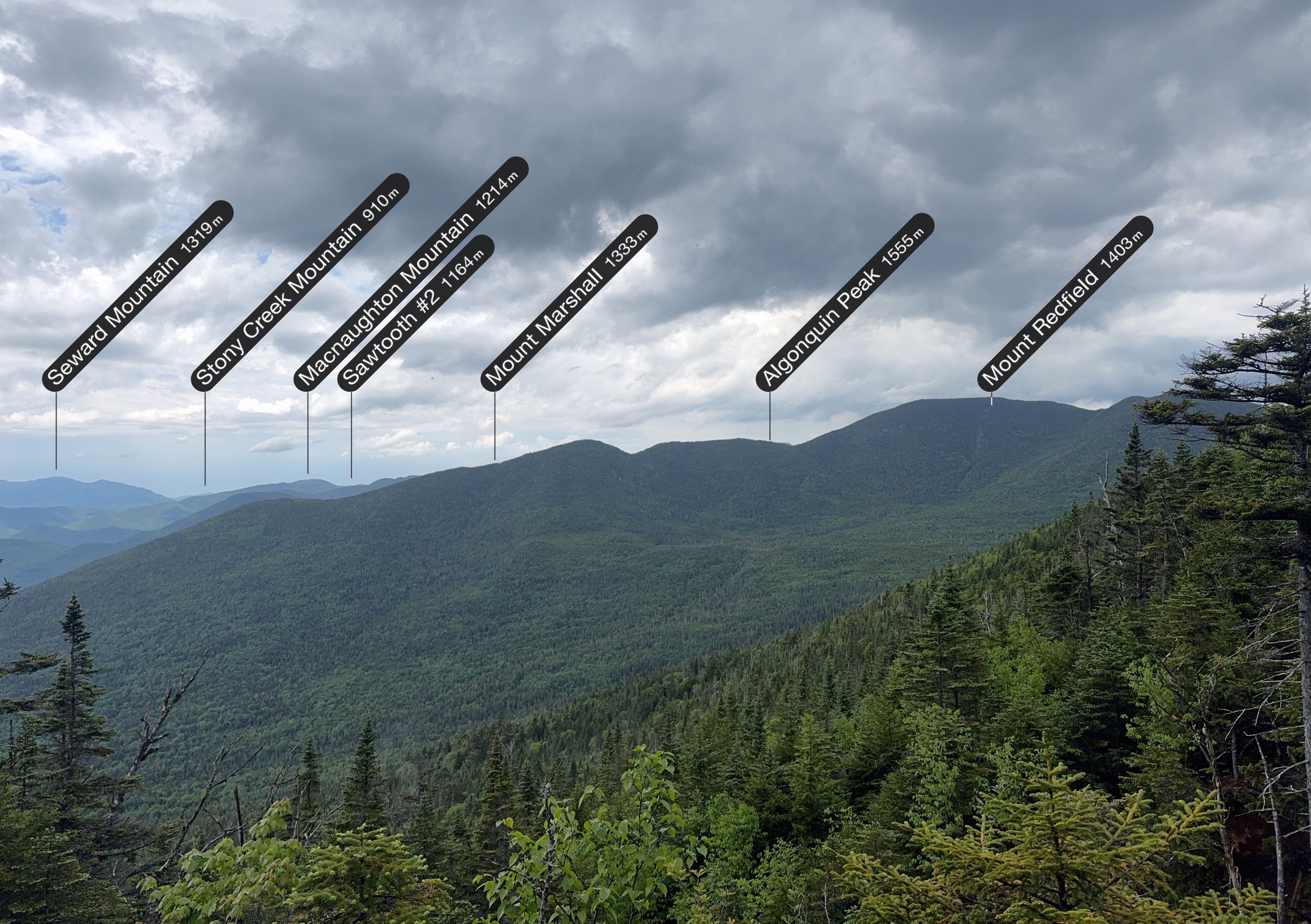
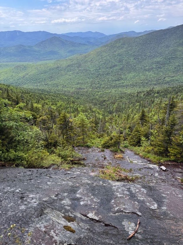
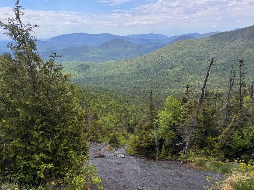
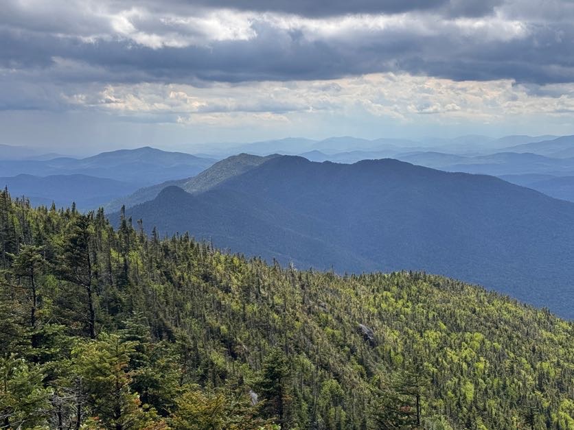
At the top of the ledge, we were rewarded with the only views we would get on this mountain – a stunning vista of Iroquois!
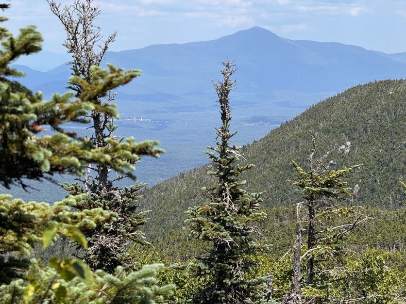
We could even see the ski jumps in lake placid in the distance, with Whiteface towering behind.
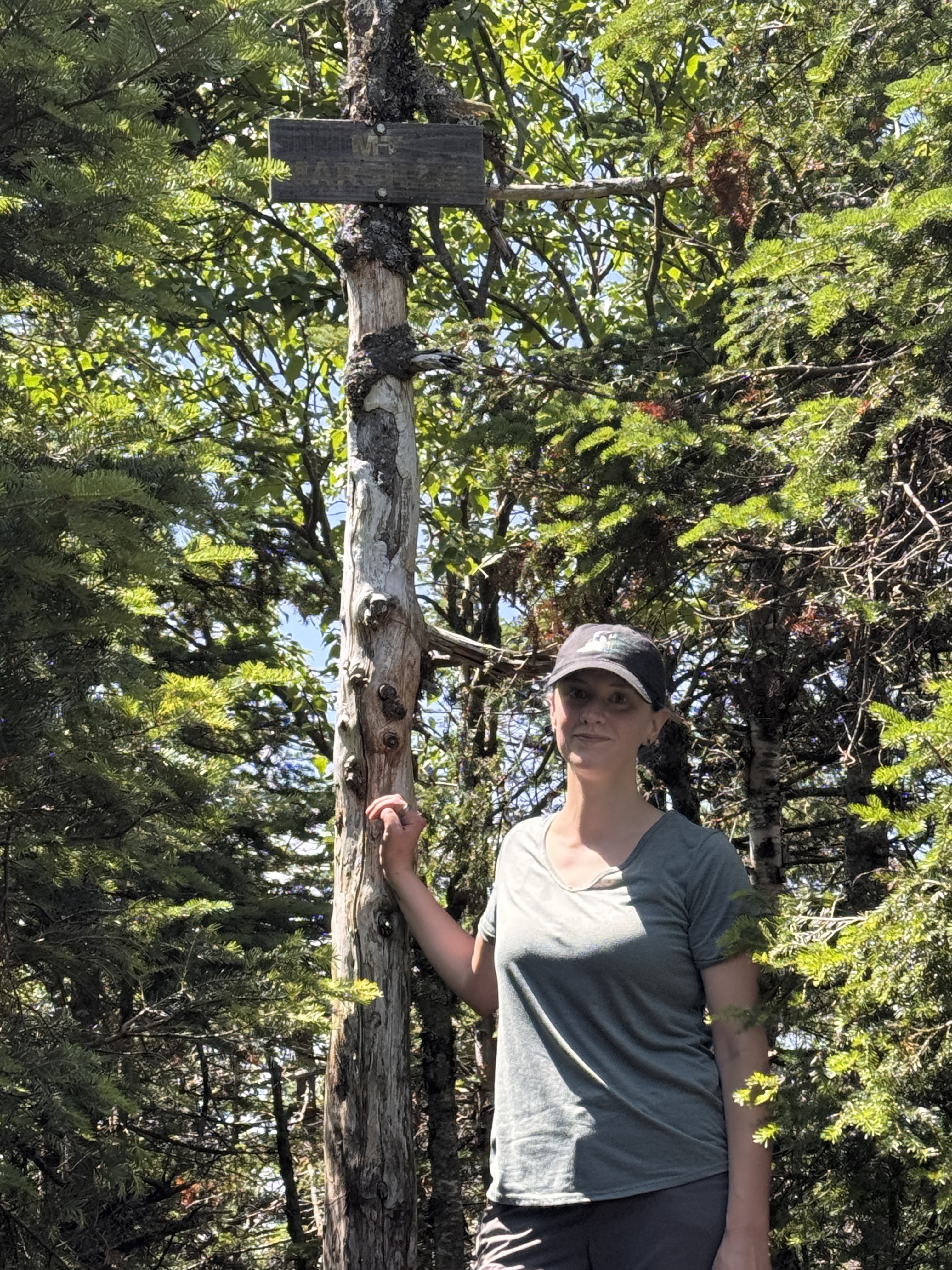
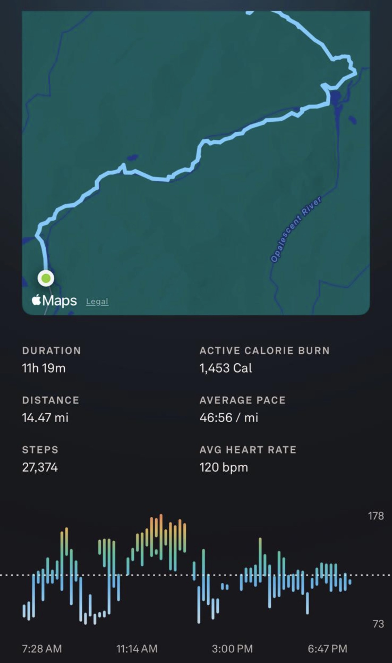
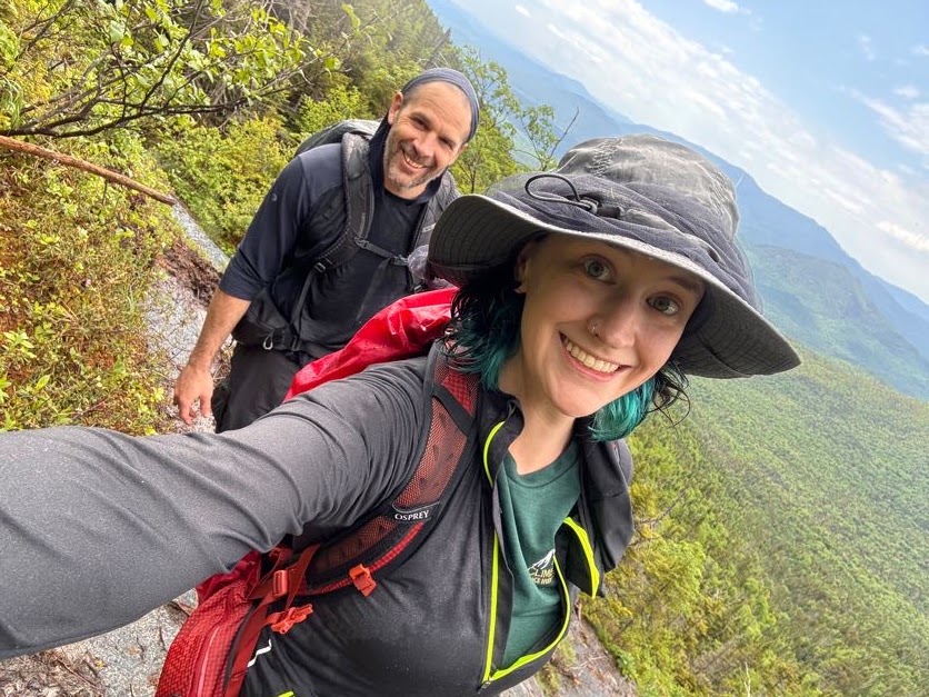
And then, at 1:06pm – 2 hours from the junction and a little over 5 hours from the trailhead – we reached the summit!
We shared the wooded summit with 2 other pairs of hikers and a pup. We claimed a small spot near the top and had second lunch – and victory chocolate!!
We didn’t want to cool off too much given how tired we already were, so as soon as we finished eating 15 minutes later, we headed right back down the trail.
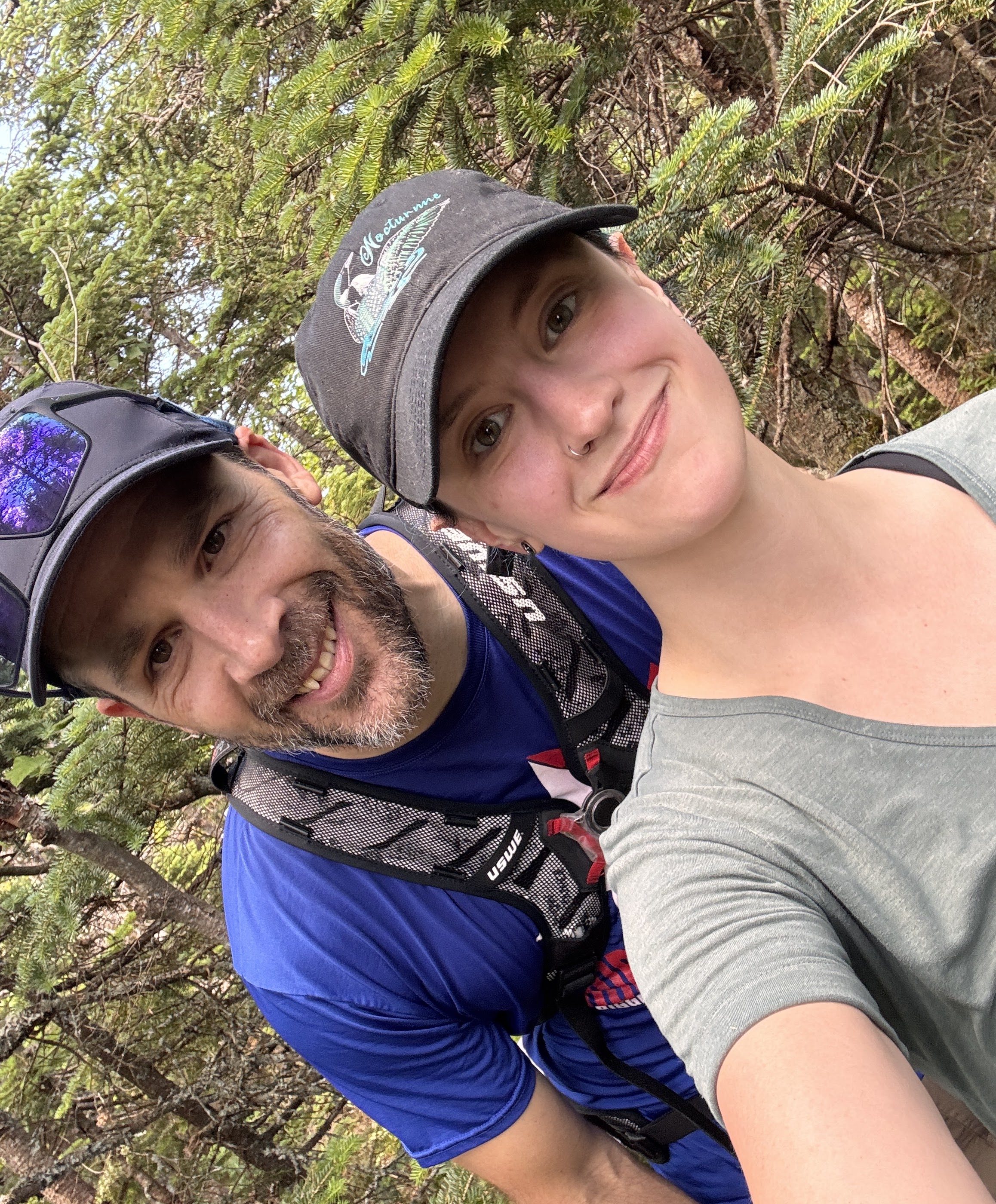
For anyone with chronic joint pain and instability, it’s crucial to find an excellent hiking partner that will lift you down off of high rocks when descending a trail. This guy makes hiking so fun and saves my knees to delay the pain for as long as he can. He’s the GOAT.
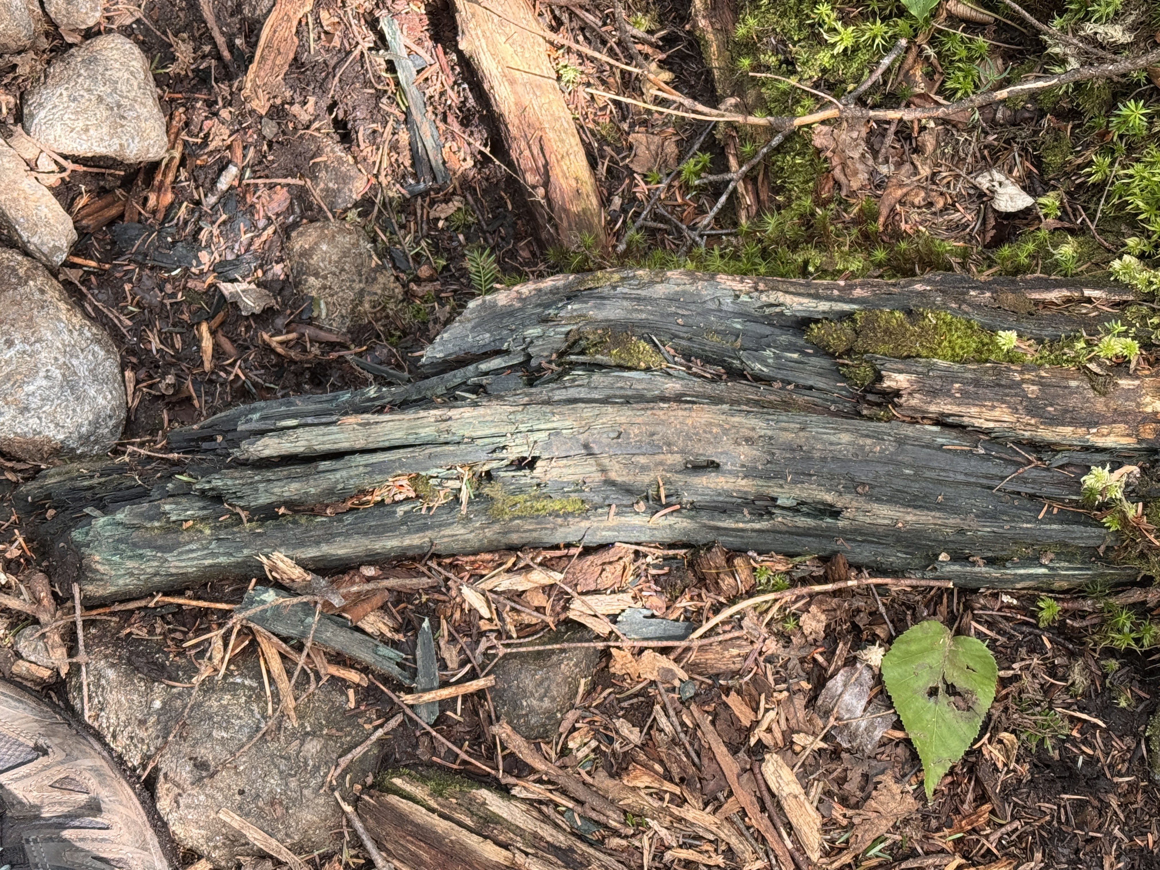
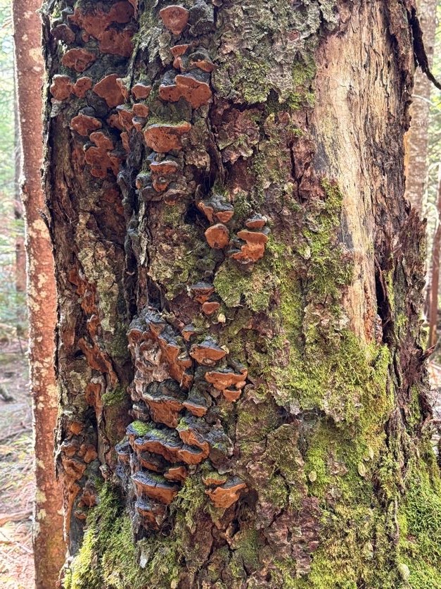
I’ve always wondered about these chunks of bluish-green wood I see when I’m hiking. I see it all the time and never knew why it’s so blue – so I looked it up! It’s caused by a ‘bluestain’ fungi that feeds on starches and sugars in the wood. Now you know!
As we worked our way down the trail, the Golden Squirrel struck again!! What a nice squirrel.
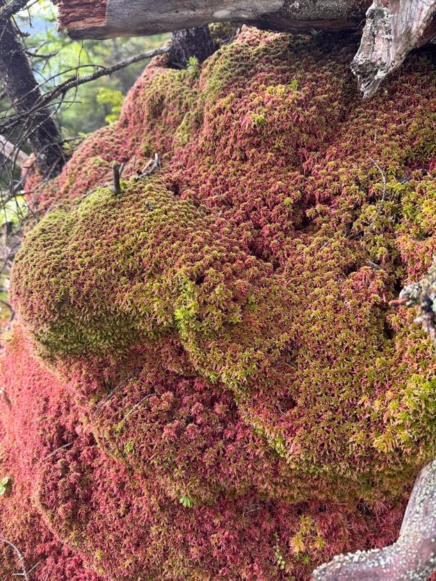
The longer I walked, the more this moss called my name. I wanted so badly to lie in it, but I had a feeling that if I did, it would just slurp me up and I’d become a permanent part of the forest. Or maybe I’d sink in so deep I’d pop out right back at home?!
At 2:15, we had once again reached the brook, so we scouted as we walked for the nicest pool we could find. We needed to refill our water supply anyway, so we might as well take a dip while we were at it!
DANG THAT WATER WAS COLD! I walked in just far enough to reach the deepest part, then dove in head first. MAN I couldn’t get out fast enough after that! Imagine, this is probably the warmest this water really gets too. I like cold water but this was like instantly numbing. When I got out though I felt so much better, refreshed and re-energized. We spent more time here than we did at the summit! At 2:45 we put some dry clothes on and continued on our merry way.
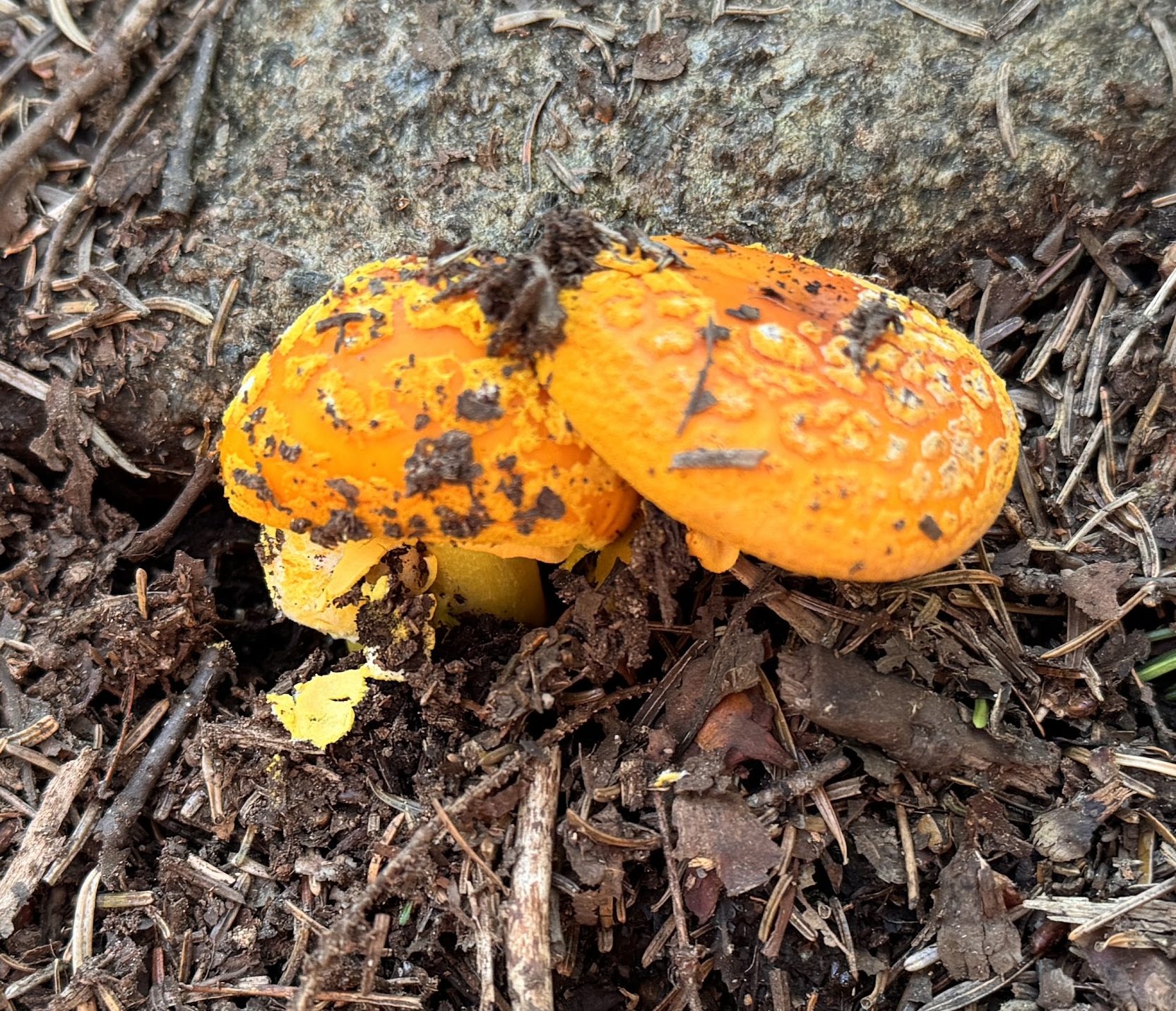
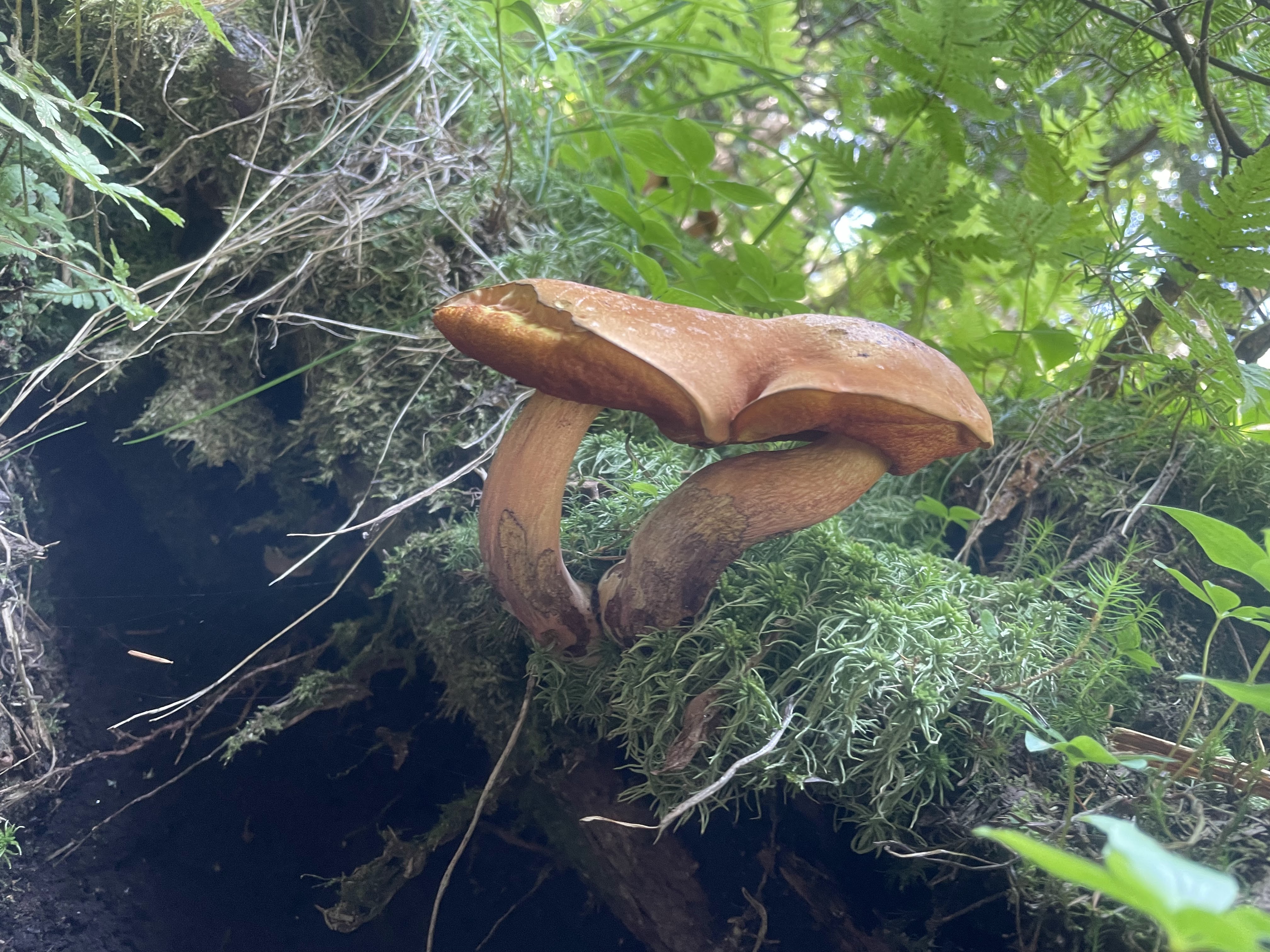
Check out these conjoined mushrooms!
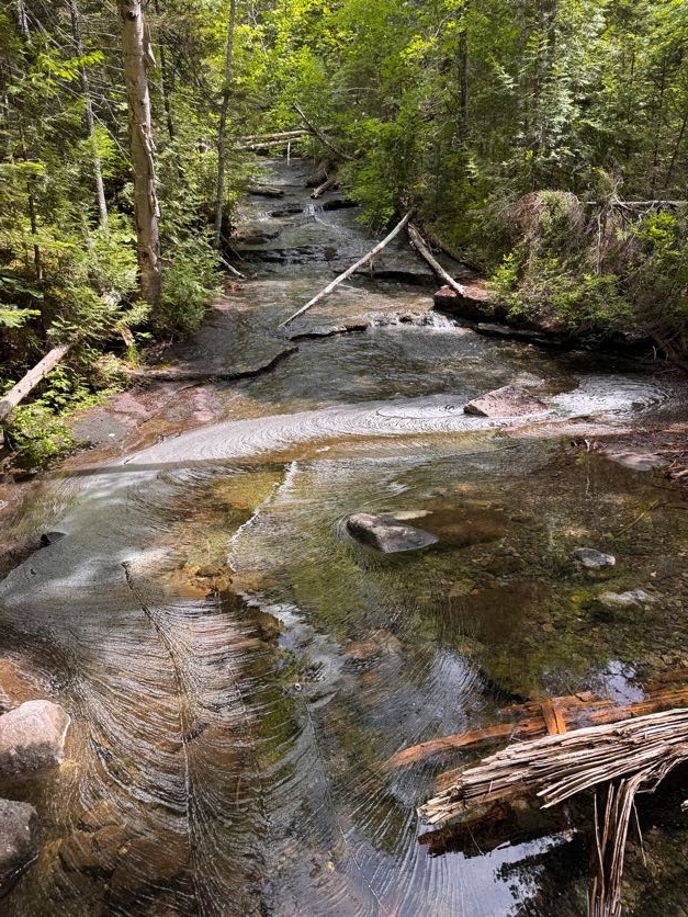
This time, we spent a lot more time in the brook itself, walking straight down the slide. It made the walk so much more enjoyable – highly recommend.
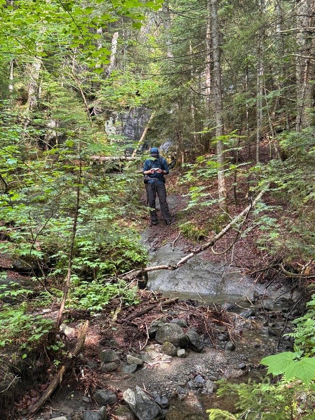
By 3:30, we were back at that first beautiful pool with a waterfall, and this time I spotted a FISH! A little trout in there, though I can’t imagine how it actually got there.
Then at 3:36 we were back at the junction. We didn’t linger and turned right to return the same way we’d come, back across the bridge towards the main junction.
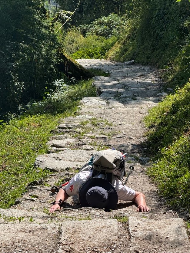
We reached the junction at 4:oo exactly, signed out, then promptly perished.
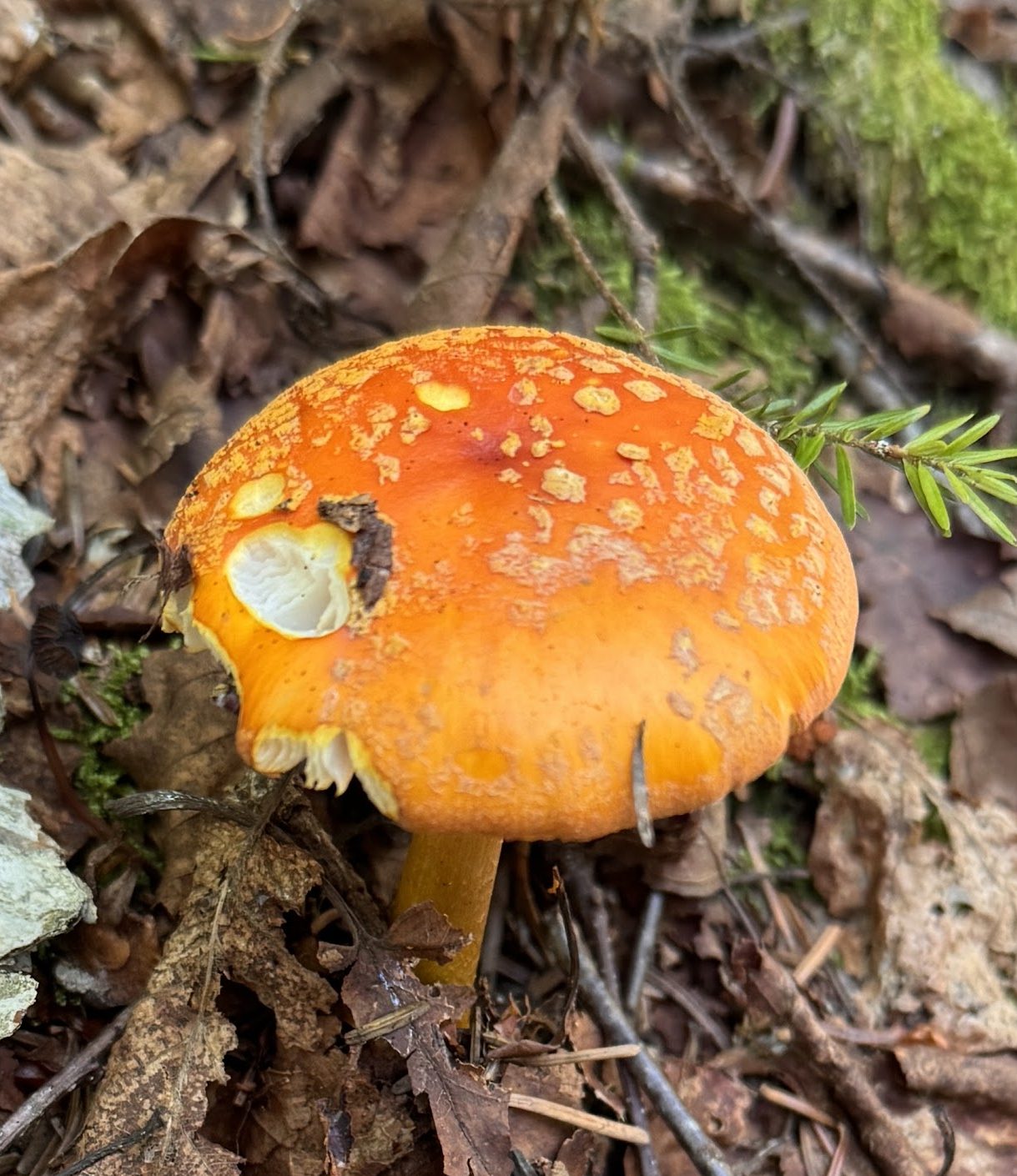
The 4.5 miles back to the trailhead felt like an eternity. But look! More mushrooms!
The first several miles are especially rocky and muddy. At one point I dared to TRUST A ROCK when both of my feet slid off at the same time and submerged themselves deep in mud. Dang it!
By 5:10pm we were back at the Calamity Brook crossing, hopping across rocks. And once again, I remembered to NOT TRUST ROCKS when I stepped on one and it tipped sideways in the water. RUDE.
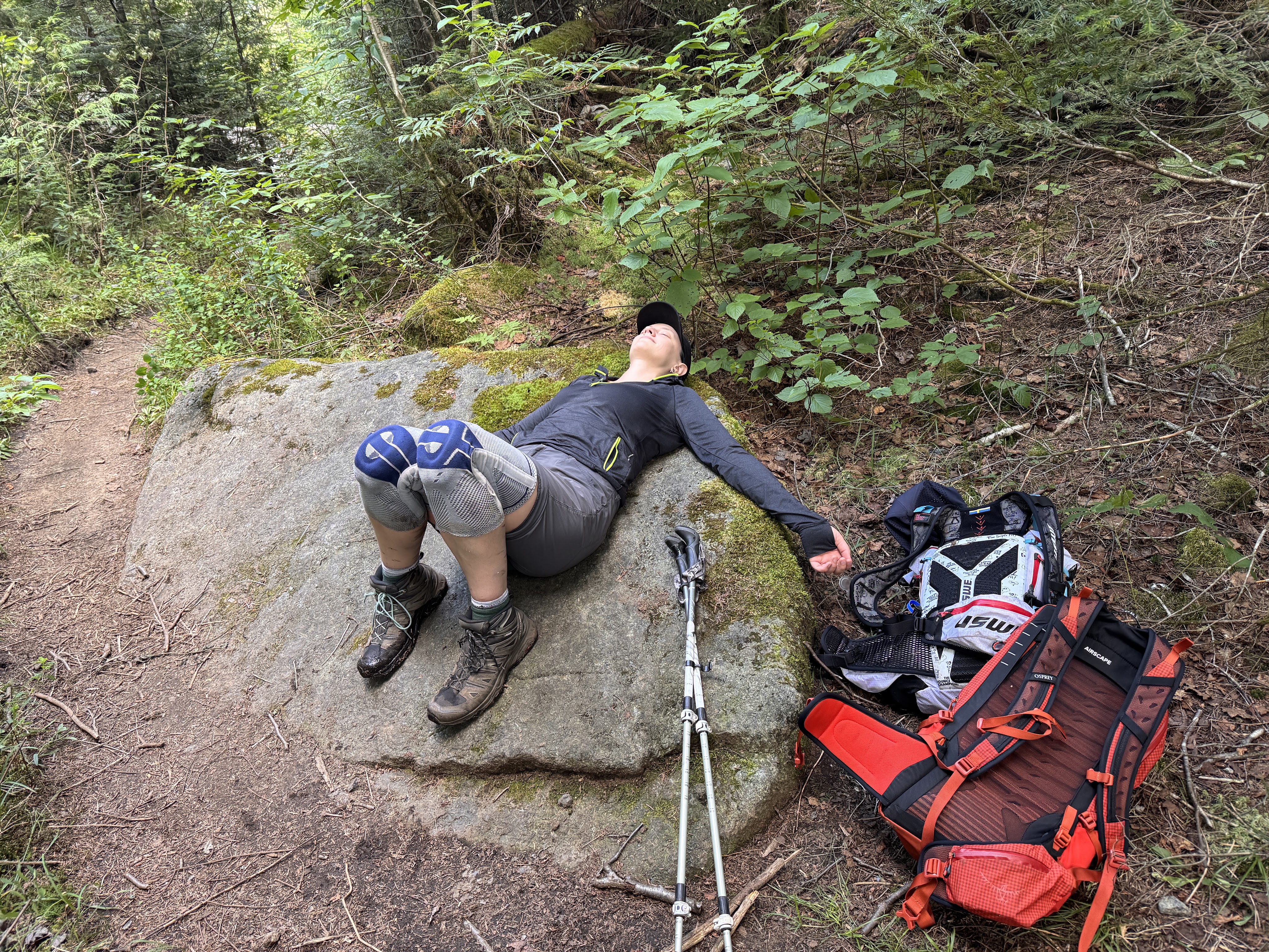
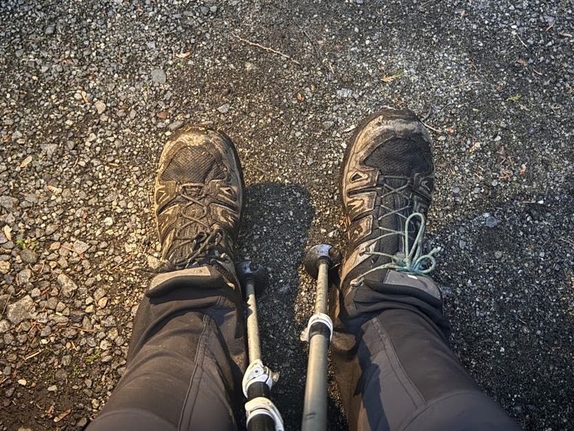
By now, I was in a lot of pain. I relied on my poles, pouring my weight into them, and counting the steps until we were done. I spent so much of this day in a bit of a daze – groggy in the morning, exhausted and fatigued later in the day, and in a lot of pain towards the end, only feeling sharp and clear following the dip in the cold water. All I can recall from the last few miles is how long they felt.
By 5:52pm, we reached the junction with 1.6 miles remaining.
We reached the next junction with Indian Pass about 30 minutes later…
10 minutes later we finally reached the register! We finished just short of 11 hours after starting, at 6:35pm.
We walked with stiff, aching legs back along the historical trail to where the car sat waiting. 43 down, just one hike remaining!!
Mount Marshall: 4360′ Elevation Gain: 2890′
Total duration: ~11 hours
Total distance: ~14.5 miles
All images are property of adktrailtalesandtails and may only be used with express permission.
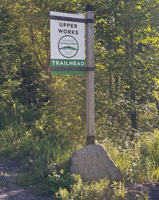
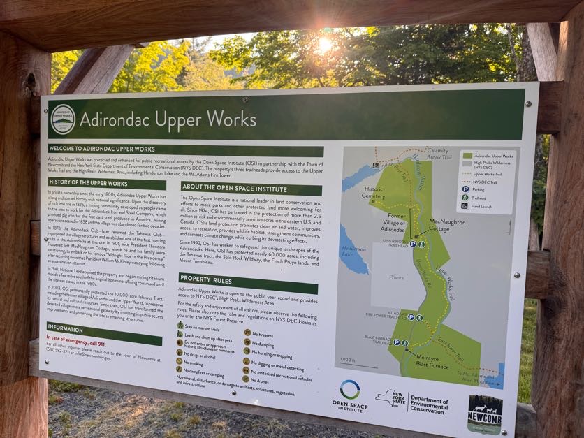
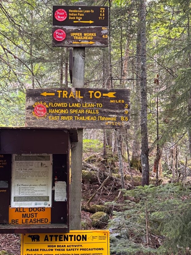
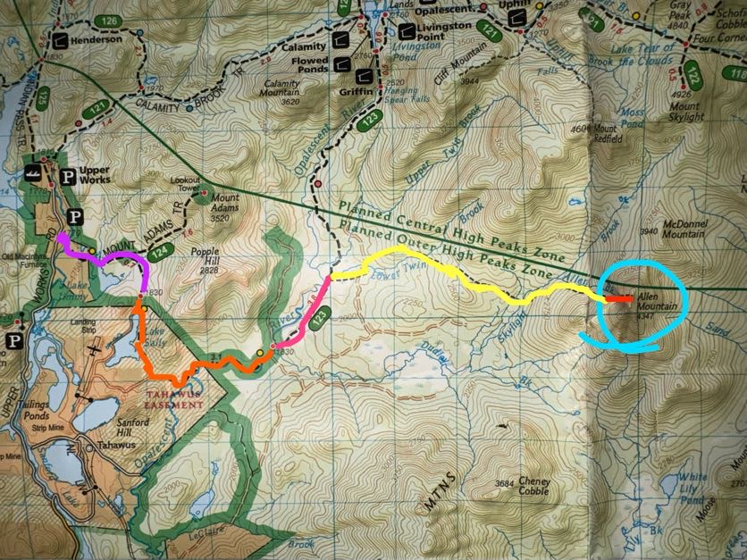
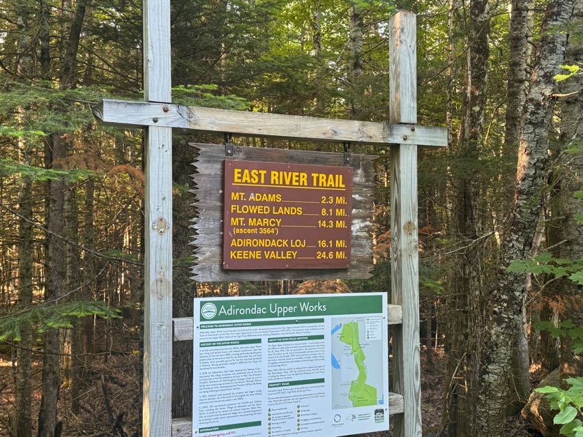
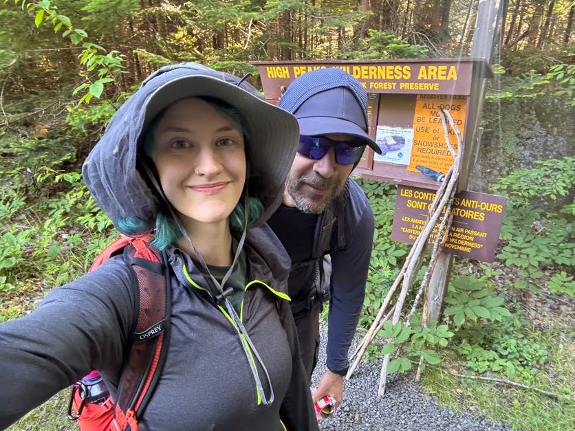
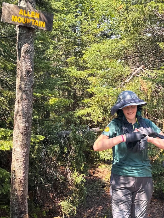
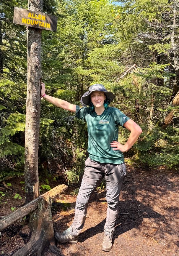
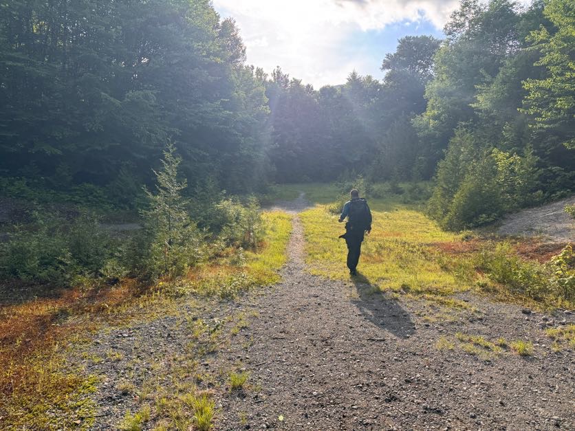
5:00 am. We wake up, throw on our boots, and hit the road towards the Upper Works trailhead. The parking lot for Allen and Mt Adams is empty when we reach it at 7:30, a rare occurrence for a Saturday morning in the high peaks!
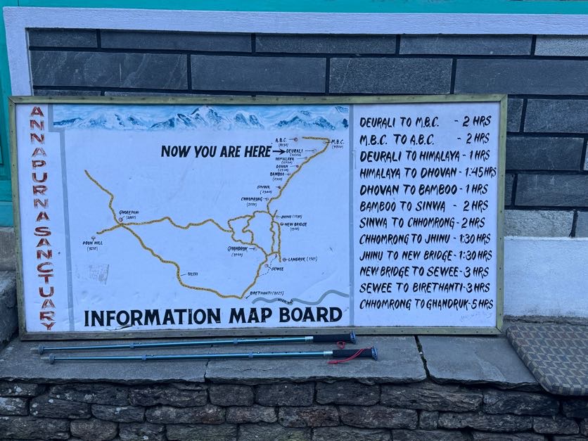
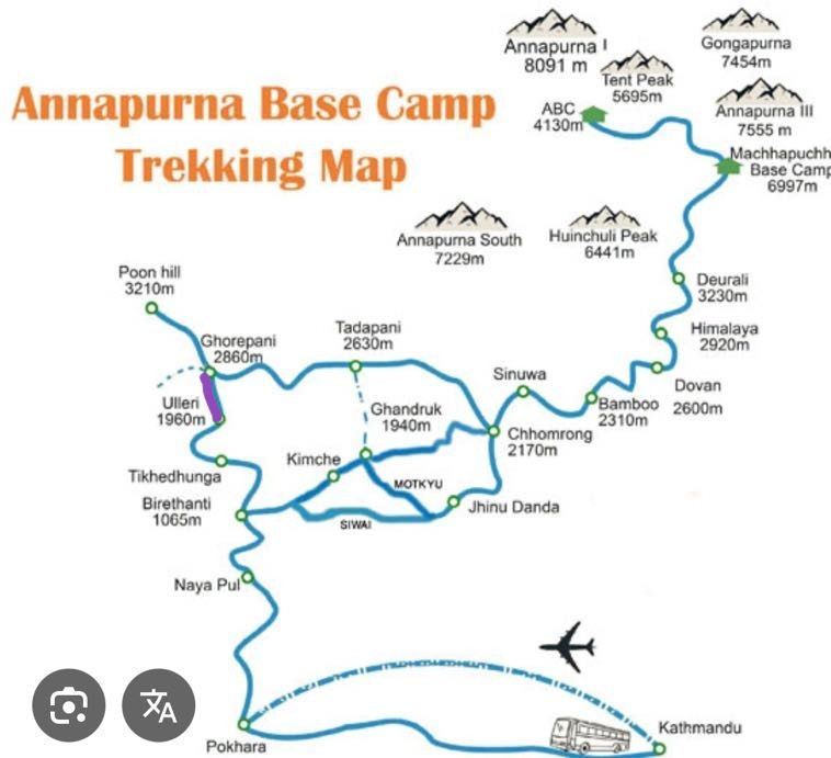
The map is actually very unclear for this particular route as far as distances go, especially the very first stretch (purple) that oddly is said to be just 0.7 miles….yet it looks longer than the trail up to Mt Adams (1.6 miles) and other longer sections of trail. The time it took us to walk it also didn’t add up to being just 0.7 miles – by our estimate, it’s more like 2 miles.
We signed in at the register at 7:50am and started on our way.
Literally 3 minutes later and we were at the first water crossing over the Hudson river, with a nice bridge
This was my first trip back to the Adirondacks in 2026. Last year I had several big trips that took my total up to 42 and I’m very determined to finish all 46 this year, so I was in pretty good spirits starting this hike – the trail and light filtering through the trees made me feel like I’d finally come home.
15 minutes after starting we skirted around Lake Jimmy, which on the map appears about halfway to the junction to Mt Adams. We stopped for a moment to admire the stillness of the water and look for bullfrogs (as you do) and noticed pieces of what looked to be an old bridge still floating around in there.
We were happy to see this nice walkway to carry us over the water and around the little lake. This wouldn’t be the case for too much longer but at least we could live in the delusion of having dry feet for a little while.
Despite wearing a bug net hat, long sleeves, and long pants, the mosquitos were chewing me uppppp. THROUGH the fabric! What’s the point of clothes if mosquitos can still bite you through them?! Anyway I stopped at this spot by the water to frantically bathe in bug spray – which in hindsight only seemed to season me in the eyes of the bugs – before shrieking in frustration and deciding to try to outrun them instead.
Between my stopping to take photos of pretty moss and soft morning light, and Gildo stopping to use his bird call identification app, I felt like we were going soooooo sloooooooow – because how could it POSSIBLY BE that the map shows the junction to Mt Adams at approximately 0.4 miles and it had been nearly 30 minutes and we still weren’t there?
At 8:22 we reached the old ranger building. We’ve seen it before on a hike up Mt Adams so we didn’t explore it, but you can go check it out.
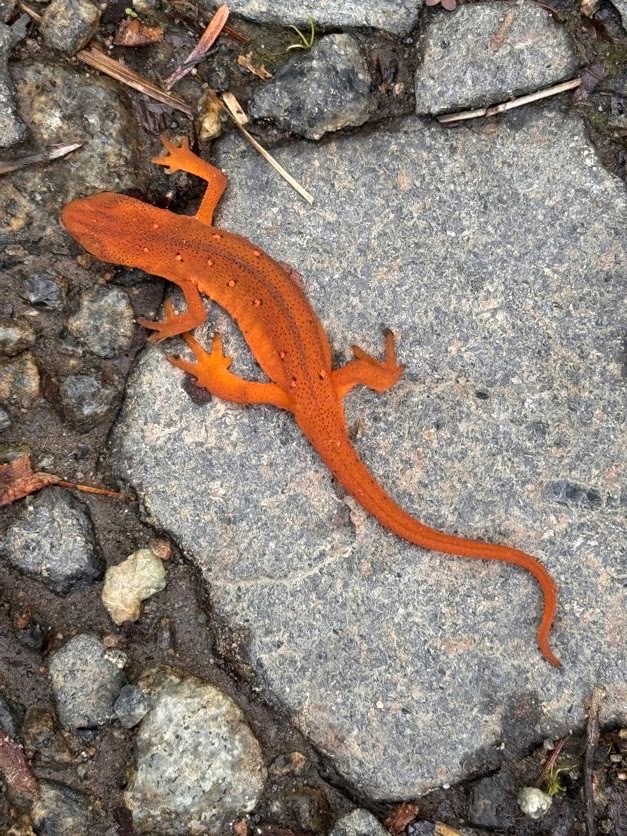
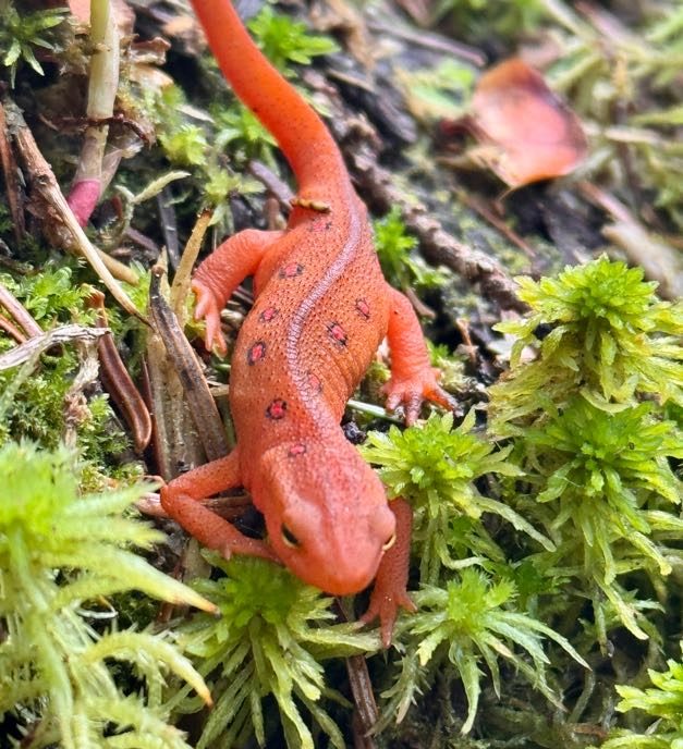
We spotted our first red eft newt on the trail! These guys like to come out when the trail is wet, I’m always looking out for them so I don’t squish em!
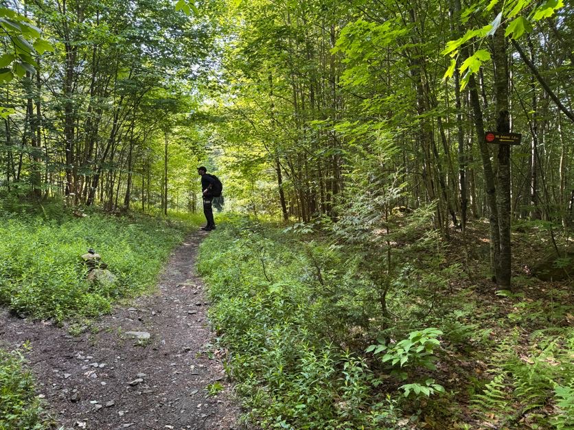
Just a minute or two after the ranger cabin is the junction to Mt Adams. It took us 35 minutes to reach. We stayed to the right to continue on towards Allen.
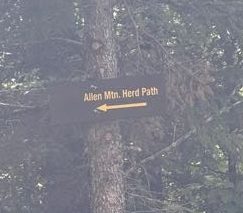
Just 4.9 miles to go to the Allen Mtn herd path!
1 hour into the hike, we noticed something odd….A red dustpan, hanging in a tree. So…I have some questions that I don’t think I’ll ever get answers to…
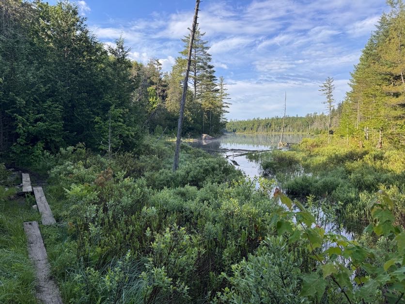
At 9:04 – 1 hour and 14 minutes after starting – we reached Lake Sally
So somehow it took us an hour and 15 minutes to go just 0.7 miles? No way. That’s the pace if I’m climbing a ridiculously steep push to a summit, not a flat ground pace. So at the risk of sounding like a broken record, for anyone else planning this trek using the map that I have, I reallllllly don’t think that first 0.7 mile segment is correct. We generally keep a 2.5 to 3 mile/hour pace on flat ground like this, so it seems like the junction to Adams is at least 1 mile in from the trailhead, and the purple segment labelled 0.7 miles is more like 2 miles at least.
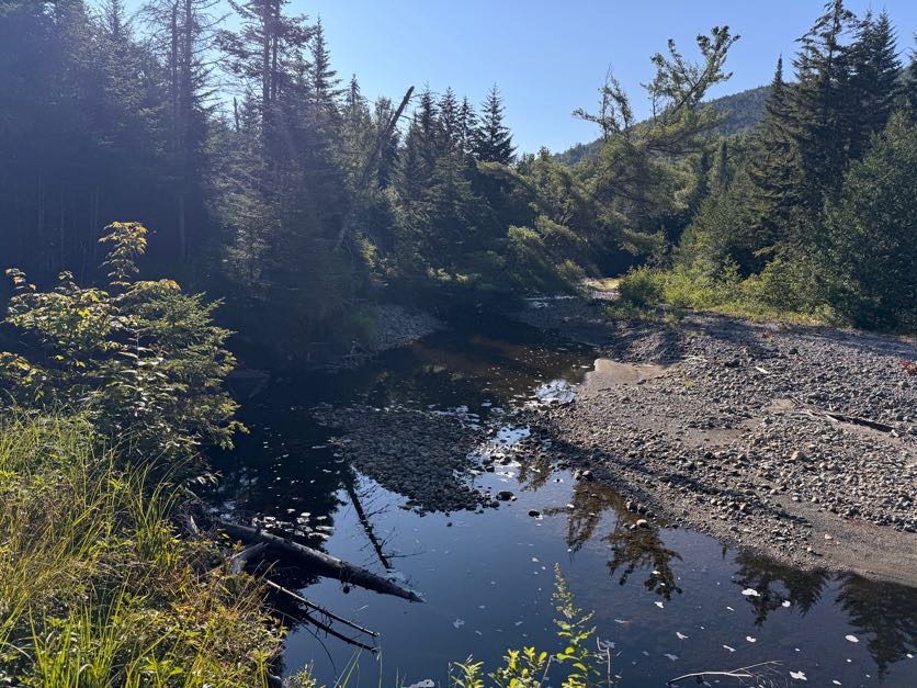
Just 10 minutes later, we had our first glimpse of the Opalescent river as the trail brushed against its banks.
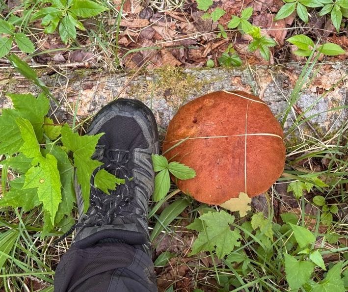
LOOK AT THIS MUSHROOM I FOUND! (Foot shown for scale)
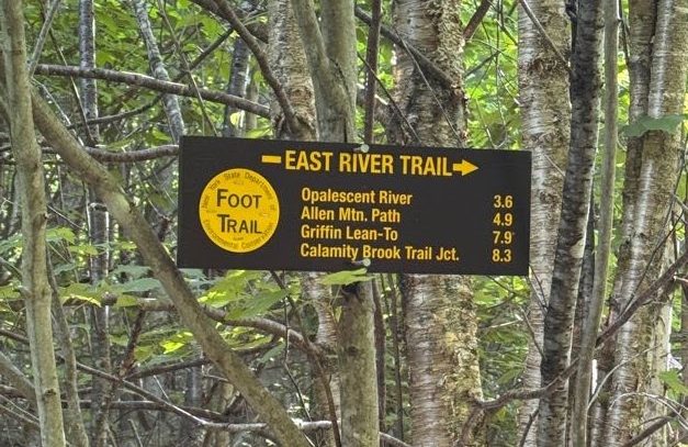
1 hour and 7 minutes and 3.6 miles after the junction to Mt Adams, we had reached the mighty Opalescent river. The water here can get pretty high in the spring or after heavy rains but we were lucky that it was manageable. We found a path across on the right which just involved 1 sketchy rock-hop across some fast-moving water.
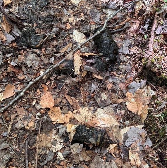
Somewhere along the way I remember Gildo saying so confidently “We’re gonna see a bear today.” To which I replied “What?!?” He said he just had a feeling. Well, we didn’t see a bear, but we did see some fresh bear poo right in the middle of the trail! It ended up becoming a landmark for us on the hike back down – “Did we reach the bear poo yet?” “No, we still have 20 minutes to reach it”. Add it to the map, I say!
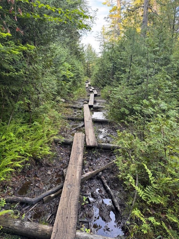
By 10:00 the trail had become muddy, narrow, and overgrown. I thought I was doing Gildo a favor by walking in front with my bug net hat so I could catch the spider webs, but given that he stands a full head taller than me….well, it’s the thought that counts, right?
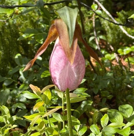
At some point something possessed me to look to the right and I was absolutely rewarded with TWO lady slipper orchids growing in the moss!! These are a rare find, it feels like such a gift from the forest to have spotted them.
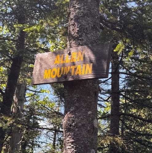
At 10:30am we reached the herd path to Allen. This one has an actual sign, so no need to worry about missing a cairn or some small indication of the trail.
A few minutes later we reached a clearing with gravel. I made sure to turn around to know what it would look like when we returned so we wouldn’t get turned around here, but it was pretty obvious where to go. We passed right through and carried on.
On the herd path, the terrain is still relatively flat and easy to navigate for the next ~4 miles…
Though the mud did present some unique challenges!
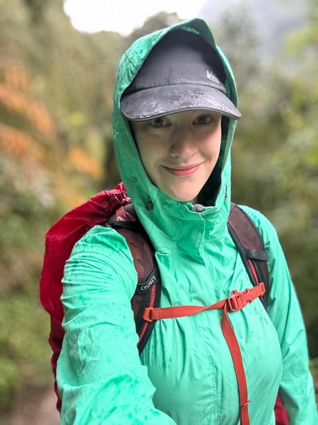
At around 11:45 we started to get some rain. We donned our rain jackets and just kept on going.
And we found a potty! Just randomly out here 6 miles into the wilderness.
At noon we reached the first of two stream crossings just before the ascent up Allen.
Fortunately these were a whole lot easier to manage than the Opalescent!
Shortly after noon, we were both feeling sooooo tiiiiiiired. I had actually looked at some of the lush moss growing on the side of the trail on the way up thinking it would be such a nice spot to have a nap. It had been over 4 hours of hiking already and we’d barely started climbing the actual mountain. We stopped for a bite to eat and to encourage our legs before starting the climb.
At 12:45 we had our first encounter with the infamous red slime on Allen Brook. Even better that it had been raining! I put my foot on a rock to cross the stream and my foot slid right off the rock – to which I declared “oh it is ESLIIIIIIIIIMEY” with a slight southern twang for no particular reason, and I couldn’t stop saying it the entire rest of the day.
Now THIS looks like an Adirondack trail.
The climb up this creek is no joke when it’s dry; but when it’s wet? Game over. It was actually comical how slippery it was and how slow we had to go to navigate our way up.
At about 1 pm, I hopped across the creek for the millionth time to where Gildo was waiting for me…..and landed my left foot in some deceptively muddy moss such that I sank in to ankle! I let out a yelp and Gildo helped me unstick my foot. But he was giving me this look like ‘you dummy, how did you manage to do that?’, or so I thought, until he said ‘Didn’t you see me just do the same exact thing?’ and when I looked at his identically muddy foot, I couldn’t stop laughing.
I mean it just does not look like the quicksand that it is at first glance.
A brief respite on solid ground…
And then right back at it! The entire surface of this rock is coated in a type of algae lovingly referred to in the hiking community as ‘Red Slime’. I decided the only way up was to practically slither my slimy self right up the rock, clinging to roots along the way.
Aren’t you impressed by my athletic prowess? Now the bug net hat was great for keeping bugs away from my face, but the problem with it is when you’re climbing up a steep incline, using your hands, looking down, is if there’s a branch hanging low across the trail, you just might whack your head straight into it. I rang my bell pretty good once, and after doing it the second time I said to Gildo “No matter how obvious it may look, just assume I don’t see any low hanging branch and let me know please!”.
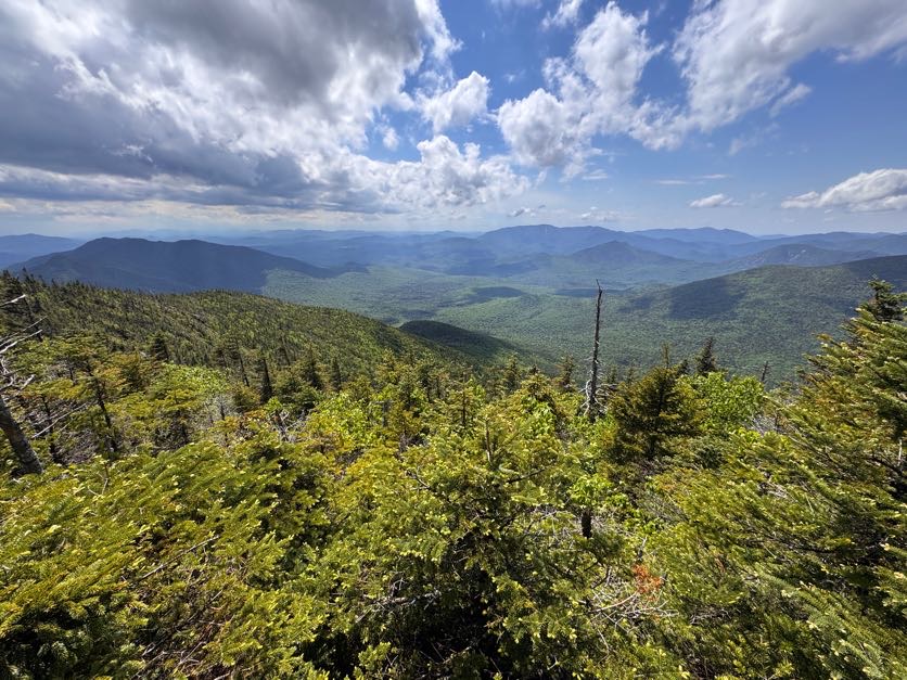
At 1:40pm we got our first view of the day.
And then back at it.
At one of the little waterfalls was a cairn – but now I can’t remember which one. At any rate, that’s the “1 mile to the summit” marker!
As we climbed we were grateful that the storm clouds seemed to be moving on, affording us some lovely views and hopefully drier conditions on the descent.
Ok HERE IS WHERE WE MESSED UP. I did not know that when you get to the slide, you should stay to the left and not go straight up the slide like a couple of buffoons. Guess what we did!
It was impossibly difficult but also hysterical. We had such a good time clawing our way up, laughing and pointing out the ESLIIIIIIIIME.
So just to reiterate – don’t climb up this way. Be smart. Go to the left and go aroooound the slide, not straight up it.
It did give us some pretty nice views though.
At 2:30 we thought we’d just about made it to the top, but no. We had to continue on through the woods a little while more.
And then 15 minutes later, WE WERE THERE!
I stripped off my soaking layers without a minute to spare. Even though rain had stopped, the trail was so narrow with overhanging pine boughs that we we continually drenched the entire time.
We hung out just long enough to snap a few pictures to celebrate #42, then we walked back down the trail to the overlook to rest our legs and enjoy some lunch.
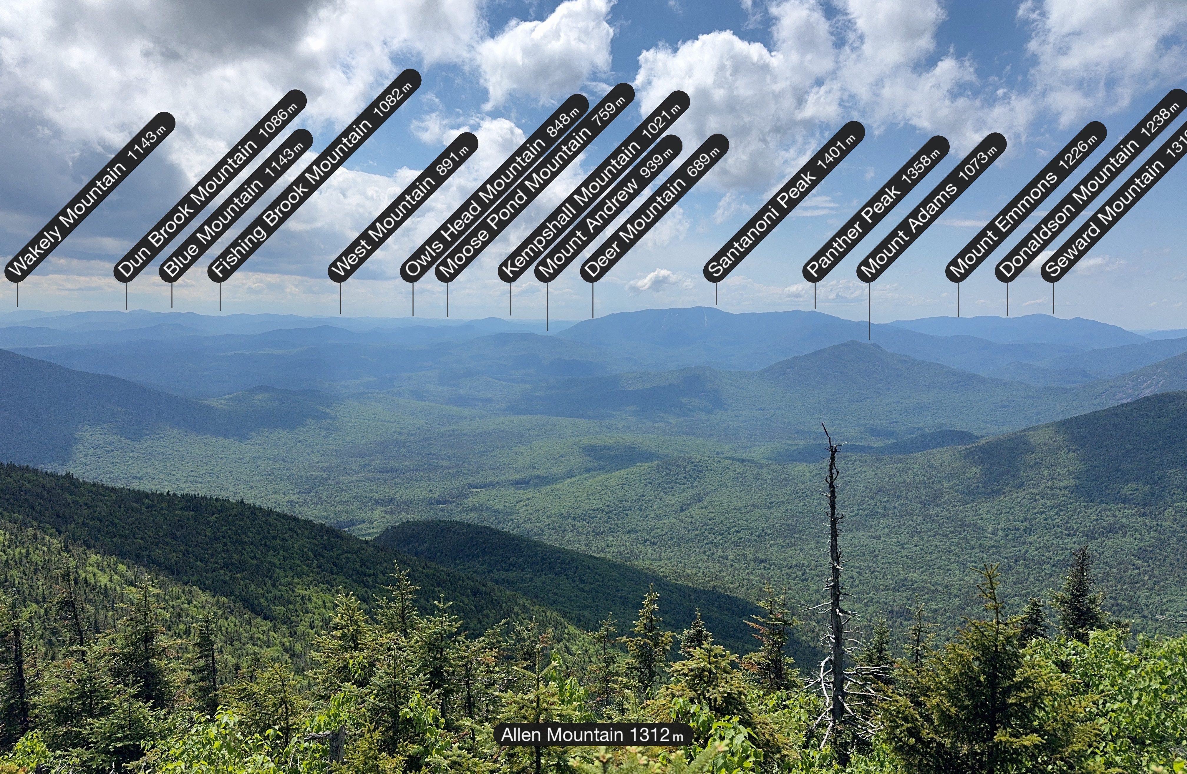
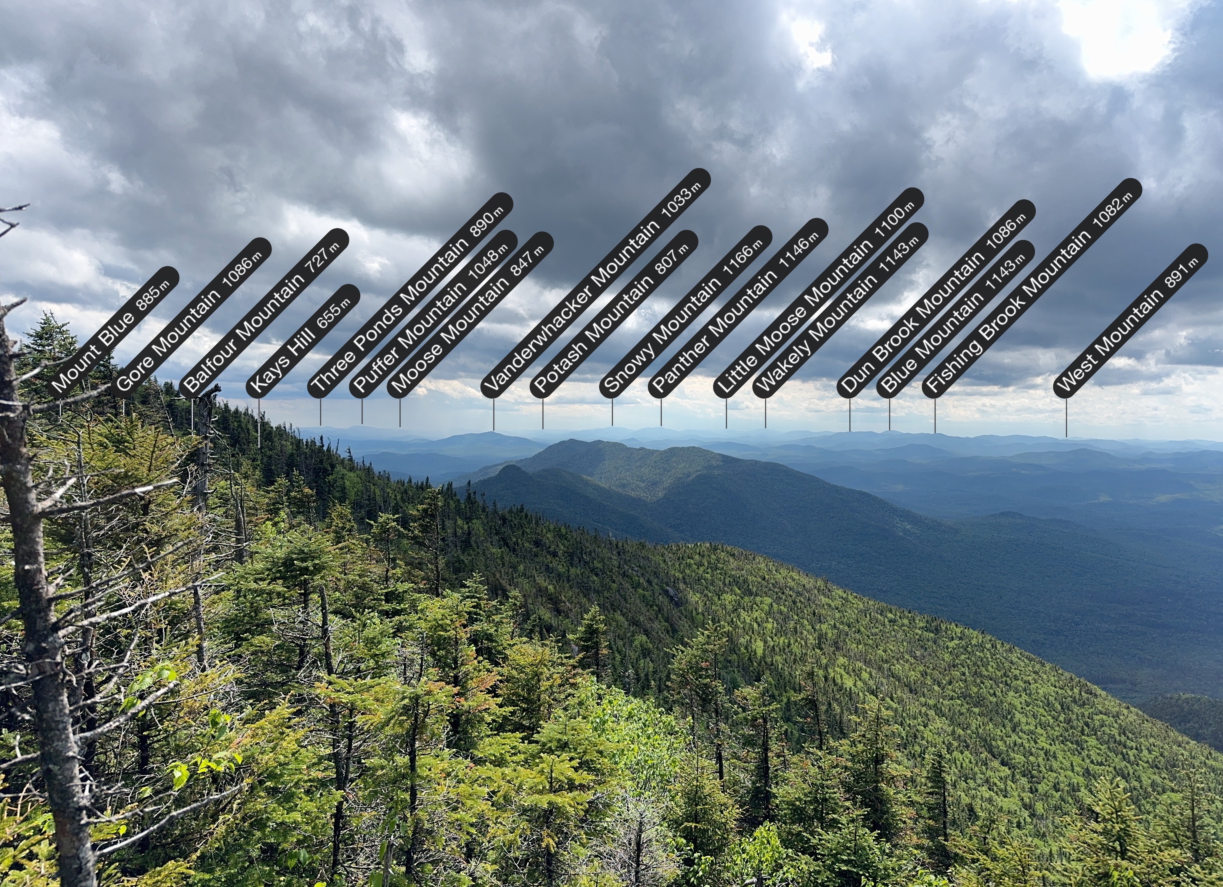
It’s so cool to use the PeakFinder app to see what all the mountains in the distance are, and even cooler to see how far away Mt Adams looks – we walked right by it on the way to Allen!
The rain definitely introduced a special kind of challenge on this mountain, but look how the view was with the mix of dark and light clouds overhead, and rain in the distance towards the left.
And some more mountain labels for good measure.
We lingered there for 30 minutes or so, then decided we’d better get going, and started back the way we came. Going down was way easier than going up, so I was able to take in more of the surroundings, like this AMAZING moss on the side of the trail.
AND I got this glamour shot of the cutest little newt around town.
I often chose the crab scoot technique coming down the ESLIIIIIMEY slides – it was so slippery that sometimes there was no stopping myself once I started.
And it wasn’t just the rocks that were coated in red slime, even the logs – now slick with rain – were just as slippery. I know better than to step on one, but when I was lowering myself down from one particular ledge and put my hand down on a smoooooth log, my hand shot straight off the end of it and I exclaimed “YOU are one slippery motherFLUFFER!” (only I didn’t say fluffer). Gildo heard my conversation with the log from further down the trail and we both lost it in laughter.
It took about 2 hours of careful descent to reach the waterfall once more.
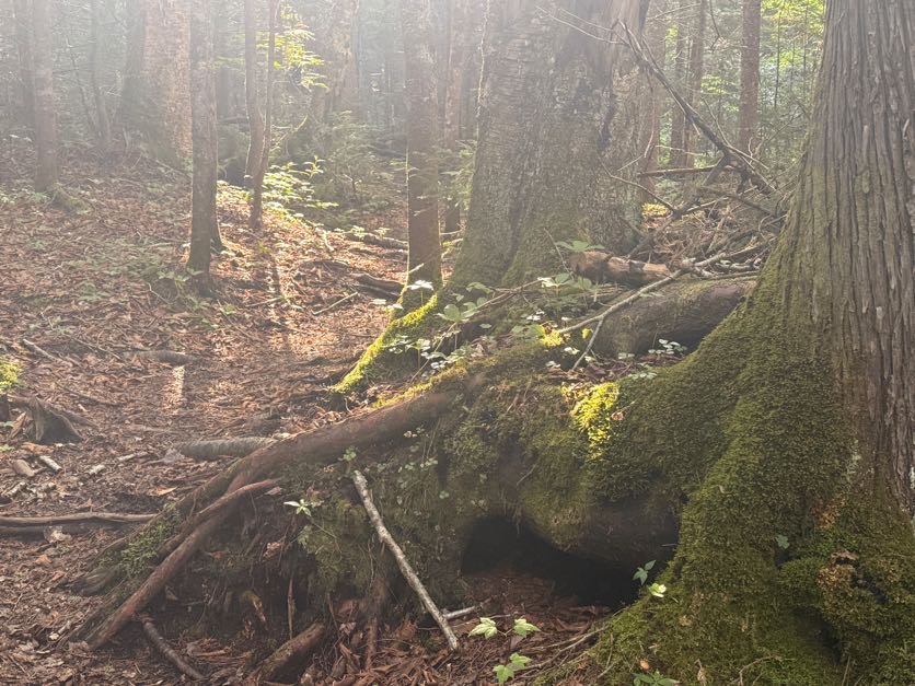
Great – just 8 miles left to go. It’s funny where the mind goes; we both saw the tree roots in the image below and thought it looked like a person sitting there with their legs crossed.
From the bottom of the waterfall, the 8 miles back to the trailhead are a piece of cake – mostly flat, easy walking by comparison.
At 6:45, a bit over 3 hours after leaving the summit, we once again reached the gravel clearing and passed straight through then to the left to stay on the trail.
10 minutes later and we were back at the junction with the main trail – 5 miles to go back to the trailhead!
30 minutes later we were back at the Opalescent river crossing, having to rock hop once more but with tiiiiired legs this time.
This is a really nice trail, but it did admittedly drag on and on at this point. I was starting to get some pain in my knees with several miles still left to go. We played word games like “Guess what animal I’m thinking of” to pass the time, but at some point we were both so gassed that we couldn’t spare a single brain cell to play games anymore.
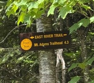
An hour later, at 8:30pm, we reached the junction with Mt. Adams. We were booking it this time despite the pain to cover as much ground as quickly as possible.
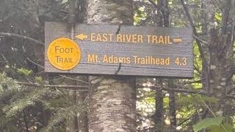
20 more minutes brought us back to the bridge. I was so grateful to see this sign! My legs weren’t cooperating with me at this point, but fortunately I had the best sherpa in the world there with me to carry me down the steps from the bridge.
Not even 5 minutes later we were back at the trailhead, right at 9pm.
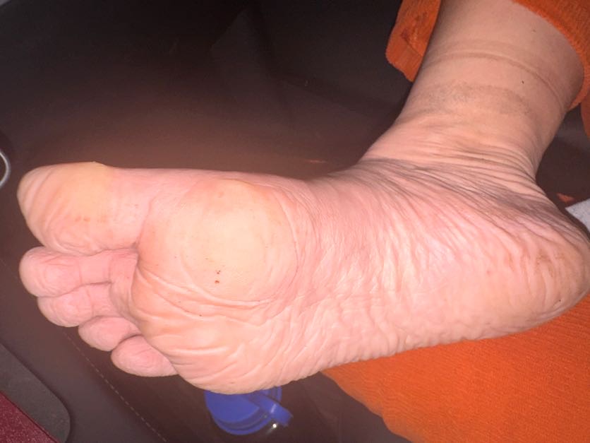
The feet took a beating this trip – they were wet for most of the day from being submerged in mud so many times. It felt sooo good to peel those stinky wet socks off my skin.
And that’s that! 42 down, 4 to go – just 2 trips remaining!
Allen Mountain: 4340′ Elevation gain: 3510′
Total duration: 13 hours
Total distance: ~20 miles
All images are property of adktrailtalesandtails and may only be used with express permission.
Our last day didn’t come a minute too soon. As I’d feared, spending so much of the day prior wet and cold had left me sick, with a sore throat and fatigue. And my sis was suffering from some serious blisters that had been developing more each day on her feet, to the point that some were now infected. So when I say in hindsight that we should not have gone to those hot springs – this is what I mean. I should have been dry, warming up somewhere out of the rain; she should not have put her feet with open wounds into warm spring waters; and we should have rested. And NOT given the leeches a free meal. But hey, now we know.
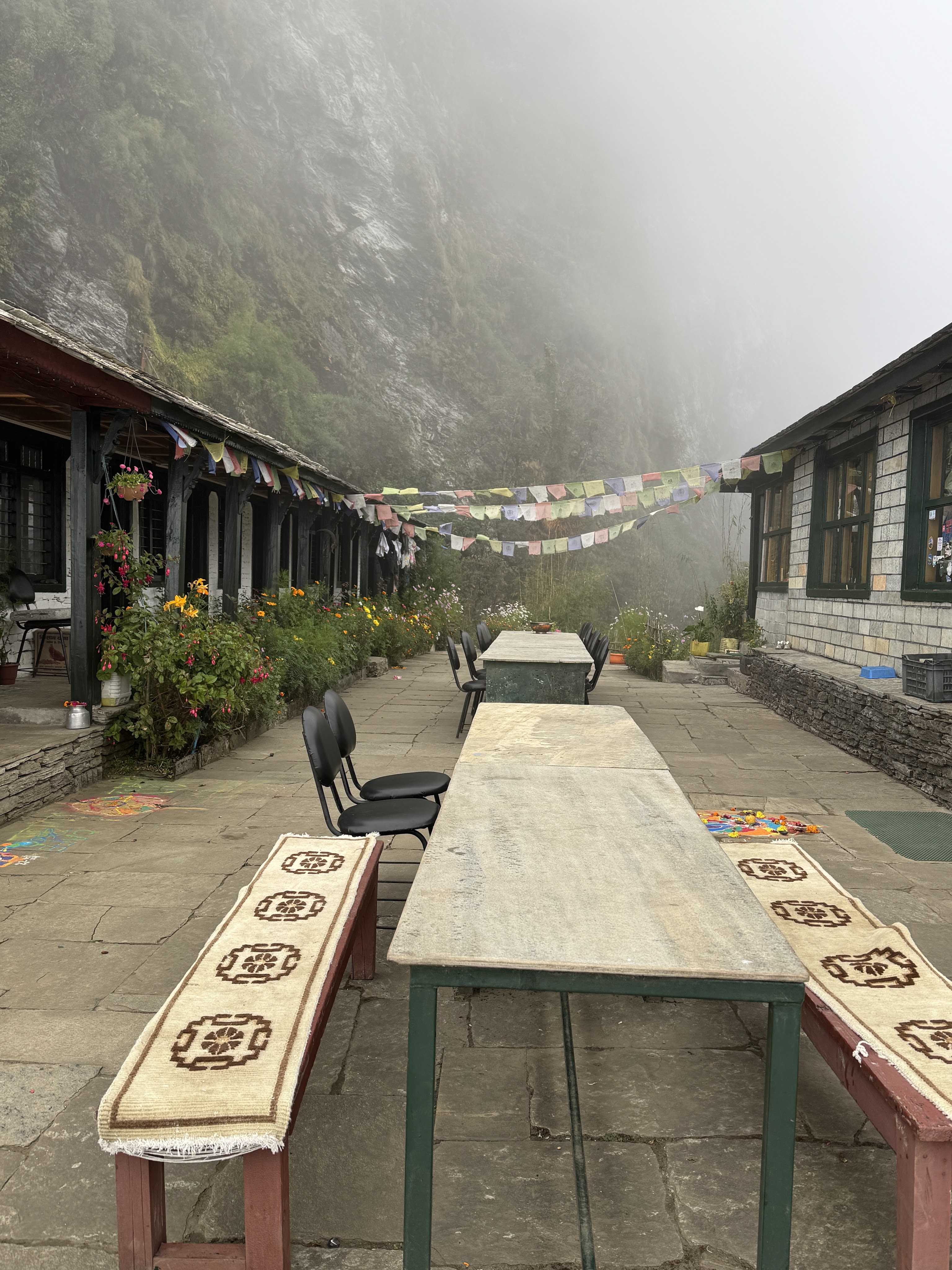
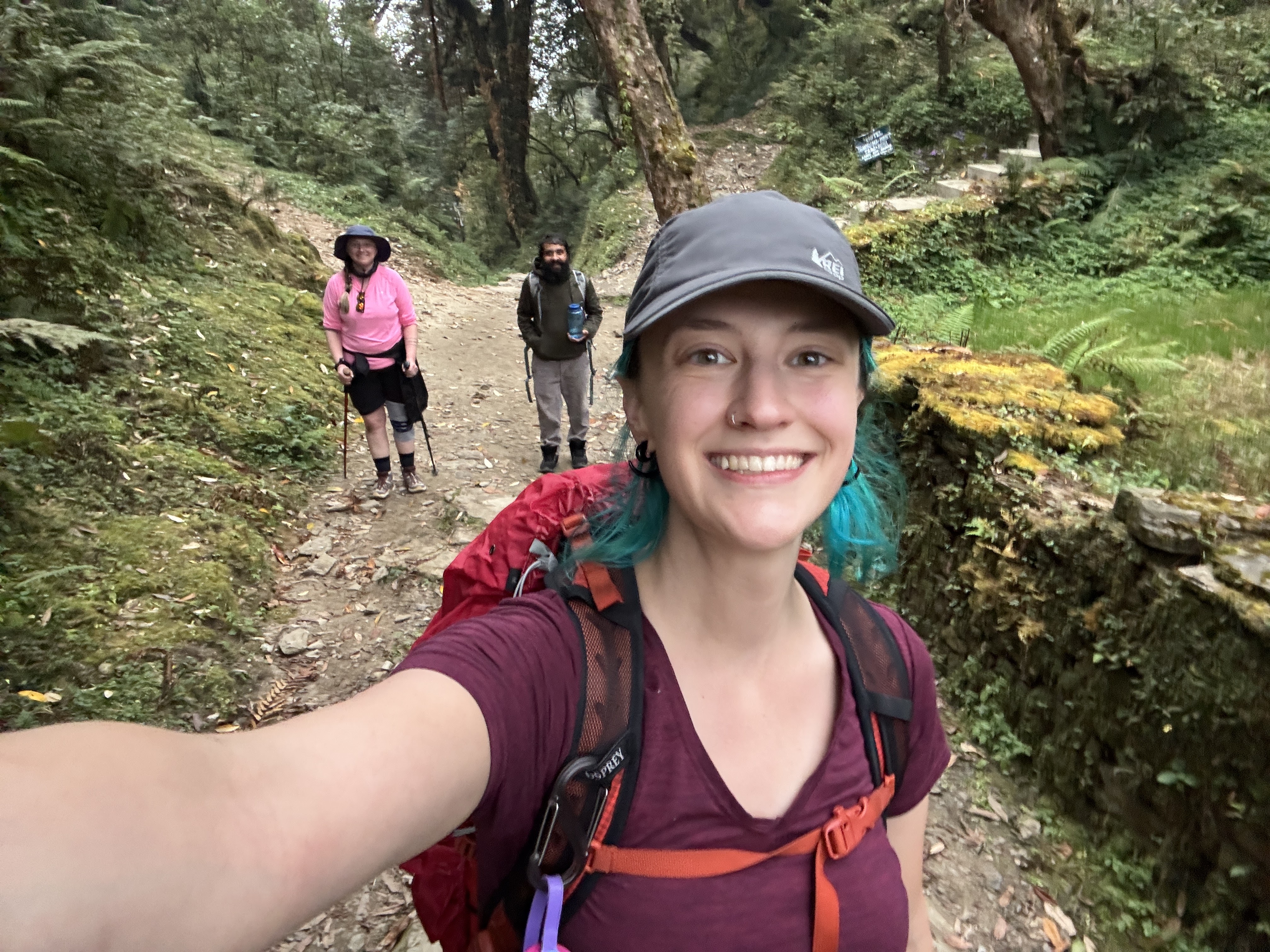
We took our time in the morning, for once in no rush to get going. So after our last tea house breakfast – banana pancakes – we started the slow walk down to the bridge, hand-on-shoulder in tandem, at 8:10am.
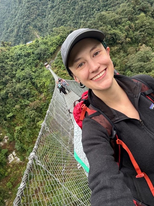
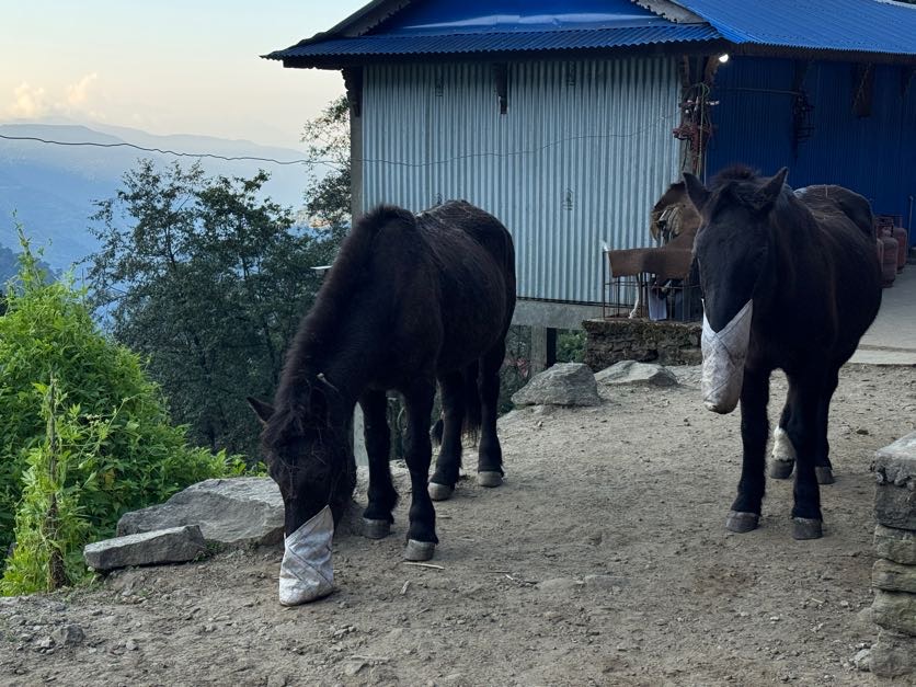
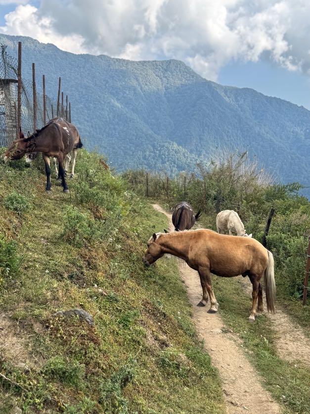
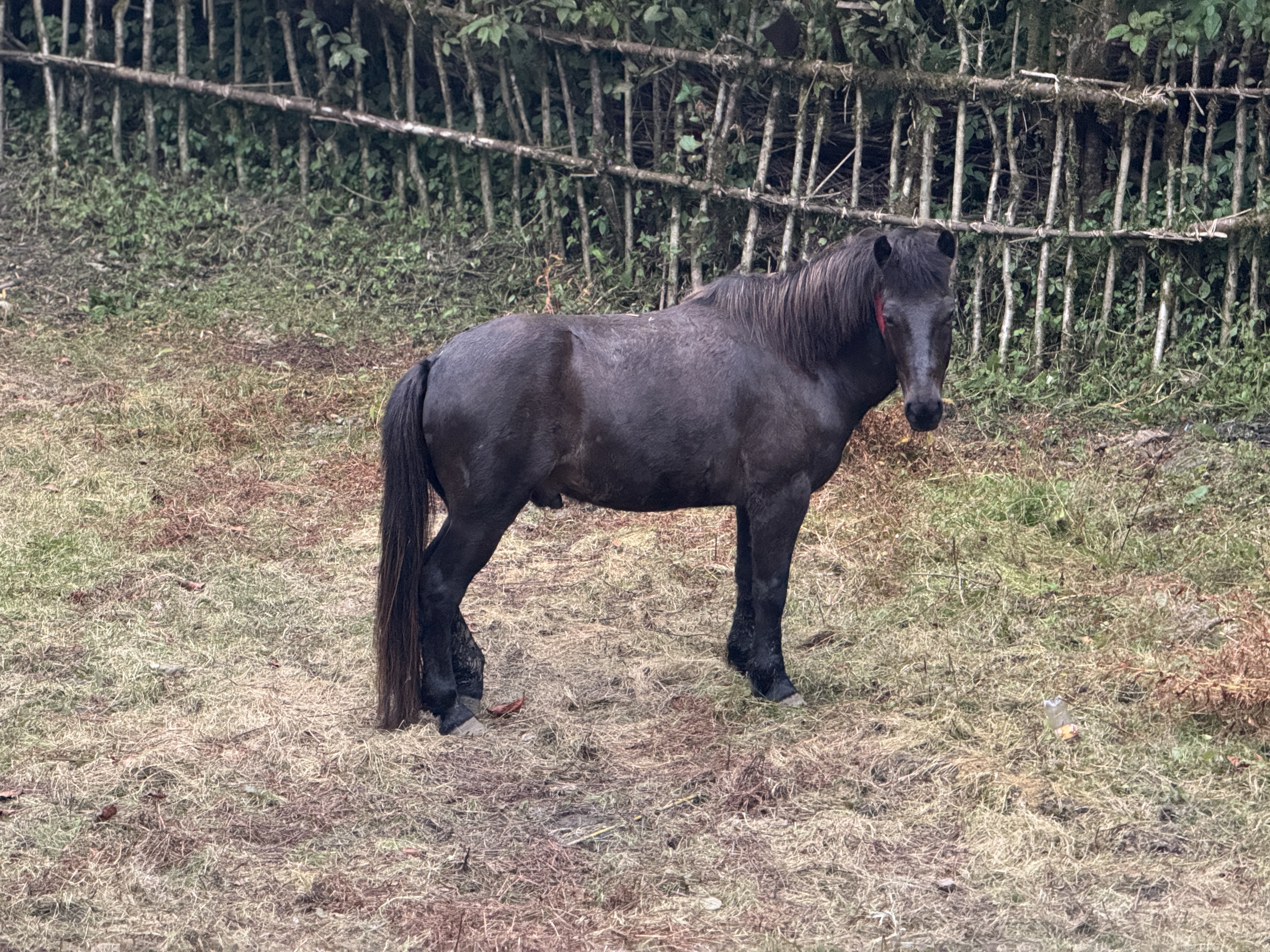
By 8:30 we were at the bridge, some of us enjoying the experience more than others, and starting back up the other side when two groups of mules and ponies came down to carry supplies across the bridge. We paused to watch them go, so impressed at how well trained they were to just calmly walk across this long, swaying, narrow bridge high over the river.
We reached the end at 8:55am, 45 minutes after leaving Jhinu, and hopped in a jeep to take the terrifying, bouncy journey back to Nayapul, and then to Pokhara.
Bamboo (7,710ft) to Jhinu Danda (5,840ft), 10km / 6.2 miles
10/28/25
Day 8. Rain. Cold. Leeches.
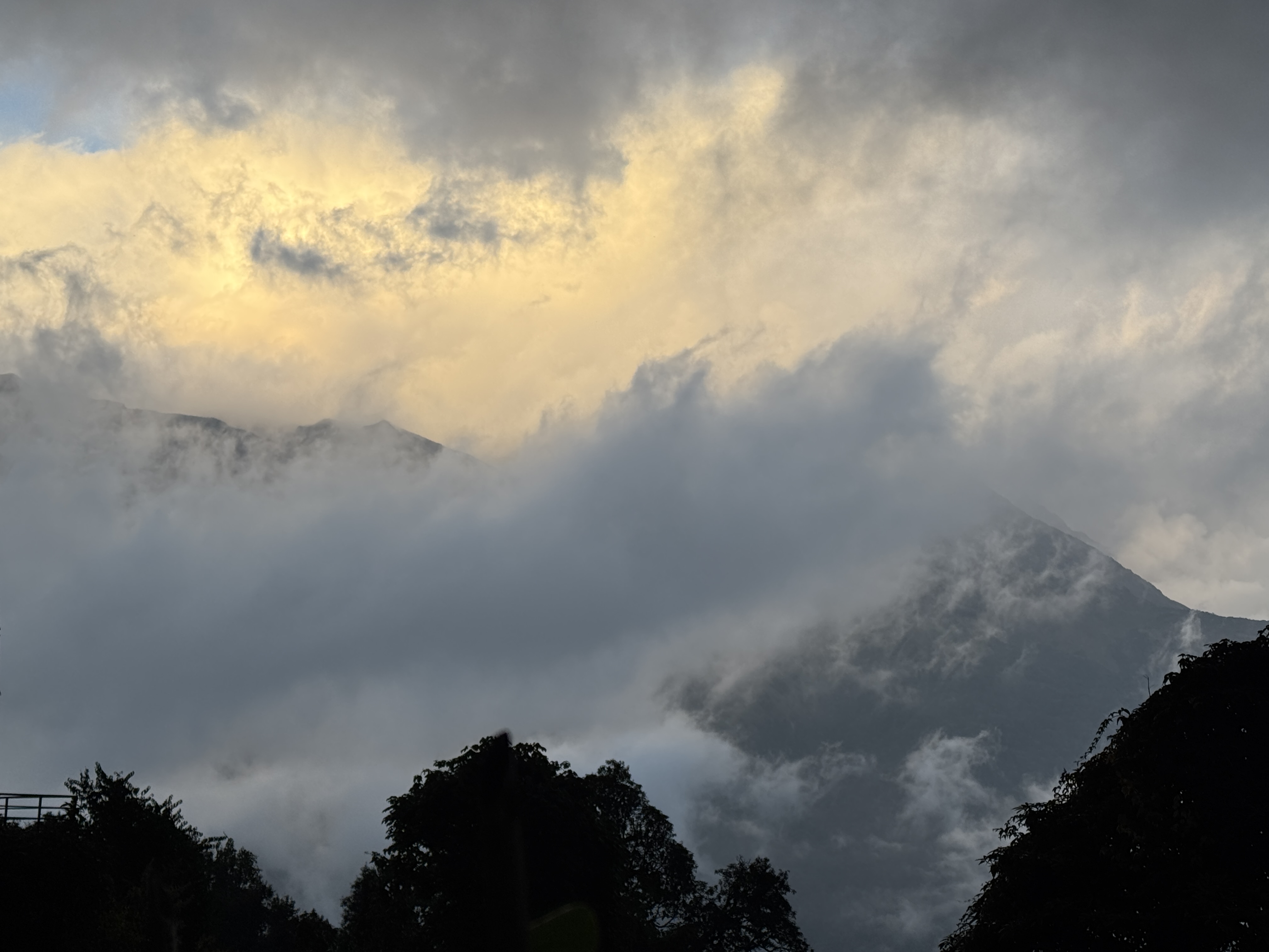
It’s raining when we leave Bamboo at 7am and it’s raining when we arrive in Jhinu at 4:15pm.
We’re the first to leave Bamboo and I am freezing cold to begin with. I try to wait for sis along the way but I get too cold so I go on ahead, planning to wait in Sinuwa.
Only I forgot how far upper Sinuwa is from lower Sinuwa, so when I passed through upper on my way to lower just thinking “keep moving to stay warm”, I realized….I have gone too far ahead. But there was no where to wait outside of the rain. Aaaaaand that’s how I temporarily went missing.
I ended up stopping at the first tea house in lower Sinuwa and turning on my cell data, but my phone didn’t immediately work (maybe from the cold and the rain?), but eventually I got a message through to Raj to tell him where I was.
40 minutes later they showed up to see me there – a pathetic drowned shivering kitten waiting under and awning. They brought me to the kitchen across the way and got me a hot tea to stop the shivering, then off we went.
Figures, I’d done so well every day of the trek with seemingly endless energy -but god help me if I get wet. I’m like a gremlin. I’d gotten so cold that I was worried I’d end up catching cold – it turns out my rain coat is not so waterproof anymore, and I was socked through to my bones. Sis was warm however and offered to trade coats, so that’s what we did.
From Sinuwa, we had to descend all the way to the river, cross the suspension bridge, then climb allllllll the way back up to Chhomrong. It took us an hour to slowly pick our way down, and an hour and a half of arm-in-arm climbing 20 steps at a time for over 2,200 steps (I counted….) to reach our lunch spot.
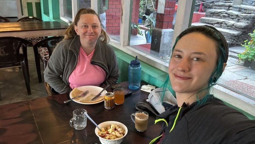
For the first time in days, I was actually hungry, and enjoyed the delicious tuna sandwich in a cozy warm dining room.
After lunch, we had to go all the way back down the other side of the hill to get to Jhinu.
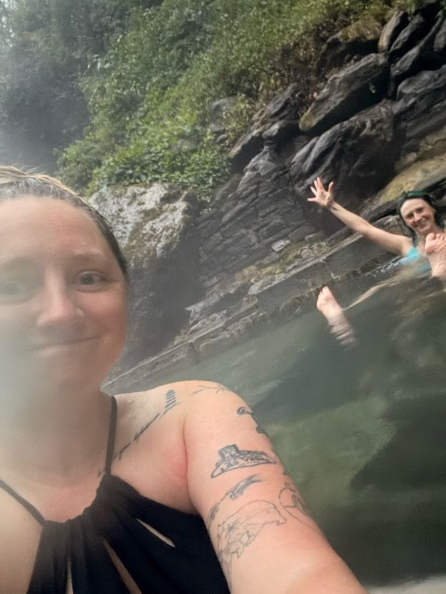
Still raining, we descended each step in tandem for support and finally reached Jhinu an hour and 45 minutes after starting our descent. We threw our things in the room, embraced in a victory hug both in surprise and relief that we’d actually made it, and switched into our swimsuits to prepare for the thing that has motivated us for 4 days – the hot springs.
Now, in hind sight, this……was a mistake.
According to Raj, it’s just a 15 minute walk down to the springs. So naturally it took us as least 30 minutes. We quickly shed our layers and hopped into the delightfully steamy waters at the edge of the river, so grateful.
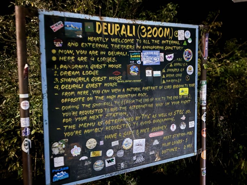
While we were experiencing cold rain at this lower elevation, base camp was completely snowed in, with more than a foot of snow falling overnight and throughout the day. In the course of just a single day, the route was shut down due to the storm – no one allowed in or out. Stuck there in freezing tin boxes they call rooms at 13,500ft. And anyone in Deurali was not allowed to go any further. If we had planned our trip for just 1 day later, WE would be stuck either at ABC or in Deurali. So yes, we were grateful.
We remind ourselves of that as we climb back up to the tea house in turbo mode – Raj and I on either side of sis -and inevitable find LEECHES feasting inside our boots on our feet and ankles when we reach our room. I’ll spare you the gory photo and instead leave you with a short poem:
A leech in the boot.
A leech on the ankle.
The carnage.
The blood.
The shrieks of “I want to go home”.
The emergency whistle hanging uselessly on our room’s door.
Day 7 of ABC Trek ABC (13,549ft) to Bamboo (7,710ft), 16km / 10 miles
10/27/25
Today we head all the way back to Bamboo, some 16km. We woke before dawn yet again to try to catch the sunrise and followed who we thought was Raj up to the ridge along with everyone else on the summit, but it turns out we followed TEMU RAJ – blue coat, beanie, glasses…..but most definitely not Raj. We owned up to our mistake later on, but I did think it was strange that he didn’t say good morning!
Unfortunately clouds rolled in and we were able to see the sun itself rise, so we headed back to the room to pack up and have some breakfast.
My sis was actually feeling effects from the altitude – headache, lightheaded, nausea, so we were eager to start heading back down.
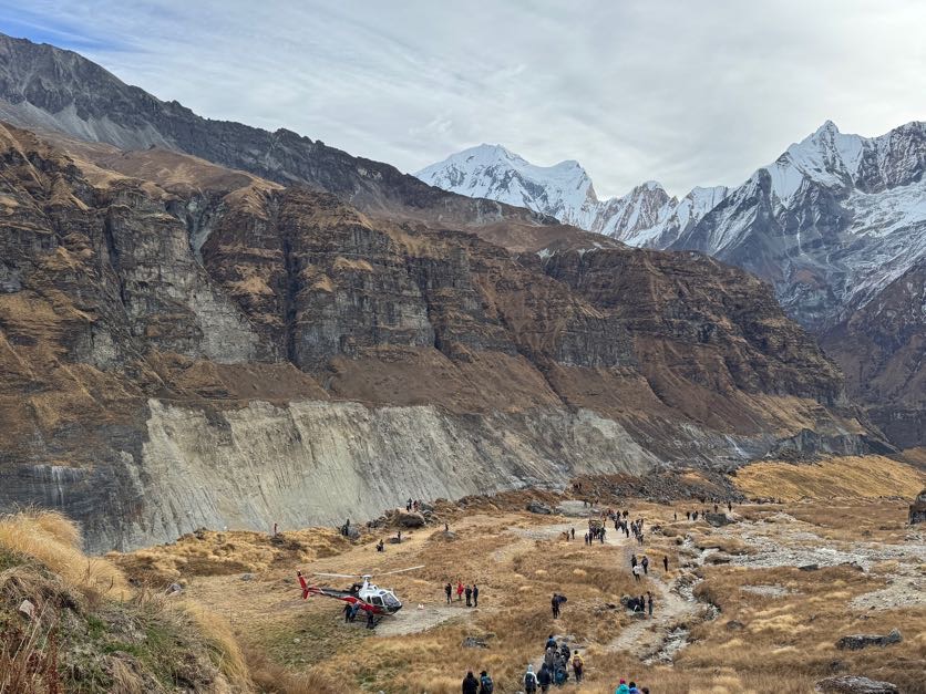
My bowels are no longer holding me at gunpoint, unlike the last 2 days. From ABC to MBC, we joined the long line of people also making their way down, witnessing a helicopter take flight just as we were descending. When they’re not carrying people needing to be medically evacuated, trekkers can hire a heli to take them back to Pokhara after making it to base camp as a quick, easy, and scenic trip back to town.
As a shock to no one, it was so much easier going down than going up, and we made it to MBC in an hour and 15 minutes.
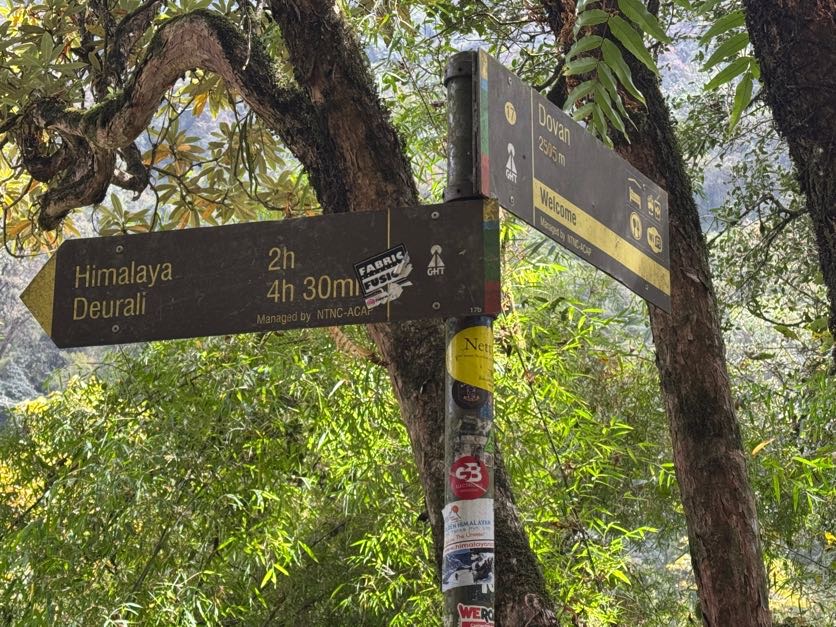
From MBC to Deurali, it was quite a bit steeper, but still not terrible, and we made it in just about 3 hours.
Here we made a choice – it was 11:20am, but we thought it best to descend the 1000+ stairs down to Himalaya and break for lunch there rather than having it now.
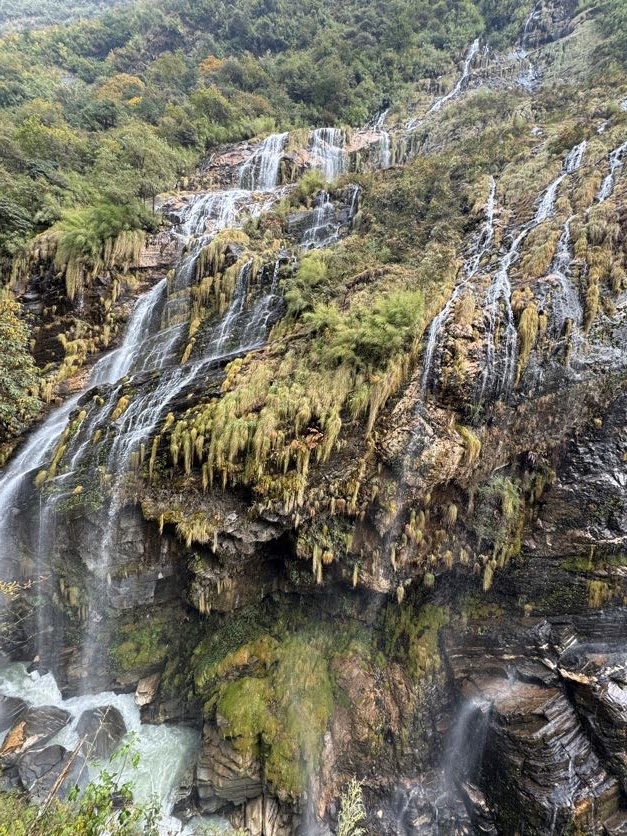
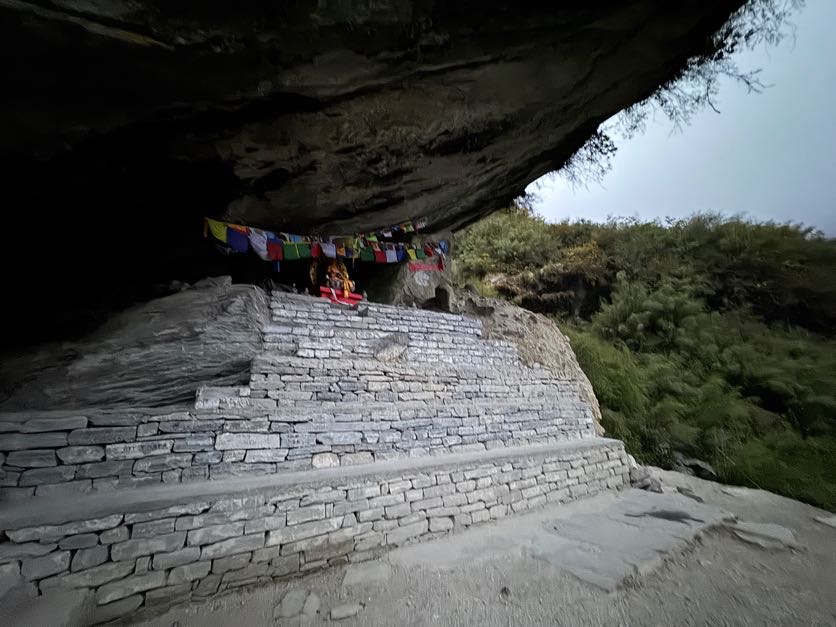
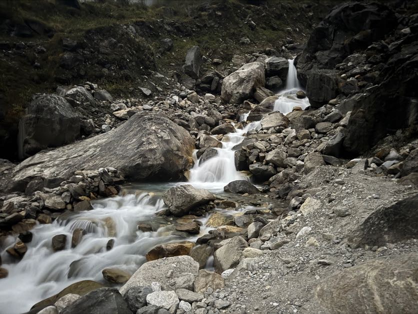
So on we went – it took 2 hours of slow, careful descent to reach Himalaya, past the waterfall that we somehow navigated around in the dark, watching objectively dumb trekkers rock hop across the turbulent waters rather than taking the bridge 20 feet away, and up past the Buddha cave.
Finally I started having an appetite again and enjoyed the most delicious sandwich and hot chocolate of my life.
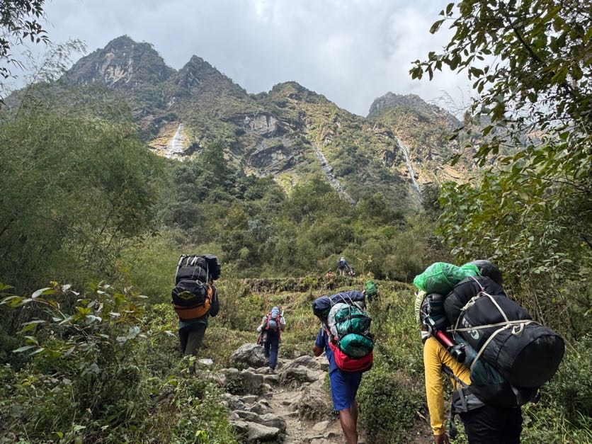
After lunch in Himalaya, we wound our way through the wet rocky jungle on the way to Dovan. The mud, rocks, and roots remind me of home in the Adirondacks. For two hours we descended to Dovan.
Once there, we didn’t stop but kept going, trying to make it to Bamboo by 5pm. Here there were yet more stairs, and we again ran into our Aussi friends. From then on we stuck together, again sharing stories from our travels and laughing. Time went by much faster and at 5:05pm we rolled into Bamboo, set up our room, and took our first hot showers in days, cleaning a few socks while we were at it.
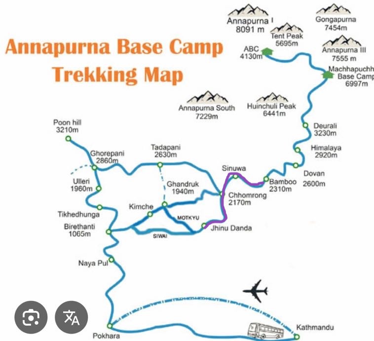
Deurali (10,500ft) to ABC (13,549ft), 10km / 6.2 miles
10/26/25
Day 6. A restless night’s sleep leaves me groggy but ready to start the day. Being so tightly bundled in my sleeping bag was not conducive to sleep, as it turns out. The air was absolutely freezing as we prepared, and we understood why they put us in a room with 3 others despite the empty room next door – to share in body heat.
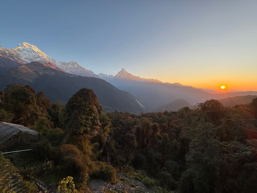
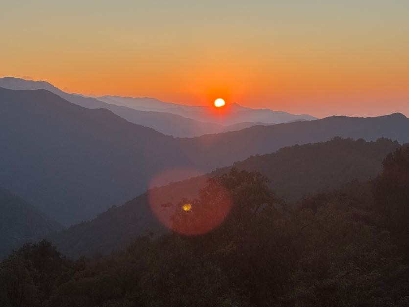
We were late to breakfast and later to leave, finally setting off at 7:30. We watched the rising sun light up the mountains as we slowly slowly made our way. At over 10,000 ft, the air is thin and we are easily winded. We are in no rush though and take many breaks to catch our breath and enjoy the views.
At one point we stopped to rest on a rock, and between the moment we sat and a few minutes later, the dry rocks suddenly became a waterfall. A pretty clear signal to keep going, so on we went.
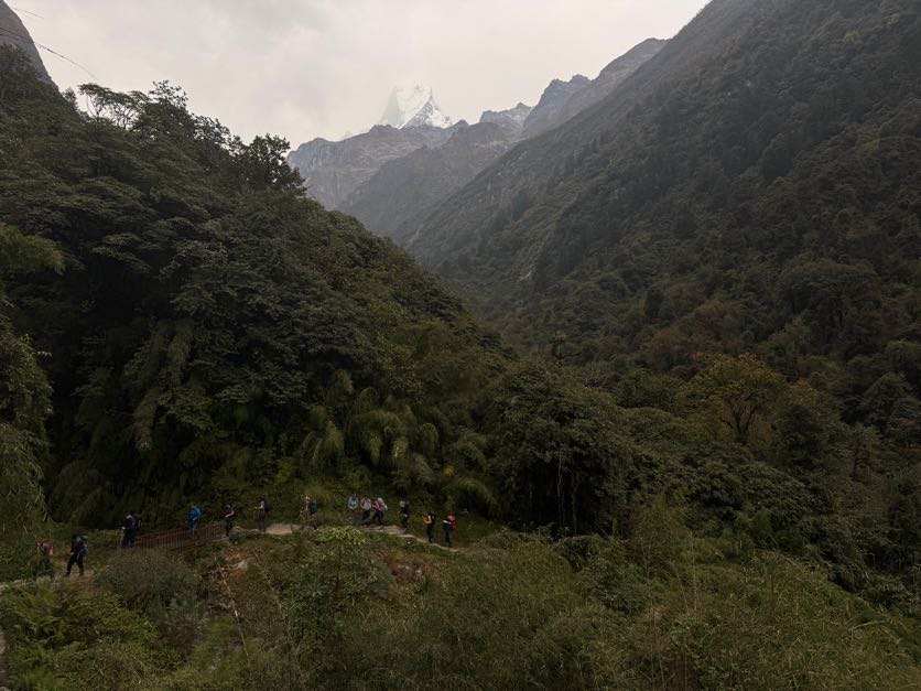
We were joined with many other people making the same journey, slowly winding our way up to Machhapuchhre Base Camp (MBC).
It’s estimated to take 2 hours from Deurali to MBC, but it took us 4, arriving just in time for lunch. Again with no appetite, I sipped on some garlic soup and ginger honey lemon tea, all things to help keep altitude sickness away.
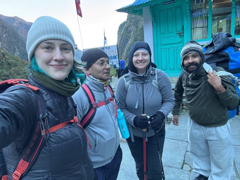
After lunch we continued on our slow crawl up to ABC, but somehow the thinness of the air wasn’t bothering me anymore. After a bit of leapfrogging with the same pair of Aussie trekkers from the day before, we decided to just join up with them.
Sam and his mother Natalie from Melbourne matched our paces perfectly – Sam with me, his mother with sis. The 2+ hours from lunch to base camp flew by as we shared stories and chatted our way up the mountain. At one point we crested a ridge, and there it was! Base Camp!
Basecamp in sight
I’ve learned not to be deceived by the apparent closeness of things here. These mountains are so massive that something that looks close can still be miles away. Which sort of proved true with ABC too – it just didn’t seem to be getting any closer the longer we walked. I’ve caught on to one of Raj’s phrases “We’re almost close”. Almost close. Aka – not close. How many times he said that before I caught on that we aren’t in fact close, I can’t say. But it’s now my new favorite phrase.
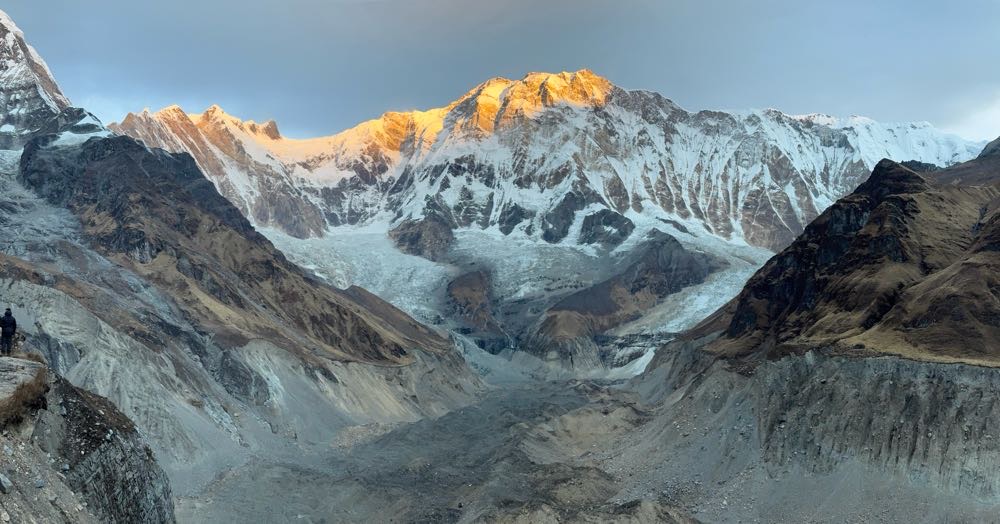
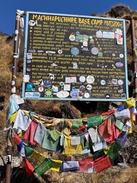
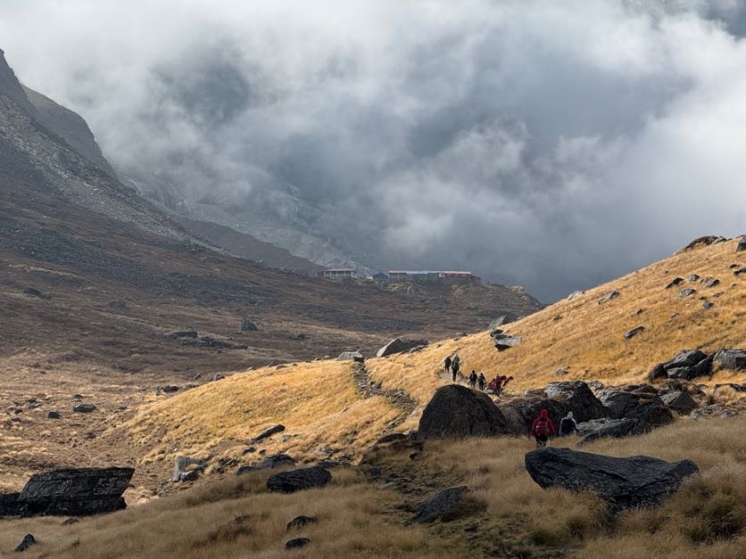
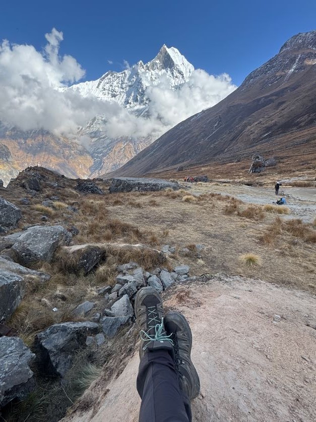
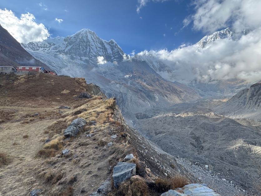
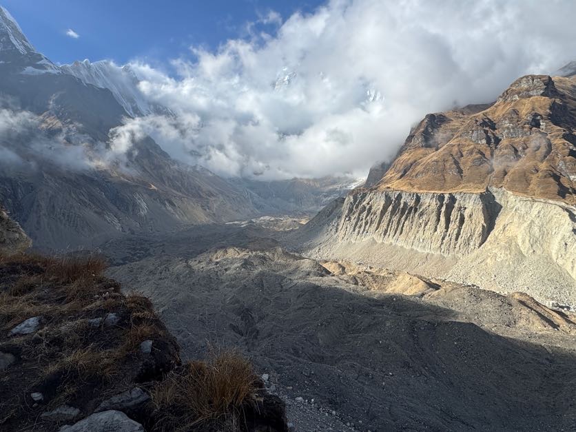
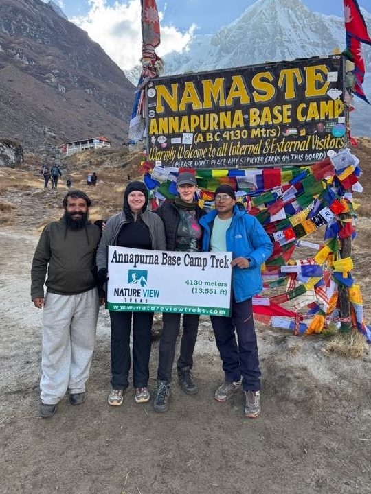
I’d separated from my group, as ever ruled by my bladder, and reached the ABC welcome sign at 3:15pm. I took a few pictures then climbed up a large boulder at the edge of a ridge to see what lied beyond – a boulder field. Massive. The sad last remnants of a glacier fast disappearing.
15 minutes later the rest of my group arrived and we posed for numerous embarrassing photos in front of the sign.
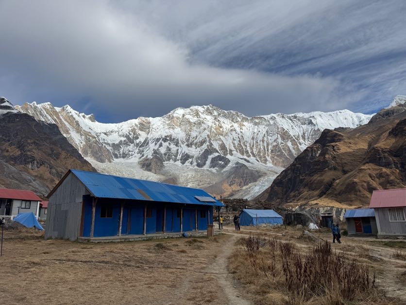
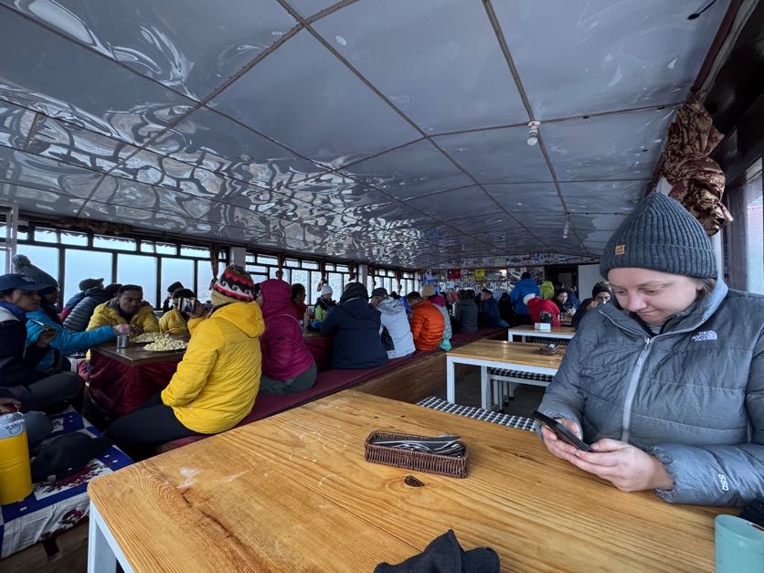
It was so nice to arrive so early in the day. We got situated in our room, then ventured back out to explore and warm up in the dining room.
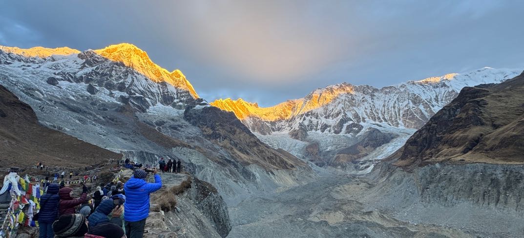
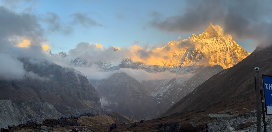
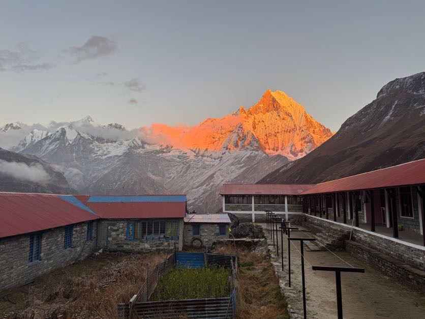
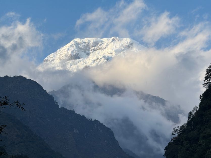
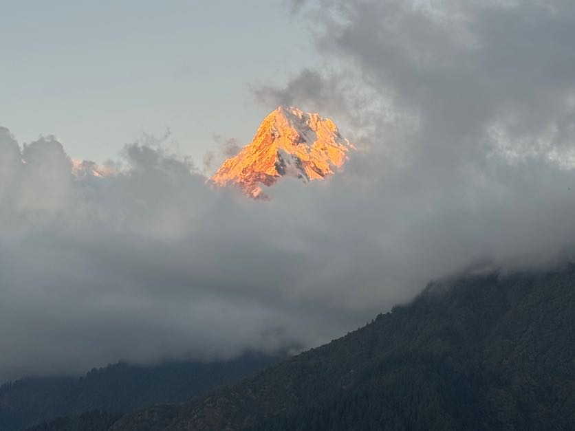
The mountain air was thin, windy, and FREEZING. But still, when the sun started to set and lit up Fish Tail mountain in front of us, we joined the throngs of people outside to take it all in before hunkering down in our room for the night.
I slept wearing every single layer that I brought with me – something like a thermal base layer, 3 or 4 coats, leggings and hiking pants, a hat and gloves, a sleeping bag, liner, and two blankets supplied by the tea house. I’d been taking Diamox since Kathmandu to help with the altitude sickness and while it definitely worked – I never even felt a tinge of the sickness during my trek – it made me have to pee a LOT. Which meant EVERY. SINGLE. NIGHT having to get up and venture outside in the cold to the toilet. This night at ABC was no exception but I was looking forward to it being the last time – tomorrow we would descend, so I could stop taking the meds. Hurrah!
Lower Sinuwa (7,677ft) to Deurali (10,500ft), 14km / 8.7 miles
10/25/25
Day 5. I didn’t want to wake up this morning. Reluctantly I rolled out of bed around 6 and started packing up. This time we pulled out some items we won’t be needing from this point on and left them, to be picked up again on our way back through after reaching base camp.
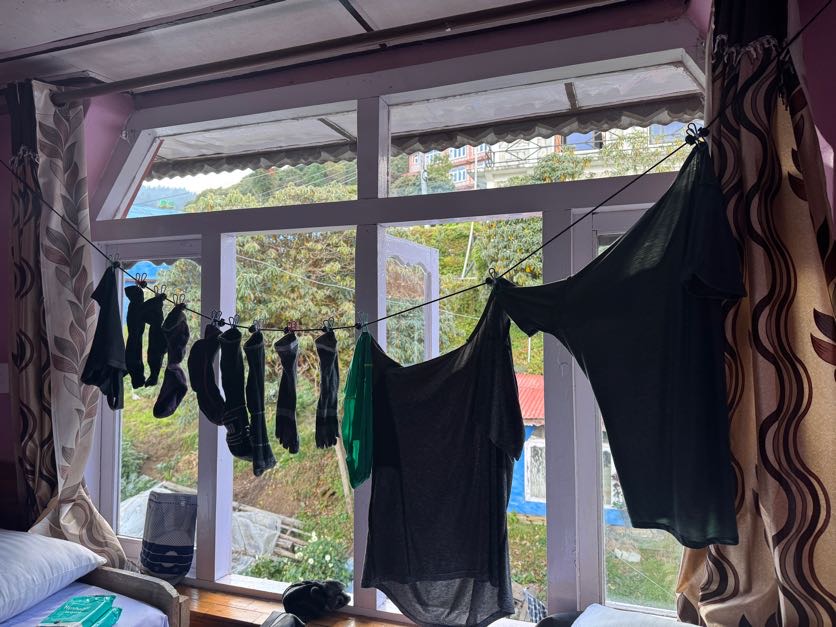
With everything packed, we sat for breakfast at 6:30am, messaging family and friends while we still had wifi, and doing some morning stretches. We’d again done laundry the day before and hung it to dry on our clothesline outside the room….without success. It was just so cold, everything was still wet in the morning. So I looped it around my backpack to let it dry while I walked, and off we went at 7:20.
An hour and 10 minutes of climbing stairs later, we arrived at Upper Sinuwa. From there, the way was more or less flat (read: Nepali flat – aka – not flat but close enough) before two long series of stairs going down to Bamboo.
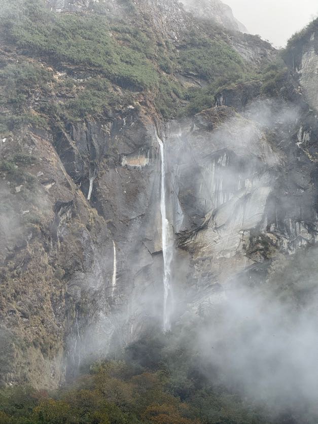
We walked through the forests, catching stunning vistas of the waterfalls coming from the glaciers beyond the mountains all around us.
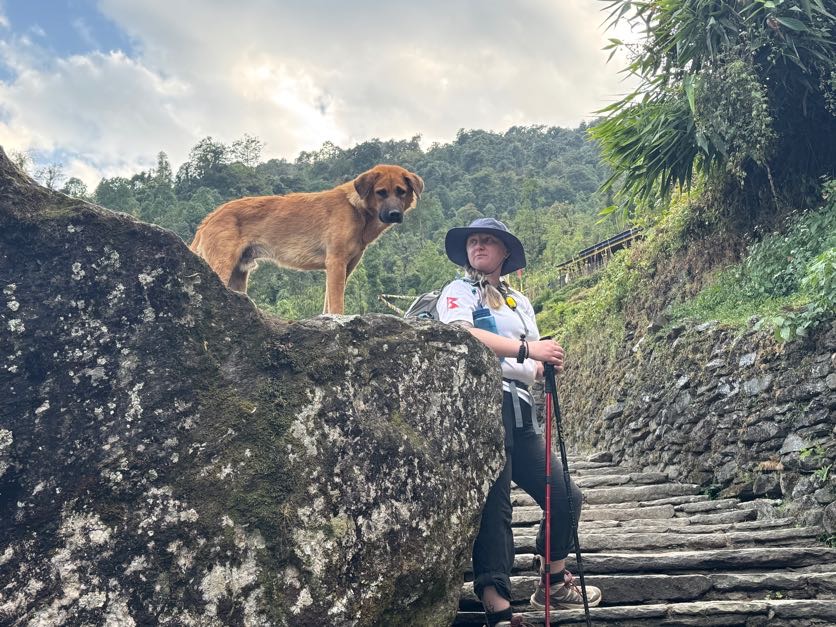
After 2 hours of walking, we reached Bamboo and enjoyed a 20 minute break with some tea, pringles we shared, and the company of a mountain dog looking for some affection. Sometimes these mountain dogs will follow trekkers from town to town and I was really hoping this one would choose us.
From Bamboo, it was a mixed bag of uphill, downhill, and Nepali flat sections. We crossed many streams from waterfalls and I stopped to dip my hands in the frigid crystal clear water.
It took us an hour and 20 minutes from Bamboo to reach Dovan. We paused briefly in town then continued another 30 minutes to our lunch spot. My appetite was nonexistant at this point, but otherwise I was feeling totally fine.
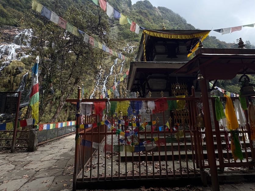
After picking at lunch, we continued on our way at 2:15pm, immediately climbing on our way to the next town: Himalaya. My belly did not agree with walking uphill so soon after eating lunch and I was grateful to find a toilet – albeit a disgusting one – just before a shrine in front of a beautiful waterfall.
From there it was about another hour before Himalaya. I remember nothing beyond stairs and hoping my stomach would hold out until the next town. It did – but barely. In Himalaya we stopped just briefly before continuing on.
From Himalaya to Dovan – 300m / 984ft of elevation gain. Stair after stair after stair. Absolutely brutal. I started counting stairs at some point along the way and stopped counting when I reached 1000.
After the last step up, we reached a cave with a small shrine inside.
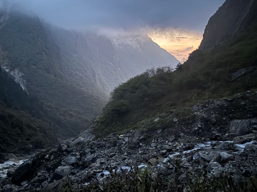
From there, down a bit to a rocky river. By then it was dark, so I fished out my headlamp, gave it to sis to use, and used my phone light to carefully pick my way down to the river. When I got there, I was shocked to be face to face with Suman! Not many porters would make it all the way to the destination, then turn around and come back to walk with the group the rest of the way, but here he was.
The way to Deurali was so incredibly long – we had met a few other straggling groups on the trail including a couple of Aussies that seemed to go at a similar pace to us, so we weren’t the absolute last ones to make it to town – but it was so important that we made it all the way because otherwise, we wouldn’t make it to base camp the next day. Tomorrow would trekking uphill 3,000ft at high altitude – it had to be shorter distance if we had any hope of making it.
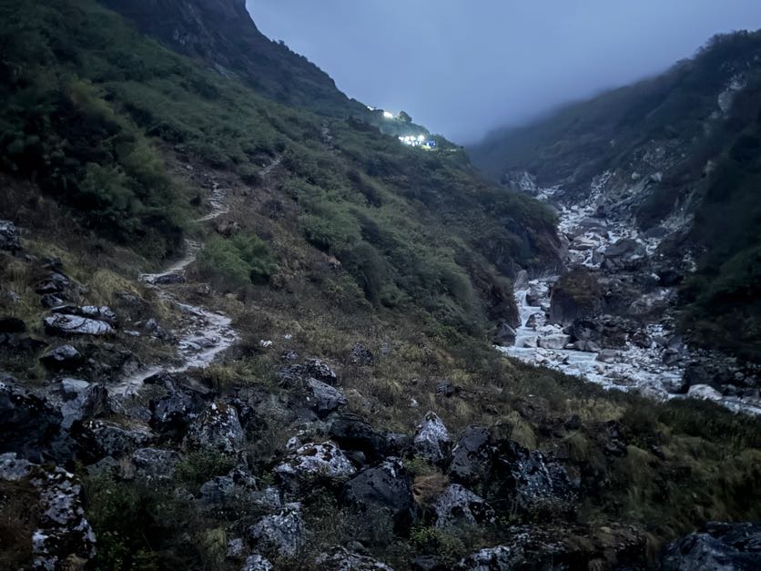
See the lights of Deurali up ahead
Our motivation for this day was to get there early enough so that Raj would get a bed – when the guides and porters get there too late, sometimes they have to sleep on and under tables in the dining room because they run out of space. I’m not sure we succeeded, but we tried.
20 minutes and a lot of climbing later and we were in Deurali. The last stop before base camp. This time we shared a freezing cold room with 3 others and bonded immediately with a lovely girl from Malaysia before going to eat.
It was surprising to me how many people had to leave members of their group behind on days 1, 2, or 3 to either stay in a tea house or go all the way back to Pokhara. Altitude sickness is no joke and can quickly turn deadly up here – so if you shows any signs of it, or even if you catch a cold, you really cannot continue without risking your life.
At 10,500ft, the cold mountain air seeped into our tin-can room. We bundled up in our sleeping bags to stay warm, skipping a shower after dinner and going straight to bed.
Tadapani (8,628ft) to Lower Sinuwa (7,677ft), 12km / 7.5 miles
10/24/25
We haven’t even been here for a week but it feels like a month. Our schedule has us going to sleep around 8pm and waking up around 5am.
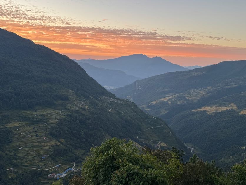
At least that means catching a nice sunrise in the mornings.
We arrived in the rain the night before so had no idea what the view might be like from this little village. Imagine our surprise when we walked out the door of our room to this view.
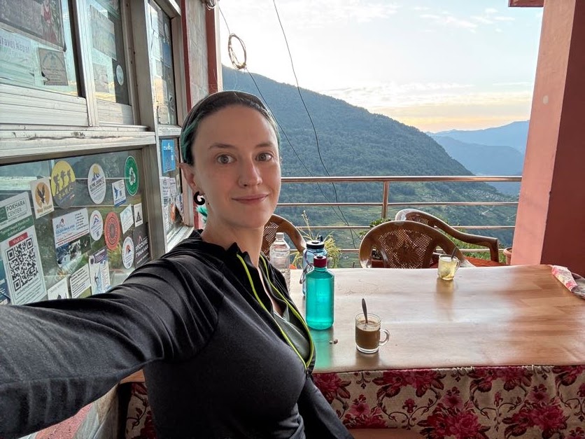
We took our time getting up, packed our bags, and set for breakfast at 6:30. By 7am, we were on our way.
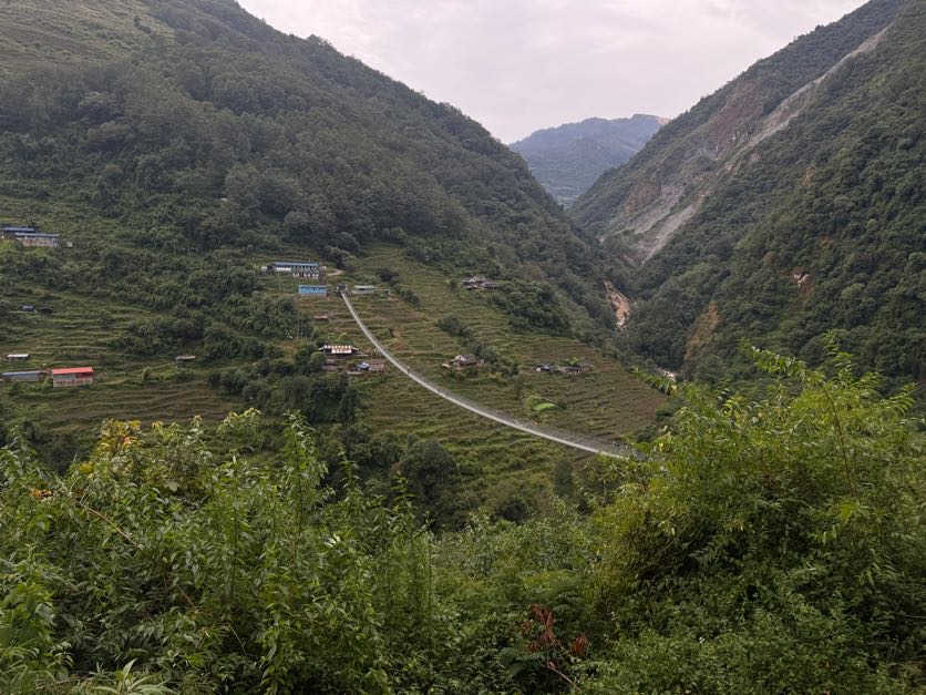
Today has us going 12km to a town called Sinuwa. We will descend 800ft down from Tadapani to Siprung, cross Kimrong River, then climb right back up the other side of the gorge to Chhromrong, then allllll the way back down, over Khola river, and back up to Sinuwa.
The descent was as always tough on the knees and seemed never-ending. Sis and I developed a rhythm of descending the steep stairs with one of her hands on my shoulder, moving in tandem. Which seemed to help, but it did take us 2.5 hours to reach the bottom still.
One particular spot had us rolling in laughter when she seemingly aimed her foot straight for a fresh pile of poo right in the path.
At some point on the way down, our guide Raj left us alone for a few minutes. I don’t remember why, but I do remember the shenanigans we got up to when left alone. Observe: Instagram vs Reality.
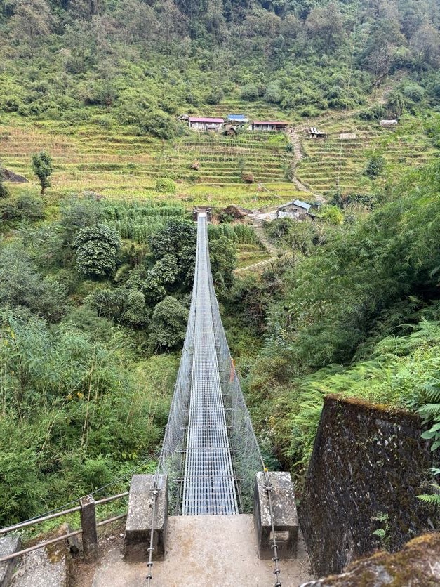
At the bottom of the stairs, we excitedly crossed a suspension bridge over the river one by one, then started climbing right back up straight away.
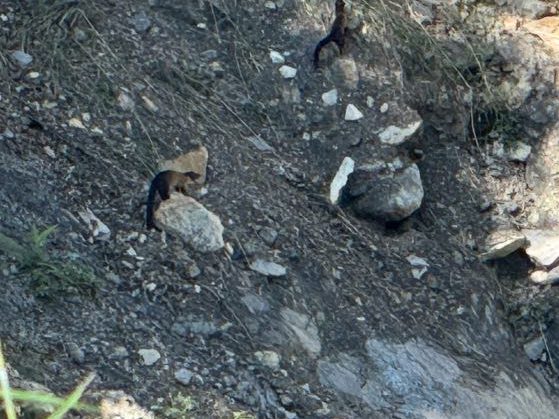
Somehow I spotted a little creature jumping around faaaar below on the edge of the river – a weasel!
Climbing up was as difficult for our little troupe as climbing down, especially under the heat of the sun. So again we employed our own version of Pony Service to power up the hill.
When we reached the top, there was just a few more flights of stairs, so I took sis’s pack and ran ahead to our lunch spot atop a hill.
Lunch was a nice break from the up and down of the day, though I sparked suspicion when I referred to “pop” as “soda” – New York has slowly beaten the midwest out of me and it has made me SUSPECT.
After lunch in Ghurjung, the next 2.5 hours to Chhomrong were relatively flat with little ups and downs all the way.
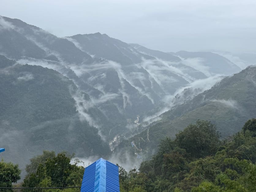
With the sun beating down hard and sucking away our life force, we made dashes from shady spot to shady spot, winding our way along the ridge. From high above, we could see Jhinu Danda – our last stop on this trek – faaaaaaar below.
The motivation for the day to get us up each hill of stairs was that, who knows? There could be ICE CREAM up there! Most likely there were just more stairs, but though the chances were low they were not zero that there could be ice cream up there. Spoiler alert – it was just more stairs each time.
Writing this during dinner at 7:30pm, I can’t remember much from the day besides stairs, cows, “maybe there’s ice cream?!”, stairs, ponies, stairs, puppies.
So any stairs, in case you haven’t realized. When eventually we reached Chhomrong, we looked across a stunning valley, distant waterfalls, and learned that the village almost directly across from where we were standing was the objective……..after going allllllll the way down, crossing a suspension bridge, and then going allllllll the way right back up.
According to Raj, this should just take an hour and a half total. But for us, it took that long just to descend to the suspension bridge.
And the same amount of time to come back up, dodging men on ponies driving them at an absolutely mad pace up the mountain relentlessly. Hand-in-hand we climbed each step one at a time and finally reached our tea house at 6pm, 11 hours after starting.
Looking at the crescent moon over Chhomrong
This was the toughest day yet. Following a long day 3, we were exhausted and feeling it in our muscles. I was getting some shooting pains down my leg from a tight hip, so after we did a bit of laundry and had dinner, I rolled out my tight calves and hips with my nalgene, and passed out for the night.
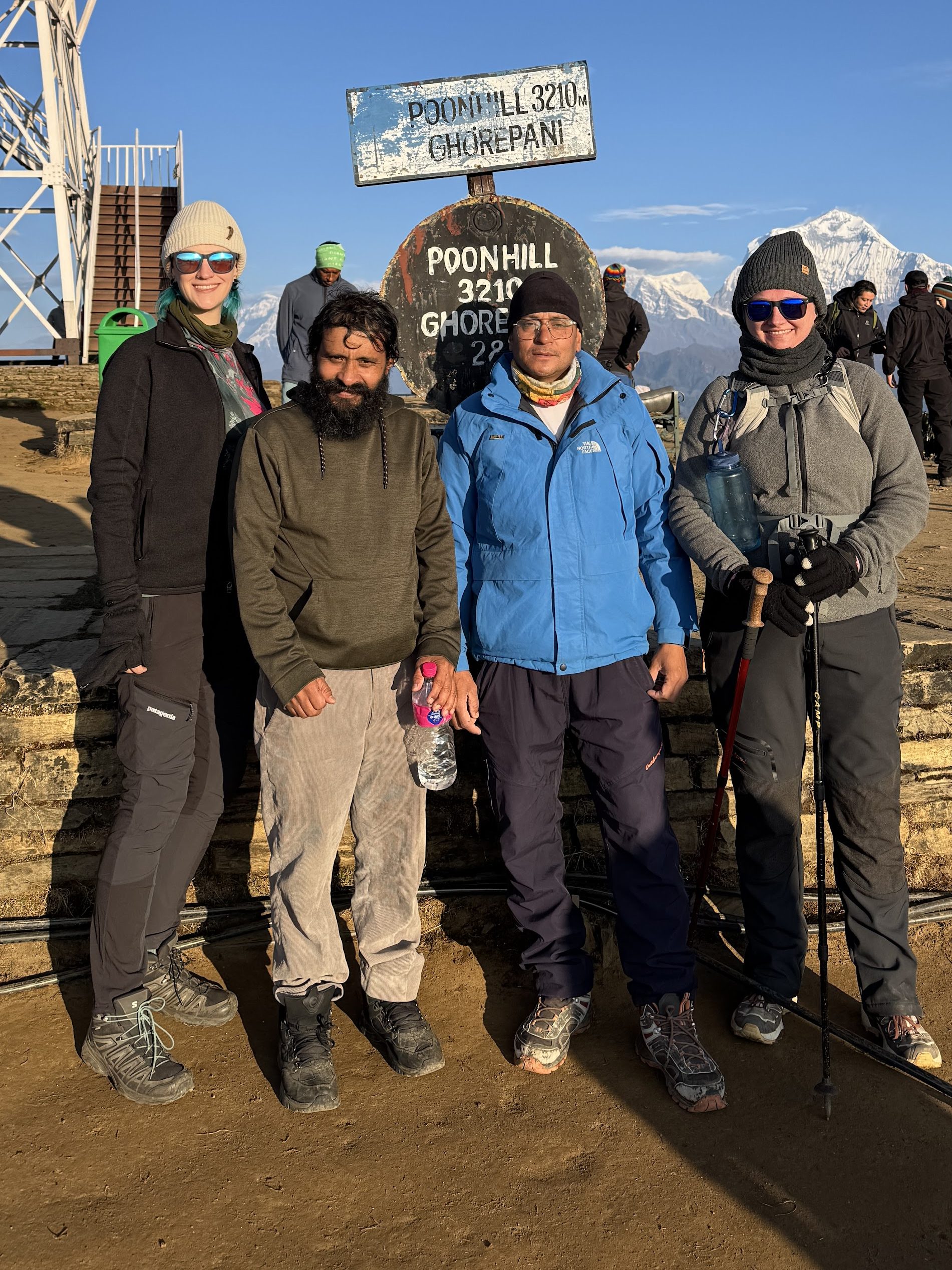
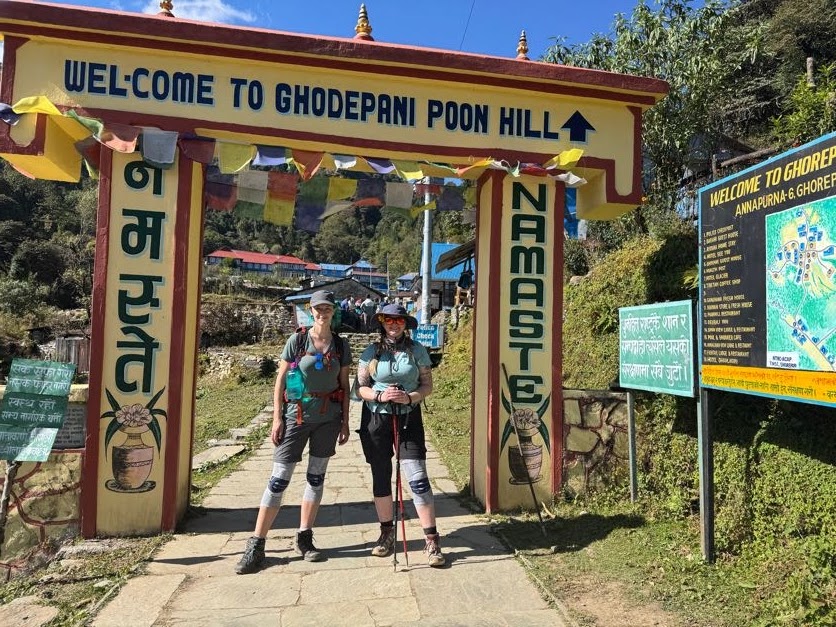
Ghorepani (9,429ft) to Poon Hill (10,531ft) to Tadapani (8,628ft), 11.2km / 7 miles
10/23/25
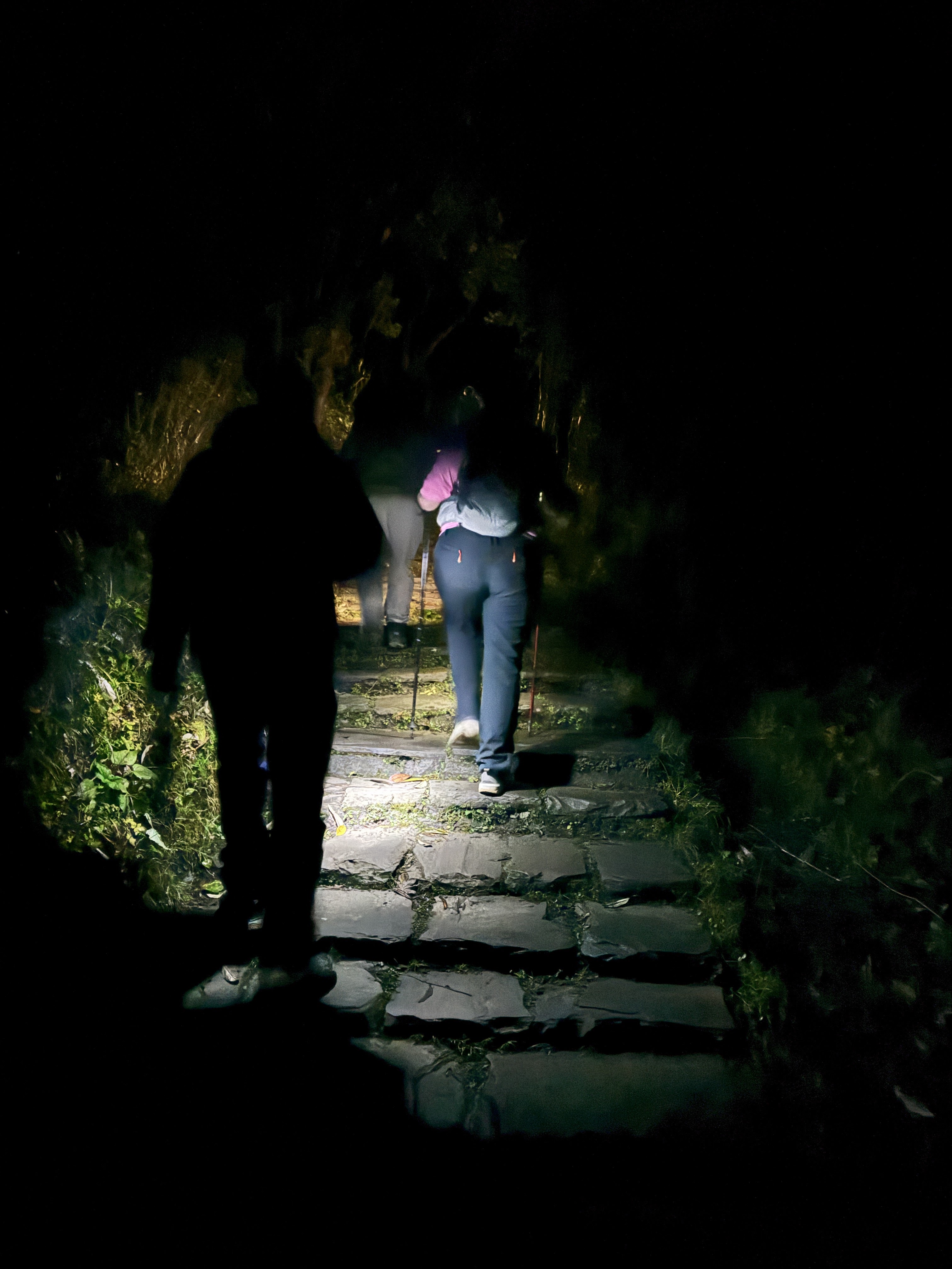
4:00am – alarms ring and we reluctantly swing our stiff legs out of bed. “Are you ready to climb Poon Hill?”, one voice asks, “No, not all all” the other responds. Yet we pulled on our layers of warm clothes, pulled our light packs over our shoulders and opened the door into the cold starry night. The darkness is dotted only by the stars and shimmering lights from hikers’ headlamps.
The plan is to climb up Poon Hill to watch the sun rise over the mountains, then come back down to our tea house in Ghorepani for breakfast, and then to continue on our way to Tadapani. Which meant we could leave with just the bare minimum essentials in our bags.
Almost immediately we start climbing at 4:30am, step after step. With sunrise at 6:15am and only 1.2km to the top, we’ve given ourselves plenty of time to climb the innumerable steps to the top.
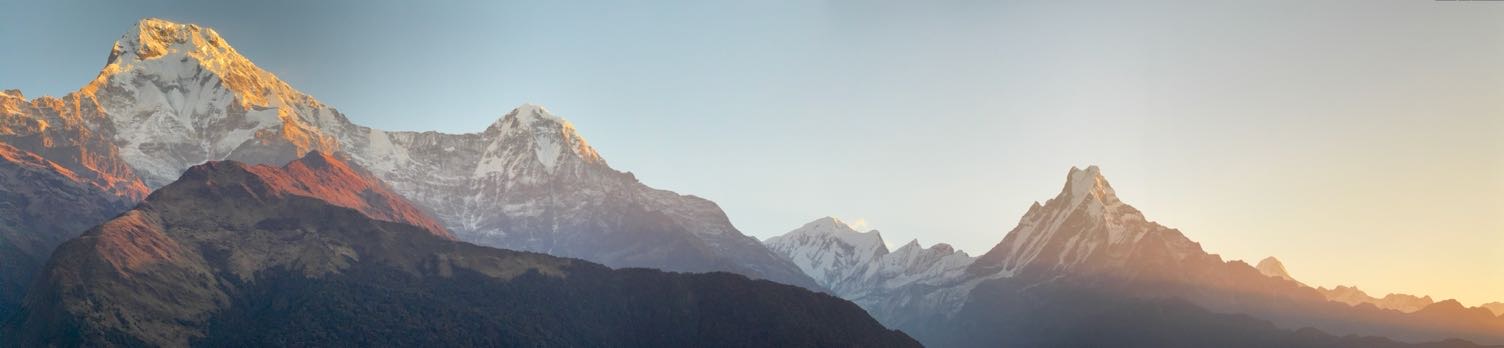
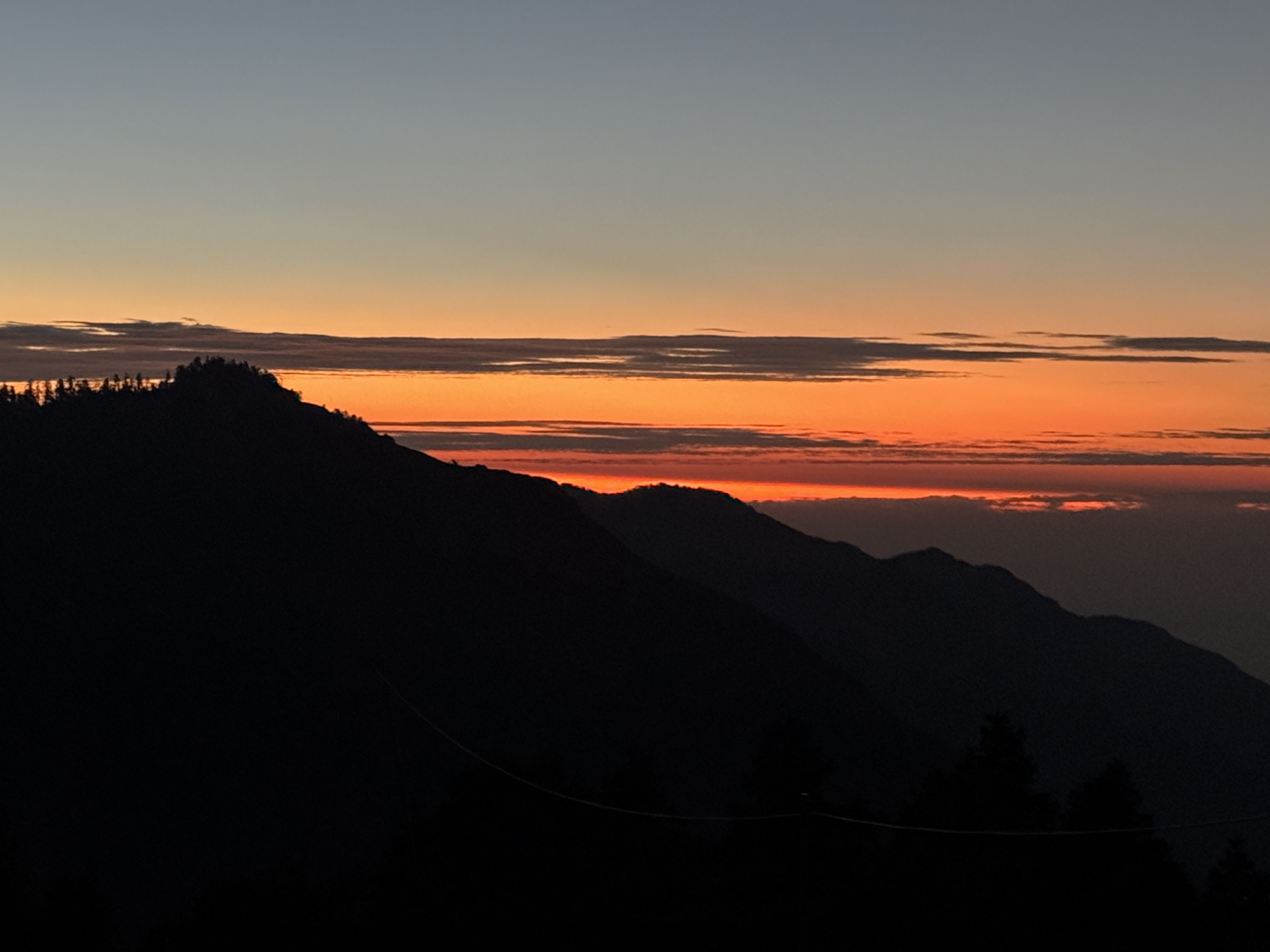
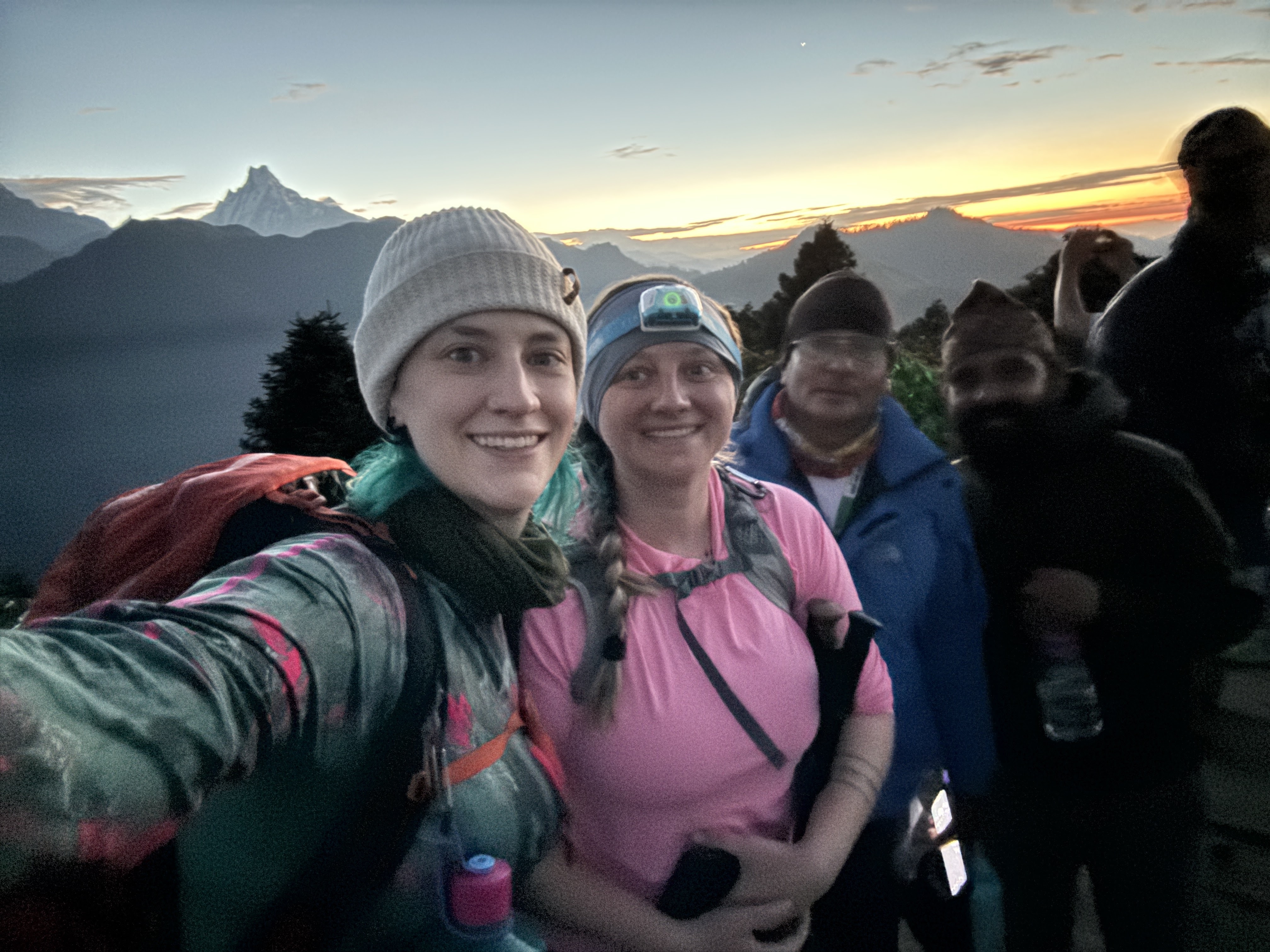
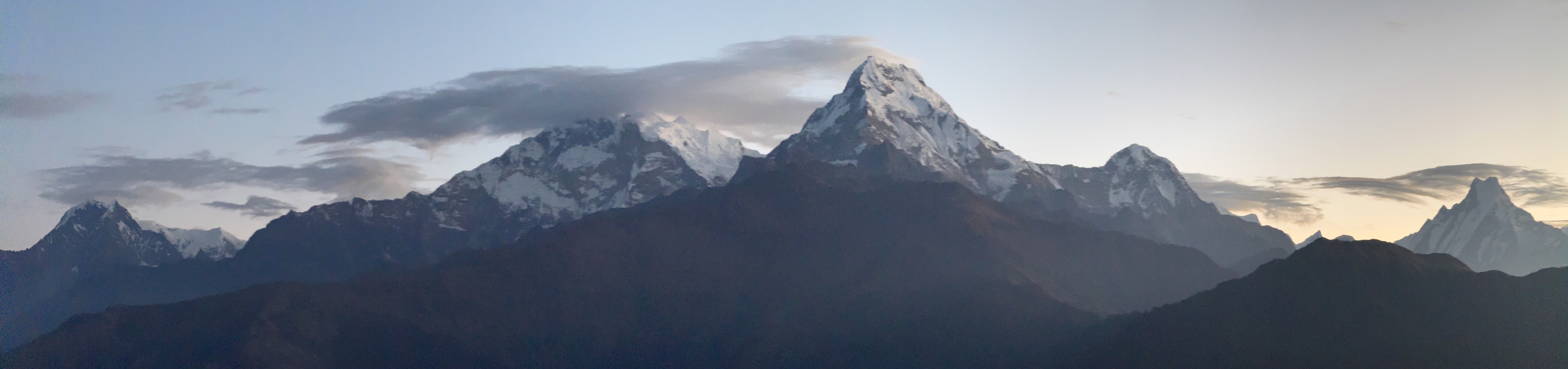
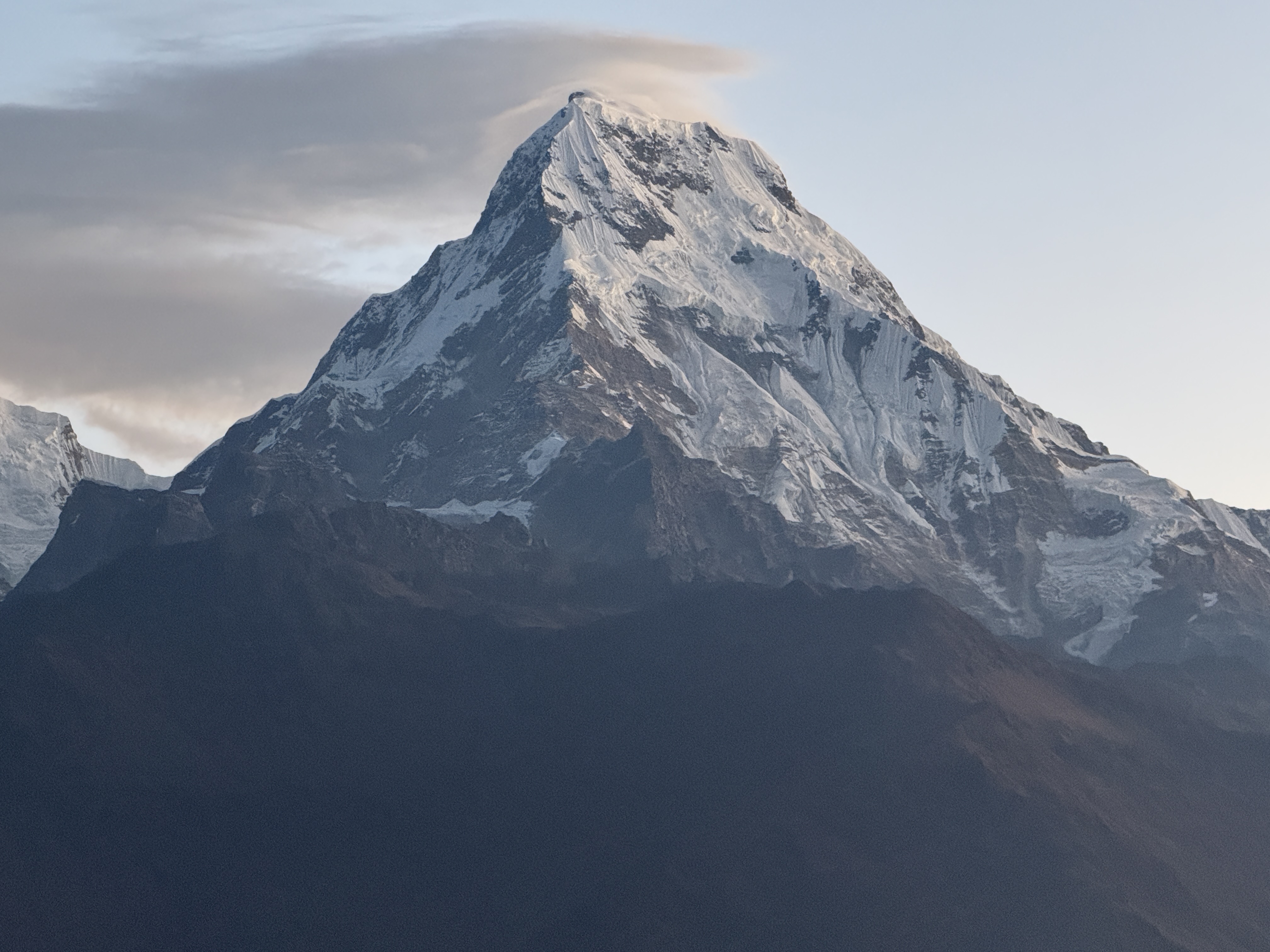
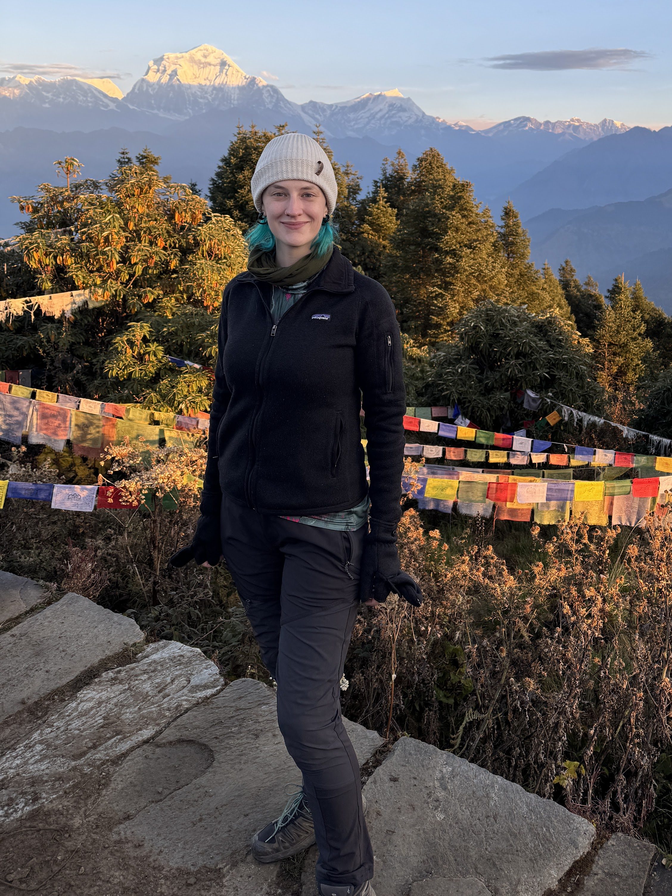
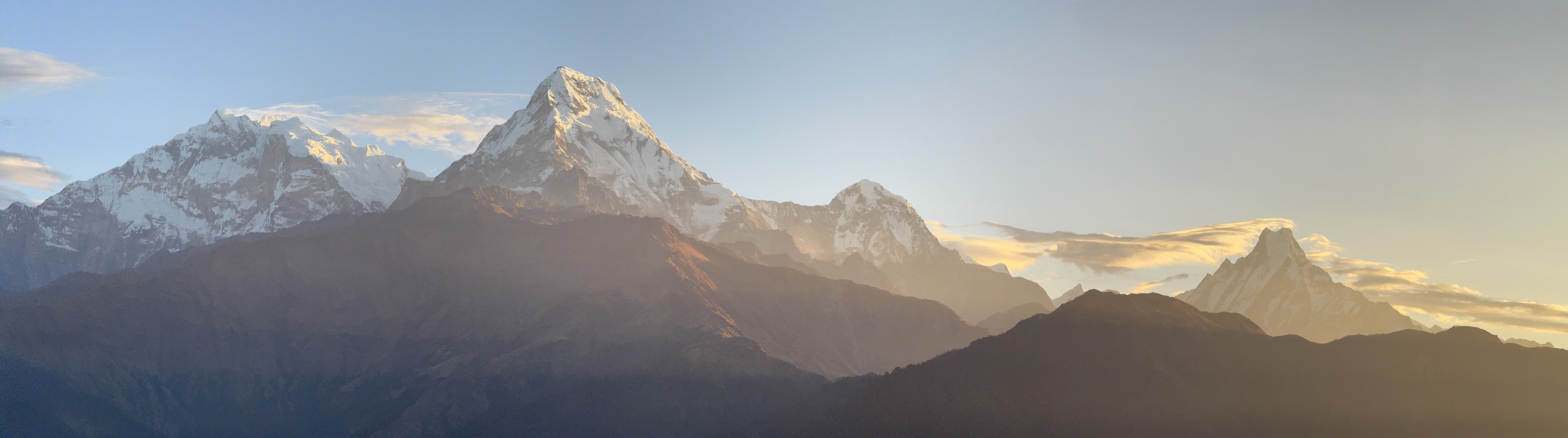
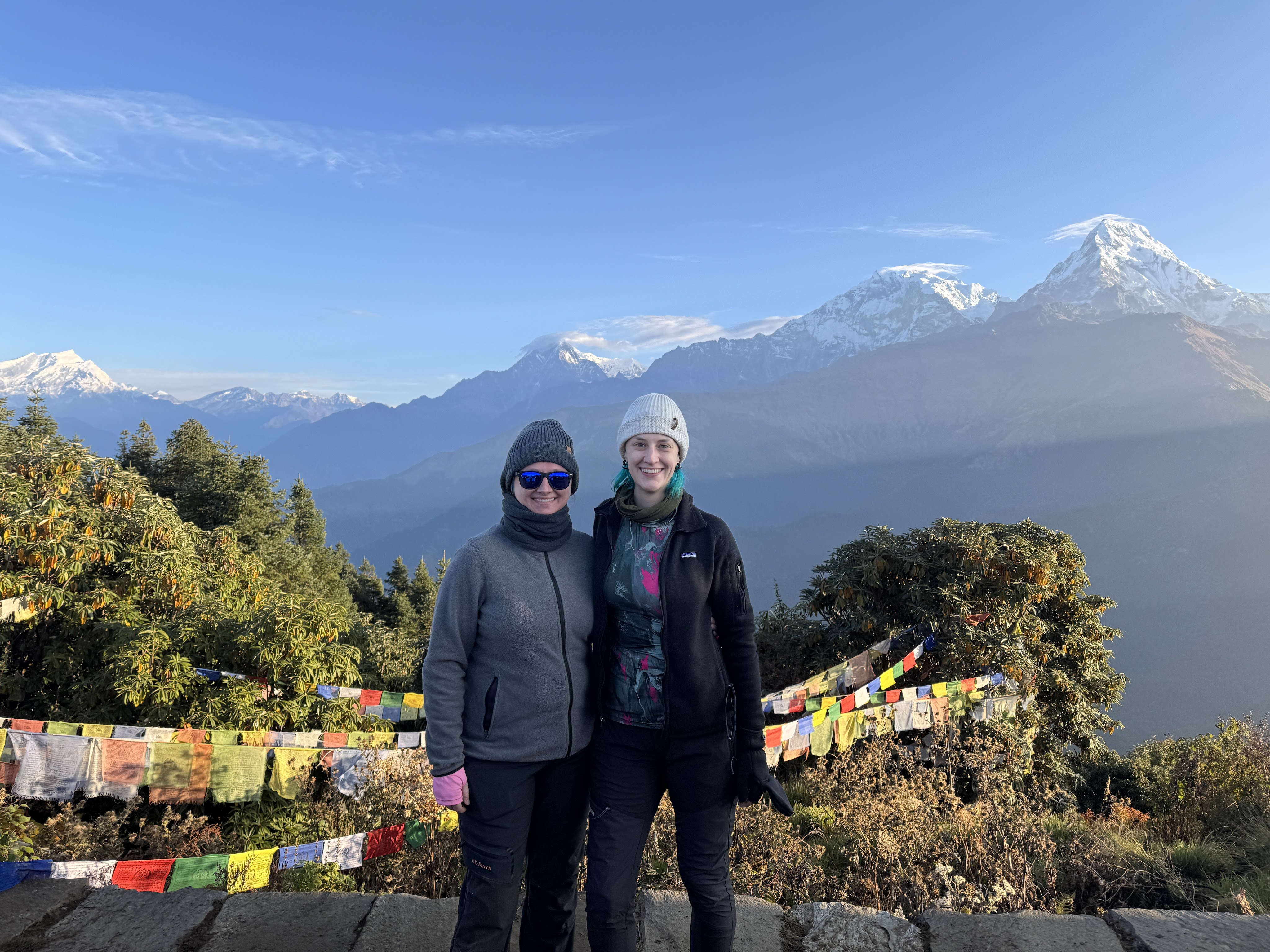
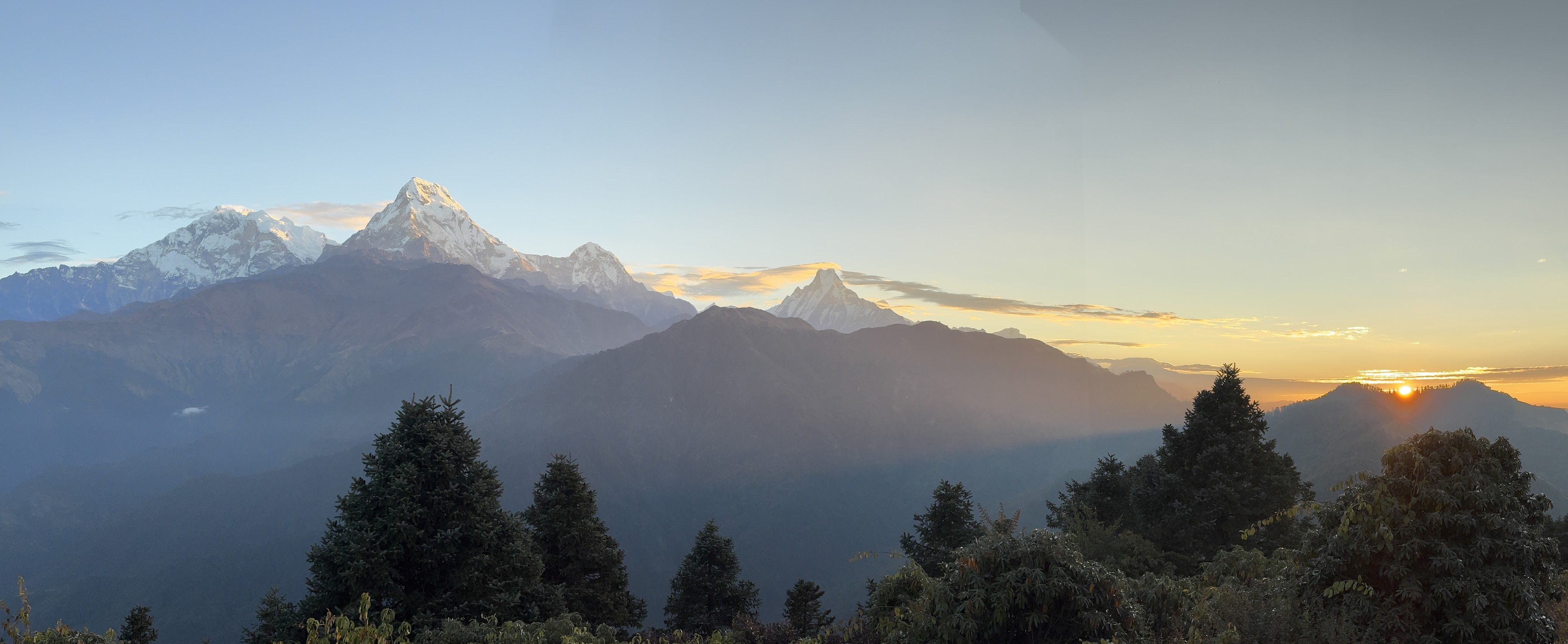
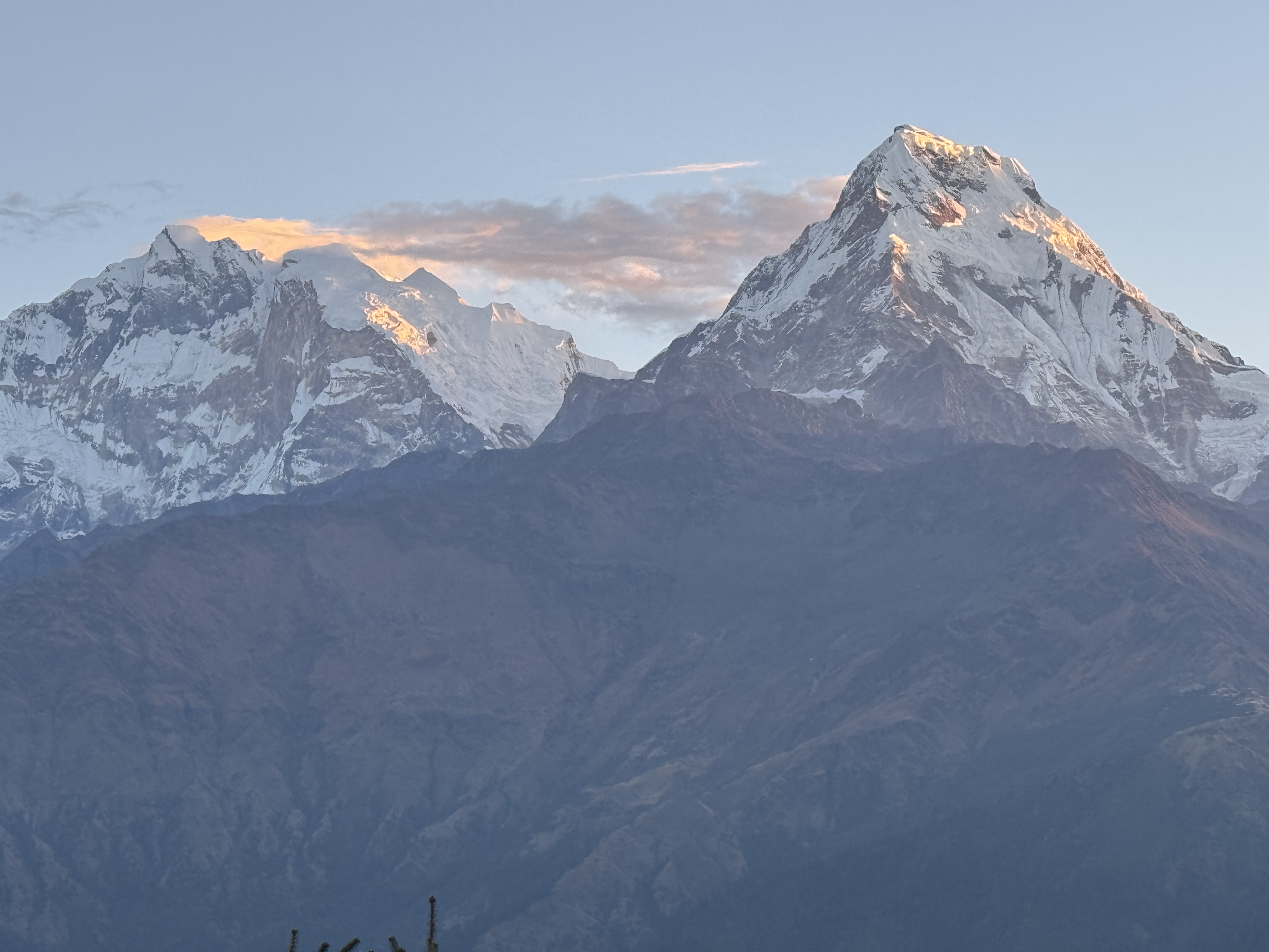
We step aside to allow porters and ponies to pass. Without a proper warmup, I’m pretty winded for the first 5 or 10 minutes. An hour and 15 minutes of climbing later, we reached the summit of Poon Hill – which seems a lot less like a hill and more like a mountain to me, but what do I know? – just as the first light of day began lighting up the sky.
We each lined up on a section of the edge where we found a gap in the crowd to wait for the sunrise. Sis set up her tripod to capture a timelapse while I zipped from one side to the other trying to capture the light on the mountains all around.
I climbed the tower for a full panorama view along with 300 other people, wandered down to one side for a view of the Dhaalagir range, then zipped back over to the other side to watch the pinks and oranges appear beyond the layers of distant mountains. Then repeat.
And making friends each place I went. Including some dogs playing on the hilltop – so while everyone else was taking photos and videos of the one-in-a-lifetime view, I was of course watching the dogs.
We stayed up there until almost 7am. I could have stayed for days. (Post-edit – I can confidently say now that the trek is over, this is the most beautiful incredible view we had throughout the entire trek).
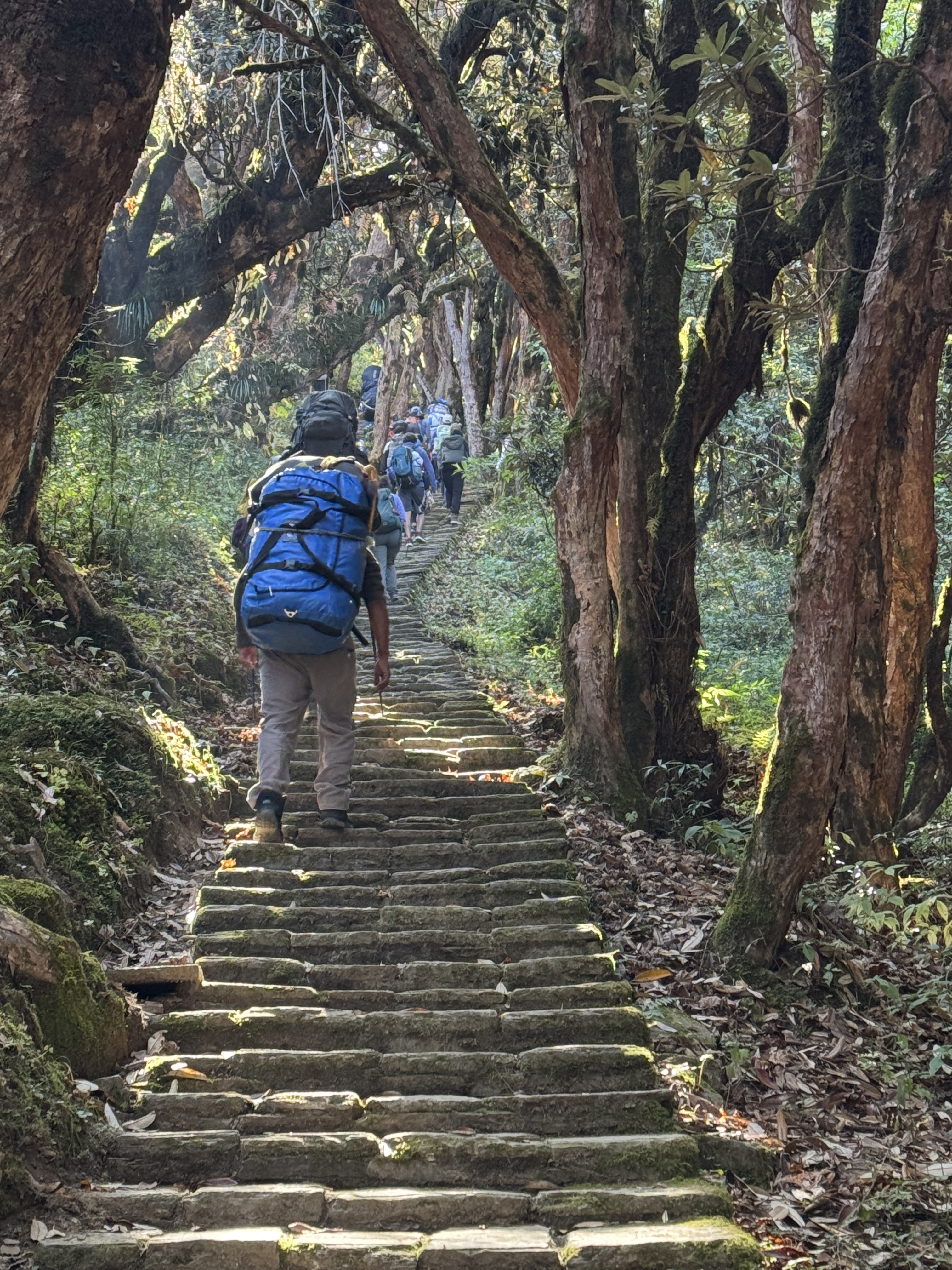
We made our way back down to the tea house in about 30 minutes, packed our bags, scarfed some breakfast, then started on our way to Tadapani.
Leaving Ghorepani, we started once again climbing stair after stair up in the opposite direction from Poon Hill. We were accompanied by masses of people heading in this same direction, a common path shared by several treks.
We climbed until we could once again see Poon Hill tower across from us, then climbed some more until we were back at the same elevation.
A bit more climbing into a forest and we were on a ridge with stunning vistas in all directions.
I found many interesting things on the path along with way, which naturally I carefully shoved in my pockets, but apparently my habit is contagious as soon my sister and Raj were also picking up small sticks and interesting things for me. Yay!
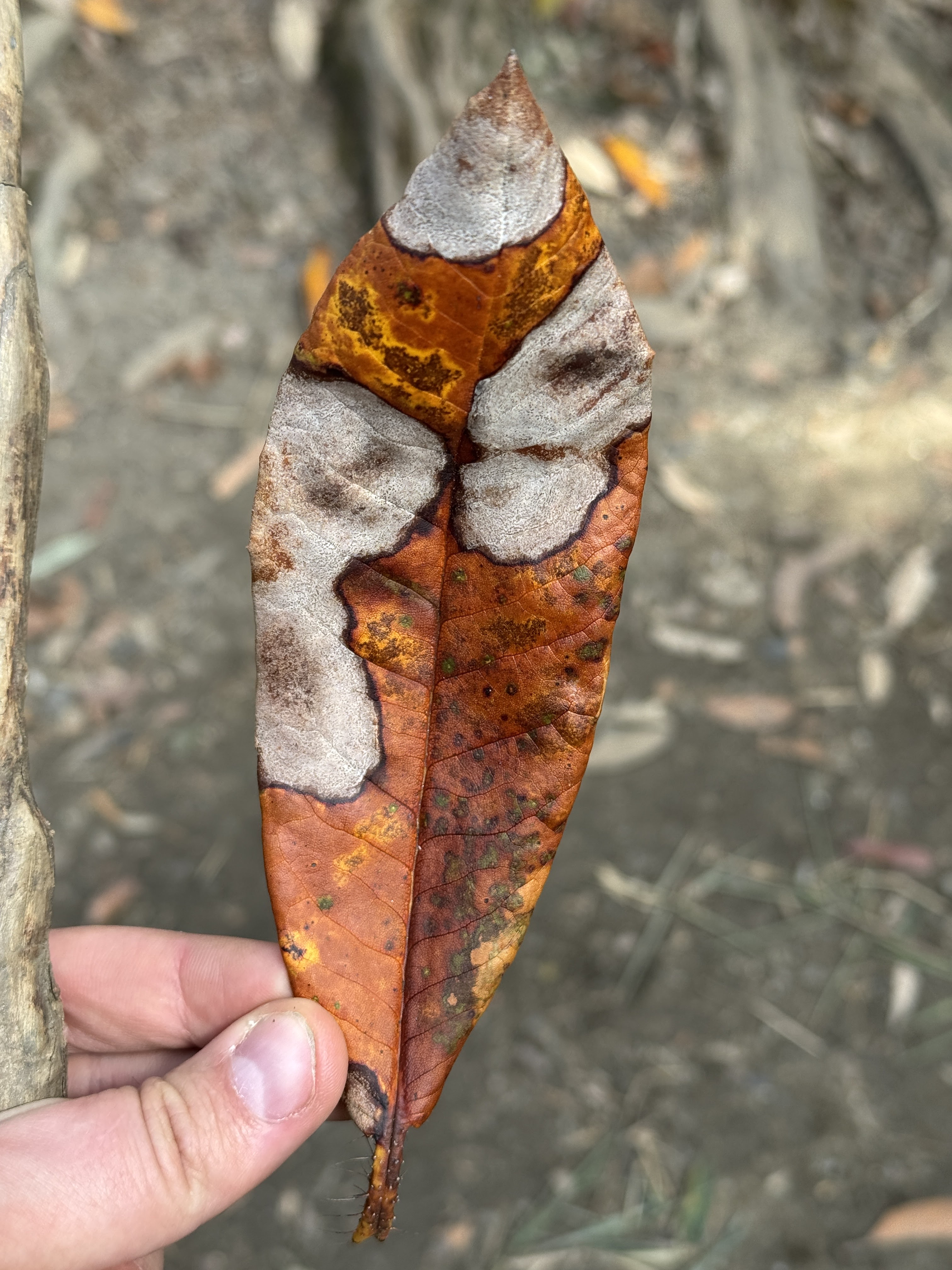
Clownfish leaf
The ridge was surrounded by Rhododendron trees stretching far as the eye could see – and they were MASSIVE compared to any I’ve seen in the state. It turns out that they thrive above 2,000m / 6,500 ft, which is why they were so huge and lush up here in the foothills of the Himalayas. I can’t imagine the beauty of walking this path in the spring, with the flowers in bloom – and it makes sense suddenly why the Rhododendron is the national flower of Nepal.
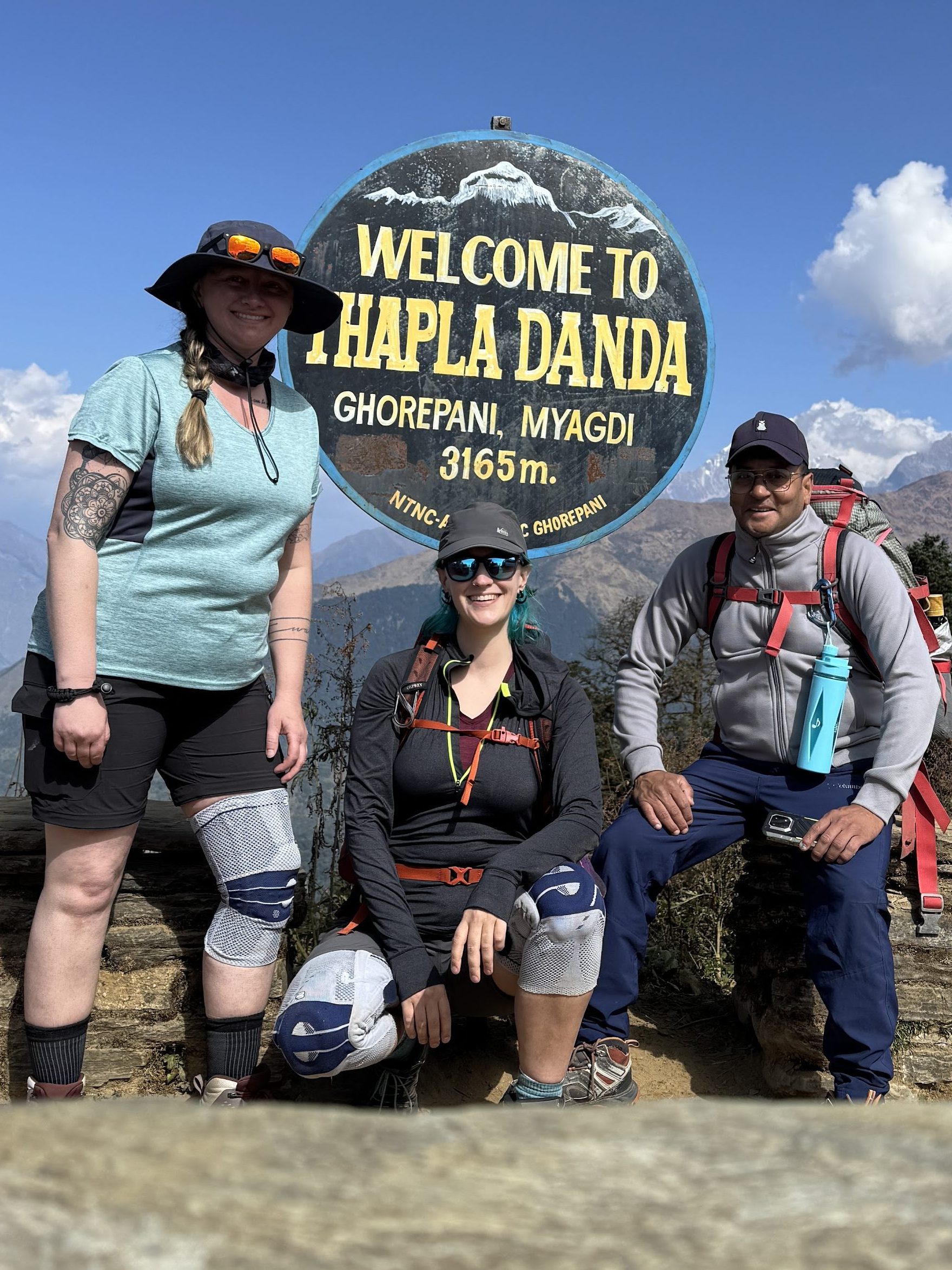
The ridge walk was delightful and more remote than any path we’d yet taken. It was 3 hours after leaving Ghorepani before we reached the next settlement and sat for lunch.
Did I mention that for the last 3 hours, I’d been walking with a clothesline wrapped around my pack, socks and shirts swaying with each step? And yet everything was STILL wet from wash the night before, so we spread everything out in the sun while we waited for our food.
The laundry in question
An hour later we were packing up our now dry clothes and starting on a looooooong descent down to Banthanti, following a stream as it cascaded down cliffs through verdant rainforest.
The trek is a bit misleading when you look at it on a map – it doesn’t necessarily show the hills you have to go up and down and up and down again as you trek from village to village.
It took us nearly 2 hours of careful descent down slick rock to reach Banthanti. From there, an estimated hour and a half of descent followed by 40 minutes of ascent.
By now, we were toast. Jello legs, sore aching feet and knees. I offered my shoulder to sis to help her descent more quickly and safely, and 30 minutes later we were at a beautiful trekkers lodge situated on a cliff. We couldn’t see much beyond the cloud we were in but it was beautiful nonetheless.
While Raj chatted with some of the folks there, we decided to cover more ground and make our way down. Not 10 minutes in, a loud crack of thunder spurred us to don our rain gear and quicken our steps.
However no rain came, just a few drops. 50 minutes later, we reached the bottom of the descent where a power station was situated, and began the climb right back up.
With Raj and I on either side, one of my sisters hands in each of ours, we practically dragged ourselves up the hill in a manner we have now dubbed Pony Service! Note that pony service is a real thing offered in some villages to get trekkers to the next village, but we like our version better. The motivation for the day was simply: Bed. Bed is waiting.
Along the way, Sumon rejoined us after having gone ahead to the tea house, a leech fell from the trees in the rain, and a few langur monkeys darted around the trees around the path. Yes, you read that right. A leech fell from the trees. More on that later.
And then, at 5pm, we were there! 12.5 hours after we started our day, we were climbing the last few steps up to our room.
The view from the room
I’m pretty sure we would have rather gone straight to sleep, but still we each took a quick shower before sitting for dinner. We looked…pretty much exactly how we felt. I’d been wondering before this trek which day would be the hardest for me. So far I was going strong, with some expected aches and pains, but after today I was sure day 4 would be the hardest.
Ulleri (6,726ft) to Ghorepani (9,429ft), 9km / 5.6 miles
10/22/25
I practically fell asleep writing in my journal last night. I felt great walking but we took so long that the time on my feet with both backpacks on my shoulders (mine and my sisters, to give her a hand on the long uphill) began to weigh me down. We were dead tired and slept GREAT.
Some anxiety-fueled nightmares left me feeling relieved when my alarm went off before 6am and we both woke feeling relatively pain-free and refreshed. We quickly got ready, packed our bags, and headed down to breakfast as the rising sun lit up the hills behind us.
A quick breakfast of oat porridge with fruit and we were off by 7:10am.
More stairs! Joy.
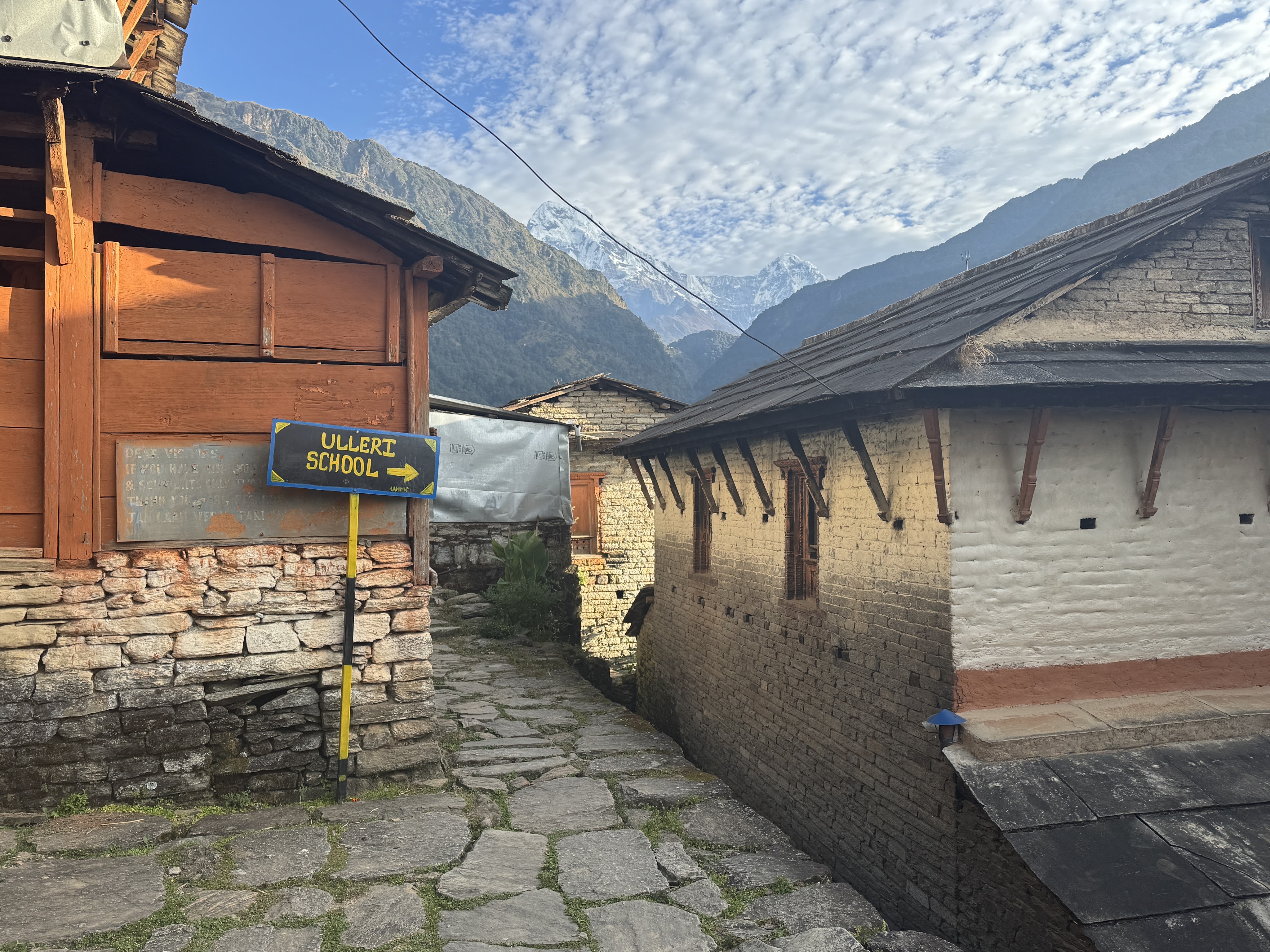
Today’s trek is shorter than yesterday at least. After 20 minutes or so, we passed a sign for Ulleri school and a man at a booth collecting donations. We donated what we had and he gave us each a marigold which we tucked behind our ears for the rest of the day.
We climbed stairs for another 1.5 hours to reach the upper outskirts of Ulleri, taking a pit stop for a bathroom break and water refill before continuing on.
We started our day a full hour before everyone else; the only people we saw for the first hour or more were porters, carrying their trekkers’ belongings up the trail.
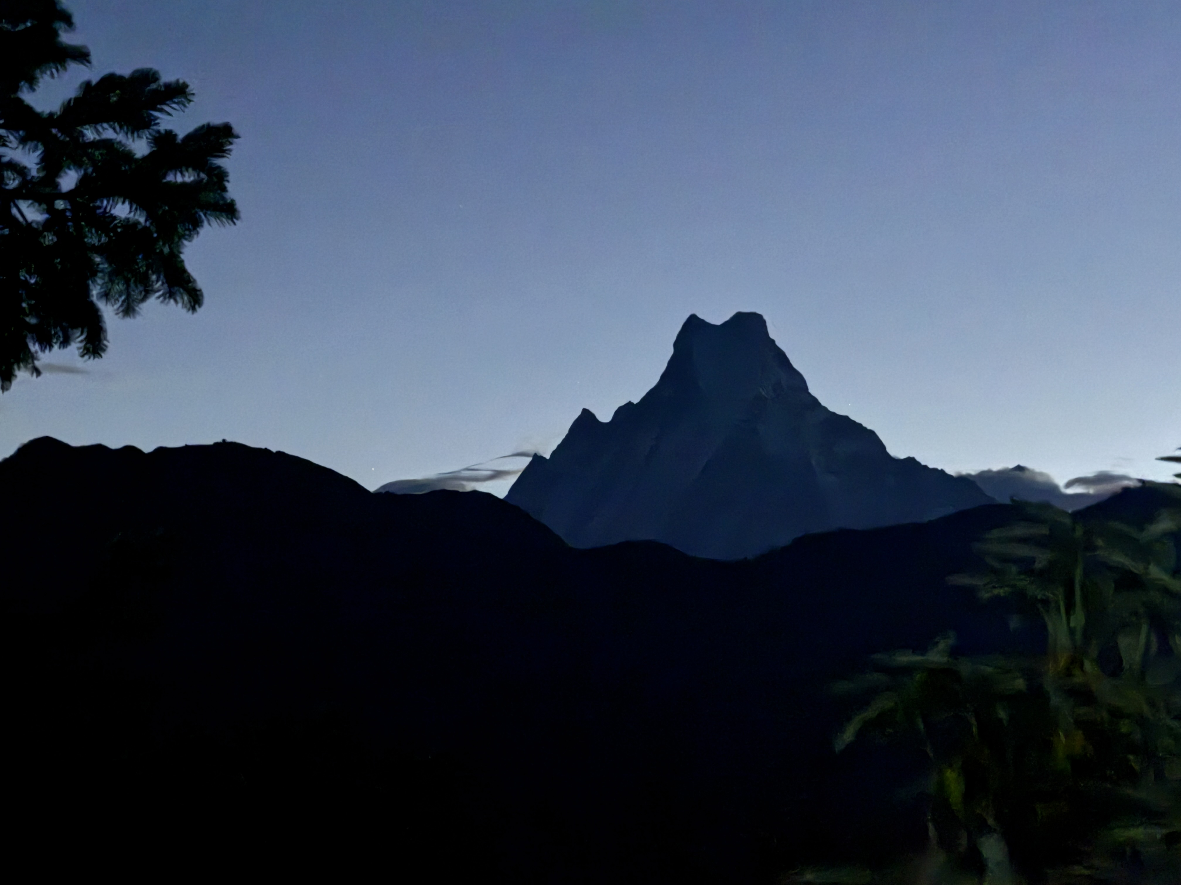
Fortunately the trail this time had stairs interspersed with flat sections and gentle uphills. 2 hours after starting we got our first view of Machapuchhre, fish tail mountain. On day 6 going up to Annapurna Base Camp, we will pass through Machapuchhre Base Camp along the way.
After walking on the road for a few minutes, we turned onto the trail again and this time had cover of the jungle around us, following along a narrow river full of waterfalls.
Little ups and downs – this was a lovely walk. Around this time I felt disappointed that a massive group had caught up with us. Today we kept a slow and steady pace, reaching Nangethati after 4 hours, including a stop for tea and a snack after crossing a bridge over the stream.
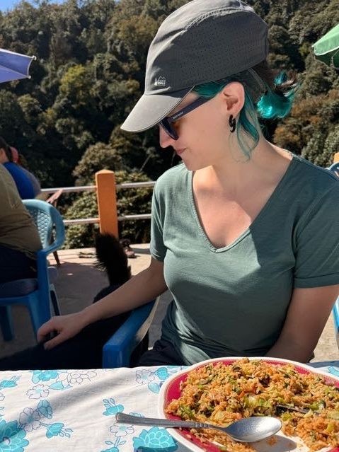
Lunch – veg fried rice (again). 2.3km / 1.5 miles to go to Ghorepani.
Petting a mountain dog during lunch
Full bellies and heavy legs. It was at this lunch spot that we had our first casualty – I’d foolishly gone to use the toilet and didn’t remove my sunglasses from my head, and they FELL IN. I gingerly pulled them out by the tip of an arm, careful not to touch anything, but there was no amount of cleaning that could convince me to put them back on my face, so in the trash they went. Luckily my sister had an extra pair of nearly identical ones that I used from then on, so you probably won’t even notice they’re gone!
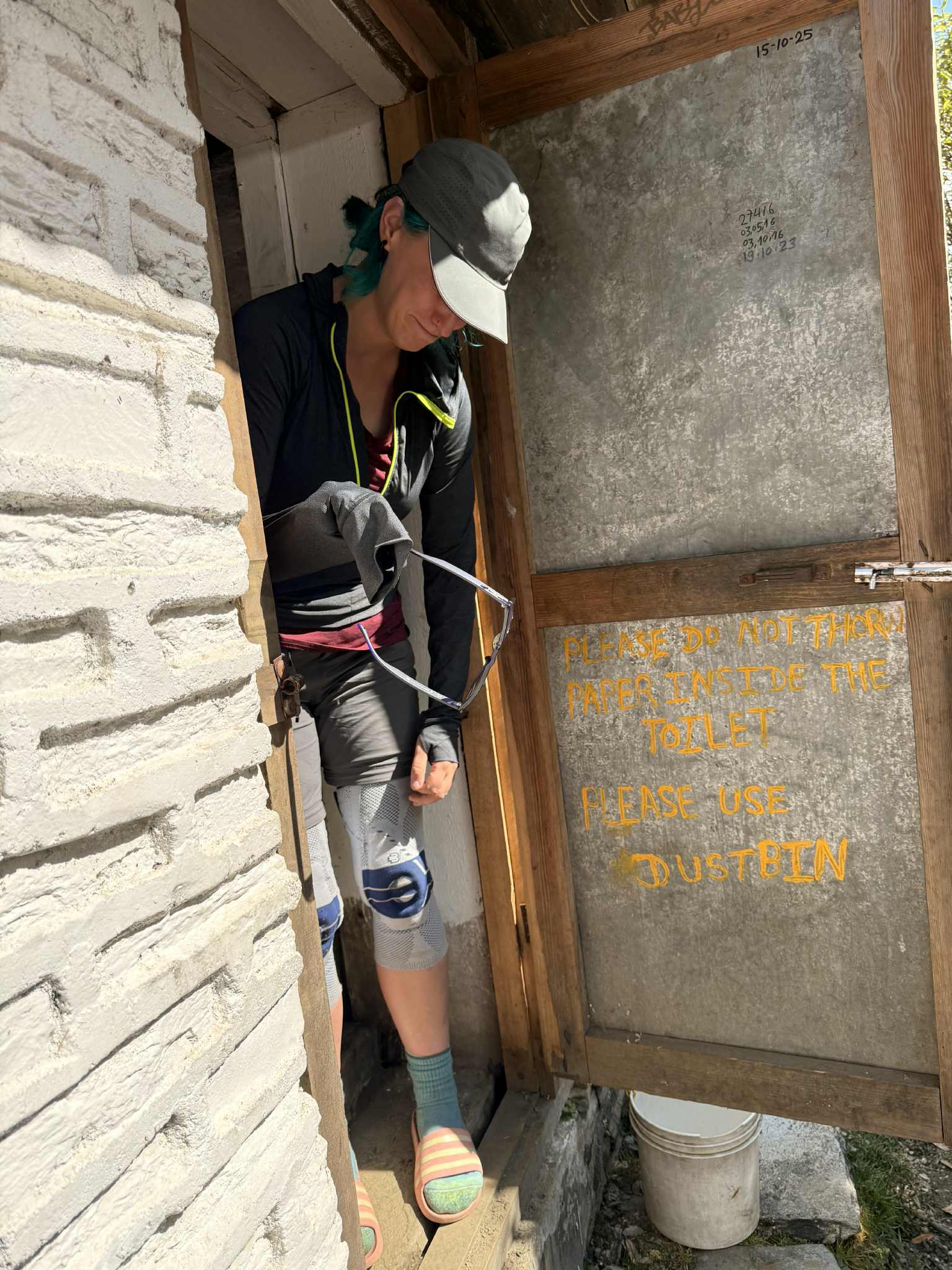
If you come to the mountains, you’d better get used to toilets like this
bye bye sunnies
Leaving the lunch spot I felt refreshed but ready to rest and relax, not walk for another 2 hours. At least we were all feeling the same.
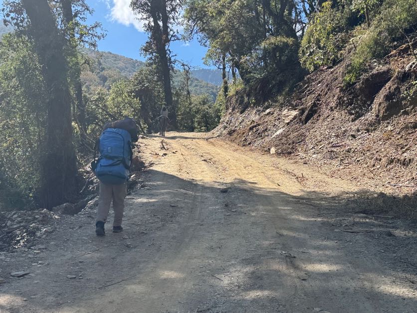
Sumon – our porter – leading the way
We stayed on the road for a while slowly but steadily climbing up and up and up. After an hour or so, we reached the junction with the trail to Ghorepani – a signed noted it would be a quick 20 minute walk to town, but it was one long staircase the whole way and took us 40 minutes to reach lower Ghorepani. The motivation for today? Yak cheese pizza. Hey, whatever works.
Another 10 minutes up steps – pausing and moving aside to let a group of ponies and their minder pass – and we reached our tea house in upper Ghorepani with spectacular views somewhat obscured by clouds.
One last flight of stairs later and we were cracking open the door to our small but cozy room. We strung up a laundry line and opened the windows wide, then used an empty trash bin to clean the days’ clothes and hang them up. With plenty of time to enjoy a relaxing evening by the heater in the dining room.
Just as the sun was setting, the clouds cleared enough to see more of the mountains around us and we rushed out into the cold to take some photos before resuming our spot by the fire.
I was feeling very well overall but my stomach was having a hard time digesting the heavy meals we were eating at lunch and dinner. I picked at a bit of dinner before heading up to bed and calling it a night.