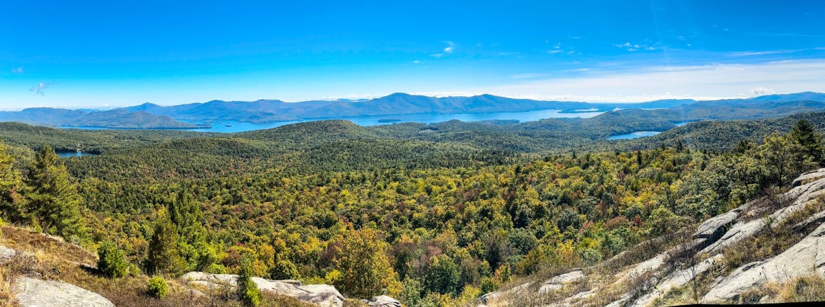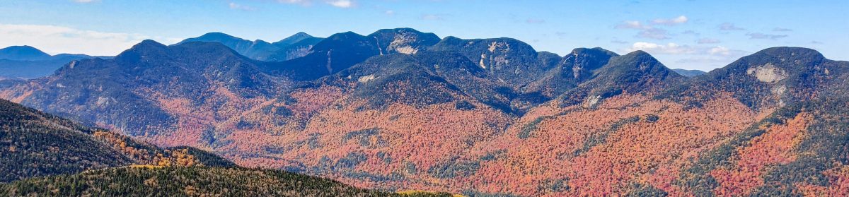
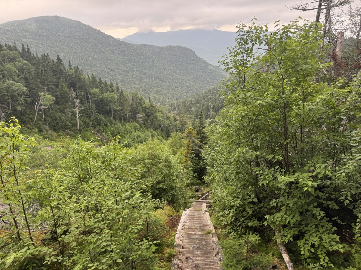
Haystack (3), Basin (9), and Saddleback (17)

7/25/25

The big HaBaSa. On my list of peaks and suggestions to group them, this one comes in dead last in order of difficulty from loads of information I’d gathered from other hikers. And I have to say…I agree with that assessment.
[Spoiler alert]
Did we see any views from the summits? Nah.
Did we get absolutely soaking wet? Absolutely we did.
Did we have a blast? Also yes.

On Thursday 7/24 we hit the trailhead at The Garden parking lot. We had a grand plan to break up the massive 18.7 mile hike by trekking in the 3.5 miles to John’s Brook Lodge, camping the night there, getting up bright and early on Friday to do the HaBaSa loop (in that order), camping again, then hiking out Saturday morning.

We signed in at the register at 12:25pm and happily trod on our way. I had three anxieties around this trip: 1. Finding a parking spot at The Garden (check – note to self, Thursdays are slow days at The Garden) 2. Finding a campsite near JBL and 3. The hike up HaBaSa itself, and managing to complete it relatively pain-free.

This time, unlike most of my other high peaks adventures, I wouldn’t be doing it alone! I brought my own personal Sherpa along with me.

For any first-time readers here, Hi! I’m a New York adventurer and I’m on my journey to become a 46er. I’m also an engineer, a singer-songwriter (check out my music), and a chronic illness sufferer. I have a connective tissue disease called Ehlers Danlos syndrome which prevents my body from creating collagen correctly. It affects everything in my body including (but not limited to) my joints, blood vessels, and stomach. As you can probably imagine, it makes intense treks like those in the ADKs pretty challenging. So my husband – er, Sherpa – takes his job very seriously and hauls not only all of our overnight supplies, but also me from time to time!

15 minutes of easy walking and we were at the first junction to the south side trail. That trail is abandoned and no longer maintained, so we decided to stay on the north side of Johns Brook.

We were in no hurry whatsoever, just so happy to be in the woods rather than sitting at our desks working. We stopped many many times to marvel at the Green Things, the Tiny Things, the Things that Tweet…


Roughly 30 minutes after starting, we’d reached the first lean-to (Deer Brook) approximately 1 mile in.

The trail up to Johns Brook Lodge is flat, wide, and super nice walking. Not much rock-hopping involved, and certainly nothing technical.

I very nearly stepped on this little cutie, so he won the prize of getting his photo taken, while Gildo stopped to use an app to identify birds based on their chirping.


Then, 1.5 hours in, we had the most magical encounter. This young deer was completely unbothered by us. We stood and watched her for a good 5 minutes crunching on leaves she found on the ground. I’ve decided she was the spirit of the forest, welcoming us back to the ADKs.


At 2:10pm, we reached the next register and signed in again. 3.1 miles down, almost to the Lodge.

By this time we were drenched in sweat – it was around 90 degrees and huuuuumid. We stopped a couple of times at the streams to dip our hats in and wet our faces, but we were daydreaming about dunking ourselves in Johns Brook.

I remember this junction from when I climbed Big Slide Mtn (27) with Bushnell Falls and the Three Brothers back in the day! That was another hot day, so instead of just climbing Big Slide as an out and back, I came down to this junction and hiked all the way to Bushnell Falls to take a dip!

By now we could hear signs of humanity up ahead, and we knew we were close.


If you plan ahead, you can reserve a spot in the lodge and get 3 meals in addition to your bed. But even if you don’t stay, it’s definitely worth a look around inside.

We had initially wandered around a bit on the other side of the river around Camp O’Brien, but it should be noted that the Crandall, Myers, and Goodwin lean-tos are private property and are reservation only. We saw that, then went to the lodge to ask about them, and ended up continuing maybe 1/4 of a mile up towards Bushnell Falls to find the camping area.

A few people had already set up camp, so we explored around until we found the furthest site available – which, it turns out, had a ‘back door’ straight back to the lodge. We’d looped around so far that we were closer to the l0dge than to the start of the camping area.

I can never manage to sleep in tents, so I set up my hammock on top of a small hill where I could hear the brook babbling below.

By 3:30pm, we had completely set up camp. Next order of business – strip down to our skivvies and submerge our grimy carcasses in Black Brook. It was sooooo refreshing, if not numbingly cold, and we welcomed it. We salamandered on some rocks in the sun, going in and out of the water for the next 45 minutes.

Then we wandered back over to JBL to lounge and cook our dinner – Chicken Teriyaki and a tuna packet, and of course some water with a Nuun tablet for hydration.

We were cozied up in our respective domiciles before the sun had even set, eager to see what Day 2 would bring.

Day 2

Sleep? What’s that? The night was balmy, hot and sticky, and I was fighting for my life against mosquitos biting me through my hammock. So I was actually relieved to get started for the day when my lovely Sherpa came to wake me up at 6:50am.

We gathered our things in one day pack, filled up water at JBL, and hit the trail at precisely 7:49am.

The path up to Bushnell Falls inclines at a steady, easy pace and crests this cool ridge, with sharp drop-offs at either side.

1.5 miles and 50 minutes of slow hiking later, we reached the first lean-to at Bushnell Falls.


The trail down to the falls is a steep 0.1 mile. I’d seen them before, and as much as I wanted to again, this was going to be a long day and I chose to save my knees for when I’d really need them, so I sat on a nice rock and waited for Gildo to make his way down and back.


We continued on our way and just 10 minutes later, we were at the next Bushnell Falls lean-to.


At this point, we hadn’t seen a single soul on the trail or at any of the campsites. Seems like Thursday is a good day to hike in to camp!

2 hours in and the trail was decidedly more Adirondack-y – complete with mud, rocks, and blowdown. But with all the recent rain, we were rewarded with picturesque moss and verdant vistas left and right.


By 10:12am, not quite 2.5 hours into the trek from JBL, we reached THE slant rock.

And it’s accompanying lean-to. Like all the others, this camping area seemed vacant and we still hadn’t encountered a single person. We were starting to wonder if everyone else knew something we didn’t? The forecast for the day was admittedly not….great. But it was waaaay cooler than the day before, so even with a little rain, it was preferable to heat and humidity, right? At the junction just after the lean-to, we continued straight on the red trail to continue towards Marcy.

This appeared to be a steep 0.9 mile segment of trail until the next junction, complete with rocks….

mud….

and running water.

Some brief glimpses of the sky and some nearby mountains did not make us hopeful for magnificent views from the summits…

Mud – a short poem. A large step up, a slick muddy slope. Feet do slide.

At 11:15am (3h 25min/4.3 miles from JBL), we reached the junction with Marcy. We stayed left to continue on the 0.5 miles to Little Haystack.

And it was….actually, it was exactly what I’d expected. Welcome back to the Adirondacks, baby. Here’s some slabs of rock to climb.

At this point it was sprinkling with rain, and I was surprised at the state of this maintained trail – it felt more like a ‘trailless’ or unmaintained trail by how narrow, eroded, and crowded by pine boughs it was. Unfortunately, with the rain, walking through here meant we got completely soaked with water from the trees.

30 minutes of tough climbing later, we were staring at little haystack, with big haystack looming behind, encased within a whipping torrent of rain and wind.

It took us 40 minutes to go just 0.5 miles to the next junction. Good thing the signs are so clear and descriptive! Just another 0.5 miles remaining to Mt Haystack – we just have to hop right over little haystack first.

Up here we were extra aware of the fragile alpine vegetation and made sure to stay on the rocks and follow the yellow blazes.

The wind was honestly unnerving and I was feeling rather trepidatious about it. But the rock surface was still dry and we continued to slowly make our way carefully up and over little Haystack, sitting when the wind came in gusts so as not to be knocked over.

We hunkered down on the back side of little haystack for a few minutes, looking towards what we assumed to be Big Haystack – not that we could see it – and debating whether this was something we could do safely.

Ultimately we decided to go for it, and carefully made our way down to the col and the relative shelter of the trees there, before emerging again and scrambling up big Haystack.


I had to remind myself a few times that compared to the hikes I’d done in Patagonia, this wind was nothing. And with that thought in mind, and one foot after another, we climbed up and up. Well, I actually bear-crawled my way up most of it, on my hands and feet to have multiple points of contact, but still – you get the point. I have NO SHAME.


Nearly at the summit now, with not a view in sight! This last part reminds me of the back of a dinosaur, jutting out at such an angle.

We made it! Almost 5 hours after leaving JBL, we sat on the summit of Haystack to admire the stunning views and share some victor nutterbutters before the skies opened up and drenched us with rain.

There was really no point in hanging around and we wanted to get out of the elements, so we pulled on our rain coats and started heading back the way we came.


Supposedly this trio of mountains has some of the best views in the ADKs, so I can only assume I’ll be making another trip out here at some point when weather is nicer!

30 minutes later, we were back in the trees at the junction with Basin Mountain, and we turned right to go on the blue trail.

Next up, 0.5 miles of downward trekking to the next junction with the great range trails.

We reached this junction after 35 minutes of careful trekking, grateful to the trees for keeping us out of the wind and the worst of the rain.

On the map, the next 0.1 mile section of trail appears to steeply descend until the junction with Slant Rock trail, and I can confirm – it’s steep, rocky, muddy, and now with the rain – slick.

Still, surely we were on that 0.1 mile stretch for at least a mile. It took us TWENTY FIVE MINUTES to reach the next junction?! What did we DO for 25 minutes? At that pace, it would take us over 4 hours to go a single mile, for reference….

After that bizarre time warp, we stayed on the blue-marked trail toward Basin Mountain, trodding through the now-familiar mud, slick rocks, and dripping pine boughs. From this point on, every step we took would bring us closer to JBL.

The 0.8 mile to Basin started out with a little bit of down and a little bit of flat before climbing up again, sometimes steep and tricky rocky surfaces. In all, we’d lost about 1000 feet of elevation and had to gain back around 900 of it all over again.

At one point, there was a most thoughtful ladder to help us up a tricky section! I’m not sure what made this spot special to necessitate a ladder over the other spots, but I’ll take it.

Overall, the stretch from Haystack to Basin wasn’t overly difficult, and the climbing – though tough in spots – wasn’t that bad either. The higher we got, the more enshrouded in clouds we once again became.

Ah, what gorgeous views we had, just breathtaking.

One last pass through rainforest-esque landscape…

And we reached the summit. Woooooooow just stunning. I believe my remark here was ‘I guess now we know what it would look like to be inside of a marshmallow.’ A wet marshmallow. But hey, at least there wasn’t much wind this time. We made it here at 3:18pm, just about an hour after leaving the last junction, and 7.5 hours after leaving JBL.

There was no point in lingering to see the whole wide nothing, so we kept on along the trail. The cloud became so thick that we could barely see beyond the ends of our noses – at times, it looked like the trail dropped off to the abyss.


Coming down from Basin was less walking and more crab-walking and scooting down the sheer wet rocks, not trusting our tiring legs nor the grip in our boots.

The path from Basin to Saddleback is only about 1 mile long, but in that 1 mile we lost about 700 feet of elevation. It was pretty though.

Over the river and through the woods, to the cliffs of saddleback we go….These cliffs are pretty notorious for being intimidatingly daunting. And we were about to climb them in the rain. At some point I looked at my beloved sherpa and asked in all seriousness, ‘Are we stupid?’.

I was sure to snap a picture of a thoughtful sign at the lodge showing the recommended route of Saddleback and referenced it before we began.

That said, it ended up being pretty straightforward to figure out which way to go, given that the route is marked with yellow blazes.

I’m not gonna lie – there was more than one spot on the cliffs when I looked at the yellow blazes and said ‘What do you MEAN?!?’ as if the rocks would explain it to me if I asked.


I’m usually the first person to promote solo hiking to people. I love it. It’s my favorite and most effective form of meditation. Plus, no ones there to see you when you embarrass yourself falling in the mud or tripping over your own toes. So take that into account when I say: you should probably not climb this mountain alone. And I DEFINITELY wouldn’t suggest doing it from the other direction (descending the cliffs rather than ascending them) – there’s a reason it’s called HaBaSa and not SaBaHa!

I am 5’9″ and there were a FEW spots that my dedicated sherpa had to hold one of my feet in position so I could lift my other leg up, because there were no footholds. So in addition to your water, snacks, and non-cotton clothing, bring a trusted friend that won’t mind giving you a boost.


Climbing up this crack in the rock actually wasn’t that hard, as a person that’s not really afraid of heights, but it really looks impressive so let’s pretend it was DEATH-DEFYING, ok?

And then….we were there. To our shock, awe, and bewilderment, we’d summited all three mountains. 1h and 20 minutes after leaving Basin, 9 hours/9 miles from JBL.

AND the sun actually peeked out just for us, to give us an inkling of a view before clouding over again.


Coming down from Saddleback was a sloooooow procedure. We started with a steep 0.5 miles down to a junction. Over the next 3.3 miles, we’ll lose about 2200′ in elevation.

Here we stayed on the blue trail to make our way back to JBL – 2.8 miles to go!

The way down was a lot less like hiking and a lot more like bouldering. It was just problem after problem. Take 5 steps, stop to figure out a way down, using every bit of upper body strength to help and compensate for the slick rock. We both slid on our hands and feet on more than one occasion.

We were PSYCHED to see the start of the stairs peeking up through the trees to take us down the slide in styyyyle.

Forever grateful to the trail workers who built this thing. What an immense amount of work! It felt so good to not have to think about every step and just go for a little bit.

I wouldn’t want to be climbing up that in the rain! (or in the sun if I’m being honest)

As we descended, the clouds started to clear. Just in time! I turned to ask my favorite sherpa if he wanted to go back up Haystack now that the clouds were clearing?? He said no.

The stairs spit us out right at the bottom of the slide. Turning to look back, I could see how someone would miss the entrance to the stairs altogether. If you are for some ungodly reason doing this range in SaBaHa order (WHY you would do that, I cannot possibly imagine, but I can only assume you feel you must atone for your existence), be sure not to follow the yellow blazes at this point but instead look for the blue markers on the skinny tree to the left.

This spot looked to be a recent mini-slide, with some stairs that look like they were knocked down in a pile of rubble.

We stepped over the rubble and found a lovely little pool of iron-rich water, freshly fed from the slide above.

Oh my GOD is that flat ground? Wide trail?? No pine boughs dumping their rainwater on us? No massive boulders to scramble down?!? Hallelujah!

After 1.8 miles of descent (1 hour and 45 minutes for anyone keeping track of our lightning pace) since the last junction, we reached the Ore Bed Brook lean-to. Just one more mile to camp!

We skedaddled down the next 0.7 miles in just 20 minutes, and we were home free.

All day long, my loyal sherpa didn’t miss a single opportunity to help boost me up a big boulder or lift me down large steps to help save my knees. When my knee pain hits, it is pain indescribable, and it’s a one-way street. There’s no going back once it starts, I can only push through. A few short years ago I would have paled at the thought of accepting help up and down these boulders – how dare anyone insinuate that I can’t do it myself! I’m strong! Yeah…Those days are long gone. I did feel a suspicious lack of dignity a few times being boosted up by my butt, or trust-falling off a rock into Gildo’s arms, but by that point I simply didn’t care. So all that to say – the very last section of the trail before the bridge back to JBL was these steep stairs, and when I tell you that man lifted me down every. single. step. so I wouldn’t strain my knees….That’s love.

We strolled through JBL and took the back way in to our campsite at 7:49pm. EXACTLY 12 hours to the dot from the time we left.

My phone seems to think we did 15 miles but it was actually more like 12. Nonetheless, a massively difficult day, made ever-more brutal by the rain, wind, and slick rocks.

I couldn’t have been happier that we’d decided to camp both nights so we didn’t have to hike out. I was tucked away in my hammock by 9:30pm and slept solid until the breakfast bell rang at the lodge at 7:30am the next day.

Day 3

I didn’t want to wake up. In between bouts of slumber I heard other campers getting ready for the day, the rustle of tents and low hiss of zippers opening and closing, birds singing…Eventually I roused and slooooowly got out around 8:30am to find Gildo preparing some coffee.

We hit the trail at 10:50am after taking our sweet time to pack up camp and have breakfast. I was not feeling super great, pretty sluggish and expectedly sore, so we were glad not to have to be anywhere at any specific time.


The hike out was unremarkable in every way. It was getting increasingly warm and the path was blissfully flat and even. No rock-hopping, no jumping off boulders, just…walking. Ahh, my favorite.

At 12:30pm we reached the last junction of our journey – just 0.5 miles remaining. That stretch from JBL seemed to be an eternity.

And finally – we saw the glisten of cars in the parking lot. We’d done it! Just shy of 2 hours after leaving JBL. I’m so incredibly proud of us. We loaded our stinky smelly strips of humanity (can you tell I’ve been listening to Anthony Bourdain’s audio book?) into the car and booked it straight to Stewarts to scarf down food. It’s no one’s business what all we ate there, let’s just say I spent all of the last 3 days SO HUNGRY – which is very unlike me – and I left Stewarts full to the brim and ready for the drive home.

33 down, 13 to go. Happy hiking!

Haystack: 4960′

Basin: 4827′

Saddleback: 4515′

Total elevation gain: 5137′

Total Duration: 12 hours (+ 4 hours to hike in/out)

Total Distance: 18.7 miles

All images are property of adktrailtalesandtails and may only be used with express permission.
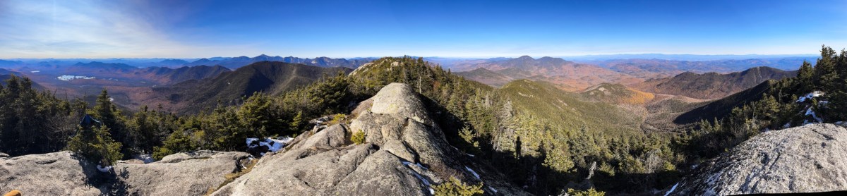
Dix Mountain (6)

10/19/2024

Wow, it’s been a while since I was last up in the high peaks! The last time I was here was in 2022, I climbed the rest of the Dix range but had to orphan out Dix itself. This time I had my husband to accompany me and we decided to make a weekend of it by staying a couple nights in Lake Placid. I was most excited about sitting in a hot tub after the hike! At this time of year, the access road to the Elk Lake trailhead is closed, making access to the other peaks in the range pretty difficult. However it’s about the same distance to the summit of Dix from Rt 73, so that’s what we did! We reached the Round Pond trailhead at about 8:45am.


We’ve been to this trailhead before and embarrassingly, it still tripped us up. We looked around for a minute before checking with another pair of hikers to find out where the actual trailhead is.


This is just the sign for the parking area, NOT the trailhead. The actual trailhead is just a few feet down the road.


We unsurprisingly started climbing pretty much right away. Based on the map, we knew we’d have an initial climb until reaching Round Pond, then another stretch of climbing before the trail would flatten out for a good while.


Oh how optimistic and naive we were when, 7 minutes after starting, we saw this marshy clearing and started to wonder if we’d already reached Round Pond! Of course not, dummies! ๐Ÿ˜…


It always takes a good half hour to find that groove when starting a hike, when the mind overcomes the body’s desire to lie down under a nice tree and just…stay there. We moved slow and steady, and after 14 minutes from the trail head we had made it the 0.6 miles to Round Pond. Yay! Only 6.2 more miles to go to reach the summit!


What a gooooorgeous day we had! We enjoyed a few minutes to ourselves here letting two groups of people pass us.


By this point we were getting nicely warmed up as we walked around the little lake, spotting beaver sign along the way.


We missed peak foliage by about 2 weeks, but some of the trees still had beautiful bright yellow leaves, and we passed through a whole section of forest full of them. At this point I had actually mis-remembered the terrain on the map – I thought we just had to go uphill a little bit and then it would be flat, so we were kind of booking it to stay ahead of the group behind us. Then we realized it was more like a mile of uphill so why don’t we chill out a little bit and let the folks behind us just pass us up so we could take our time! Duh ๐Ÿ˜†


Eventually the climbing levelled off. It took us about 45 minutes to go the 1.7 miles from the pond to the next junction.


It’s really important to note that on the map, it looks like there are two junctions – one to Round Mountain, as the sign below shows, and one to Noonmark Mountain, but there is actually just ONE junction. Going to the right here would take us up Round Mtn, going to the left would go to Dix, and going straight (more or less) is the way to Noonmark, but it wasn’t as obvious a trail as the others.


We were really looking forward to a nice, easy 1.9 mile mostly-flat walk through the woods before the more arduous climb started. The trail here follows along a stream, weaving in and out of it along the way.


Conditions were mostly dry, though we still couldn’t escape a few muddy sections that made for some fun navigation.


As we grew nearer to the leanto on the map it became a bit difficult to make sure we stayed on trail. There’s one spot in which we crossed a little stream, and continued straight to the banks of the larger N. Fork Boquet River – it almost looks like you’re supposed to rock hop across the river, but actually the trail turns sharply to the right.


There was some blowdown near the leanto, where we spotted some signs for camping directing hikers to the leanto, but we made sure not to follow those and instead cross the river to stay on trail. This spot was particularly hard to follow; the group that had been ahead of us actually ended up behind us because they got turned around here! On the other side of the river, just before 11am (2 hours from the trailhead) we knew we’d reached the end of our easy 1.9 mile stretch and it was time to start a gradual ascent.


This section of forest was so lovely to walk through. It consisted of lots of spindly deciduous trees, some still with bright yellow leaves, so we could see farther through the wood than we usually can.


The path followed the stream for a while longer, and I couldn’t help but notice how rocky the trail is. I tend to be a powerhouse on the way up but have a hard time on the way back down the mountain, so I was already getting nervous about how rocky the trail was.


The higher we climbed, the further we moved through the seasons, with a glimpse of the conditions we’d find ourselves in at the summit.


The grade became a bit steeper with about 1.5 miles to go to the summit, following the stream closely and offering the occasional glimpse of the slide to come.


It was right about noon when we found a nice log in the sun on a little island in the stream to sit and have some lunch. We hadn’t taken a break in the 3 hours since we started so it was nice to sit for a few minutes, but we didn’t linger long due to the cold. 20 minutes of rocky muddy climbing later and we were at the base of the slide.


As we were hiking to this point, a group of 3 young men passed us going down – they were adorably enthusiastic about the day they were having, and warned us to stay to the right on the slide and exit at the cairn – the slide does not lead to the summit. They found this out the hard way, going up for sunrise and bushwhacking out of the top of the slide, then sheepishly admitting that only 1 of the 3 had brought microspikes – because of those two mistakes, they missed sunrise! Thanks to them though, we were prepared when we made it to the slide.


While I probably wouldn’t want to be on this slide in wetter conditions, we really weren’t on it for more than a few minutes before exiting at the cairn. Even so, the wind here was ROUGH! It was so cold I had to sit down and layer up right away to stay warm. Thanks to those folks coming down trail, we knew to look out for the cairn – which was great advice, because it wasn’t super obvious.


Just after re-entering the trail from the slide, we saw this no camping sign, indicating we were right at 3500′! This also meant we had a heck of a climb ahead of us.


This past spring, I spent 4 days solo trekking through mountains in Patagonia, and I was amazed at how good I felt. I had no pain, no issues at all – I loved every minute of it. So I’ve been wondering what’s different about Patagonia from the mountains here? Is it the air? The water?


No. It’s the FREAKING ROCKS. Who put all these rocks here ๐Ÿ˜ญ The paths in Patagonia where I was hiking were much more level – yes, you were climbing uphill for 7 miles, but the trail itself was flat and easy to walk on. That’s the difference. But I digress. It was just before 1pm when we got our first views of the day.


And then…


More….


ROCKS. Seriously, this last half mile to the junction felt so much longer than it was, it was such slow going. We had one or two near miss incidents with slick ice before we decided it was dumb to go any further without putting on our microspikes.


Just when we were starting to feel like the climb would never end, we reached the junction! Just 0.4 miles left to the summit! Despite all my whining about the rocks, I was actually feeling so good all day. I felt strong and had so much energy on the uphill.


The third sign reads: “Beckhorn Trail Junction – 2.7miles, Lillian Brook Leanto – 3.3miles, Slide Brook Leanto – 4.7miles, Elk Lake Trailhead – 7miles”

We instantly scrambled our way up a steep icy ledge and got this view.


From here on it was very icy, interspersed with deep sections of mud that threatened to pull off my boot once or twice, along a ridge with lots of nice spots to sit in the sun and enjoy the view. We continued along just until the trail was about to go down toward the beckhorn, then found our own perch to enjoy the fruits of our labor. We did it!!! Summit time – 1:45pm, 4h45m after leaving the trailhead.


Enjoy this closeup of my face.


We savored our hard-earned victory chocolate, then hubby took a nap on a rock while I took photos. Despite the snow around us and on the way up, the summit was so warm! There was no wind at all and the sun warmed us up. It was so nice to be able to rest up there without worrying about getting cold.


At 2:30pm we decided we should probably be on our way. My #1 priority now was to make it back to our motel by 8pm so we have time to soak in the hot tub! Lucky for me, I got a lift down off the tall ledges to help save my joints by this handsome guy ๐Ÿ˜Š


I wasn’t joking about the deep mud from the snow and ice melting in the warmth of the sun…I was able to navigate around one of the wannabe boot-thieves, but this is the only way I could think of to get around this one.


We were back at the junction at 3pm, ready for our steep treacherous descent back down to the slide.


The going was slooooow on the way down, as expected. I can fly up but I have to take such care on the way back down to make sure I don’t hurt my knees. Even so, the trail is so rocky it was impossible to avoid tweaking my knees and ankles at least a few times. For months, I’ve been climbing the mountain near my house 2-4 times per week, with larger more strenuous hikes on the weekend, including some of the Lake George 12ster peaks, and I’d done so without pain. I finally felt like I was gaining strength and endurance back and I didn’t want to ruin it on this hike.


It took us an hour to get back to the slide from the junction. I was relieved that we’d gotten the steepest part of the hike behind us.


It didn’t take long to reach the end of the slide and slink back into the woods along the stream filling with water from snowmelt on the summit.


Another 40 minutes after that, we were nearing the lean to. Somewhere along the way I started getting pain in my right knee again – I wholly blame the rocks. As we hiked down I remember taking about 4 steps on a flat, dirt section of trail and saying “Ah, this is nice!” and then it was over ๐Ÿ˜ญ I was so grateful to be back to the 1.9 mile flat stretch.


We crossed the river towards the lean-to, and spotted the reason why people may have gotten so turned around here. Notice the arrow sign in the third picture below, obscured by branches of the fallen tree.


And just like that, our nice little flat section was over, and we were back at the downhill to Round Pond right at 5:30pm.


I was having a pretty tough time hobbling along by this point. The smallest tweaks from stepping slightly off on a rock would send pangs of lightning out from my knee, so I tried to keep it locked in place and use my hip to move my leg. All of this is doable on flat even ground, but on a rocky downhill trail? Not so much.


At 6:20 we reached Round Pond and caught the last remnants of the sun hitting the trees across the pond.


By now I had started thinking about the inevitable dilemma I have after every major hike – what should I do first when I finish? The hunger, exhaustion, need for a shower, and a soak in the hot tub all seemed equally urgent. Maybe I could eat a pizza in the hot tub? That might do the trick.


My husband had been carrying my backpack for the last couple of miles to take some weight off my knees and try to help with the pain, but I guess it must have gotten too much for him to watch me struggle because suddenly it wasn’t enough for him to carry my backpack, and he picked me up and carried me probably 3/10 of a mile down the trail. By the time he set me down and I again hobbled down the trail by the light of my headlamp, I almost cried tears of joy when I saw headlights of cars on Rt 73 in front of me – I was about 15 feet from the trail register and had no idea.


We made it back right at 7pm! We ordered some food from our favorite local brewery in Lake Placid, picked it up on our way to the motel, ate in the car, then hopped in the hot tub. On the map and trail signs, it says this hike is 13.6 miles, but both of our phones clocked it in at about 14.9 miles.


30 down, 16 to go! Happy Hiking!

Dix Mountain: 4,857′, elevation gain: 3,725′

Total Duration: 10 hours

Total Distance: Either 13.6 or 14.88 miles ๐Ÿคทโ€โ™€๏ธ

All images are property of adktrailtalesandtails and may only be used with express permission.

Thomas and Cat Mountains

9/27/2024

I was really overdue for some time off work, so I took the day off and set out with the pups to tackle two more of the Lake George 12sters – Cat and Thomas! Only, not in that order. We rolled into the parking area on Valley Woods Rd at about 9am with just 2 other cars there, whose hikers were still getting ready for the hike.

I got the doggies suited up and off we went. I signed in at the register as the first hiker of the day.

I had a map with me, but took a picture of the one at the register just for good measure. The plan was to go up the ‘Cat and Thomas Ridge Trail’, summit Thomas, then Cat, then go back down ‘Cat Mtn Trl’ to ‘Thomas Mtn Edgecomb Pond Trl’.


The trail starts off wide and pretty much flat, albeit rocky, and parallels the Valley Woods Rd for a while.

Between the trail and the road is a nice little stream, lush and green.


After 3/4 of a mile of flat walking, the trail splits – right to go directly up Thomas, and left to go towards Cat.


We took the path to the right and the trail became a bit narrower and started climbing. It wasn’t particularly steep, and the terrain was easy to walk on, but the climbing did not let up.

Writing these trip reports really helps me to stay in the moment during my hikes. It’s so easy to get lost in thought and miss little details in my surroundings, like this little guy!

And this pretty miniature stream in a mossy jungle. I make a conscious effort to live in the moment and appreciate the little moments in life, and stopping to enjoy the beauty of the things around me helps me to do that.

Though the path all the way up looks identical (I took about 12 photos at different points and they all looked almost exactly like the one below -.-), I could sense the elevation we were gaining.

Stopping to look at the little flowers was also a good excuse to take a break and catch my breath! Being the first person on the trail, that made me the designated Spider Web Clearer for the day. Oh joy. I had to be mindful to keep my mouth closed so I didn’t get any extra unexpected protein in my diet.

Along the way I noticed some random rocks stacked on the side of the trail. I looked around but didn’t see anything to indicate that I was supposed to go that way to get to the summit. Per the tenets of Leave No Trace, please do not stack rocks found in nature. We should make as little impact as possible on the trail – “Take only photos, leave only footprints.” Not to mention that cairns typically indicate something important to draw a hiker’s attention to, so these little decorative stacks are misleading. Soooo I kicked them all over.

It took me a couple of tries to get a picture of this cutie – I took the first one just as it had hopped away, giving me a stunning photo of some leaves on the ground.

I was catching the most beautiful glimpses of blue sky between the trees and couldn’t wait to see the view from the summit.

We’re almost there! Just near the summit were some downed trees, casualties of the storms this summer, but the Trail signs and markers help guide the right way.


We did it! It took just 45 minutes to reach the summit of Thomas Mountain, 1.5 miles from the trailhead.

The drive to the trailhead was super foggy that morning. I was really hoping there would be some fog left in the mountains by the time I made it to the summit – I think it makes the view that much more beautiful! So I was so glad to see some remnants in the distance from the summit of Thomas.

Note that the true summit of Thomas is off the marked trail. This viewing point is the site of an old cabin and is considered the Official summit. No need to bushwhack to find the true one for sake of the hiking challenge.

We sat down just for a couple of minutes to take in the view, but we weren’t tired at all yet so I didn’t bother to unpack the snacks and water.

You can see our next stop, Cat Mountain, to the left of center in the picture below!

Just as we were getting ready to leave, a group of women was just making it to the summit. The puppies sat at attention.

Here’s another view of Cat. I know better by now that it’s never as far as it seems, but heck that does not look close by.

There’s only one thru trail going up Thomas, so no worries about taking the wrong path, unless you somehow get confused and go back the way you came. The path down is toward the right of the summit, and is pretty tricky right away.

There are loads of signs to help hikers stay on trail, but between the damage from the storm and the slick rocks, there were some difficult moments navigating.

Much of the trail looked like below – I just walked slowly and constantly looked for the next yellow marker on the trees.

We reached the flat section below the summit and continued through the forest, looking for our next yellow marker. On the map, it looks like we go up and around several bumps on our way to Cat, so I was expecting some ups and downs.

I was so grateful for all directions on the trail – I’ve never seen so many. At points this trail reminded me of so-called ‘trailless’ hikes I’d been on. Very rugged.


My goddddd were there a lot of spider webs. They were starting to demoralize me a bit, if I’m being honest. I am not the biggest fan of silky webs clinging to my arms, neck, face, and hands. I was starting to wonder if I’d have enough of them by the time I’d finished to knit a scarf.

While the recent rain made the rocky path more treacherous than usual, it also made the forest so verdant, vibrant and green.

There were several places where fallen trees made it tricky to stay on trail, but they’ve been down long enough by now that I could see where other feet had trod before me. It helps to have path-finding doggies leading the way too!


Here’s one of many spots I almost ate it, stepping on slick wet rock. At least it’s pretty.

I spotted this little glade through the trees and hiked a bit off trail to get to it. I could just imagine having a picnic here and reading a book in the sun.

I cannot emphasize enough HOW. MANY. SPIDER WEBS. I passed through. I think I invented some great new dance moves – one waving my arms alternately in front of me like an elephants trunk to clear the webs before my face does, and one to wipe them off of myself when I inevitable walk into them. There were several like the one below too – beautiful ornate webs with happy little spiders sitting in the middle. I tried to go around or under so as not to disturb them, but couldn’t help but wonder how many of these I HADN’T spotted and just walked through, and therefore….how many happy little spiders were currently hitching a ride up to Cat Mountain with me?

Despite being a rugged, tough section of trail, it was really beautiful and looked a bit different at every turn. I particularly liked this section of forest with skinny spindly trees.

As we came up another little hill, I started thinking this must be it. We couldn’t possibly be on this ridge trail for much longer. It was very slow going due to being a bit treacherous, wet, and hard to follow, but still, we’d been on it for AGES.

Over an hour after leaving the summit of Thomas, I saw this sign – “<- CAT 0.5” woohoo!

Pluto likes to sit and wait for me while I haul my slow self along.

I figured with just 0.5 miles to the summit of Cat, we must have a fair bit of climbing left to do. We did go up a bit,

and around some more blowdown,

before we arrived at the intersection with the blue trail! I don’t think the sign here is accurate – or maybe the previous one wasn’t – because why did it take 12 minutes to go just 1/10 of a mile?? That doesn’t seem right. We made it here just before 11:30 – 2 hours and 20 minutes after we left the trailhead.

I saw this warning for Bees on the trail to Thomas – fortunately we avoided them! We have encountered a few ground yellow jackets in the last few weeks on different trails, much to the dogs’ dismay.

The path up Cat starts off somewhat flat, until we passed this stinky stagnant green puddle. I kept the dogs close so they wouldn’t jump in or drink from it – I have a feeling it would be the gift that keeps on giving it they had.

Not gonna lie, the absolute biggest thing I was looking forward to on this trail was hoping that someone else had been up already and CLEARED THE DANG SPIDER WEBS. I’m like a broken record but wow I had forgotten what it’s like to clear a trail of webs using your own face.

There was just one spot where a trail arrow was needed, otherwise it was an easy to follow trail.

The climbing was not steep or challenging here. Just a little bit of ups and flats.

After just about 10 minutes from the junction, I could feel we were very near the summit. There wasn’t much more Up we could go.

And sure enough, at 11:40am, 2.5 hours after we started, we reached the glorious summit of Cat!

There was just one pair of hikers already up there (thanks for clearing the webs for me and my sanity!!) so we went to the left toward the edge and sat in the sun to enjoy our lunches.


It was getting a bit toasty up there, when I looked to my left and saw my clever boy Pluto lying in the shade of a tree on some grass. So I packed up our stuff and headed over there with him!


It was a phenomenally clear day, and I could see all the mountains we’ve climbed recently on the other side of Lake George. Black Mountain, Erebus and Sleeping Beauty, and Buck Mountain.

I turned around again and saw this time my clever girl Juno finding a comfy spot in the shade too.

So I decided to be a clever girl too and join them. The last hike we did was Erebus and Sleeping Beauty. We were on such a time crunch that we didn’t stop to rest or enjoy the summits much at all that day. This time we let ourselves get comfortable.

Maybe a little too comfortable!


What a gorgeous view of Buck on the other side of Lake George.

And Erebus to the left. I could just start to see autumn colors emerging in the trees.

Despite being a challenging hike between Thomas and Cat, I was pain free and in great spirits. Especially since the spiderweb-pocalypse was over.

We hung out in our nice shady spot for about 30 minutes before packing up and heading back the way we came. Not before first going to the other side of the summit and checking out the views from there!

At 12:35 we left the summit and reached the junction again just 10 minutes later. Up until this point, the only people I’d seen on the trail all day had been several groups of women! No men! It was a special day.

The path down from Cat was similar to the one going up Thomas. Somewhat wide, free of blowdown, and easy to follow.


We passed a marshy area on the way and I couldn’t resist wandering in a little bit.

This part of the walk was very enjoyable. A gentle downward grade, easy terrain, no webbbbbbs.

Ok. This is the point in the trip report where I explain my error in judgement so no one else repeats it. Even though I had taken a picture of the map at the register, the one I was relying on was the one I brought with me, the first picture in this post.

So when I saw these signs, I was a little bit confused. I didn’t want to go back to Thomas Mountain, and when I read ‘Edgecomb Parking’ I must have just skimmed over the Edgecomb part and skipped straight to ‘Parking’. Sooooo I went the wrong way and didn’t even realize it. I even thought ‘Oh cool, red markers’ and my map didn’t give any indication to what color markers were for each trail, so I didn’t think twice about it.

There were signs that I was on the wrong path….aaaaand I missed them entirely.

At this point I was admittedly starting to get suspicious that I was not on the right path. But looking at the map, I didn’t see where I could have gone wrong.


Past the barrier, the trail was completely blocked by an overflowing pond. So I went into the woods on the right to cross at a narrow stream.


It was perfectly picturesque.

On the other side of the stream I could see the pond that had taken over the trail.

Just beyond that was a gorgeous stream which followed the trail.


On the right side of the trail, the most beautiful forest.

THIS was the point where I realized completely that I’d messed up. Through the trees….what’s that blue thing? A lake? There’s no lake on the trail back to the valley woods trailhead….There’s only edgecomb pond, which is on the way to……not the trailhead I had started at. Oh boy.

Well, we might as well enjoy it!

When I saw this sign for the red trail going to the right, I was skeptical and trusted my instincts to keep going along the water’s edge to reach the not-my-trailhead.

Now I know that the point where I made the wrong turn was the blue dot on the map below. I turned right when I should have gone straight. I didn’t even consider that the white trail intersecting the black dashed line would just look like any other trail. It looked like a road to me on the map. The trail marker and sign in the picture above was at the point marked in yellow – leading up the back way to Cat. I think the trail down from the summit to go that way was right near where the pups and I were sitting under that tree.

Even though we went the wrong way, we might as well enjoy the views and the lovely pond we’d come across.

And then…we were at the Edgecomb Trailhead. The not-the-trailhead-the-car-is-at Trailhead.

And so we walked. Tell me how this road went up and UP and UPPPPP. Hadn’t I climbed enough for the day ๐Ÿ˜ซ It felt like it took forever, walking on the side of this road with no real shoulders, but at least very few cars drove by while we were there. I didn’t have any cell service so we used the map to navigate on the roads back to Valley Woods parking area.

We were so hot from walking in the sun on the asphalt for the last 45 minutes, so when I saw the turn to the trailhead up ahead, I knew that if we went into the woods to our left and crossed the stream, we’d be back on the trail for the last little bit, and could enjoy the cool shade of the trees. So we bushwhacked our way back in!

We made it back to the car at about 2:15pm, about 5 hours after starting. Next time….we’ll take the blue trail ๐Ÿ˜€

Happy Hiking!

Thomas: 2031′

Cat: 1956′

Total Duration: 5 hrs

Total Distance: ~9 miles

All images are property of adktrailtalesandtails and may only be used with express permission.

Erebus and Sleeping Beauty

9/8/24

The dogs and I set off ambitiously to try to climb these two mountains on a Sunday morning. We had plans for the evening so I had to be back at the trailhead by 3pm. We arrived right at 10am so that gave us a 5 hour window.

I signed in at the register with my trusty companions, noting the warning for rattlesnakes in this area of forest.


I didn’t find much information on this route online, so I’ll be as descriptive as possible for anyone else planning this trip! See the map below – my plan was to start on the blue trail to Bumps Pond, then go left at the junction (green section) to do this loop clockwise. Then up to Erebus, with the orange line approximately where I think I went up (there’s no official trail to the summit), down to Fish brook Pond, then up to Sleeping Beauty (light purple) and back down to the trailhead. There were a few tricky spots on this hike so I’ll reference this map later on.

This trail starts off wide and rocky with a gentle incline, and continues that way up to the junction with Sleeping Beauty at 0.6 miles.

I wasn’t sure how much water would be on the trail for the dogs, so we made sure to take advantage of the little streams we crossed along the way.

15 minutes from the trailhead and we were at the first of many junctions. To do the clockwise loop, we stayed left here.

Things got a bit steeper after that, with no pause in the climbing for the first 30 or 40 minutes from the trailhead. While rocky, the trail was still wide, easy to follow, and free of any blowdown.

We spotted this cool old stone wall on the way up to Bumps Pond too. I wish I knew the history here but with just a cursory search online, I couldn’t find much of anything. If anyone knows about this old wall, please let me know!

About 25 minutes after leaving the junction to Sleeping Beauty, the trail started to level off. I had to stop to admire the forest here, as it looks like something out of a fairy tale. Fitting, since we’re on our way to Sleeping Beauty!

A minute later and a little bit of descent and we were at the edge of Bumps Pond.


It’s only early September but this morning was COLD. Quite a shock after so many hot days. I could see the clouds rolling in and out, and felt the occasional icy cold raindrops spattering my face, but the tree canopy overhead did a pretty good job of keeping most of it off of us.

Just 2 minutes later and we were at the next critical junction. The sign was very warn, but it says “Fish Brook Pond -> , <- Dacy Clearing, Sleeping Beauty”. Looking at the map, I was very confident that this was the junction I’d have to turn left at, but the worn sign didn’t indicate a 3rd path toward Erebus.

There was however a much narrower trail to the left which had these blue markers on a tree (I marked this trail as Green on my map above) so I headed that way.

This was starting to look a lot more like an Adirondack trail. At this point in the day, I’d only see one pair of people coming down right at the beginning, and I guessed I wouldn’t be seeing anyone else on this particular trail either, judging by how little it appeared to be traversed.

This is when we started to see our first indications of the summer’s storms and the damage they left behind.

We ended up on top of a ridge, and could see light through the trees on either side, though it’s hard to capture in a photo.

Descending the other side of the ridge, the trail got a bit messier and a bit more Adirondack-y. Usually I kind of disagree with the rating All Trails gives to trails. The last few I did were marked as ‘Hard’ but I would have classified as ‘Easy’ (for a mountain, anyway). This one however I was starting to see that I might agree with the All Trails rating!


The trail down the ridge led us to a marsh that we had to navigate through. Still the trail was easy to follow and well marked.


We reached the junction to Shelving Rock Rd. exactly 1 hour after starting, 2.5 miles from the start. There were several signs on different trees to help orient, but the only indication that the intersecting trail led towards Shelving Rock rd was a small with marker with handwritten directions.


We continued straight/to the right towards Erebus, on what is the Yellow trail on my map above. It was clear right away that I’d have to keep my head up along this trail and not go too far without checking for trail markers. There’s more blowdown here and muddy sections of trail that make it really hard to tell which is the right way to go. This particular spot (below) almost got me – in my research I couldn’t find where the unofficial trail or bushwhack up to Erebus from the trail would start, and I was wondering if maybe this was it. Looking at the map though, that didn’t really make sense because I’d be going straight up a cliff, and I was certain there’d be some cairn or unofficial marker to point the way to Erebus summit. So I stayed to the left here to follow the red markers.

The trail went up and up and sure enough, at 11:20am, just 20 minutes after leaving the Shelving Rock junction, I saw exactly what I thought I might see – a little white marker with a hand written note and a small cairn marking the start of the ‘bushwhack’ up to Erebus (orange trail on my map above).


Ok this was very much a ‘choose your own adventure’ adventure. While hard to spot though, there was a defined route going up that I could follow if I paid attention.

When unsure, I looked around to see if there was evidence of many feet passing over the ground before me, such as this section of decomposing log that had been squashed.

And even better, some thoughtful yellow markers had been tied to trees to guide the way. Again, I had to move slowly and keep my head up to stay on ‘trail’, which was difficult because it was really very steep and messy terrain.

I reached the top of this steep hill 10 minutes after starting and the trail flattened out nicely.

Not to be deceived though, because the climbing continues up this last steep stretch before reaching the summit. I was pretty slow going here, while the dogs ran up ahead of me. When I pulled myself up the last bit, I lifted my eyes to look for my pups, and saw them both standing on top of a boulder ahead of me looking down at me to make sure I made it up alright.

Just another minute through the woods and I reached this little cairn and weird plate with Erebus Summit written on it, so I assumed I had made it. It took just 15 minutes from the junction.


We didn’t bother stopping to take a break because there was nothing to see and it was chilly! So we just turned right around and headed back the way we came.

Sometimes during steep difficult descents, I turn around and go down backwards so I can use my hands, which I’d definitely recommend here.

Because I was going backwards, I didn’t see Pluto just sit himself down to wait for my slow self. What a good dog.

On the way I noticed a view that I’d missed going up! Weather was really spotty, with rain one minute and sun the next, so I was really hoping to have clear skies by the time I made it to Sleeping Beauty.

On the way up I kept telling myself that it would be really easy to lose the trail coming back down, and I’d have to be really careful to pay attention….and yet, I still lost the trail. It wasn’t a big deal honestly because as long as you just keep going down in the right general direction, you’ll make it back to the trail. I did end up finding the little yellow ribbons again though, and was back at the junction just 15 minutes after leaving the summit. For any families working on the Lake George 12ster, I would not underestimate this particular summit. Personally I don’t think I’d bring young kids up here – there were plenty of opportunities for uncareful feet to take some nasty tumbles. I’d also note that this little junction might be hard to spot of doing this loop counterclockwise – the cairn and white marker were on the side of a tree that would be seen only when coming from the clockwise direction.

Back on the main trail we still were navigating around blowdown and muddy bogs, but it was so much easier than the trail up the Erebus that it felt like a breeze. 15 minutes later at 12:15 we reached the junction partway to Fish Brook Pond and turned to the right to go towards the pond.

Again, I don’t think this trail is traversed too often ๐Ÿ˜… That’s the trail there, that muddy area cutting through the green.

It was on this stretch that I started to see the first signs of Autumn!


There was still some blowdown to navigate around on this section, but nothing that looked recent. My girl Juno smartly followed behind me to see how I’d navigate around the tricky spots, so she didn’t work harder than she’d need to.

We passed a little bog on the way and the pups enjoyed a drink of water at the first stream we’d seen in quite a while.


At 12:30pm, 2.5 hours after leaving the trailhead, we reached the junction at Fish Brook Pond. There was another sign that indicated the trail to the right was a bridle trail, but I was sure that was the way I wanted to go, so we turned right there.

I could see the lean-to on the other side of the pond, at the back of a clearing at the edge of the water, with some folks enjoying the view, but I still hadn’t seen anyone on my own trail since earlier that morning.

I have a bad habit of forgetting to eat while I hike, so even though we were on a tight schedule, I stopped at the edge of the water to give the dogs a snack and have one myself. We didn’t take a long break though – I only had 2.5 hours to make it back to the trailhead on time, and still had 4.5 miles to go. So on we went.

Saw this weird thing along the way, which apparently I deemed worthy of a photo, so there you go.

We reached the other end of the pond just before 1pm. I kind of regret not taking the longer route around the pond for the views, but I just didn’t have time.

There was a clearing at this trail junction with what looked like a fire pit and a few people hanging out there, so we went on by following the sign back toward Dacy Clearing.

The trail here was much more maintained that what I’d been on for most of the day and I was grateful for it!

I was so happily plodding along, lost in my thoughts, that I nearly missed the junction for Sleeping Beauty! If it wasn’t for the dogs going down the trail, and me noticing the little bridge down to the left, I would have passed it right up. The only marker is this little yellow one, with two others on the opposite tree behind me.


We hung a left and crossed a little bridge to start the trek up Sleeping Beauty at 1:20pm.


The trail up Sleeping Beauty from this direction was never difficult – it was uphill, but it had switchbacks and flat sections along the way. It took less than 20 minutes from the junction for the trail to level off.

Here was the second part of the day that I was unsure of – where to find the actual summit of Sleeping Beauty. I knew it wasn’t at the popular viewpoint up ahead, and that Sleeping Beauty has two kind of bumps – the true summit is on the first ‘bump’. See the bright blue dot on the purple trail on my map. THAT is the summit. I thought I’d see some indication of where to find it on the trail, but there was nothing that I saw – no cairn, no ribbons, no hand-written marker…nothing. But when the trail started to descend again, I stopped, turned around, and turned left (when coming from Sleeping Beauty viewpoint) into the woods. There were no markings or anything but it was easy to see which way was up, and to keep going until there wasn’t any more…up. I went maybe 50 feet and found this little cairn at 1:40pm, with nothing else to indicate that this was the summit, except that there was no other noticeable higher ground. So I assumed I’d made it.


We walked down a bit through a beautiful forest toward the viewpoint. I was really looking forward to getting there, but the weather wasn’t really cooperating! Back at Fish Brook Ponds, the sky was overcast and rainy, but I was hopeful it would clear up.

At 1:50, we reached the junction to the spur to the viewpoint of sleeping beauty, and headed straight along.

Just 2 minutes later, we were standing at a VERY windy, beautiful rocky overlook!


It was so beautiful with the clouds casting shadows over Lake George and the mountains beyond.


We finally sat down to take our first real break of the day and eat some lunch. We found a nice spot in the sun out of the wind and had the whole peak to ourselves for about 10 minutes before anyone else showed up.


I could see darker clouds moving in and the wind had gotten intense, so at about 2:15 I packed up our things and we started making our way back to the trail, leaving behind a few groups of people still enjoying the lookout.


We reached the junction a minute later and stayed to the right this time. The trails run parallel for a bit and I was careful to stay on the one marked as dark purple on my map.

This is clearly a well loved trail. There was no blowdown, but it was slick with rain from the morning and a bit steep and rocky in parts, so I made my way down carefully.

We passed just one group with two small kids making their way up, otherwise we had the trail to ourselves once again.


30 minutes after leaving the summit and we were at the last junction of our loop, at 2:45pm. Just 0.6 miles to go!

We reached the trailhead at EXACTLY 3pm, right on time. I signed us out of the register and gave a ranger some information about the trail conditions – I think they were expecting a lot of down trees from the wind blowing through that day, but I hadn’t seen any fresh blowdown all day thankfully. I got the doggies in the car and they wasted no time in getting some zzz’s. Until next time – happy hiking!


Erebus: 2527′

Sleeping Beauty: 2347′

Total Duration: 5 hrs

Total Distance: ~9.2 miles

All images are property of adktrailtalesandtails and may only be used with express permission.