Jenkins Mountain

05/06/18
I woke up on this Sunday morning itching for a hike. So around 1pm I loaded up my pack, called my hiking buddy, and we hit the road. I was originally planning on hiking St. Regis mountain, but when we pulled up to the trailhead there were several cars still there and I was in a mood to be away from people. So instead we parked at the trailhead on the opposite side of the road and headed into the VIC trails to climb Jenkins Mountain. There were a few people finishing up a fishing adventure, but the lot was otherwise empty, so we took our starting photos and headed off at about 3:00pm.

We stopped to sign in at the register and look at the map before leaving. The route we were taking is outlined in purple. We did end up taking an ill-advised shortcut, but more on that later.

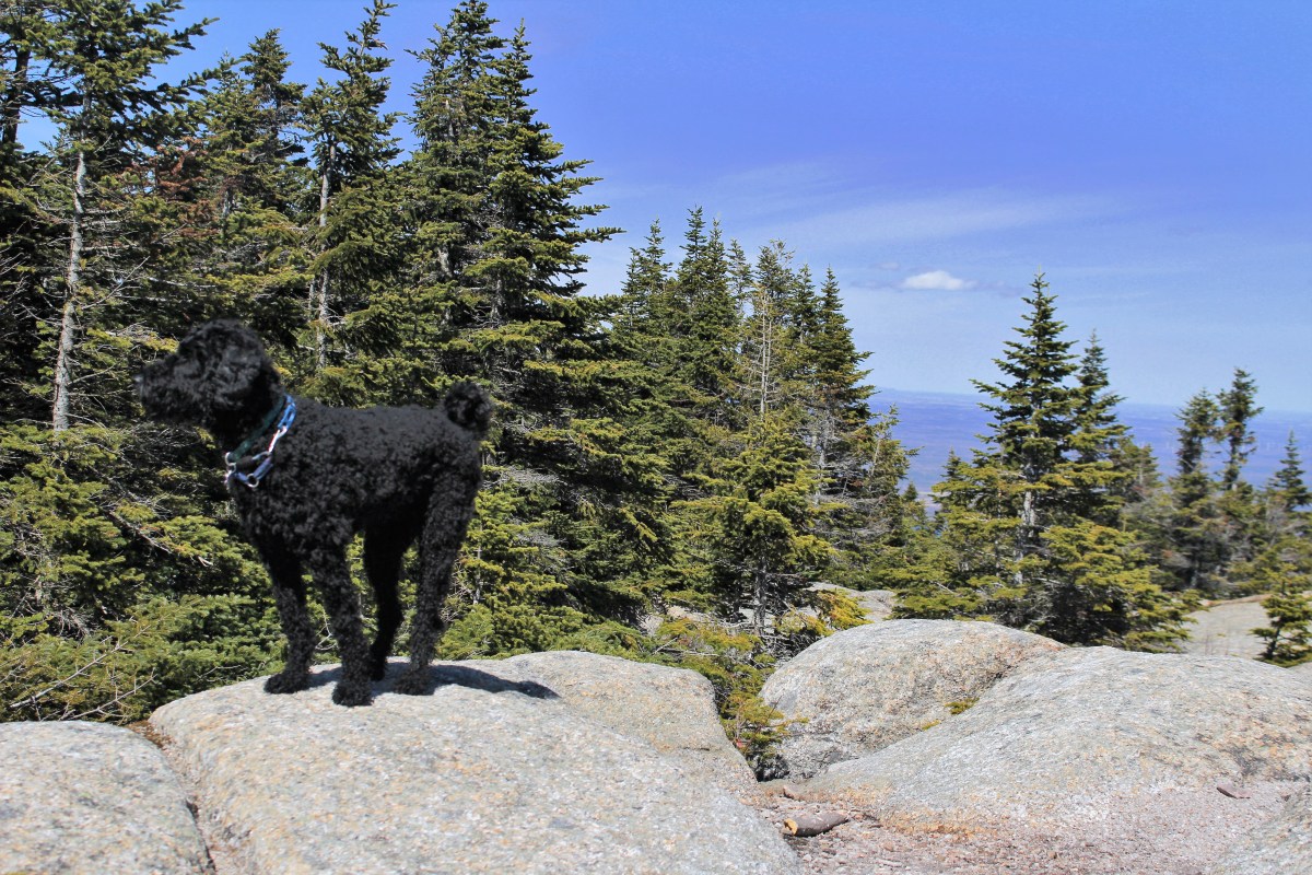
Right at the start of the trail is the beginning of Black Pond, so naturally Juno had to christen our hike with the first swim of the day.

About 10 minutes later we reached the first lean-to on Black Pond. I keep saying I want to come here for stargazing some night, hopefully soon I’ll make it happen!

The trail was surprisingly dry, with only a few spots that were low enough to be flooded from the high water levels as we made our way around the pond. We stopped frequently to view the water and two loons that sporadically surfaced, only to disappear and reappear 5 minutes later halfway across the pond.

Black Pond lean-to visible on the right

About half an hour later we reached the fish barrier dam between Black Pond and Long Pond, and continued straight to skirt Long Pond. Within about 5 feet along this trail we spotted 3 little snakes soaking in the sun in the middle of the path! Somehow Juno missed all of them….I’m not sure that my dog is, in fact, a dog.

At 4:15pm, a little over an hour since we’d left the trailhead, we arrived at the Long Pond lean-to. We checked out the dock for a few minutes before discussing a shortcut we were curious about.

So we noticed on the map that there is a roundabout way to get from our path to the path up the mountain, so we decided to climb up to the ridge to cut out all of the extra path. We scrambled up the side of the ridge, past the privy, and reached the top….only to realize that we would have to descend the other side of the ridge and climb up another adjacent ridge to get back to the trail! I’d just like to state for the record that, while curious about a possible shortcut, it did occur to me that seemingly roundabout paths are usually that way for a reason. So now we know!

We followed this meandering path for quite a while, frequently wondering when on Earth we would start the climb, because up until this point we had been gently ascending and descending alternately. My hiking buddy continually vented frustration that the path was so inefficient, going for a mile in one direction without climbing at all before turning back in the other direction (see the map, haha). I, on the other hand, didn’t mind it. It was a ridiculously easy, gentle climb, and my knees were grateful.

While the climb was very easy, it was made more difficult by all of the blowdown from the recent wind storms. We couldn’t walk 20 feet without having to navigate around fallen limbs and trees. My hiking buddy may have a future in trail work, as he stopped just about every time to clear the trail of debris. It definitely made the descent easier! There wasn’t much to photograph along this trail, besides the occasional teasing glimpse of a view through the trees. Finally, 3 hours after leaving the trailhead (remember that we stop constantly for photos and scenery-viewing…most normal people would have done this much faster!), we reached the last marker before the summit.

Check out all of the blowdown!

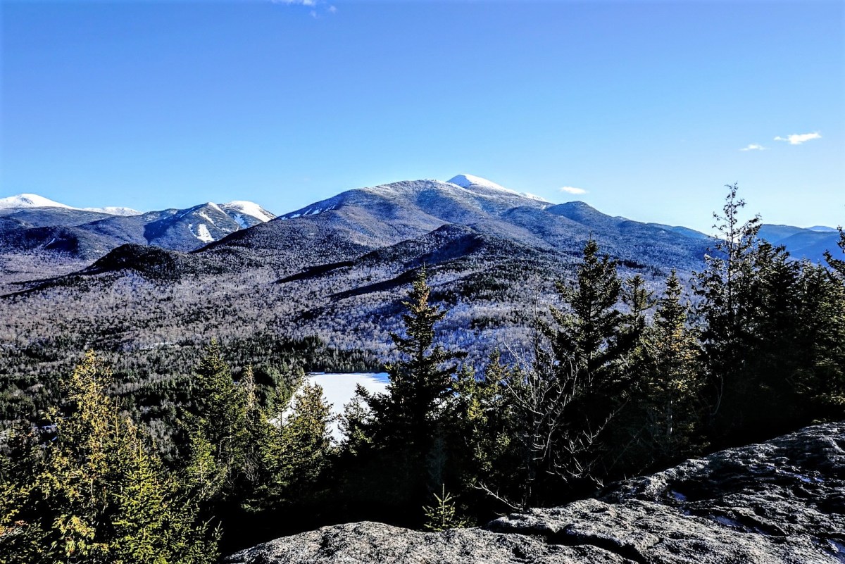
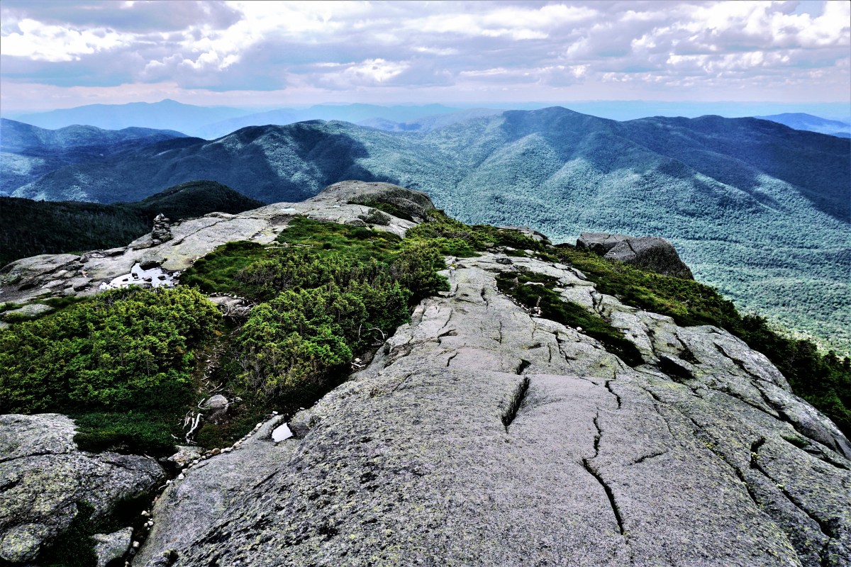
We scrambled up to the top to take in the views, have some snacks, and relax.

St. Regis mountain in the center

The views were way more than I was expecting! No one ever talks about this mountain, so I wasn’t sure what the summit would be like, but I was pleasantly surprised.

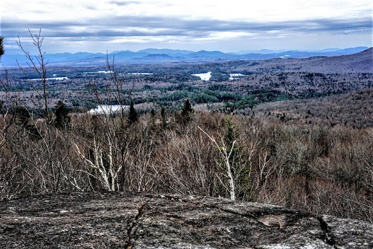
We hung out up here for about an hour. Upon realization that the sun was setting on the opposite side of the mountain and we wouldn’t be able to watch it, we decided to take our leave. The climb down seemed to take no time at all, and along the way we passed a few cool beaver ponds with frogs singing their cacophonous anthem all around us.

This time, we opted not to take our lovely shortcut but to follow the actual path, and we encountered this gem:

If you’re thinking, “Did a tree fall down, so they removed the section with the trail marker and placed it back on it’s stump?” Then you are correct! You win a pat on the back from yourself. This was so funny, I just had to take a picture. Soon after (9pm) we were back at the Long Pond lean-to checking out the dock again.

The hike out was enjoyable; I submerged my foot in water by making the rookie mistake of thinking a clod of grass in a flooded section of trail was stable, and we saw a MASSIVE salamander while walking on some flooded puncheon! Juno sensed my excitement (I mean it wasn’t hard, I was kind of shrieking in excitement) and started wailing and barking along with me, with NO CLUE WHATSOEVER why she was barking. I wasn’t able to get a picture before he scooted away, but luckily internet has plenty of pictures:

At 10pm we made out way back to the car, passing through another frog chorus so loud it left my ears ringing, and headed home. And hey, NO KNEE PAIN!!!!!! Woohoo!!

Jenkins Mountain: 2513′ Elevation Gain: ~900′ (? There are conflicting numbers for this, but 900 seems right)
Round Trip Distance: 8-9 miles
Total Duration: 7 hours (including 1 hour at summit and countless minutes putzing around)


Happy Trails!

Azure Mountain

04/23/18

After being sooo spoiled with amazing weather all weekend, I still hadn’t had enough when Monday rolled around and weather got even nicer. So, naturally, I left work early to go climb something. You might think to yourself, wow that’s irresponsible! But I had a great excuse — It was Juno’s 3rd birthday! What kind of parent would I be if I didn’t treat her to an amazing adventure? So come 3:30pm she and I set off to climb Azure Mountain. My knees are still not 100% so I didn’t want anything too arduous, and this seemed like the perfect option. We reached the trailhead at about 4:30pm and went along our merry way.

Almost immediately Juno shoved her face down into the snow and scooted herself around, tossing and rolling through it. Is…Is this normal for a dog, or….? Either way, it was so funny to watch!

We reached the trail register just a moment later.

I couldn’t believe how much snow was still on the trail and in the woods! Luckily I had worn my gaitors because the snow quickly became a muddy creek, and I didn’t even bother trying to side-step it.

Shortly after that creek the trail started to ascend sharply. Surprisingly I didn’t have a hard time considering how out of shape I must be, and continued up slowly and steadily.

Of course, I had to stop every 6.2 feet to turn around to check out the views during the climb. And I wonder why it takes me so long to climb mountains…..

Along the way, two pairs of people passed us coming down. One group was playing music loudly on a phone, which was pretty irritating to me so I pulled off to the side with Juno to wait for them to pass. After waiting for 5 minutes and not hearing them get any closer, we made our way up and finally passed them…and I had to laugh because it was then so obvious why they were taking FOREVER to climb down…They were woefully unprepared. One of them was literally wearing boat shoes and cargo shorts!

I passed them and laughed so hard. I mean, sure, Azure is an “easy” mountain to climb, but it’s still a freaking Mountain! In April! With a steep trail covered in slush and ice and snow and mud! Sometimes I really wonder about people….I thought they would be the only ones to make such a ridiculous decision, but several minutes later another group passed verrrrry slowly wearing very similar clothes. Even Juno wears boots when hiking! Anyway, about an hour after leaving the trailhead (5:30pm) and 0.9 miles of ascent, we caught our first glimpse of the firetower!

I scampered my way up there, dropped my pack, and ran to the ledge to soak it all in. I never know exactly how long I stand marveling at the view; the second I step foot on a summit all sense of time dissipates and I lost myself to the Adirondacks. The most amazing feeling.

I stayed there for only a moment before go to the right to sit in the sun by “the boulder”.

I lay on my back in the sun there for ages, watching crows fly impossibly far below as the sun sunk lower in the sky, until I noticed Juno starting to eat sticks and other non-edibles, at which point we proceeded to devour our typical ridiculous amount of food (and victory chocolate, of course!).

I decided not to stay up for sunset to facilitate the trip back down, and at about 7pm headed back to the fire tower to check out the views from there. Juno has apparently not learned from previous tower endeavors and followed me right up, much more confidently this time!

We finally took our leave at about 7:45pm. I was actually smart on the way back down and stowed my precious camera in my pack. The descent was partially walking, partially jogging with style, and partially skating. It was…an adventure! There was more than one well-placed tree I used to stop my momentum, and I never fell! (Ok ok I totally fell flat on my ass once, but it was so pathetic it was essentially just me slowly sitting down, so it doesn’t count.). When the trail became muddy again, I joined Juno in jumping in the muddies puddles we could find. Before I knew it we were back at the parking lot just as the moon was peaking through the trees at 8:30pm.

Azure Mountain: 2518′ Elevation Gain: 912′
Round Trip Distance: 1.8 Miles
Total Duration: ~4 hours….including ~2.5 hours at the summit

Mt. Jo

4/21/18

SPRING IS FINALLY HERE! I was seriously thinking that winter would just roll through spring, summer, and autumn, and we’d just be winter year round until I woke up Friday morning and checked the weather for the weekend…60 degrees and sun!! Holy moly theres no way I could stay home on a day like that, so I set my sights on Lake Placid.

Saturday morning, Juno and I got up, packed our bags, and headed out. Our first stop was to see some freaking baby goats at Asgaard Farm!! (We were a little bit excited about this).

I could not believe the amount of cars there. I had to laugh seeing all of the families with little kids, and then there’s just me and my fur-kid powing around. The line to see the newborn goats was crazy long, so we opted instead to see some of the older ones.

Then we stopped by to see some other babies!!

Looking at baby goats really works up an appetite, so Juno and I took our leave after an hour or so and headed into Lake Placid for lunch. I left Juno to nap in the car while I had a delicious meal at the Upstairs Grill (BBQ pulled pork…my stomach is growling just thinking about it now). Afterward, Juno and I went for a stroll around town to help digest the massive amount of food I’d just consumed, while I contemplated an adventure in the mountains. My knee has been slooooowly recovering since last July, so I settled on climbing Mt. Jo. We left the town shortly after arrived at the Loj at about 4:30pm and set off.

Fortunately, though there was of course snow covering the trail, it was not enough to warrant snow shoes, so we had a nice easy ascent going up the shorter, steeper path. Juno was the happiest I’d seen her in a long time, zipping here and there tearing new paths through the snow. I, on the otherhand, took my sweet time like an 102 year old lady so as to not hurt my knee. After about an hour of climbing, we reached the summit!

That moment when I stepped foot on the summit absolutely took my breath away. It felt like my soul could finally breathe again after being away from the Adirondacks for so long. After standing in the sun breathing the mountain air for who knows how long, I set to work taking some photos.

Since it was already like 6:30pm and the sun set at ~7:30, I figured I’d just stay up there to watch the sun set behind the mountains before heading back down. It was so warm when I first got up there, but as that sun went down boy did it get cold! I put on every layer I had in my pack, which included like 3 jackets, mittens, and a fleece cowl, and wrapped a travel blanket tarp thing around my legs to keep warm. (Side note: Juno and I are now starting our own line of ultra fashionable mountain-top gear XD).

Finally the sun began to set and I made my way off the summit to a more convenient ledge to capture the last rays of the day.

I didn’t waste any time in getting off the mountain after that and slid my way down the slushy trail. My knees were feeling so good that I actually jogged down much of the way, giggling like a mad-woman all the while (good thing we had the mountain to ourselves!). We made it down in no time at all without ever even needing to use a headlamp. We left the Loj at about 8:30pm, and stopped along the way to enjoy the stars in the perfectly clear night sky.


Looking toward lake placid; You can see the ski jumps towards the middle

Happy and exhausted, we (…I) filled our bellies with ice cream at Ben & Jerry’s and made our way home.

Who knew a half-moon could be so bright?

Day 1 – Las Vegas


After being up at 5am for a 7am flight, we arrived after 7 hours of travel in Las Vegas at noon (time zones are so weird). We took some time to become human again (ie. a much needed shower), ate a super delicious home cooked meal, and headed out on the town. I never realized how ubiquitous gambling is in Vegas. That may seem like a stupid revelation, but I mean come on, WHY do you need a slot machine in the grocery store? In every gas station? They’re even at the airport, which is somewhat less surprising, but still.

Our first stop was to see the Welcome to Las Vegas sign, and pay our respects to the memorial for the recent shooting.

The Welcome sign, with the memorial and Mandalay Bay visible in the background

The memorial was incredibly humbling. Seeing the names and faces of all of the innocent victims of a senseless murder spree, the majority of whom weren’t even native to Las Vegas, hit home with a lot of the people visiting, especially when seeing mourning family members placing flowers on the crosses.

The memorial with the light from the Luxor shining vertically in the background

After that uplifting trip, we headed to the Bellagio to see their gardens.

Ceiling of the entrance to the Bellagio

The gardens were incredible! I can’t imagine how much work they put into building and upkeeping the displays. Next, we went outside to the fountains in the front to watch the show, synced with classical music.

We went on our way, heading downtown to explore the nightlife there. We entered a casino, where my family enjoyed playing the poker machines, and I lost $5 to a slot machine. I really don’t understand the appeal of gambling; I work very hard for my money, and don’t want to just feed it to a hungry machine! I’d much rather have something to show for it….so, naturally, my grandmother and I went to a little souvenir shop across the way and spent our hard-earned money on candy 😀 We spent a good deal of time hanging out in that casino, but the omnipresent smoke was really starting to get to all of us, and we took our leave and headed back. Finally, after being awake for ~21 hours, we passed out in our beds.

Day 2 – Zion National Park


Iroquois (8), Algonquin (2) and Wright (16) Mountains (+Boundary Peak)

7/16/17

It’s been a couple of weeks since I climbed Nippletop and Dial, and with my PhD dissertation defense looming over me (it’s on the 24th of this month, and I’m dreading it), I desperately needed to get into the mountains. I signed in at the trailhead at the ADK Loj at exactly 6am, grabbed a rock to take to the summit, and set off.

The trail was nice and wide and flat, with nice puncheon and walkways throughout. A few times, I had to check the map because the trail intersected with several ski trails, but I just continued straight, following the blue trail markers.

Not long after starting, I came across a junction sign and followed the path towards Avalanche Lake, 4 miles away.

Most people climb these three mountains by going right at that first sign to hit Wright first, then Algonquin, then Iroquois, then BACK OVER Algonquin, then back down the way they came up. I was determined to make this hike a loop by going up the steep pass after Avalanche Lake, going up to Iroquois, then to Algonquin and Wright.

Half an hour later, I came upon a trail sign for Mt. Marcy, and Marcy Dam followed shortly afterward. The dam itself wasn’t crossable, but a sign led me down towards a nice bridge.

Moments later I encountered another junction sign and went right to continue towards Avalanche Lake. 15 minutes later I came across another bridge over the brook, and took the opportunity to sit on a rock and have a snack.

Yet again, only a few moments after I left the bridge, another junction sign pointed the way towards my destination. Up until this point, I’d been leap-frogging with another hiker (Chris!) and we’d continued to do so all the way up to the summits, so I passed him up and continued on my way.

I knew I was starting to get close to the lake when I started feeling like I was in Nelson’s Ledges (look it up…then book a trip to Ohio).

I crossed another little bridge along the way, and when I turned to look behind me I saw the most perfect spider web catching the light from the morning sun.

At 8am, I made it to Avalanche Lake and it took my breath away.

I went right, slogging through the thick mud, and was super grateful for my gaitors. I followed the trail for just a few minutes before stopping on a big boulder to enjoy another snack and take a few photos.

The trail around the lake was tricky, and included awesome hitch-up Matildas (which are being replaced in August, and are named for a story about a woman named Matilda Fielding back in 1868), giant boulders to climb over and between, and steep ladders. It was a ton of fun.

Good thing they’re being replaced, because this one was missing a board. I’m glad I wasn’t there when that happened!

I reached the other end of the lake an hour later at 9am, and another register just a few minutes later.

The trail was so luscious and green after that point, and several minutes later I crossed another bridge.

After I crossed it and started to descend again, I looked back up and saw a junction sign that I had missed on the other side of the bridge. I’m so smart guys, because I decided, ‘Nah, This path feels right!’ and unknowingly proceeded 0.25 mile in the wrong direction. I reached this little outpost, and a junction sign thereafter, at which point I took out my map to figure out where the hell I was.

Just as I was reaching the conclusion that I had to backtrack, a group of badass backpacking women came through and set me on the right path, back at the junction I stupidly passed.

I was back on the right path at 9:40am, and the path immediately started climbing and following a beautiful brook full of waterfalls.

At one point, I reached the top of the falls, and the trail actually went out into the stream bed. It was so incredible to be up there, looking up at the falls.

Despite being overwhelmingly beautiful, this trail was *expletive of your choice* BRUTAL. It involved tons of boulders to climb up, and the trail continued to follow the stream, often being directly IN the water. I was baffled at how there was water when I was up so high. Where does it even come from?? The ground, I guess, but…I just don’t know. This trail was sort of becoming my own personal hell. It just kept GOING, and going and going and….I seriously considered more than once that I had never actually woken up that morning, and was instead having a nightmare about being on a neverending stairmaster.

I was frustrated, tired, and getting a bit lightheaded from the constant UP, when I met a small group of people who asked where I was headed. I told them, Iroquois, and they looked at me confused and said I was going up Algonquin. My stomach dropped. They asked how far down until they would reach the top of Boundary….I asked, were they certain the junction wasn’t behind them? Because the trail I was on literally hadn’t stopped ascending, for even a second, since I had started it. I left them there to consider their options while I continued up, certain that I hadn’t reached the junction yet. After seriously questioning my life choices for a few moments, lo and behold, I FINALLY reached a large cairn at 11:30am, to the right of which was the looming Algonquin, and to the left was a narrow, overgrown trail that could be easily be missed by anyone.

The views were beautiful, and the ascent up to Boundary Peak was quick and painless. I was so excited, the pain in my legs and feet just faded away. Boundary peak was supposedly named because it was the boundary between the Iroquois and Algonquin Native American tribes., however I’m not sure how true this is. Despite being 4,829 feet high, is not considered a high peak because it does not have enough prominence.

Looking toward Iroquois from the summit of Boundary Peak.

At about Noon, I had reached the impressive summit of my 14th high peak, Iroquois!

Looking back toward Algonquin.

Mt. Colden behind me.

The views were phenomenal, with complete unimpeded 360 panorama. I immediately sat my butt down and ate my sammich and victory chocolate.

I enjoyed seeing the beastly trail around Avalanche Lake and up to Boundary from the summit.

Lake Colden toward the middle, with the Flowed Lands to it’s right.

While there, I met many awesome people, including the trio that had unintentionally given me a heart attack. We chatted for a time (shoutout to Matt Cook!) and took photos for each other.

I ruefully left the summit at about 12:45pm, and made it back to the junction 15 minutes later to look up at the monster Algonquin.

The way up Algonquin was steep and exhausting, but the thought of the views at the summit kept my feet moving.

20 minutes later and I was sitting near the summit ripping my boots and socks off of my blistered feet to roam around barefoot. I HIGHLY recommend this! It was made even better by the fresh clean socks I kept in my pack for afterward, so I wouldn’t have to put the same nasty socks on again.

I enjoyed my time at the summit for about an hour, talking with a bunch of awesome people and enjoying another snack (of course). I spoke with one group who had brought their friend up for his first ever mountain. Not even first high peak, but first MOUNTAIN. This guy was hilarious, he was just yelling nonstop about how he couldn’t believe how amazing it was, and making phone calls to presumably ever person he had ever met to tell them he was on top of a mountain. It was really funny to witness, and I had to turn away to stifle my laughter, noticing as I did that several other people were doing the same.

I took my turn at the summit to take a photo of my beat-up feet with the geo marker.

At 2:15, I began my descent and deposited my rock at the pile designated by a small sign on the way down.

The descent was stunning, walking above the treeline to see out to the mountains around me.

Along the way, I joined with another hiker making his descent (shoutout to Fred) and we had a fun time talking, until I fell flat on my ass on my way down a slippery, steep rock slab. Nothing was hurt, besides my dignity (and some scrapes on my hands) and we carried on our way.

Lake Placid towards the upper middle.

Below the treeline, the descent was quite steep and time consuming. I finally reached the junction to Wright Mountain about an hour after leaving the summit, and turned to head straight back up.

“Wright” is written on the rock.

It was only 0.4 miles to the summit, however it was exceptionally steep and I was very nervous about coming back down. Nevertheless, I put one foot in front of the other and was soon above the tree line, once again.

Towards the summit, there was a little sign pointing right towards the summit, and left towards the plaque for the plane wreck. In 1962, a B-47 bomber practicing low-altitude bombing runs over Watertown veered 30 miles off course in inclement weather and high windes, when the wingtip clipped the summit of Wright Mtn. The mountain shattered the plane, scattering the wreckage along the southwest side of the peak. Read more about the accident here.

I popped right up to the summit, where a couple was hanging out shouting Tarzan-like ululations, and we took photos for each other.

Algonquin.

I was on a bit of a tight timeline, wanting to be back at the trailhead at 6pm, so I stayed at the summit for all of 5 minutes before heading down to explore the plane wreck.

Just a few minutes of descent and I was at the plaque with the scraps of debris.

I scampered back up to the peak, and began my descent at 4pm.

Surprisingly, despite seeming so steep on the way up, the climb down really wasn’t that bad, nor did it last very long. After 20 minutes, I was back at the junction to Algonquin. The descent after that point was rather rocky and steep, and I really had to take my time. That stupid song from one of those puppet christmastime cartoons started playing in my head, and it drove me a little bit more insane, the one that goes “put one fooot in front of the other, and soon you’ll be walking out the dooooor”. UGH. Of all things to be in my damn head. Anyway, after an hour of that, I made it to a nice waterfall where another group was hanging out. I took the opportunity to rest my feet and have another snack.

After that point, the trail was significantly easier, finally with some flat dirt path instead of constant rockhopping. For once in my life, I was passing everyone on this trail! I was not the slowest person on the mountain! But really though, this NEVER happens. A few uneventful miles later and I was back at the trailhead, signing out at about 6:20pm, 12hrs 20mins after I began. I headed straight to my car, changed into clean clothes to try to pretend like I didn’t stink as much as I did, and headed home.

This was absolutely my favorite climb, to date. Every single summit had complete 360 degree views, it was a beautiful day, and I felt so accomplished at having taken the tougher route to climb these three. 16 down, 30 to go!

Iroquois Mountain: 4,840 feet

Algonquin Mountain: 5,114 feet

Wright Mountain: 4,580 feet

Boundary Peak: 4,829 feet

Round Trip Distance: 13.4 miles

Total Elevation Gain: 4300′ feet

Total Duration: ~10 Hours of hiking +2 Hours at summits

All images are property of adktrailtalesandtails and may only be used with express permission.

Nippletop(13) and Dial(41) with Bear Den and W. Noonmark Shoulder

07/04/17

I had the day off of work, and decided that the day couldn’t be better spent than by climbing the two peaks that I left out when climbing Colvin and Blake. I left the house at 4am, thinking that the trails might be crowded despite being a Tuesday since it was Independence Day. I enjoyed the sights of dense fog lifting with the sunrise on the drive down.

Barnum Pond

I arrived at the trailhead at St. Huberts just before 6am, put my boots on, and set off toward lake road.

15 minutes later I arrived at the register, signed in, and started my long trek down Lake Rd. I had read mixed reports about whether to climb these mountains clockwise or counterclockwise; many people suggested climbing clockwise, going up Leach trail and coming down Elk Pass because Elk Pass is very steep despite being only 1.5 miles long. However, I would much rather climb up a steep path than down it, and I wanted to do the long lake rd walk early in the hike as a warm up, so I chose to go counterclockwise, anticipating a miserable climb up Elk.

I noticed two signs for “Flume” while I was walking, and decided to check out the latter. Without backtracking all the way, I walked just a few feet along the little spur trail to see some awesome waterfalls.

Usually the walk along lake is boooring, however this time, just as I was cresting a hill, a sweet little spotted fawn came galloping toward me from the other side! She skidded to a stop, as did I, and we stared at each other in shock for a few moments before she bolted into the brook alongside the road, and watched me while floating in a little pool. Hopefully that baby’s momma was close by!

I passed the first sign for Gill Brook, and continued until I saw the second sign for Gill Brook cutoff, while I reached at about 7am, an hour after leaving from the parking lot.

The trail climbed slowly but steadily from this point until reaching the junction with the Gill Brook Trail 20 minutes later.

I went right, up towards Colvin, and ruefully continued straight past the junction for Indian Head a few minutes later. Indian head is amazing, but I’d already been there a month before and wanted to see new things.

The trail climbed pretty steadily on the way up towards Colvin. I hadn’t been bothered by bugs yet, but it was still quite early. I had also expected a ton of mud due to the recent deluge, and though there were muddy areas, none of them were sloppy, boot-slurping mud. After climbing up some rock slabs and stone steps, my stomach started complaining loudly, so I decided to take a short break just before 8am and have a snack.

After a little over a mile of climbing, I reached a decrepit sign at the junction for Elk Pass, Colvin, and Lake Rd at 8:30am. Two of the signs had fallen (presumably recently, because I think they were intact when I was there before), and I spent a moment with a couple of other hikers to ensure we were all going the right way. I headed left from the direction I came to go towards Nippletop.

The trail picked up again, climbing steadily, and I started hearing sounds that seemed out of place for a mountain trail….Frogs. It didn’t make any sense to me, and definitely made me pause for a moment or two in confusion, until the trail took a downward turn and I found myself on a muddy, overgrown little path through a bog. I excitedly took a little spur in the trail to view the bog, and the lumber supplies that hopefully mean a bridge will be built in the future.

It was so beautiful here. After a very quiet morning, the birds were waking up and the frogs were certainly lively. More than once while walking I stepped in what I thought was shallow mud and nearly left my boot behind in foot-deep muck. I’d laugh to myself, remove my foot, and immediately do it again. I was pleasantly surprised moments later to see another small pond, on the right this time, and took the opportunity for a short break.

At this point, the trail was almost lower than the level of the ponds, and boy did it show. The mud was ridiculous, and much more along the lines of what I had expected. I passed through the absolutely worst of it by balancing precariously on a sodden, broken log, and made it to dry land. THEN I took out my pole to help with any future mud. Better late than never!

I had reached a nice dry clearing with views of another small pond, which I later saw was a campsite, and then headed up the trail again.

This is when the real ascent up Elk Pass starts. Honestly, I wasn’t even really convinced I was on Elk Pass until I was almost to the summit of Nippletop because it was so much easier than everyone made it seem. I was expecting some beast with giant rock slabs and slick slides all the way up. While it was indeed steep and constant, it wasn’t at all technically difficult. For reference, I always carry my camera around my neck while hiking and put it away during difficult sections; I never even had to put it away during this entire hike.

The grade was certainly tiring, and I made myself stop for 5 minute breaks every hour (which really helped with muscle fatigue), but it was made so much better by the views I had almost every time I turned around.

While it wasn’t technically difficult, this trail seemed to go on FOREVER. Finally, at about 10:15am, I reached the crest in the ridge and the junction for Nippletop and Dial, and headed right.

20 minutes later and I was standing next to a big rock, asking a man standing nearby “Is this it?” It was indeed! Climbing out onto the rocks, I was blown away by the views of the Dix range.

I hung out at the top for about an hour, chatting with a few different people (shoutout to Doug from Delaware, the surgeon!–I’m trying really, really hard lately to remember things about people…like their names.) and enjoying my lunch and victory chocolate.

I took a photo for a pair of ladies, they returned the favor, and I convinced them to do the loop down elk pass to visit Indian Head. Seriously, the views from Indian Head are some of the best around.

Elk Lake just visible to the South (left)

Finally, at around 11:30, I decided I had to make the move to head towards Dial. Bugs had started to show their ugly stupid faces with the warming sun and mud, flies and sandflies and mosquitos and all, but they weren’t really a nuisance while I was moving, so off I went. I passed the junction with Elk Pass and marveled at the view of Giant Mtn to the NE.

Everyone I had previously spoken to had said that the trail was all downhill after leaving Nippletop heading toward Dial, Bear Den, and back to Lake Rd. This was totally not true, and I had gotten pretty frustrated at having expected it to be so much easier. It was more like, down then up, then down then up to Dial, then down then up to Bear Den, then down then up to Noonmark Shoulder, then down….Anyway, I passed several people travelling the other way while heading to Dial, and asked every one of them if I had accidentally passed over Dial without realizing it…I just kept going downhill, I thought for sure I had missed it!

Along the way, I spied a little spur trail off to the right just before noon, so of course I took it and found some beautiful views from a large boulder!

Finally, 2.1 miles and about an hour after leaving the summit of Nippletop, I reached the summit of Dial Mountain. For some reason, I was expecting the summit to have no views, however I was thrilled to see a huge boulder outcropping.

I hopped right up, and eagerly sat down to enjoy an apple, and snapped a few photos.

Unfortunately, within 5 minutes of being up there, I was SWARMED by sandflies! These things are awful! Despite having a cap coated in permethrin and being covered head to toe in deet, these things just did not care. One after another I was swatting them off of my hands, my neck, my face, and even from up under my cap. At one point, I took the deet out of my pack and literally sprayed it into the swarm, and they gave me one of these:

So I packed my stuff up and courageously ran like hell off of the summit, without even having my apple snack. After a hundred feet or so I slowed back down and lamented my short stay on the summit. The trail immediately went downhill for about a mile before climbing again up to the summit of Bear Den (1:30pm). There weren’t any views from Bear Den that I could see, and I didn’t even realize I had reached the summit until I saw the sign at Noonmark saying I had already passed Bear Den.

After a half mile descent from Bear Den, The trail again began climbing. While somewhat demoralizing to be climbing again (my knees were hurting from all of the ‘down’, and going up only means climbing right back down, and then some), the trail up to the W shoulder of Noonmark Mtn was stunning. A fire had ravaged the area in 1999, creating now-beautiful views from the summit of the shoulder and a unique young forest full of birch and aspen trees, with white bark and bright green leaves.

I climbed the slab up to the shoulder and plopped my butt down. The views were AMAAAAAZING. I wanted to sit there for so much longer than I did, but alas, bugs. Writing this the day after the hike, I have a number of itchy bites, where mosquitos had bitten THROUGH MY DEET-SOAKED PANTS. What even are these things?! How do I prevent this?! Grenades?! Ugh.

After only a few minutes respite, I continued on up and over the shoulder and again headed downhill through the beautiful forest and some mud.

From here on out the trail was much easier. There was less mud and the decline was less rocky. At some point I passed this beautiful little mushroom, still somehow intact despite residing in the middle of the trail.

A mile and a half later I was back on Lake Rd, and at the parking lot at about 3:45pm, about 9hrs and 45 minutes after leaving.

I learned some valuable information on this trip:
1. Adirondack bugs don’t give a hoot whether you’re wearing deet or permethrin. If they’re hungry, you’re lunch.
2. Elk Pass wasn’t bad at all, and I would recommend any and everyone go up Elk and down Leach, for several reasons. First, you get the long walk down lake road out of the way early on, and it serves as a nice warm-up before any climbing. Second, you reach Nippletop for some awesome views faster than you would if coming from the Leach Trail. Third, it’s easier to climb up steep, slippery rocks than to climb down them.
3. The Fourth of July isn’t a crazy busy hiking day when it’s during the week (except maybe on a Monday or Friday). I only saw a handful of people all day. Good to know!

13 down, 33 to go! Happy Trails!

Nippletop Mountain: 4620′

Dial Mountain: 4020′

Bear Den: 3399′

Total Duration: 8.5 hours of hiking + 1.25 hours at summits

Round Trip Distance: ~14 miles

All images are property of adktrailtalesandtails and may only be used with express permission.

Colvin (39) and Blake (42) with Indian Head and Fish Hawk Cliffs

6/3/2017

Weather reports for this day had been spotty all week, with everything ranging from sun to clouds to rain to snow, but I had been set on hiking no matter what, and at least if weather wasn’t great, then the trails shouldn’t be very crowded. I got up at 4am, checked the weather again, and it looked promising! So I hopped in my car and headed to the St. Huberts parking lot off of Rt. 73 (technically on Ausable Club Rd.). I arrived at around 7am, the lot was already around half-full, and headed up the road alongside a very difficult looking golf course.

 photo DSC00012_zpshwz3y7wt 2_zpslni2ojpr.jpg
Ausable Club

I met and chatted with a friendly couple from Ottawa along the way, and 10 minutes later I signed in at the register by the gate with a pep in my step.

Surprisingly, there were no bugs out yet, but I fully expected o be swarmed later in the day. At any rate, the walk along Lake Rd was a nice warm up before starting any climbing, and it follows a scenic brook along the way.

My initial plan for the day was to hit Indian Head first, because people are always talking about how amazing it is and I wanted to see what all the fuss was about, then to hit Fish Hawk Cliffs, Colvin, Nippletop, then Dial, and I wanted to follow Gil Brook on the way up. So when I saw the first sign for Gil Brook, I followed that trail.

I absolutely have to recommend this trail to anyone and everyone looking to hike in this region, and I recommend going up it instead of down, because you can see all of the waterfalls as you come up to them. I spent soooo much time putzing around by the brook, but it was only 8am and I wanted to get to know my new camera (a mirrorless Sony a6000, much smaller and lighter than my big Canon, which was also in my pack of course)!

If at any point along a trail you encounter a sign with two arrows, one for an “easy” route and one for a “Scenic” route, take the scenic route!

There were two such signs along the path, and boy were they worth it. It wasn’t even a difficult traverse, and the waterfalls were stunning. What is it about waterfalls that makes me want to be standing under them?

Shortly after the last waterfall, I came upon a junction for Colvin/Indian Head/Elk Pass, and as I paused to snap a photo, another hiker approached from the trail I had just been on. We stopped to talk for a minute, and he suggested that I absolutely do not want to orphan out Blake Mountain, since the way to get to it is generally by climbing Colvin first.  So if I didn’t do it today, I’d have to come back and climb Colvin again to get it. So I said, Ok, this hike is getting really ambitious, but sure, I’ll add Blake to the list! He continued on, and I admired the Gil Brook for a moment more before continuing on.

About two minutes later, at 9am, I encountered the same hiker (shoutout to Josh) at another Junction sign. He was debating whether to climb Indian Head, but was hesitant because he hadn’t told anyone he would be going there. I said I was planning to climb it too, so together we set off up the path to Indian Head.

30 minutes later we arrived at the summit and our minds were blown. Honestly, I could have stayed there all day, it was so incredible. But, alas, I’m an aspiring 46er and didn’t want to miss the chance to bag some high peaks.

We stayed up there for almost 30 minutes enjoying the views and trying to figure out which mountains were around us. It was really nice having someone to hike with; not only did I have someone to talk to besides myself (I’d already caught myself mumbling to myself a few times that day, which was mildly concerning), but I had someone to take my picture! I had taken my tripod out of my pack that morning, so I wasn’t really planning on being in any photos.

 photo DSC00055_zpserxbadjp 2_zpskifjlb2v.jpg
The peaks behind me are Colvin and Blake

Having enjoyed our fill of the beautiful landscape, we next set off for Fish Hawk Cliffs, and arrived there 15 minutes later at 10:15am. NOW I KNOW WHY IT’S CALLED INDIAN HEAD! I was really wondering about that on the climb up, and it was so freaking cool to see Indian Head from another angle.

 photo DSC00059_zpsthods0up 2_zpslmoetjse.jpg
Indian Head, in the center

We didn’t linger long there, and began our descent down to the col between Colvin and Indian Head. Now, as I’ve mentioned before, I am SLOW when hiking steep terrain. I have very weak joints, and landing wrong could collapse my knees, so I go very slowly, using my arms a lot to lower myself down to avoid any injuries. My new hiking buddy, however, was much faster, so I encouraged him to go on at his own pace so I wouldn’t slow him down and, at some point along the way to Colvin, he did. This was fine with me, because now I could go exactly as slowly a I needed without feeling rushed. After reaching the col, the climb back up Colvin was a bit tricky and just never seemed to end. It was getting pretty muddy and slick, and more than once as I walked through a muddy patch I felt my boot sink in and schlurrrp as I pulled it back out. At least there were still, somehow, no bugs! At some point I started hearing people talking, and finally, 2 hours after leaving Fish Hawk Cliffs and about 5 hours from the trailhead, I made it to the summit!

The summit was a glorified rock with about 6 people already hanging out at the top. My hiking buddy and I reunited, and I immediately sat my butt down and ate food. And then ate some more food. And then a little more. I was really hungry, guys.

The summit was very windy, and it was about 52°F, which is probably why bugs weren’t an issue all day. While the views from the summit certainly weren’t 360°, it was incredible to be right in the middle of the Adirondacks and so close to the other high peaks.

 photo DSC00064_zpslofyrljv 2_zpszznlhd2a.jpg
Looking back toward Indian Head
 photo DSC00068_zpsb0canqtv 2_zpswjciaewi.jpg
Mt Marcy behind me, with snow still towards the summit

This was my 10th high peak, so I’m officially in double digits! Talking with the other people at the summit, it seemed the overall consensus was that Blake Mountain SUCKS. It’s a steep climb down from Colvin, and a steep climb  up to Blake, which has no views and isn’t even 4000ft, then back down Blake and up Colvin again. Now, on the climb up to Colvin, I had had my cap on and was looking down and completely missed BOTH junction signs just before the summit. Yikes. We left the summit at about 12:40pm and headed down towards Blake.

The descent didn’t start out too bad, albeit expectedly muddy, and 20 minutes later I had the first glimpse of Blake. Boy was that a demoralizing sight.

 photo DSC00077_zpsfxe52mqc 2_zpsubko1kzm.jpg
Blake Mtn

As we headed down, things got STEEP. The mud made things very tricky and slick, and it was a bit intimidating. Luckily there were a few ladders to help with the worst spots.

Both of us decided to descend next to the ladder rather than actually using the rungs due to how steep and widely spaced the rungs were. Now, being the graceful moose that I am, I lost traction part of the way down, and slid down on my butt. On the way, my hiking pole got caught under my pack, which jammed the pole about a foot into the mud at the bottom of the slope. I had to laugh at myself, as Josh asked me “Is your pole stuck in the mud?” and I replied, “Sure is!”. I unearthed it, and we continued on down to the col.

 photo DSC00089_zpsbiuhjb6d_LI_zpscf51vifw.jpg
The hole from my pole, circled in red

As I’m writing this, I’m surprised because it felt like that descent took forever, but was apparently only 35 minutes. At 1:15pm, we reached the col between the mountains.

My hiking buddy went on ahead during the ascent up Blake, and another hiker or two passed me as well, looking tired and covered in mud, but still in good spirits. Everyone I met this day had been absolutely awesome, and I stopped to talk with many of them. I even met a group of students from my university coming down Blake, one of whom I’d actually taught before! Even though Blake is kind of a really awful mountain, the people I met along the way more than made up for it, probably because the only people who would be out there are people who just love hiking, like me. No matter how tough the hike, everyone is willing to meet one another and lend a hand.

As this climb was dragging on, I saw a man who had passed me earlier was now coming back down. When I asked him if the summit was anywhere close, I heard Josh yell up ahead “It’s right here! Keep going!” so with a last burst of energy, I scrambled up to the summit at 2:15pm, which was noted with a small pile of rocks and no view. Time from Colvin: 1.5hrs. Time from trailhead: 7hr 15min.

We both had some snacks and victory chocolate, and I gratefully let my heavy pack fall off of my shoulders.

While we were up there, another gentleman reached the summit with us, and the first word out of his mouth was an exasperated “F**k!”. We burst out laughing; that one expression completely summed up the hike to Blake. The three of us sat together for some time chatting and dreading the trip back to Colvin.

Nevertheless, at 2:45 we headed back the way we came. I was moving so incredibly slowly sown the steep, muddy rocky slopes, and was soon left behind by my hiking buddy, which was again fine with me. At least if I fell on my rear no one would be there to see it! Surprisingly, despite my lack of grace, I never did fall. I was so incredibly relieved when I made it back to the col to Colvin, because the worst of the descents for the whole trip were over. I made my way back up Colvin, and again the climb never seemed to end. Every time I though I must be close, it just kept going.

I sat once again upon the summit of Colvin at 3:50pm, alone this time, and enjoyed the most delicious fruit cup I’ve ever eaten in my life. At 4pm, I left my perch, now drained of any ambition to climb Nippletop and Dial. It was getting windier and the clouds were more forboding, and I didn’t want to be on a summit in the rain. As I headed down, I met another group of really fun people heading up for Colvin and Blake, and encouraged them to keep going because the summit was literally 2 minutes away. We talked for a few minutes, then parted ways. Climbing down from Colvin was tougher than I had anticipated, with lots of slick muddy rocks, steep descents, and rock hopping, and my knees soon started to ache and feel weak. I finally reached the junction after an hour of very careful descent.

The going was much easier after the junction, and I sped right along the Gil Brook trail, bypassing the scenic overlooks that I’d already seen. I made it back to Lake Rd at about 6pm. I hadn’t used a restroom since 7am, and the rushing water of Gil Brook alongside the road was not helping my bladder situation, so I really picked up my pace to make it back to the parking lot! Along the way, I rescued a small bright orange salamander from the middle of the road and chatted with a nice fellow from Montreal (shoutout to Maxim) while we walked back to the gate. I signed out, then practically ran back to the parking lot. I made it there at about 7pm, after 12 hours of hiking, and was SO HAPPY that I had a change of clothes, socks, and shoes waiting for me in the car.

I drove the two hours back home all with a stunning sunset in front of me. 11 down, 35 more to go! You’re next, Dial and Nippletop.

Colvin Mountain: 4057′

Blake Mountain: 3960′

Indian Head: 2700′

Fish Hawk Cliffs: 2600′

Total Duration: ~12 Hours

Round Trip Distance: ~15 miles

All images are property of adktrailtalesandtails and may only be used with express permission.

Jay Mountain

05/20/2017

Today was a perfect day for hiking, so Juno and I loaded up our packs and headed out at 7am to get to the trailhead at 9am. I just have to say, ::SPOILER ALERT:: this was in the top 2 of the COOLEST MOUNTAINS I’VE EVER CLIMBED! Seriously, even though this mountain isn’t a high peak, it should not be overlooked. Clearly, other people already know that secret, because the little parking lot at the trailhead at the intersection of Jay Mountain Rd and Upland Meadows Rd was already full when we arrived. We parked on the street, took our starting photos, and headed off.

 photo IMG_3194 2_zpsvwzksedw.jpg
New hiking backpack!

The trail started climbing right from the start, gradually and continually via switchbacks. We signed in at the register a few minutes after leaving the trailhead, and soon after followed a cool low rock wall along the trail.

 photo IMG_3196 2_zpsyms4qwrv.jpg
Rock Wall

Juno was so excited to be sporting her new pack so that she could carry her own water! Or maybe just I was excited to not have to carry her water! Either way, she trotted back and forth excitedly, while I trudged up behind her.

I’ve come to realize that the first 30 minutes of any hike are the hardest! I’m constantly checking my watch, thinking “It must have been an hour already!” and it’s only been 15 minutes. After those first 30 minutes I tend to find my stride.

Juno was on her best behavior today. About 20 minutes in, this little cream colored poodle came running up to us from behind, owner nowhere in sight, and started BITING JUNO! She jumped back, looked at me like “What the heck, Mom?!” and then chased him off. She made sure the dog stayed away from me, then came back, and we waited together for the irresponsible owner and his dog to pass us. I thought this would be a one time thing, but unfortunately those two would continue to haunt our beautiful hike. This happened two or three more times throughout the day. The owner claimed the dog was just afraid of big dogs, but  scared dogs tend not to run up to big dogs trying to fight. No, sir, your dog is just aggressive, not scared. I don’t want to go on about this anymore, just, if you have a dog that’s not friendly with other dogs and doesn’t respond to your commands, KEEP IT ON A LEASH! My poor pupper was snapped at/possibly bitten 4 times during this hike, while she has never bitten anything/anyone in her entire life, and there were so many other dogs on this trail that the angry little dog could’ve hurt. Anyway, that’s enough of that. We were determined to enjoy our day to the max anyway, and continued on our way, enjoying the bright greenness of everything around us. What a welcome sight after dreary winter!

After about an hour of steady but gradual climbing, we paused for a short snack and water break, and to let a couple of young guys and their sweet hound pup pass us. A little bit afterward, I looked to my left and saw a tall mountain through the trees. I thought, “Hey! That might be Whiteface! I remember reading that there’s a great view of it from Jay!”, then I realized, nope, that tall mountain that looks sooooo far away is, in fact, Jay Mountain. So, we picked up our pace.

So I learned for sure during this hike that my dog requests my permission to do things (you wouldn’t know at home, when she’s constantly scheming and stealing socks). She saw these big boulders, ran over to them, then looked at me and started heading back, expecting to be told “No”. So when I encouraged her to go up there, she ran back excitedly, hopped up on the biggest boulder, and literally posed for the camera. Later, she did the same thing at a much more dangerous rock cliff that she wanted to climb up, I told her no, and she sighed and fell into line behind me.

Since Juno and I apparently dawdle–a lot–we had to stop quite a few times to let speedier people pass us up. We don’t mind though! Everyone was so happy today, and happy to see my sweet little girl, and she was happy to see them. After about a mile, mile and a half of climbing, we reached a little col over to Jay mountain, and Juno got a nice refreshing drink from the stream.

I was well prepared for bugginess today, with deet and permethrin, but there really weren’t many out! I also thought it was be a sea of mud, but again, nothing! It was really a perfect day, clear blue skies, moderate temp, and I couldn’t have asked for more.

Nearing 2.5 miles into the trail, the woods cleared out quite a bit, and we got a sneak peek of the amazing views behind us.

Shortly after, we reached a small junction where the trail split to the left and right. We chose to go left, which led us up to a gorgeous bare-rock lookout where a few of the people who passed us were lounging and having a snack.

I looked to the right, saw an impressive-looking rocky peak, and asked the nearest couple if that was indeed the peak of Jay. They confirmed this, and said that even though the ridge looks like it’s wooded from this angle, we’ll be walking along the other side where it’s open.

We were excited about the ridge, and didn’t want to waste any time, so Juno and I took a last look at the views, then headed off. We went back to the junction, met a really fun group of young men heading up to the lookout, then turned left at the junction to head up to the ridge.

 photo IMG_3241 2_zpsnydstlto.jpg
Whiteface Mountain, with it’s many ski trails.

This is where things got interesting. Very soon after this point, the foliage really thinned out and I could see we were indeed following a trail across a ridge where we could see out all around us. It was INCREDIBLE!! I couldn’t stop pausing to stare in awe. There were some thin trees that I could see through and around, and a lot of green ground foliage.

 photo IMG_3246 2_zpswtchvdcu.jpg
This is the ledge where Juno would later find her own dog pack

The trail continued climbing steadily, but I really didn’t notice it since I was so absorbed in the scenery. When we surpassed the little thin trees, we were basically in open air, often climbing on bare rock ridge in between following dirt trails.


The mountain in the distance, in the center, is Big Slide Mountain with the smaller Three Brothers leading up to it just to the left

The summit(s) looked so far away, but honestly it was nice to know that we’d have so much time to travel along the ridge. It was like a great book that you don’t want to finish because then it’d be over; we wanted to prolong the adventure for as long as possible.

There weren’t any blazes or trail markers along the ridge, but luckily, there were many many cairns leading the way. There were so many times when I’d stop and look around, unsure of which way to go, and I’d spot a cairn placed just perfectly to guide the way.

While the trail up Jay is pretty mellow for the most part (until the final stretch up to the real summit), there were a couple of places where I had to pause and plan how to climb up a huge vertical boulder. Juno of course just popped right up to the top with no effort at all, and would sit at the top to watch over me while I dragged my butt up there too.

 photo IMG_3294 2_zps91llfgmi.jpg
False summit on the left, true on the right.

We followed this for about a mile and a half before we reached what we had been thinking was the peak at about 11:45am. Well, it turned out that it was a false peak, and to get to the “real” summit we would have to first descend, then ascend very steep, large rock faces to get to a slightly higher elevation than we were already at. It was probably only less than 0.5 miles away, but I guessed it would take at least half an hour to climb. As much as I hate not making it to the summits of mountains, I didn’t want to make Juno come back down that steep trail to the summit and risk hurting her joints. I decided to just stay where we were and enjoy more of our time at the false summit instead of using that time to hike to a slightly higher peak. Plus, there were a bunch of people at the true summit but I had the false one to myself for the time being!

Juno and I sat down and enjoyed our lunches, she ate almost all of her kibble and half of my Babybel cheese on top of that. Refreshed, we put our feet up to soak in the sun and feel fresh mountain breeze and I enjoyed my victory chocolate.

After a few minutes, I unpacked my tripod, switched to my wide-angle lens, and trekked over to the other side of the ridge to take some photos.

Looking East to Lake Champlain below the horizon with Vermont’s Green Mountains beyond.

After about 25 minutes, a large group arrived and set up near where I had left my pack. Juno and I headed up there and made quick friends with the boisterous group. They were so funny, cracking the same weird kinds of jokes that I do, and we enjoyed each others company while Juno cozied up to them trying to get food. I offered to take a photo of them, and they excitedly obliged. Meanwhile, while they were lining up, one of them shout-laughed at Juno to “Get out of my bag!”. Yup, my little schemer was using the opportunity to snoop and look for morsels. That’s my girl! Then she and I lined up to have our photo taken.

I really enjoyed the group of people I was hangin’ out with, and we sat and chatted for quite a while. Just as Juno and I were getting ready to go, a group of 4 older people came to the false summit from the real summit, fawning over Juno. Seriously, it must be nice to be such a cute dog. The other group left, and June and I sat and chatted with this awesome, energetic, HILARIOUS new group for a few minutes and took a photo for them, too. We were so lucky to meet such awesome people today!! So many times, people we pass just look miserable on hikes, and just mumble as we pass them, but the thrill of hiking was contagious today.

We talked for a few minutes, the we all headed down the mountain at about 1pm. This part of the hike was hilarious. While climbing up the rocky ridge, there are a lot of very well-placed cairns to show the way exactly where and when they were needed. However, on the way back down, there wasn’t such luck. The 6 of us got turned around about 5 times, slipped gracefully down some very loose scrabbling, and tripped over Juno since she’d adopted them all as her packmates for the day.

After a while, I ended up leaving the little group behind. They were enjoying the views, and I was concerned about getting Juno back into the shaded woods, out of the sun. I had hoped to see them again before we left, but no such luck 😦

At one point, I had paused to admire the scenery, and when I turned back to the right, Juno was up on a rock ledge…with 3 other dogs!! They were all SO CUTE with each other! She fit right in, like they were all just a pack of sweet dogs that had known each other forever. Then, yet another dog showed up, a mastiff who looked like she was really over all of this “exercise” business, and all four dogs went to greet her, tails wagging. This was just the sweetest thing, they were all so happy together.

We left them to continue on their way, and made our way back into the forest. The rest of the descent was completely uneventful. We didn’t encounter any of the fun groups we’d met on the way up, just a hiker or two here and there making their way up the mountain. We kept up a good pace, with Juno mostly following right on my heels. I was almost surprised when we made it to the trail register and signed out by 3pm, and couldn’t believe the amount of cars now lining the road!

We took our leaving photo together, which didn’t go very well, and headed to the car to pack up. This was such a great day, with great people and perfect weather. I can’t wait to climb this one again, and make it all the way to the summit! Happy Trails!

 photo IMG_3335 2_zpsilbodhdh.jpg
My fabulous hat hair
 photo IMG_3336 2_zpsoocxyzmd.jpg
One sleepy pupper

Jay Mountain: 3600′ Elevation Gain: ~2000′
Round trip distance: ~8 miles
Total Duration: 5 hiking hours + 1 summit hour

All images are property of adktrailtalesandtails and may not be used unless with express permission

Gear and Tips

Hiking solo is one of the greatest joys I’ve experienced in my adult life. You learn a lot about yourself when it’s just you and your own two feet conquering a mountain. There are feelings of wonder, peace, and pride at having accomplished something so great on your own. That said, hiking solo isn’t something that I take lightly. I strive to be Prepared, Informed, Strong, and Smart for every single trek, no matter how small. I research the trail location, plan my route, plan for backup routes, check the weather, and check the trail conditions all the day of the expedition. Here’s how it all starts:

Pre-Hiking Prep:

  • Clean and waterproof boots (once per year). I use Camp Dry Water Repellent Spray found here.
  • I wear a baseball cap during buggy months which I coat in Permethrin (once a year) to protect against flies, mosquitos, and ticks. Find it here. Now I use a hat with a built-in bug net! IT’S THE BEST! Check it out here.
  • Check trail conditions and weather, inform a friend of mountain name, trailhead location, intended route, estimated time of arrival and estimated time of departure.

What to Wear:

  • Here’s my typical outfit, from bottom to top, for warmer months (spring to fall):
    • Gel Toe Protectors to go on my toes to prevent blisters and calluses. These are THE BEST THING ever. Buy them.
    • Sock Liners to help prevent blisters (I also apply blister bandages to problem areas before I leave)
    • Wool Socks (and I keep a spare pair in my pack)
    • Shorts or Running Pants, or Water Resistant pants, depending on the weather.
    • Synthetic Fiber T-shirt or tank
    • Lightweight running jacket -> I love this, it keeps me cool when it’s warm out, and warm when it’s cool out.
    • Waterproof Windbreaker -> This is absolutely essential. I keep it in my pack at all times. You never know when it might rain, and the summit is usually much cooler than ground  level, not to mention much windier. I’ve gotten chilled even on hot days from the wind hitting my sweaty back, and this has been a lifesaver.
    • Baseball cap for when bugs are out
    • TIP: Avoid wearing ANY cotton while hiking, during any time of the year. Opt for wools and synthetics to help wick moisture away from your skin to keep you dry and prevent blisters.

In my Pack:

  • Here’s a list of things I typically keep in my pack during the warmer months:
  • My Pack  carries up to 50L, and while I do like it, I’m considering getting a slightly larger one to accommodate all of my gear. Though I LOVE hiking alone, one of the drawbacks is that I have to carry all of my emergency gear myself, instead of spreading it out across multiple packs. This pack also has a rain fly that you can remove and cover it with to protect the contents.
    • A 3L Camelback  + 1 bottle of gatorade -> Mostly for longer trips/hotter weather. This way, when the camelbak runs dry, I still have 1 bottle left while I search for more water.
    • The day of the hike, I pack my food, and always pack more than I think I’ll need. I include salty things (crackers and trail mix), sweet things (fruits and chocolate), proteins (bars), and sweet gherkin pickles for electrolytes to fend off cramps. 
    • I learned the hard way that dehydration and heat exhaustion hit me HARD, fast, and unexpectedly. (See the Noonmark Mountain adventure, where I had to be rescued by rangers). Now I will never be without Nuun tablets, Gu gel, and Salt Stick chews. 
    • An extra pair of wool socks and liners
    • Carmex chapstick, hand sanitizer, and tissues
    • Deet Wipes that I use to cover all of my clothes, bare skin, and even my pack. I like the wipes because I’m not inhaling the aerosolized vapors, and I put the used wipes in the mesh pockets of my pack to help keep bugs away. Reapply every couple of hours.
    • Bear Spray for obvious reasons
      • Learn about bear safety HERE
    • Gaitors to keep my legs dry in rain or muddy conditions, or when walking through a stream
    • A Headlamp + extra batteries for those early morning starts or in case of emergency
    • Trailbook and Map for the regions I explore
    • Hiking Poles -> These are decent and retract down to a small size, however be careful that they’re tightened properly before putting weight on them.
    • Water Purifiers -> I carry both Iodine drops and a Sawyer Mini filter. The Sawyer is the greatest, its tiny, and quick and easy to use.
    • I carry This first aid kit + an Ace Bandage + a knee and an ankle brace
    • Stormproof Matches
    • Emergency Kit -> including :
      • Whistle flashlight * 1
      • Multifunction calipers * 1
      • Mosquito Head Net * 1
      • Hand see-saw * 1
      • Flint bracelet * 1
      • Risers * 1 (10M)
      • Fast hang buckle * 2
      • Outdoor emergency blanket * 1
      • Earplug * 1
      • Hooks * 2
      • Fishing line * 1 (33M)
      • Bait * 2
      • Swivels * 2
      • Floats * 6
      • Compass Thermometer * 1
    • I also carry an additional emergency blanket, several large, medium, and small carbiner clips, a Swiss Army multitool, a Tactical Knife, Sunscreen, extra blister bandages, Ibuprofen, Tick-repellent bug spray, a large ziplock bag (which can be used in a variety of circumstances, including keeping my camera dry) in which I keep a roll of TP, a plastic grocery bag, a brick of super high energy emergency food (lasts for like 6 days), an external battery supply charger for my phone, and a waterproof container.
    • From late fall through early spring, I keep a pair of HIGH QUALITY Microspikes carbined to the back of my pack, because you literally never know when there might be ice (see Whiteface Mountain, where a lousy pair of spikes broke halfway up the mountain)
  • Extra Stuff (Camera Supplies)
    • My camera is a Sony Alpha 6000
    • A Lowepro shoulder bag that I carry my camera in outside of my pack
    • A sturdy, reliable tripod that collapses to fit in my pack (barely)
    • A wide angle lens
    • Lens filters, cleaning Q-tips, cleaning cloth, spare battery, spare memory cards

Winter Hiking/Camping

  • Hiking Gear :
    • Spyder ski pants
    • base layer – fleece-lined leggings
    • thermal top layer plus a 2-layer ski coat
    • Face cover
    • Ski goggles
    • Lightweight jacket/hoodie
    • Spyder ski jacket
    • Fleece Cowl -> I love this thing, it keeps everything warm, from neck to ears to chin to mouth/nose, and head.
    • Glove Liners -> These are awesome to wear just on their own or under mittens and have fingertips that allow you to use touch screens
    • Mittens -> I clip these to my coat sleeves to remove them easily without losing them
    • Microspikes, snowshoes, and crampons.
    • Zip ties to fix the microspikes if the rubber snaps – see Whiteface Mtn to know what I’m talking about.
    • A thermos full of hot chocolate or hot apple cider! DONT UNDERESTIMATE HOW MUCH YOU’LL LOVE YOURSELF FOR THIS!!!
  • Camping Gear :

I think that’s about it, though I’m certain I’ve forgotten some things. Now you know why I complain about my pack being so heavy! If you’re still reading this, I hope this helps you plan your own adventures! Any questions, feel free to ask. Happy Trails!

Lyon Mountain

4/23/17

It had been 5 months (gasp) since I’d last climbed a mountain, and I’d been itching to hike for quite some time. I wanted to start the season with a relatively easy mountain to get back into shape and knowing that there would most certainly be some vestiges of winter remaining towards the peak. It was a beautiful 60 degree day, and it was also Juno’s 2nd birthday, so I wanted to give her a really fun day. So, after a miserable winter of constant asthma, flu, and pneumonia (I really hate winter, guys), I excitedly set off with Juno to climb Lyon Mountain! We got a late start and arrived at the trailhead at 11:30am.

The trail was muddy, as expected, and not 2 minutes in we encountered our first pair of people, who remarked how cute Juno was as she raced by at 40mph. Surprisingly, despite the full parking lot, we didn’t encounter any other people until we were almost at the summit. 5 minutes after leaving the trailhead we signed in at the register, crossed a cute little bridge, and were on our way.

The trail immediately started out in a gradual climb. There are actually two trails up this mountain, the new one with gradual switchbacks all the way up to the summit, and the old trail which is literally just straight up the mountain. Knowing I was out of shape, I opted for the longer, more gradual route. I’m embarrassed to say that, as gentle as the climb was, I had to stop SO OFTEN to catch my breath and relieve some of the weight of my pack from my shoulders. I could already feel my lungs resisting me, but after about 20 minutes the trail leveled out onto a sort of ridge that we followed for quite some time over to Lyon.

This trail was really nice. There still weren’t any leaves on the trees, so we could see out behind us to the scenery beyond the trees (though the camera couldn’t quite capture it). Being early spring, there were also a number of gushing streams in which Juno had a field day splashing around. Despite the trails muddiness, there were no bugs out yet!! I was sure to tromp right through even the muddiest patches so as to prevent further erosion of the trail.

After about an hour, I was feeling pretty hungry so we stopped for a little trail mix break. At this point, Juno realized I had packed an extra-special summit snack for her–a hard-boiled egg. She lost all interest in her kibble at that point, haranguing me about that dang egg until we left again.

It was about this time that the climbing started to pick up again. We continued for another hour or so, and began to notice more and more snow lying in patches on the ground; it was only a matter of time before the trail would be covered as well, and I patted myself on the back for packing crampons this time (see the disaster that was ampersand mountain).

Well, as we continued to climb, there certainly were winter conditions, but there wasn’t really ice, just about a foot of snow packed onto the trail. It wasn’t SO bad, until my foot would go straight though the snow unexpectedly. Even poor Juno was having this problem, though she didn’t seem to care too much at first. We carefully trod along for about half an hour, until I heard voices. I pulled Juno off to the side, where my foot again crashed through several feet of snow so I was up to my thigh in snow, while the group carefully tried to pass us. None of the four people passing us were dressed appropriately (wearing shorts, regular sneakers, no packs, etc.) and they looked MISERABLE. I can’t imagine having done this hike with exposed legs and crappy shoes. They pointed out that I was about 2/3 of the way done, and that when I got to the intersection with the old trail up ahead, I should go left to take the old trail up the rest of the way; it was steeper but went straight to the summit. This…was bad, BAD advice, but I didn’t know that at the time, so I followed it. A few minutes after leaving the group behind and crashing through ever-deeper snow, we came to the intersection, and turned left to go UP. I can’t express how awful this was. There were literal FEET of snow, probably deeper than I am tall, sometimes over running water from the snowmelt. There was now way around it, and I could see tracks in the snow where people had decided to slide back down on their rears, which was a bad omen for our return trip. Juno and I SLOWLY made our way up, wondering if we would ever reach the summit, when I turned around for my first glimpse of scenery.

Imagine that the slide in the picture continues up past me, very very steeply, and that was what we were climbing. I was worried that my foot would crash through so deeply that I would get stuck, but I only ever went in up to my hip. As we climbed, several other groups passed us going both up and down. One of the pairs coming down was another group of thoroughly unprepared people wearing cargo shorts, and one of the unfortunate men had bloody scrapes all down his legs from punching through the sharp snow so many times. FINALLY the slope leveled off a bit, and we continued up. The going was a bit easier at this point, since the trail was in shadow and the snow wasn’t as melty, we were able to stay on top of the snow a lot better. Unfortunately, it was also starting to get slippery, and my crampons were still safely carbined to the back of my pack. With no easy way to get them on my feet, I just made my way up very slowly and carefully. Just as I was feeling like we would NEVER reach the summit, I looked up and saw this:

Somewhere along the way, Juno had discovered a sopping cotton glove, and when I looked up I saw her thrashing it around, water spraying outward like a sprinkler. She proudly carried it up to the summit, where were found a nice rock in the sun to enjoy our late lunches. I enjoyed my sammich and she downed almost all of the food I had brought for her, then delightfully ate her egg, and shared my apple with me.

I didn’t even realize until later that night at home that I NEVER EVEN ATE MY VICTORY CHOCOLATE! I was so focused on that stupid egg for the puppy. Anyway, after we had our lunch and relaxed our legs for a few minutes, I got my tripod out and trekked over to the outer rock ledges to take some photos. The views were really incredible from this mountain. Lyon is pretty much a standalone peak at the most northeastern point of the Adirondack park. From the summit, we could see Chazy Lake, with Vermont’s Green Mountains in the distance to the East, to the south we could see the magnificent high peaks of the Adirondacks, and, from the firetower, we could see straight through to Montreal to the North.

Chazy Lake

 photo IMG_3153_ed 2_zpsdsofs4cs.jpg
High Peaks

 photo IMG_3144_ed 2_zpsjg8nwtal.jpg
Wind Farm!

Now, let me preface this by saying that I HATE climbing firetowers. I know they’re safe and all, but high winds freak me out, not to mention climbing a rickety metal structure on top of a mountain. However, I really wanted those views, so I left Juno to hang out at the bottom (expecting she’d stay around there) and started to climb up, with the intention to go only to the second or third landing. Well, a few steps up, I look behind me and there’s my sweet, faithful little hound right behind me. I continued my way up, took some photos, and decided to go back down. I beckoned to Juno to follow me, she said “No can do, Mom,” and refused to come back down. Of course. I went a few steps down, urging her to come with me, when I looked up and saw some of her fluff peaking through the steps heading towards the very top of the firetower. So instead of going down, she went higher up. Of course she did. I made my way up there, and the winds were ridiculous. I took the opportunity to take in the views, then led her back down by the collar, her brave little legs shaking. I still cannot believe she followed me up there.

Before we went up the firetower, there were a few pairs of hikers enjoying the views, but when we came down everyone was gone. It was already 2:40pm, and I didn’t want to be the last person on the mountain (for safety reasons) so we packed up our stuff (well…I did. Juno needs to get a backpack.) and headed back the way we came.

I was considering just sliding down the whole mountain on my butt, taking the steep old trail, but was really dreading going back the way I came and sinking into the snow. At some point during the descent, I reached what I though was a little junction, and took the more worn-looking path to the left. The trail here was difficult to follow at times, but thanks to the snow I could follow the footsteps of other hikers. However, though I continued to see red trailmarkers on the trees, I was confused because this was definitely not the way I had come up. After a few minutes of this, I met an older couple who confirmed that I was following the newer, gradual trail, not the steep older trail I had turned onto on the way up. Let me tell you…this trail was GREAT! Sure, maybe it was a little longer, but I didn’t crash through the snow once, partly because I learned how to avoid doing that (stay towards the middle of the path), but mostly because it wasn’t steep at all and I had my crampons on this time. Shortly after meeting that couple, I came to the junction where I had left the safe trail before, and continued straight to stay on it. OMG the going was SO much easier this time. In no time at all, the trail was mostly cleared of snow, so I took off my crampons at a little stream, cleaned them off, and continued on down. At this point, Juno was flat out exhausted. She had been following in my exact footsteps the whole way down to avoid falling into the snow. I would occasionally look behind me to see where she was, not hearing her running rampant, only to find that she was practically on my heels. She was an absolute angel during the whole trip, actually responding to my commands even where there were other people around! I guess that’s the difference between being 1 and 2 years old.

The rest of the hike was bliss. I was much more appreciative of the gradual slope and the beautiful birch forests on the return trip than on the way up. There were no rock scrambles or difficult sections, and it was easy on my knees, which were hurting regardless. This hike would be beautiful to do in late spring-early summer, when it’s apparently abundant wildflowers are in bloom. Even the old trail would be nice to do, since you have constant views of the scenery behind you during the ascent, and even more so on the descent, though this path is much tougher due to it’s steepness and scrambly-ness. Lots of loose rocks and erosion. Juno and I made it back to our car at about 4:40pm, making our descent 1 hour faster than the ascent, which I contribute to not taking the old path down from the summit. That ate up so much time. So the two of us, covered in mud, headed home, where the birthday girl got to enjoy her ice cream and promptly passed out until morning, when both of us were loathe to get out of bed. That’s the sign of a good day’s hike!

Lyon Mountain: 3830′  Elevation Gain: ~2000′
Round trip distance: ~6.8 miles
Total Duration: ~5 hours
 All images are property of adktrailtalesandtails and may not be used unless with express permission