
7/25/25
The big HaBaSa. On my list of peaks and suggestions to group them, this one comes in dead last in order of difficulty from loads of information I’d gathered from other hikers. And I have to say…I agree with that assessment.
[Spoiler alert]
Did we see any views from the summits? Nah.
Did we get absolutely soaking wet? Absolutely we did.
Did we have a blast? Also yes.
On Thursday 7/24 we hit the trailhead at The Garden parking lot. We had a grand plan to break up the massive 18.7 mile hike by trekking in the 3.5 miles to John’s Brook Lodge, camping the night there, getting up bright and early on Friday to do the HaBaSa loop (in that order), camping again, then hiking out Saturday morning.

We signed in at the register at 12:25pm and happily trod on our way. I had three anxieties around this trip: 1. Finding a parking spot at The Garden (check – note to self, Thursdays are slow days at The Garden) 2. Finding a campsite near JBL and 3. The hike up HaBaSa itself, and managing to complete it relatively pain-free.

This time, unlike most of my other high peaks adventures, I wouldn’t be doing it alone! I brought my own personal Sherpa along with me.

For any first-time readers here, Hi! I’m a New York adventurer and I’m on my journey to become a 46er. I’m also an engineer, a singer-songwriter (check out my music), and a chronic illness sufferer. I have a connective tissue disease called Ehlers Danlos syndrome which prevents my body from creating collagen correctly. It affects everything in my body including (but not limited to) my joints, blood vessels, and stomach. As you can probably imagine, it makes intense treks like those in the ADKs pretty challenging. So my husband – er, Sherpa – takes his job very seriously and hauls not only all of our overnight supplies, but also me from time to time!

15 minutes of easy walking and we were at the first junction to the south side trail. That trail is abandoned and no longer maintained, so we decided to stay on the north side of Johns Brook.

We were in no hurry whatsoever, just so happy to be in the woods rather than sitting at our desks working. We stopped many many times to marvel at the Green Things, the Tiny Things, the Things that Tweet…


Roughly 30 minutes after starting, we’d reached the first lean-to (Deer Brook) approximately 1 mile in.

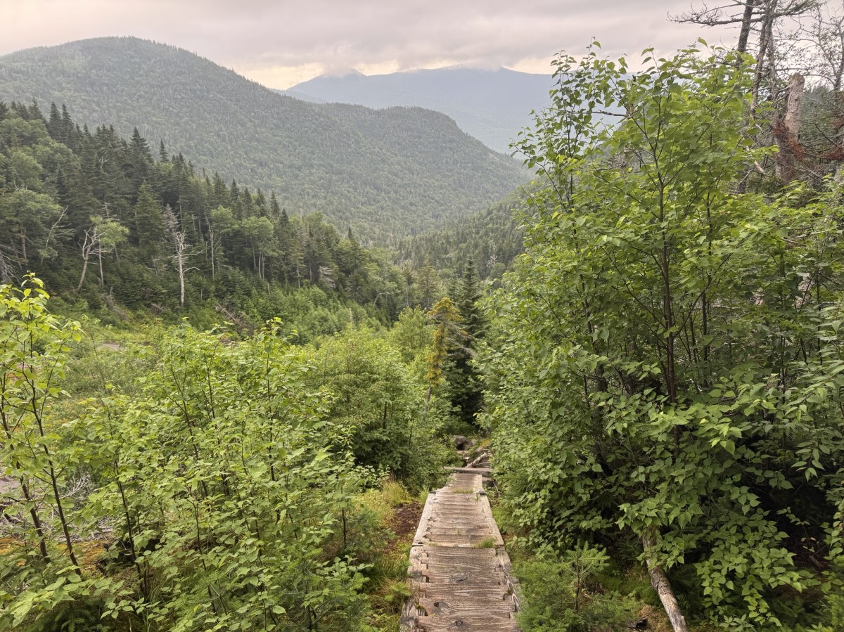
The trail up to Johns Brook Lodge is flat, wide, and super nice walking. Not much rock-hopping involved, and certainly nothing technical.

I very nearly stepped on this little cutie, so he won the prize of getting his photo taken, while Gildo stopped to use an app to identify birds based on their chirping.


Then, 1.5 hours in, we had the most magical encounter. This young deer was completely unbothered by us. We stood and watched her for a good 5 minutes crunching on leaves she found on the ground. I’ve decided she was the spirit of the forest, welcoming us back to the ADKs.

At 2:10pm, we reached the next register and signed in again. 3.1 miles down, almost to the Lodge.

By this time we were drenched in sweat – it was around 90 degrees and huuuuumid. We stopped a couple of times at the streams to dip our hats in and wet our faces, but we were daydreaming about dunking ourselves in Johns Brook.

I remember this junction from when I climbed Big Slide Mtn (27) with Bushnell Falls and the Three Brothers back in the day! That was another hot day, so instead of just climbing Big Slide as an out and back, I came down to this junction and hiked all the way to Bushnell Falls to take a dip!

By now we could hear signs of humanity up ahead, and we knew we were close.


If you plan ahead, you can reserve a spot in the lodge and get 3 meals in addition to your bed. But even if you don’t stay, it’s definitely worth a look around inside.

We had initially wandered around a bit on the other side of the river around Camp O’Brien, but it should be noted that the Crandall, Myers, and Goodwin lean-tos are private property and are reservation only. We saw that, then went to the lodge to ask about them, and ended up continuing maybe 1/4 of a mile up towards Bushnell Falls to find the camping area.

A few people had already set up camp, so we explored around until we found the furthest site available – which, it turns out, had a ‘back door’ straight back to the lodge. We’d looped around so far that we were closer to the l0dge than to the start of the camping area.

I can never manage to sleep in tents, so I set up my hammock on top of a small hill where I could hear the brook babbling below.

By 3:30pm, we had completely set up camp. Next order of business – strip down to our skivvies and submerge our grimy carcasses in Black Brook. It was sooooo refreshing, if not numbingly cold, and we welcomed it. We salamandered on some rocks in the sun, going in and out of the water for the next 45 minutes.

Then we wandered back over to JBL to lounge and cook our dinner – Chicken Teriyaki and a tuna packet, and of course some water with a Nuun tablet for hydration.

We were cozied up in our respective domiciles before the sun had even set, eager to see what Day 2 would bring.

Day 2
Sleep? What’s that? The night was balmy, hot and sticky, and I was fighting for my life against mosquitos biting me through my hammock. So I was actually relieved to get started for the day when my lovely Sherpa came to wake me up at 6:50am.

We gathered our things in one day pack, filled up water at JBL, and hit the trail at precisely 7:49am.

The path up to Bushnell Falls inclines at a steady, easy pace and crests this cool ridge, with sharp drop-offs at either side.

1.5 miles and 50 minutes of slow hiking later, we reached the first lean-to at Bushnell Falls.


The trail down to the falls is a steep 0.1 mile. I’d seen them before, and as much as I wanted to again, this was going to be a long day and I chose to save my knees for when I’d really need them, so I sat on a nice rock and waited for Gildo to make his way down and back.


We continued on our way and just 10 minutes later, we were at the next Bushnell Falls lean-to.


At this point, we hadn’t seen a single soul on the trail or at any of the campsites. Seems like Thursday is a good day to hike in to camp!

2 hours in and the trail was decidedly more Adirondack-y – complete with mud, rocks, and blowdown. But with all the recent rain, we were rewarded with picturesque moss and verdant vistas left and right.


By 10:12am, not quite 2.5 hours into the trek from JBL, we reached THE slant rock.

And it’s accompanying lean-to. Like all the others, this camping area seemed vacant and we still hadn’t encountered a single person. We were starting to wonder if everyone else knew something we didn’t? The forecast for the day was admittedly not….great. But it was waaaay cooler than the day before, so even with a little rain, it was preferable to heat and humidity, right? At the junction just after the lean-to, we continued straight on the red trail to continue towards Marcy.

This appeared to be a steep 0.9 mile segment of trail until the next junction, complete with rocks….

mud….

and running water.

Some brief glimpses of the sky and some nearby mountains did not make us hopeful for magnificent views from the summits…

Mud – a short poem. A large step up, a slick muddy slope. Feet do slide.

At 11:15am (3h 25min/4.3 miles from JBL), we reached the junction with Marcy. We stayed left to continue on the 0.5 miles to Little Haystack.

And it was….actually, it was exactly what I’d expected. Welcome back to the Adirondacks, baby. Here’s some slabs of rock to climb.

At this point it was sprinkling with rain, and I was surprised at the state of this maintained trail – it felt more like a ‘trailless’ or unmaintained trail by how narrow, eroded, and crowded by pine boughs it was. Unfortunately, with the rain, walking through here meant we got completely soaked with water from the trees.

30 minutes of tough climbing later, we were staring at little haystack, with big haystack looming behind, encased within a whipping torrent of rain and wind.

It took us 40 minutes to go just 0.5 miles to the next junction. Good thing the signs are so clear and descriptive! Just another 0.5 miles remaining to Mt Haystack – we just have to hop right over little haystack first.

Up here we were extra aware of the fragile alpine vegetation and made sure to stay on the rocks and follow the yellow blazes.

The wind was honestly unnerving and I was feeling rather trepidatious about it. But the rock surface was still dry and we continued to slowly make our way carefully up and over little Haystack, sitting when the wind came in gusts so as not to be knocked over.

We hunkered down on the back side of little haystack for a few minutes, looking towards what we assumed to be Big Haystack – not that we could see it – and debating whether this was something we could do safely.

Ultimately we decided to go for it, and carefully made our way down to the col and the relative shelter of the trees there, before emerging again and scrambling up big Haystack.


I had to remind myself a few times that compared to the hikes I’d done in Patagonia, this wind was nothing. And with that thought in mind, and one foot after another, we climbed up and up. Well, I actually bear-crawled my way up most of it, on my hands and feet to have multiple points of contact, but still – you get the point. I have NO SHAME.


Nearly at the summit now, with not a view in sight! This last part reminds me of the back of a dinosaur, jutting out at such an angle.

We made it! Almost 5 hours after leaving JBL, we sat on the summit of Haystack to admire the stunning views and share some victor nutterbutters before the skies opened up and drenched us with rain.

There was really no point in hanging around and we wanted to get out of the elements, so we pulled on our rain coats and started heading back the way we came.


Supposedly this trio of mountains has some of the best views in the ADKs, so I can only assume I’ll be making another trip out here at some point when weather is nicer!

30 minutes later, we were back in the trees at the junction with Basin Mountain, and we turned right to go on the blue trail.

Next up, 0.5 miles of downward trekking to the next junction with the great range trails.

We reached this junction after 35 minutes of careful trekking, grateful to the trees for keeping us out of the wind and the worst of the rain.

On the map, the next 0.1 mile section of trail appears to steeply descend until the junction with Slant Rock trail, and I can confirm – it’s steep, rocky, muddy, and now with the rain – slick.

Still, surely we were on that 0.1 mile stretch for at least a mile. It took us TWENTY FIVE MINUTES to reach the next junction?! What did we DO for 25 minutes? At that pace, it would take us over 4 hours to go a single mile, for reference….

After that bizarre time warp, we stayed on the blue-marked trail toward Basin Mountain, trodding through the now-familiar mud, slick rocks, and dripping pine boughs. From this point on, every step we took would bring us closer to JBL.

The 0.8 mile to Basin started out with a little bit of down and a little bit of flat before climbing up again, sometimes steep and tricky rocky surfaces. In all, we’d lost about 1000 feet of elevation and had to gain back around 900 of it all over again.

At one point, there was a most thoughtful ladder to help us up a tricky section! I’m not sure what made this spot special to necessitate a ladder over the other spots, but I’ll take it.

Overall, the stretch from Haystack to Basin wasn’t overly difficult, and the climbing – though tough in spots – wasn’t that bad either. The higher we got, the more enshrouded in clouds we once again became.

Ah, what gorgeous views we had, just breathtaking.

One last pass through rainforest-esque landscape…

And we reached the summit. Woooooooow just stunning. I believe my remark here was ‘I guess now we know what it would look like to be inside of a marshmallow.’ A wet marshmallow. But hey, at least there wasn’t much wind this time. We made it here at 3:18pm, just about an hour after leaving the last junction, and 7.5 hours after leaving JBL.

There was no point in lingering to see the whole wide nothing, so we kept on along the trail. The cloud became so thick that we could barely see beyond the ends of our noses – at times, it looked like the trail dropped off to the abyss.


Coming down from Basin was less walking and more crab-walking and scooting down the sheer wet rocks, not trusting our tiring legs nor the grip in our boots.

The path from Basin to Saddleback is only about 1 mile long, but in that 1 mile we lost about 700 feet of elevation. It was pretty though.

Over the river and through the woods, to the cliffs of saddleback we go….These cliffs are pretty notorious for being intimidatingly daunting. And we were about to climb them in the rain. At some point I looked at my beloved sherpa and asked in all seriousness, ‘Are we stupid?’.

I was sure to snap a picture of a thoughtful sign at the lodge showing the recommended route of Saddleback and referenced it before we began.

That said, it ended up being pretty straightforward to figure out which way to go, given that the route is marked with yellow blazes.

I’m not gonna lie – there was more than one spot on the cliffs when I looked at the yellow blazes and said ‘What do you MEAN?!?’ as if the rocks would explain it to me if I asked.


I’m usually the first person to promote solo hiking to people. I love it. It’s my favorite and most effective form of meditation. Plus, no ones there to see you when you embarrass yourself falling in the mud or tripping over your own toes. So take that into account when I say: you should probably not climb this mountain alone. And I DEFINITELY wouldn’t suggest doing it from the other direction (descending the cliffs rather than ascending them) – there’s a reason it’s called HaBaSa and not SaBaHa!

I am 5’9″ and there were a FEW spots that my dedicated sherpa had to hold one of my feet in position so I could lift my other leg up, because there were no footholds. So in addition to your water, snacks, and non-cotton clothing, bring a trusted friend that won’t mind giving you a boost.

Climbing up this crack in the rock actually wasn’t that hard, as a person that’s not really afraid of heights, but it really looks impressive so let’s pretend it was DEATH-DEFYING, ok?

And then….we were there. To our shock, awe, and bewilderment, we’d summited all three mountains. 1h and 20 minutes after leaving Basin, 9 hours/9 miles from JBL.

AND the sun actually peeked out just for us, to give us an inkling of a view before clouding over again.


Coming down from Saddleback was a sloooooow procedure. We started with a steep 0.5 miles down to a junction. Over the next 3.3 miles, we’ll lose about 2200′ in elevation.

Here we stayed on the blue trail to make our way back to JBL – 2.8 miles to go!

The way down was a lot less like hiking and a lot more like bouldering. It was just problem after problem. Take 5 steps, stop to figure out a way down, using every bit of upper body strength to help and compensate for the slick rock. We both slid on our hands and feet on more than one occasion.

We were PSYCHED to see the start of the stairs peeking up through the trees to take us down the slide in styyyyle.

Forever grateful to the trail workers who built this thing. What an immense amount of work! It felt so good to not have to think about every step and just go for a little bit.

I wouldn’t want to be climbing up that in the rain! (or in the sun if I’m being honest)

As we descended, the clouds started to clear. Just in time! I turned to ask my favorite sherpa if he wanted to go back up Haystack now that the clouds were clearing?? He said no.

The stairs spit us out right at the bottom of the slide. Turning to look back, I could see how someone would miss the entrance to the stairs altogether. If you are for some ungodly reason doing this range in SaBaHa order (WHY you would do that, I cannot possibly imagine, but I can only assume you feel you must atone for your existence), be sure not to follow the yellow blazes at this point but instead look for the blue markers on the skinny tree to the left.

This spot looked to be a recent mini-slide, with some stairs that look like they were knocked down in a pile of rubble.

We stepped over the rubble and found a lovely little pool of iron-rich water, freshly fed from the slide above.

Oh my GOD is that flat ground? Wide trail?? No pine boughs dumping their rainwater on us? No massive boulders to scramble down?!? Hallelujah!

After 1.8 miles of descent (1 hour and 45 minutes for anyone keeping track of our lightning pace) since the last junction, we reached the Ore Bed Brook lean-to. Just one more mile to camp!

We skedaddled down the next 0.7 miles in just 20 minutes, and we were home free.

All day long, my loyal sherpa didn’t miss a single opportunity to help boost me up a big boulder or lift me down large steps to help save my knees. When my knee pain hits, it is pain indescribable, and it’s a one-way street. There’s no going back once it starts, I can only push through. A few short years ago I would have paled at the thought of accepting help up and down these boulders – how dare anyone insinuate that I can’t do it myself! I’m strong! Yeah…Those days are long gone. I did feel a suspicious lack of dignity a few times being boosted up by my butt, or trust-falling off a rock into Gildo’s arms, but by that point I simply didn’t care. So all that to say – the very last section of the trail before the bridge back to JBL was these steep stairs, and when I tell you that man lifted me down every. single. step. so I wouldn’t strain my knees….That’s love.

We strolled through JBL and took the back way in to our campsite at 7:49pm. EXACTLY 12 hours to the dot from the time we left.

My phone seems to think we did 15 miles but it was actually more like 12. Nonetheless, a massively difficult day, made ever-more brutal by the rain, wind, and slick rocks.

I couldn’t have been happier that we’d decided to camp both nights so we didn’t have to hike out. I was tucked away in my hammock by 9:30pm and slept solid until the breakfast bell rang at the lodge at 7:30am the next day.
Day 3
I didn’t want to wake up. In between bouts of slumber I heard other campers getting ready for the day, the rustle of tents and low hiss of zippers opening and closing, birds singing…Eventually I roused and slooooowly got out around 8:30am to find Gildo preparing some coffee.

We hit the trail at 10:50am after taking our sweet time to pack up camp and have breakfast. I was not feeling super great, pretty sluggish and expectedly sore, so we were glad not to have to be anywhere at any specific time.


The hike out was unremarkable in every way. It was getting increasingly warm and the path was blissfully flat and even. No rock-hopping, no jumping off boulders, just…walking. Ahh, my favorite.

At 12:30pm we reached the last junction of our journey – just 0.5 miles remaining. That stretch from JBL seemed to be an eternity.

And finally – we saw the glisten of cars in the parking lot. We’d done it! Just shy of 2 hours after leaving JBL. I’m so incredibly proud of us. We loaded our stinky smelly strips of humanity (can you tell I’ve been listening to Anthony Bourdain’s audio book?) into the car and booked it straight to Stewarts to scarf down food. It’s no one’s business what all we ate there, let’s just say I spent all of the last 3 days SO HUNGRY – which is very unlike me – and I left Stewarts full to the brim and ready for the drive home.

33 down, 13 to go. Happy hiking!
Haystack: 4960′
Basin: 4827′
Saddleback: 4515′
Total elevation gain: 5137′
Total Duration: 12 hours (+ 4 hours to hike in/out)
Total Distance: 18.7 miles
All images are property of adktrailtalesandtails and may only be used with express permission.

Natalie, I absolutely LOVE your trip reports! You always make me feel like I’m right along with you, and they are also filled with great humor.
What a hike! Wow, I’ve read so much about this triad, and you guys nailed it, especially in such crappy weather. And you didn’t seem at all bummed about the weather, especially when you hear about the supposed great views. I think you’ll be back.
Thanks for a great read!!
LikeLike
Thanks for reading Gary! This one was a doozy, but hey, we did it!
LikeLike
Enjoyable report, as always.
LikeLike
Thanks for reading!
LikeLike