
05/21/2016
Weather: Clear
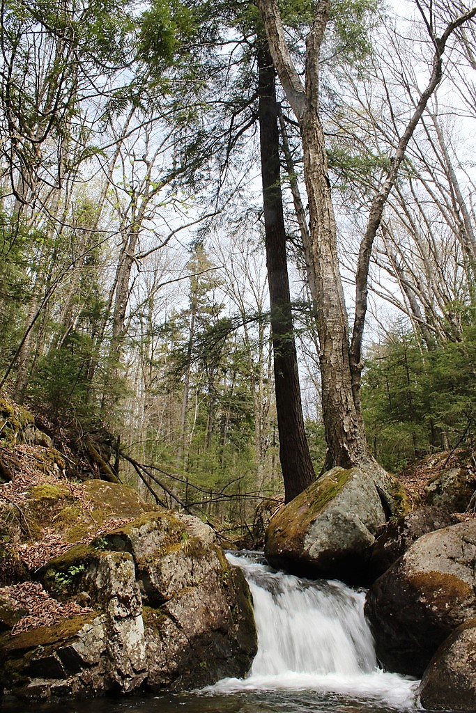
My hiking buddy Sam and I had been pretty eager to climb McKenzie mountain ever since we first hiked the Haystack trail, so we set off to do so. Unfortunately, my navigationally-challenged friend had us driving in the wrong direction for 20 minutes until I realized we were not where we should have been…So we finally got to the trailhead at around 11am. The beginning of the trail was gentle and steady, as we expected from our venture up Haystack previously, and we soon encountered the little brook.

As we followed alongside the brook, the trail began climbing steadily. We didn’t mind though, we were so preoccupied with enjoying the green buds on the trees and the waterfalls along the brook.


At 2.4 miles, the trail to haystack branched off to the left (we found the junction this time!) and the trail to McKenzie immediately started a strenuous but relatively easy upward climb. I’m not really sure how we missed the sign when we climbed Haystack, but the stamped label in the tree was pretty cool!

At 3.6 miles, the trail wasn’t a trail so much as it was a river. There was a lot of rock-hopping involved, but I didn’t really mind, it was fun and kept our minds off of how far we had to go. My camera went away for this part in case I fell in the water. The river section of the trail was relatively short though, and soon we were facing a steep, eroded, MUUUUDDY 1000ft ascension in half a mile of hiking, and boy was it tough. It was slow going, and we were filthy and exhausted.

See that picture above? That went on for at least a mile, and several sections were bare, nearly-vertical rock faces covered in mud and water. It was not easy, but we both managed to climb it without falling!
At 4.3 miles, the trail branched off to the right where there was an enormous boulder that I climbed, then helped Sam to climb up. From there, we were able to catch our first glimpses of the valley below.

We stayed on that nice boulder for 15 minutes or so, and I ate the most delicious orange of my life (I think I was just really hungry) before jumping off of the boulder and continuing onward. After the first false summit, the going was a lot easier and we passed through cool white birch subalpine forests. We climbed, we descended, and climbed some more, and came to the next two false summits.

We were really thinking we had to be close to the real summit, but alas, we made it to the last (4th?) false summit, and looked to our right to see a mountain way the hell far away…that was McKenzie, and to get to it, we had to descent several hundred feet just to climb right back up, and then do it again to come back. So we had to make a very difficult decision. We’d come all this way, but our water supplies were nearly depleted, and Sam’s knees were starting to swell up. In the end, we looked longingly toward the summit and dejectedly turned around to go back, but not before snapping one last photo.

If possible, going down was even tougher than climbing up. I ended up lowering myself down using purely upper body strength (which I didn’t know I had!) and supporting myself on tree roots and branches. It was intimidating looking down a 70 degree slope, hoping my boots still had good traction. At one point, I was semi-delirious from the long, exhausting trek, and was sliding down a rock face on my butt, when the song “Jukebox Hero” by Foreigner started playing in my head, only my subconscious had replaced the words “Jukebox Hero” with “butt scoot hero”, and I busted up laughing. My hiking buddy looked back at me, probably thinking ‘this is it, she’s finally snapped’, so I just sang “He was a butt scoot hero, he had muuud on his thiiiighs!” and we laughed hysterically together for a few minutes. Anyway, we continued our way down and admired some of the rare mountain flowers we saw sprung up in the most unlikely of places, and helped an adorable little amphibian cross the trail!


We finally made it back to the trailhead by about 6pm, exhausted and hungry. While we were upset that we didn’t make it all the way to the summit, we were resolved to climb it before the end of the summer.

McKenzie Mountain: 3861′ Elevation Gain: 2200’+
Round Trip Distance: ~10 miles
Total Duration: ~7 hours
All images are property of adktrailtalesandtails and may not be used unless with express permission.

One thought on “McKenzie Mountain”