10/14/2018
It was a month and a half into the semester and I really needed some solitude in the mountains to replenish my spirits, so I settled on heading out on Sunday to climb Colden Mountain. I woke up at 4am on a cold, dark morning and made it to the trailhead at the ADK Loj right at 7am. The lot was already about half full, and I was a little disappointed that I wouldn’t have the trails to myself, but that was to be expected. While I waited in a short line to sign in at the register I took a picture of this amazing sign instructing hikers to poop responsibly and took a super glamorous selfie of my drowsy face.


I headed down the path at 7:30am with a smile on my face, so happy to be spending a day in the woods. After 20 minutes, I arrived at the first junction in the trail. Whenever possible, I like to hike a loop instead of an out-and-back, so I chose to climb up from Lake Colden (the steeper path) and head down via Lake Arnold. With that in mind, I turned left at this junction to head toward Marcy Dam and Avalanche Lake.


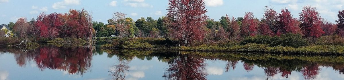
About 30 minutes later I arrived at Marcy Dam, 2.2 miles from the trailhead. I took some photos of the rising sun’s rays on the surrounding mountains and took my obligatory 5 minute break at a rock on the other side of the dam at the “Marcy Dam Outpost” sign. I try to take a 5 minute break once every hour to stretch, drink water, and give my back a break from my pack.


At 8:30am, an hour after leaving the trailhead, I reached the next junction and continued to the right to head towards Avalanche Lake and Lake Colden. 30 minutes later I was at the next junction. I continued to the right, and took note that I would be returning on the path to the left toward Lake Arnold.


I was excited about the next portion of the trail, which is surrounded by large mossy boulders alongside the Avalanche Pass Slide.


I was having a heckin’ hard time with my camera today! Every time I brought it up to my eye, everything would fog up! With that in mind, I apologize for the “misty” images on this trip report 😅 I made it to Avalanche Lake at 9:40am, a little over 2 hours after leaving the trailhead. Avalanche Lake is one of my favorite spots in the high peaks. This 9-acre lake sits at over 2800′ in elevation right between the vertical cliffs of Mount Colden and Avalanche Mountain.

I started my way around the lake and stopped for second breakfast on a nice rock overlooking the lake. While sitting there, I passively noticed a boat on the other side of the lake…after several minutes, it occurred to me….How did that boat get there?! I assume it was helicoptered in, but I can’t help to imagine a person hauling it over their shoulders on the 5.2 mile trail in!

AFter a few minutes respite, I continued on the trail around the lake. Boy, I had forgotten how intense this trail is! Between the huge boulders to climb over and around, the ladders, and the hitch-up matilda’s along the way, it takes me a solid half-hour to traverse the lake.


At 10:20am I happily found myself at the other end of the lake. I snapped a few lousy pictures before continuing ahead toward Lake Colden.

The trail here because quite muddy, which pretty much set the stage for the trail conditions for the rest of the day. While I was trekking toward Lake Colden, I had an AMAZING moment where I was walking across some puncheon over a muddy bog while a Ranger was coming the opposite way on his patrol. OF COURSE I stepped on the end of a puncheon board and OF COURSE it wasn’t secured at the other end, so there I am flailing my arms while the board flies up in a comically dramatic teeter-totter fashion….AND OF COURSE I did the exact same thing at the OTHER END of the board…At the ONE MOMENT IN THAT LAST 4 MILES that someone else is on the trail.
My gracefulness is really astounding sometimes!


There were a few portions of the trail along Lake Colden that were completely submerged in the lake itself from all of the recent rain and snowmelt, so some bushwhacking was involved to make it across. Before long I had made it to the next junction at 11:00am. I turned left to leave the lake and head up to Colden.


The initial trail up was quite pleasant. It was never particularly steep or too muddy. I foolishly thought “Hey! Maybe it’s not as steep as everyone said it would be! This is nothing!”….Yeah, you all know where this is going. OF COURSE it was way more difficult, I just hadn’t gotten to that point yet. But in that brief moment of bliss, I happily traipsed along and let a large group of French Canadians pass me by.

After about a mile the conditions changed…a bit…(read: The trail amped up to a 10 to cruelly haze the unworthy). Thankfully some AMAZING trail crews had built ladders and steps to traverse the truly difficult sections.

At about this time, I kept catching up to the back end of the large group that I had let pass me. I was getting quite frustrated to have to keep stopping every time they stopped, so just as the trail started to get icy I opted to pass them all and hustle a bit to make sure they didn’t catch up again. (They were quite nice, it was just a large group and I didn’t want to hear voices behind me while I was hiking!) At this time, a couple were coming down the slick slides verrrry carefully and they informed me that there was a lot of ice up ahead. With that in mind, I trudged on.

Sure enough, they were not lying. And I am SO SMART that I, being the stubborn mule that I am, opted not to put on the microspikes that were conveniently strapped to the back of my pack for easy access.

I clawed my way up tooth and nail very carefully along Colden’s smooth rock slides until I reached another ladder, and I just KNEW that this one would bring me to the top.

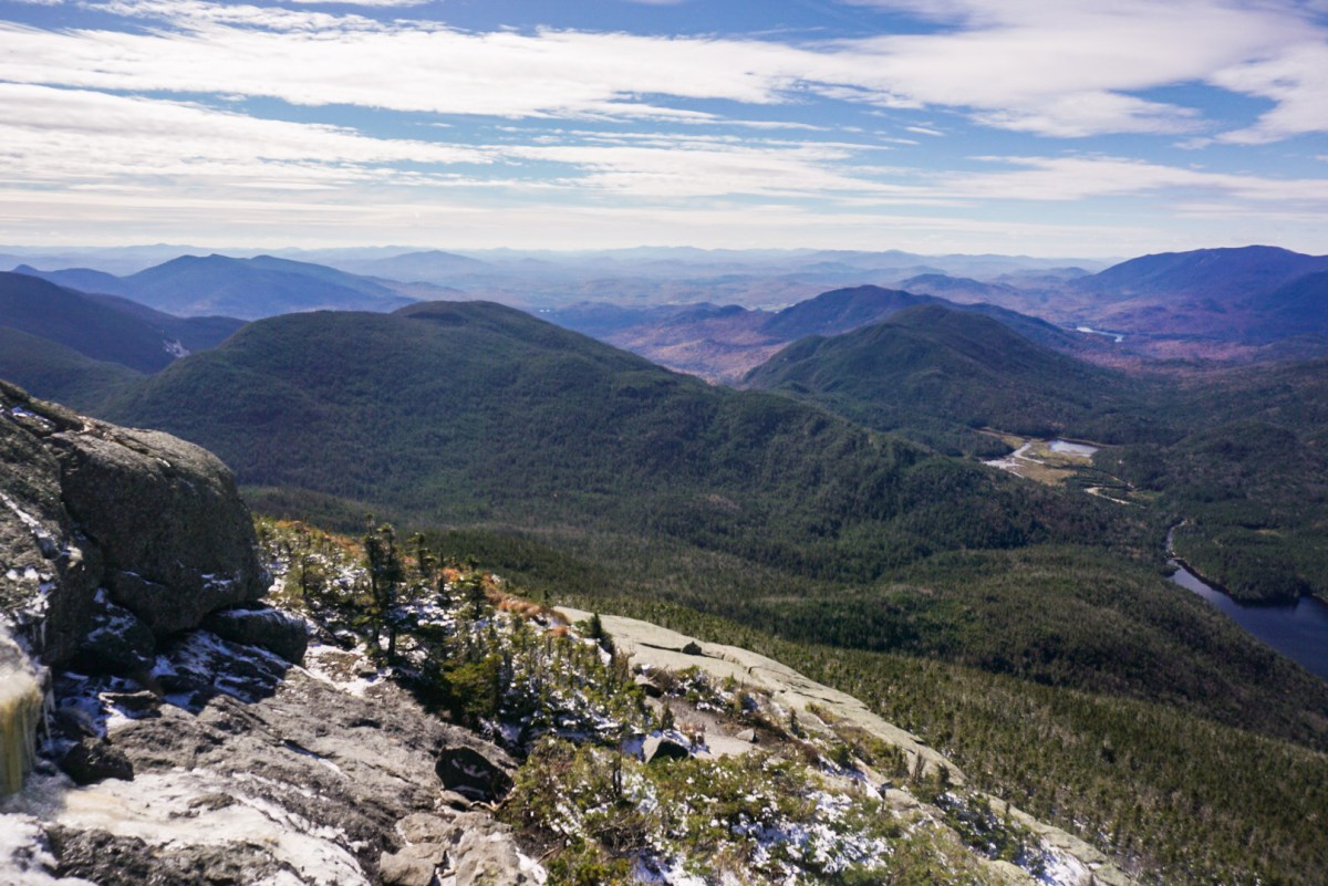
I turned around at the top and let out a hearty laugh in awe at the views. Those views make everything worth it, every time.


I had really thought I was close to or at the summit, but, and I’m sure this comes as no surprise, I most definitely was not. So onward I went, but now I had some stunning views every step of the way.

I loved seeing the path that I had taken up there from the “almost summit” or whatever it was that I was on. And even better, I had a fantastic view of my favorite trio of peaks along the MacIntyre range.


I climbed up one final stretch to see a stunning view of a chilly Mt Marcy, with some supplied that may have been dropped in for some impending trail work.


I was a little bit confused, as I continued along the snowy trail and was unsure of exactly where the summit was. I came upon a sign designating where to leave a rock carried up from the trailhead, and wandered down a path to a rock in a small clearing. At 1pm, while I was standing on that rock, a couple of fellas came down and “tagged” the rock, at which point I shouted (or yelled and frightened them probably) “WAIT. Is this the SUMMIT?!?” and it was! How anticlimactic! So I snapped a picture of some circle on the rock (I’m so technical) and wandered back out of the clearing to find a nice spot to have lunch.


I enjoyed my lunch of a sandwich, babybel cheese, and some gherkin pickles (oddly delicious after a day of hiking) while looking out towards Algonquin. And can’t forget the victory chocolate!


Now, let’s talk again at how intelligent I am. AFTER I had passed over all of the steep icy sections of trail, while I was sitting at the summit, I thought, hey, it’d be such a great idea to put my spikes on now! So I did….and encountered no more ice along the trail. Ha! At least I tried. As I headed down the path toward Lake Arnold, the trail passed over a bare rocky outcropping, so I sat for a break and to take in the breathtaking sight of Mt Marcy right next door.


At about 2pm I left again for Lake Arnold. The trail down from Colden was quite tough. It was all mud and rockhopping. Almost immediately, my right knee began to ache, so I stopped frequently to stretch and roll out my IT band with my trekking pole. Who knew trekking poles were so versatile?

By the time I made it to the junction with Lake Arnold 45 minutes later, the twinges in my knee had ceased to subside and an old injury in my SI joint was starting to cause lightning-like spasms in my lower back. It’s so fun having a body that acts like it’s been bowled over by a steamroller with the slightest provocation! So I chose not to visit Lake Arnold but went left to keep slowly making my way down the mountain.

Along the way down, I met a couple coming up who seemed perturbed. They thought they were on the wrong trail coming down from Colden because it looked so different from the path they were on that morning. After looking at the map, I suggested that there was no other path down from the previous junction, and that the trail looked so different because all of the snowmelt was turning it into a veritable river. Still unconvinced, we all continued our way down. I passed them up, and about 30 minutes later I came to another junction which verified the path we were on was the correct one. It’s incredible how much water just a little bit of snow can create!

I didn’t take many photos after that. The pains in my knee and back were intense and it took all of my mental acuity to focus on getting down the mountain. Finally, at 4pm, I made it to the junction and lied down on this wooden bridge to stretch my legs and back.

After I probably freaked out a few passing hikers by lying there on that bridge, I continued my way back toward Marcy Dam.

And that’s the last picture I took of the day. The pain was relentless and I lulled myself into a trance-like state to focus through the pain. I continually reminded myself to take one step at a time, and that the worst was behind me. After continuing on like this for 3 more miles, I dragged my aching body out to my car just before 6pm and let out a frustrated huff as I sat down to drive home.
I’m so disappointed that these so-called “overuse” injuries are still plaguing me, considering I’ve been resting with minimal straining activity for 15 months. Back to the drawing boards, hopefully I’ll be back soon.
19 down, 27 left!
Mount Colden: Elevation – 4714′ Elevation Gain – 2535′
Round Trip Distance: ~14 miles
Total Duration: 10.5 hours

Natalie, you are truly an inspiration!! I very seldom take photos when we hike, until we reach the summit. Your trip reports are awesome & funny, thank you for sharing them! I know you like to hike alone, but it would be so much fun to hike with you someday!!
LikeLike
Thank you, Gary! I Will certainly let you know if I’m ever in your neck of the woods 🙂
LikeLike
Nice TR and pics. That loop is probably my favorite that I did this year.
Also, gonna say your overall elevation gain was much more than 2500′. I used the truck trail approach to Marcy Dam (mostly flat) – my GPS showed over 3300′ of overall elevation gain. Little ups and downs count. If your injuries have been nagging you, it may be a good idea to look at backpacking the majority of your remaining 46 instead of day hiking them. Take it nice and easy, get to a campsite, and relax for the rest of the day. Then bag on day 2.
LikeLike
Thanks for the advice! It doesn’t seem to matter how far I go, if I go downhill at all it all flares up again. Back to PT for me! I’ll definitely be backpacking for the longer trails though 🙂 happy hiking!
LikeLike
Looking at what you have left… They’re mostly “longer trails.” 😉
look forward to the next post!
LikeLike
Seriously the most badass thing you did. Hiking that mountain alone! I WISH I was that brave and experienced to do that! Kudos to you! Love the pictures of the actual hike up. Gives me a better idea of what to expect when I do muster up the courage to hike this one!
LikeLike
Thank you so much! So much self discovery happens when I hike alone, I hope you have a great experience out there 🙂
LikeLike